Photo Credits (2)
Difficulty
Easy
Trail Length
3.5 km
Trail Type
Out And Back
Elevation Gain
88 m
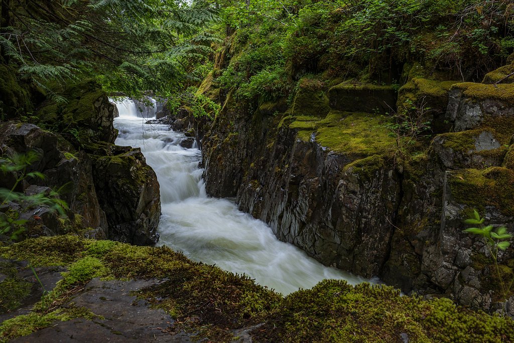
About Medicine Bowls
Medicine Bowls is a small, less-documented waterfall feature near Courtenay on central/eastern Vancouver Island (coords 49.6845, -125.1345). It appears in local place-name usage rather than as a frequently maintained public-site waterfall; reports indicate a forested setting with mossy banks and a creek/stream drop. Specifics about the vertical drop and formed plunge pool are not well documented and may vary seasonally. Access details are limited in major guide databases, so the information below is conservative and may be incomplete.
Why This Waterfall Exists
Medicine Bowls flows over layered sedimentary rock laid down about 66-101 million years ago. Over time, the stream has worn through these layers at different rates, creating the step that forms the waterfall.
Trail & Hike Details
The Approach
The easy 3.5-km out-and-back trail gains 88 metres of elevation on the way to the falls.
Trail Description
There is no well-documented official trail to Medicine Bowls in the primary public trail databases. Approaches reported by local hikers may involve following a creek/old logging road, short off-trail bushwhacks, and negotiating steep/rocky banks near the stream. Trail conditions (roots, mud, steep sections) are likely and signage may be minimal or absent. If you attempt access, plan for route-finding and variable underfoot conditions.
What to Expect
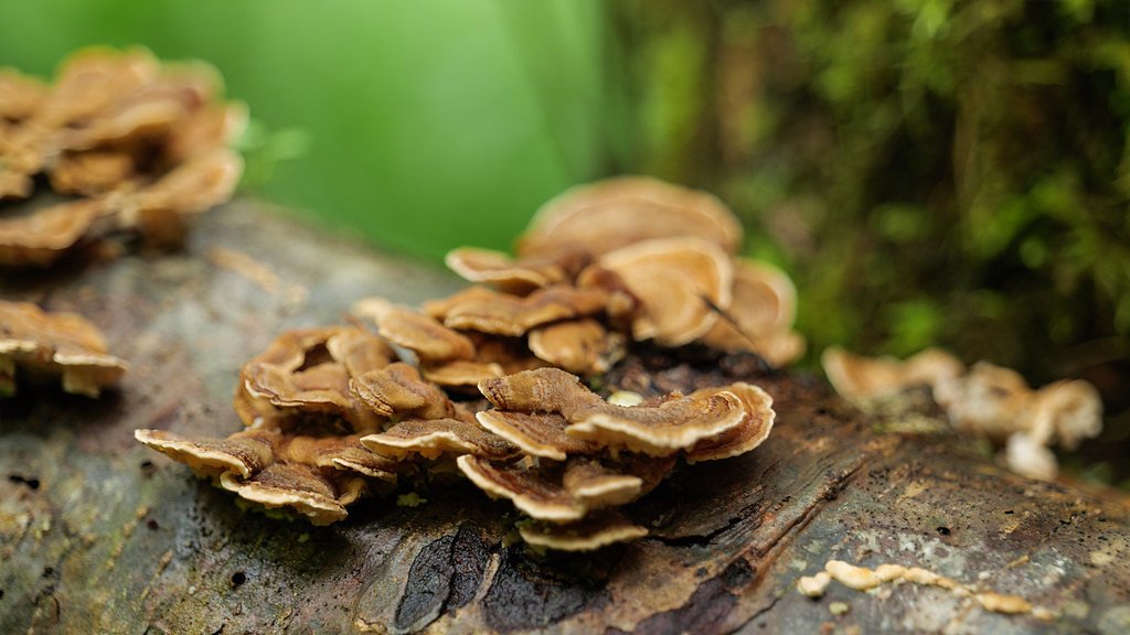
A small to moderate stream-fed waterfall in a temperate coastal rainforest setting (conifer and alder), with moss-covered rocks and fallen logs. Flow is typically highest in spring/early summer or after heavy rains and lower in late summer. Expect slippery rocks, muddy approaches, and limited viewpoints. There may be limited or no constructed viewpoints, railings, or maintained paths.
Accessibility
The trail is not wheelchair accessible. Uneven terrain and elevation changes require steady footing.
Frequently Asked Questions
🐶 Are Dogs Allowed at Medicine Bowls?
❌ Dogs are not allowed
Are There Any Fees or Permits Required?
🆖 No fees required
🏊 Is There Swimming at Medicine Bowls?
❌ Swimming is not allowed
When to Visit
Late spring (snowmelt/rain-fed peak flows) for the most impressive water volume. Summer offers easier access and more stable weather but lower flows. Fall provides pleasant colors while still having moderate flow. Winter may be wet and hazardous and access roads/trails can be closed or muddy.
Seasonal Access
The best time to visit is Spring, Summer, and Fall. Winter access may be limited. Check with the managing park or local authority for current conditions.
Safety Information
Hazards: slippery and unstable rocks near the creek, steep banks, possible sudden changes in water flow after heavy rain, faint or non-existent trails leading to getting lost, limited parking and cell service, and potential logging- or forestry-road traffic. Use caution near edges and do not climb wet rock faces. If travel requires driving on forestry roads, be aware of seasonal closures and posted restrictions. Always carry navigation aids and tell someone your plan.
Current Water Conditions
10.6 m³/s
Current discharge — how much water is flowing
About average for this time of year
Based on 32 years of record
120.55 m
Water depth at gauge
7-Day Discharge Trend
What does this mean for your visit?
Flow is about average for this time of year.
About This Gauge
7-Day Flow Outlook
Based on the WSC gauge PUNTLEDGE RIVER BELOW DIVERSION (4 km away).
Today
Moderate
11 m³/s
8/10Tomorrow
Moderate
11 m³/s
9/10Tue
Moderate
11 m³/s
8/10Wed
Moderate
11 m³/s
8/10Thu
Strong
12 m³/s
8/10Fri
Moderate
11 m³/s
8/10Sat
Moderate
11 m³/s
8/10Best window: Tomorrow — moderate flow, sunny (trip score 9/10).
Best time of year: this gauge typically runs highest from early September to late September, peaking in January.
How we calculate this
This is a transparent outlook, not a precise forecast. We take the waterfall's current flow strength (how it ranks against its historical normal for today, from the nearest WSC stream gauge), carry that ranking forward along the gauge's seasonal curve, and nudge it for forecast rain. Confidence is highest for the next day or two and falls further out. Always check official conditions and your own judgment before visiting — high flows can be dangerous.
Know when to go.
Get a free email alert when waterfalls near Courtenay hit peak flow. We only send when conditions are worth the trip — no weekly newsletters, no spam.
Weather Forecast
Location & Access
Getting There
General approach: travel to the Courtenay/Comox area on eastern Vancouver Island, then follow local forest/secondary roads toward the coordinates (49.6845, -125.1345). Exact official trailheads are not well documented; reaching the site may require driving on unpaved forestry roads and hiking cross-country or on informal trails. Expect limited signage. Check local maps, recent trip reports, or contact Comox Valley or Courtenay-area recreation/forestry offices for up-to-date access information.
Get Directions on Google MapsParking
Likely limited or informal roadside/forest-road parking near a trail or logging-road pullout. There does not appear to be an established public lot. Park legally and avoid blocking gates or private driveways. If unsure, verify current access with local authorities.
Elevation
255 metres above sea level
Coordinates
49.684510° N, -125.134538° W
Visitor Tips & Gear
• Treat details as tentative, this site is not well-documented on major trail guides; check local sources before you go. • Use a GPS with the provided coordinates and carry a detailed topographic map for route-finding. • Wear sturdy, non-slip footwear; expect wet and muddy conditions. • Respect private property and posted signs; many accesses in the area cross Crown land and forestry roads that may be gated or seasonally closed. • Tell someone your route and expected return time, especially when traveling on unmaintained roads or off-trail. • Cellular coverage may be limited; download maps offline.
As an Amazon Associate, we earn from qualifying purchases.
This easy 3.5 km hike is straightforward — comfortable trail shoes and plenty of water should do. Sun exposure on the trail makes good sun protection a must in summer.

Polarized Sunglasses (Knockaround)
Cuts glare off the water so you actually see the falls — and your photos turn out better too.

Columbia Watertight II Rain Jacket
Packs into its own pocket, seam-sealed, and keeps you dry from spray and surprise rain.

Earth Pak Waterproof Dry Bag
Keeps your phone and gear dry when waterfall mist soaks everything else.

Waterproof Phone Pouch (AiRunTech)
Cheap insurance — take photos right next to the falls without killing your phone.

JOBY GorillaPod Starter Kit
Wraps around railings and rocks for long-exposure waterfall shots — no flat surface needed.

Osprey Daylite Daypack
Light, organized, and just the right size for a day hike — fits water, snacks, and layers.
Where to Stay
Browse vacation cabins and private rentals nearby
Unique outdoor stays — tents, yurts, and treehouses
Rent a campervan or RV for your waterfall road trip
Some links are affiliate links. We may earn a commission at no extra cost to you.
Nearby Campground
Camp Gilwell
4.4 km away
Additional Information
Nearby Attractions
Courtenay and the Comox Valley (shops and services), Comox Lake, Seal Bay/nearby coastal viewpoints, Mount Washington alpine recreation area, Strathcona Provincial Park (further inland).
Wildlife
Black bears, deer, small mammals, cougars (rare), and a variety of forest birds. Streams in the region can support salmon runs in certain watersheds; confirm for this specific creek before assuming fish presence.
Cities near Medicine Bowls
Nearby Waterfalls

Writing about Medicine Bowls? Embed this waterfall on your site for free.