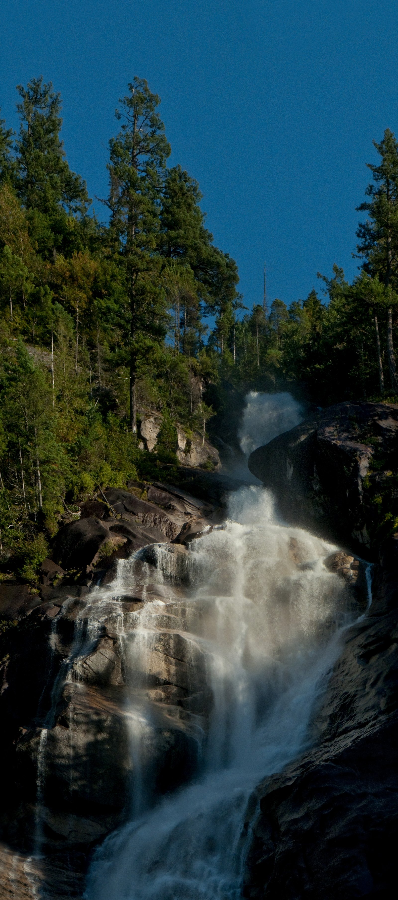
Upper Shannon Falls
British Columbia • Stawamus Chief Park • 7 m
By Armen Suny · Last verified Jun 2026
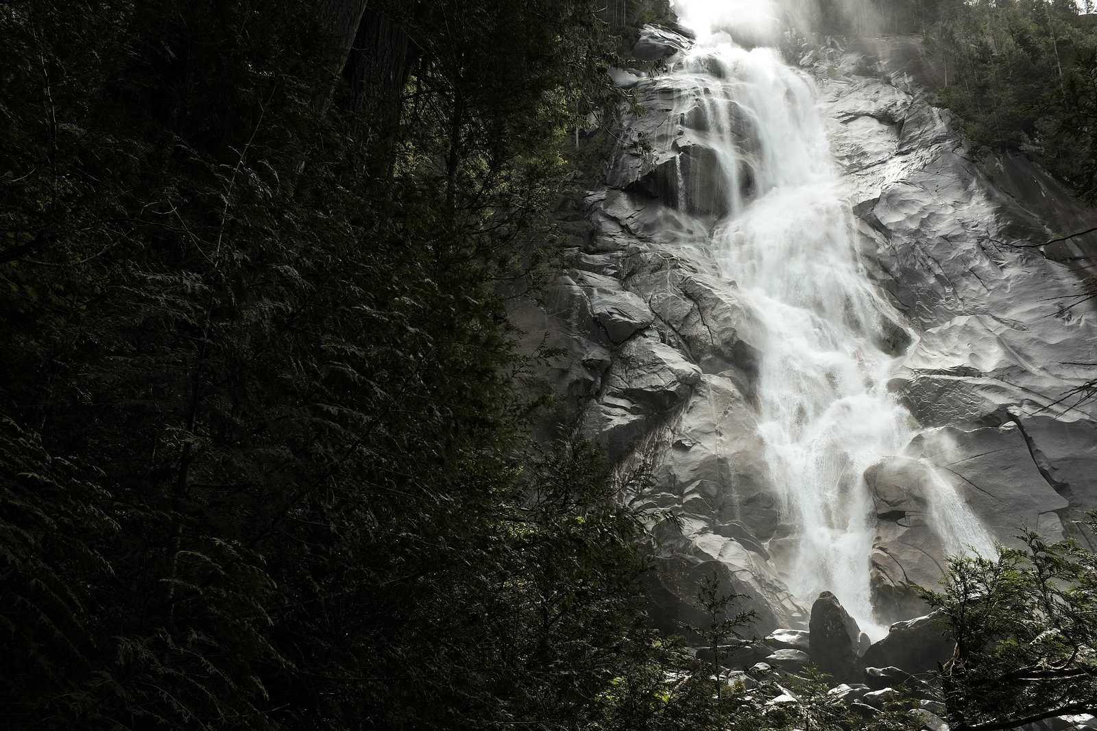
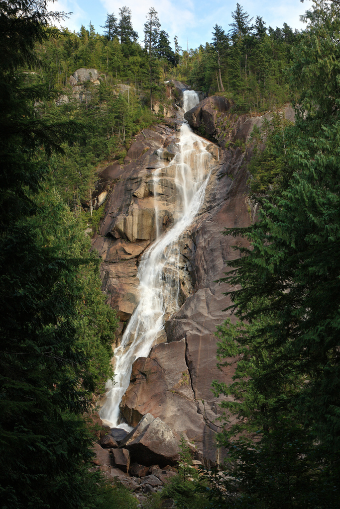
Photo Credits (5)
Difficulty
Moderate
Trail Length
7.0 km
Trail Type
Out And Back
Elevation Gain
450 m
About Upper Shannon Falls
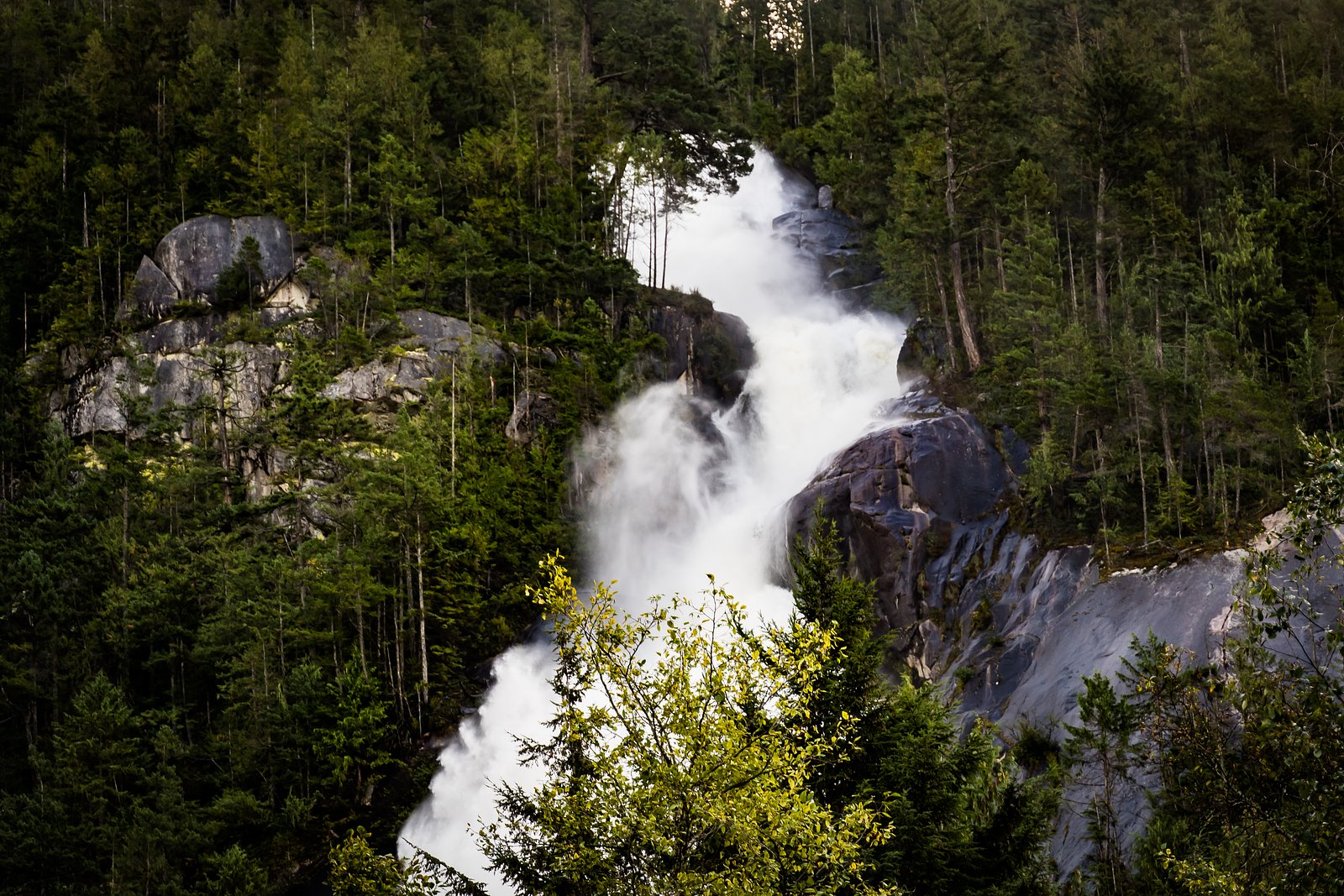
Upper Shannon Falls refers to the higher/upper cascades on the Shannon Creek system upstream of the main Shannon Falls viewpoint in Shannon Falls Provincial Park (Sea-to-Sky Highway corridor, near Squamish, BC). It is less developed and far less visited than the main Shannon Falls pullout; access typically requires leaving the maintained boardwalk and following an unmaintained/steep route upstream. Flow is strongest in spring and after heavy rain or snowmelt. Information about an official, maintained trail specifically to an "Upper Shannon Falls" is limited, so access may involve route finding and scrambling.
The Setting
Upper Shannon Falls sits at 395 metres within Stawamus Chief Park, in the foothills of British Columbia. The falls drop 7 metres.
Why This Waterfall Exists
Upper Shannon Falls flows over hard intrusive rock laid down about 66-101 million years ago. These resistant rocks form a durable ledge that water cannot easily wear away, creating a 23-foot drop where softer material downstream has already eroded.
Nearby Falls Worth Visiting
Shannon Falls (335 m) lies 0.3 kilometres to the northwest. Also nearby: Mineral Creek Falls (18 m, 5.5 km).
Trail & Hike Details
The Approach
The moderate 7.0-km out-and-back trail gains 450 metres of elevation on the way to the falls.
Trail Description
There is a short, paved boardwalk and viewpoint for the main Shannon Falls near the parking lot. Upper Shannon Falls is upstream from that viewpoint and does not have an established maintained trail to a formal viewing platform. Reaching the upper cascades typically involves following the creek upstream on an unmaintained, steep route with exposed rock and roots, and may require scrambling. Trails are likely faint and brushy in places; route-finding skills and good footwear are recommended. If you prefer an easy, short visit, stick to the main Shannon Falls boardwalk/viewpoint instead.
What to Expect
The falls drop a gentle 7 metres over hard intrusive rock.
Accessibility
The trail involves steep, uneven terrain with significant elevation change and is not accessible to mobility devices.
Frequently Asked Questions
🐶 Are Dogs Allowed at Upper Shannon Falls?
❌ Dogs are not allowed
Are There Any Fees or Permits Required?
🆖 No fees required
🏊 Is There Swimming at Upper Shannon Falls?
❌ Swimming is not allowed
When to Visit
Late spring (snowmelt/high flows) for the most powerful waterflow and lush vegetation. Early summer offers good conditions with warmer weather. Fall provides good light and fewer visitors. Winter visits are possible but trails and rocks can be icy and more hazardous; use caution.
Seasonal Access
The best time to visit is Spring, Summer, Fall, and Winter. Check with Stawamus Chief Park for current conditions.
Safety Information
Upper Shannon Falls access is on unmaintained, steep terrain with slippery and unstable rock. Major hazards include: slipping/falling on wet rock, falling rock, steep drop-offs, sudden changes in creek flow during storms, hypothermia in cold/wet conditions, and limited cell service. If you are not an experienced scrambler or hiker, remain at the official Shannon Falls viewpoint. Always give waterfalls a wide berth and do not attempt to climb the cascade. Check weather and recent trip reports before attempting upstream access.
Current Water Conditions
0.9 m³/s
Current discharge — how much water is flowing
Lower than usual for this time of year
Based on 33 years of record
1.64 m
Water depth at gauge
7-Day Discharge Trend
What does this mean for your visit?
Flow is lower than usual for this time of year.
About This Gauge
7-Day Flow Outlook
Based on the WSC gauge STAWAMUS RIVER AT HIGHWAY NO. 99 (3 km away).
Today
Low
0.9 m³/s
5/10Tomorrow
Low
0.8 m³/s
5/10Tue
Low
0.8 m³/s
5/10Wed
Low
0.8 m³/s
5/10Thu
Low
0.8 m³/s
5/10Fri
Low
0.7 m³/s
5/10Sat
Low
0.9 m³/s
4/10Best window: Today — low flow, cloudy (trip score 5/10).
Best time of year: this gauge typically runs highest from mid April to late June, peaking in May.
How we calculate this
This is a transparent outlook, not a precise forecast. We take the waterfall's current flow strength (how it ranks against its historical normal for today, from the nearest WSC stream gauge), carry that ranking forward along the gauge's seasonal curve, and nudge it for forecast rain. Confidence is highest for the next day or two and falls further out. Always check official conditions and your own judgment before visiting — high flows can be dangerous.
Know when to go.
Get a free email alert when waterfalls near Vancouver hit peak flow. We only send when conditions are worth the trip — no weekly newsletters, no spam.
Weather Forecast
Location & Access
Getting There
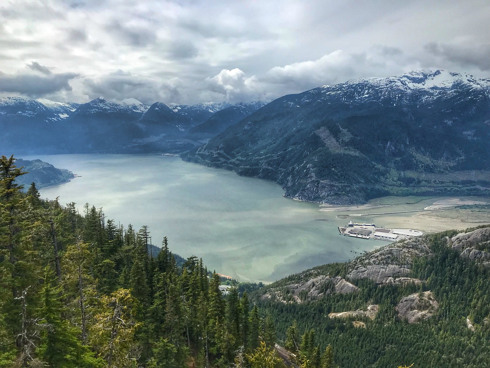
From Vancouver (approx. 21.3 miles / 34 km from the city center) drive north on Highway 99 (Sea-to-Sky Hwy) toward Squamish. Shannon Falls Provincial Park has a designated turnout and parking on the east side of the highway just south of Squamish. To reach the upstream/upper cascades you will typically continue upstream from the main Shannon Falls viewpoint and follow an unmarked, steep path; expect route-finding and scrambling.
Get Directions on Google MapsParking
Official parking lot at Shannon Falls Provincial Park adjacent to Highway 99. Parking can be busy during peak travel times and weekends; overflow parking or shoulder parking on Highway 99 may be unsafe. Check local signage and BC Parks guidance if unsure.
Elevation
395 metres above sea level
Coordinates
49.667339° N, -123.154253° W
Land Management
Managed by Government of British Columbia
Visitor Tips & Gear
• Use the official Shannon Falls parking and boardwalk if you are not experienced with unmarked routes. • If attempting to reach the upper cascades, go with a partner, tell someone your plan, and allow extra time. • Wear sturdy waterproof boots with good traction; bring layers and waterproof gear. • Avoid cliff edges and wet rock; do not climb on unstable ledges. • Parking can fill on weekends, arrive early. • Check recent trip reports and BC Parks for any temporary closures or safety notices. • Cell coverage may be intermittent in the canyon and up-valley.
As an Amazon Associate, we earn from qualifying purchases.
With 7.0 km and 450 m of elevation gain, sturdy boots and trekking poles will help on this moderate trail. Icy conditions are common in winter — traction cleats are a smart addition.

Columbia Watertight II Rain Jacket
Packs into its own pocket, seam-sealed, and keeps you dry from spray and surprise rain.

Polarized Sunglasses (Knockaround)
Cuts glare off the water so you actually see the falls — and your photos turn out better too.

Earth Pak Waterproof Dry Bag
Keeps your phone and gear dry when waterfall mist soaks everything else.

Waterproof Phone Pouch (AiRunTech)
Cheap insurance — take photos right next to the falls without killing your phone.

Timberland Euro Sprint Mid Waterproof
Trusted waterproof boot with premium leather and grippy rubber sole — reliable on rocky, wet trails.

TrailBuddy Trekking Poles
Lightweight aluminum, cork grips, and flip-locks that actually hold — a best-seller for good reason.
Where to Stay
Browse vacation cabins and private rentals nearby
Unique outdoor stays — tents, yurts, and treehouses
Rent a campervan or RV for your waterfall road trip
Some links are affiliate links. We may earn a commission at no extra cost to you.
Nearby Campground
Stawamus Chief Campground
1.1 km away
Additional Information
Nearby Attractions
Shannon Falls Provincial Park (main viewpoint), Sea-to-Sky Gondola (Mount Habrich / Sky Pilot viewpoints), Stawamus Chief (hiking/climbing), Britannia Mine Museum, Squamish townsite.
Wildlife
Typical coastal British Columbia species: black bears, cougars (rare but possible), deer, raccoons, small mammals, and many bird species. Be bear-aware: carry bear spray where appropriate and follow local wildlife safety guidance.
Cities near Upper Shannon Falls
Nearby Waterfalls
Writing about Upper Shannon Falls? Embed this waterfall on your site for free.