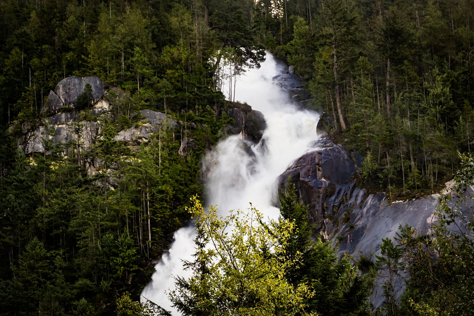
Upper Neverland Falls
By Armen Suny · Last verified Jun 2026
Difficulty
Hard
Trail Length
6.9 km
Trail Type
Out And Back
Elevation Gain
515 m
About Upper Neverland Falls
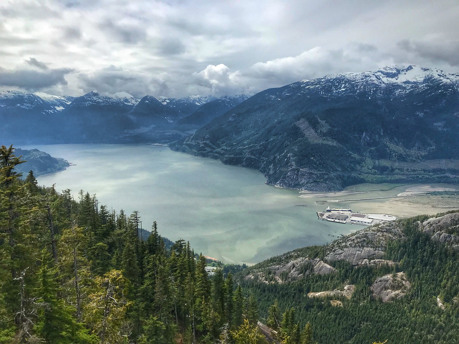
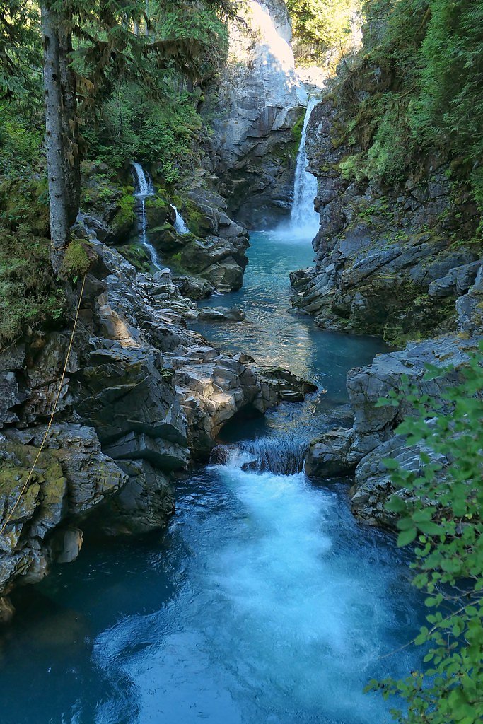
Upper Neverland Falls (coords 49.6698, -123.109) is a coastal temperate-forest waterfall located on the mainland near the southern coast of British Columbia, not far from the Vancouver metropolitan area. Specific published guidebook or trailhead information for this named cascade is limited or not readily available. The falls are likely fed by a small creek and may have a strongly seasonal flow (higher in spring/after rain). Visitors should treat location details as approximate and consult recent trip reports, local park authorities, or mapping resources before visiting.
Why This Waterfall Exists
Upper Neverland Falls flows over hard intrusive rock laid down about 66-101 million years ago. These resistant rocks form a durable ledge that water cannot easily wear away, creating the falls where softer material downstream has already eroded.
Nearby Falls Worth Visiting
Shannon Falls (335 m) lies 3.4 kilometres to the west. Also nearby: Mamquam Falls (19 m, 5.8 km) and Upper Shannon Falls (7 m, 3.2 km).
Trail & Hike Details
The Approach
The hard 6.9-km out-and-back trail gains 515 metres of elevation on the way to the falls.
Trail Description
Detailed trail descriptions are not available from major trail resources for 'Upper Neverland Falls.' Approaches may involve cross-country travel on legacy/unmaintained paths, creekside routes, or short spur trails from a nearby established trail. Expect variable footing, potential scrambling over roots and rocks, and limited signage. Verify route and conditions with recent trip reports or local land managers where possible.
What to Expect
Expect a forested setting typical of coastal British Columbia, conifer trees, ferns, and understory shrubs. Water flow may be highest in spring and after heavy rain; summer flow may be reduced. Terrain may be steep, muddy, and slippery near the creek and falls. Limited or no facilities (no restrooms, picnic shelters, or potable water) are likely. Cell service may be unreliable in valleys or dense forest.
Accessibility
The trail involves steep, uneven terrain with significant elevation change and is not accessible to mobility devices.
Frequently Asked Questions
🐶 Are Dogs Allowed at Upper Neverland Falls?
❌ Dogs are not allowed
Are There Any Fees or Permits Required?
🆖 No fees required
🏊 Is There Swimming at Upper Neverland Falls?
❌ Swimming is not allowed
When to Visit
Spring (snowmelt and seasonal rains) and immediately after rainy periods typically provide the best flows and photogenic conditions. Summer may offer easier, drier access but reduced water flow. Avoid visiting during heavy rainstorms due to flashier stream flows and increased hazard.
Seasonal Access
The best time to visit is Spring, Summer, and Fall. Winter access may be limited. Check with the managing park or local authority for current conditions.
Safety Information
Hazards that visitors should be aware of: • Slippery, moss-covered rocks near the falls and creek, risk of falls and serious injury. • Rapidly changing water levels during/after rain, avoid crossing or standing in swollen streams. • Unmarked or unmaintained trails/informal routes that may require route-finding and scrambling. • Limited cell coverage and lack of facilities, carry emergency supplies and a way to communicate. • Possible private property boundaries, inadvertent trespass may pose legal risk. Always check local advisories, recent trip reports, and confirm land status before visiting. Consider visiting with an experienced local guide if route is unclear.
Current Water Conditions
0.9 m³/s
Current discharge — how much water is flowing
Lower than usual for this time of year
Based on 33 years of record
1.64 m
Water depth at gauge
7-Day Discharge Trend
What does this mean for your visit?
Flow is lower than usual for this time of year.
About This Gauge
7-Day Flow Outlook
Based on the WSC gauge STAWAMUS RIVER AT HIGHWAY NO. 99 (4 km away).
Today
Low
0.9 m³/s
5/10Tomorrow
Low
0.8 m³/s
5/10Tue
Low
0.8 m³/s
5/10Wed
Low
0.8 m³/s
5/10Thu
Low
0.8 m³/s
5/10Fri
Low
0.7 m³/s
5/10Sat
Low
0.9 m³/s
4/10Best window: Today — low flow, fog (trip score 5/10).
Best time of year: this gauge typically runs highest from mid April to late June, peaking in May.
How we calculate this
This is a transparent outlook, not a precise forecast. We take the waterfall's current flow strength (how it ranks against its historical normal for today, from the nearest WSC stream gauge), carry that ranking forward along the gauge's seasonal curve, and nudge it for forecast rain. Confidence is highest for the next day or two and falls further out. Always check official conditions and your own judgment before visiting — high flows can be dangerous.
Know when to go.
Get a free email alert when waterfalls near Vancouver hit peak flow. We only send when conditions are worth the trip — no weekly newsletters, no spam.
Weather Forecast
Location & Access
Getting There
Coordinates provided (49.6698, -123.109). The falls are roughly 21.5 miles from Vancouver, and within driving distance of the Point Roberts / Blaine border area. Exact public trailhead and formal access route are not confirmed. Access may require a walk from a nearby road or established trail; approach may cross informal paths or unimproved forest access. Confirm access with local land manager (municipal/regional park, provincial crown land, or private-property owner) before attempting.
Get Directions on Google MapsParking
Undetermined. Parking conditions at the nearest trailhead are not confirmed and may be limited. Park legally and avoid blocking private driveways or gates. If visiting, plan for limited or informal parking and consider carpooling.
Elevation
1,312 metres above sea level
Coordinates
49.669768° N, -123.109026° W
Visitor Tips & Gear
• Check recent trip reports or local hiking resources before visiting. • Respect private property, do not trespass. • Wear sturdy, waterproof footwear with good traction. • Use a map/GPS and carry a compass; do not rely solely on phone navigation. • Tell someone your plan and expected return time. • Avoid getting too close to the edge, wet rock and moss are extremely slippery. • Pack out all trash and follow Leave No Trace principles.
As an Amazon Associate, we earn from qualifying purchases.
This challenging 6.9 km trail gains 515 m in elevation — come prepared with proper hiking boots and trekking poles. Sun exposure on the trail makes good sun protection a must in summer.

Sawyer Squeeze Water Filter
The backcountry standard — filters 99.9% of bacteria and weighs just 3 oz.

Columbia Watertight II Rain Jacket
Packs into its own pocket, seam-sealed, and keeps you dry from spray and surprise rain.

Earth Pak Waterproof Dry Bag
Keeps your phone and gear dry when waterfall mist soaks everything else.

Waterproof Phone Pouch (AiRunTech)
Cheap insurance — take photos right next to the falls without killing your phone.

Timberland Euro Sprint Mid Waterproof
Trusted waterproof boot with premium leather and grippy rubber sole — reliable on rocky, wet trails.

TrailBuddy Trekking Poles
Lightweight aluminum, cork grips, and flip-locks that actually hold — a best-seller for good reason.
Where to Stay
Browse vacation cabins and private rentals nearby
Unique outdoor stays — tents, yurts, and treehouses
Rent a campervan or RV for your waterfall road trip
Some links are affiliate links. We may earn a commission at no extra cost to you.
Nearby Campground
Stawamus Chief Campground
3.4 km away
Additional Information
Nearby Attractions
Nearest major urban center: Vancouver (~21.5 miles). Other nearby coastal and recreational areas may include regional parks, shorelines near Boundary Bay, and cross-border communities (Point Roberts/Blaine). Confirm exact nearby attractions once the precise access point is known.
Wildlife
Typical Lower Mainland coastal wildlife may be encountered: songbirds, small mammals (squirrels, raccoons), deer, and potentially black bears. Always store food securely and be bear-aware. Larger predators (cougars) are present in the region but encounters are rare; be cautious and follow local wildlife advisories.
Cities near Upper Neverland Falls
Nearby Waterfalls
Writing about Upper Neverland Falls? Embed this waterfall on your site for free.