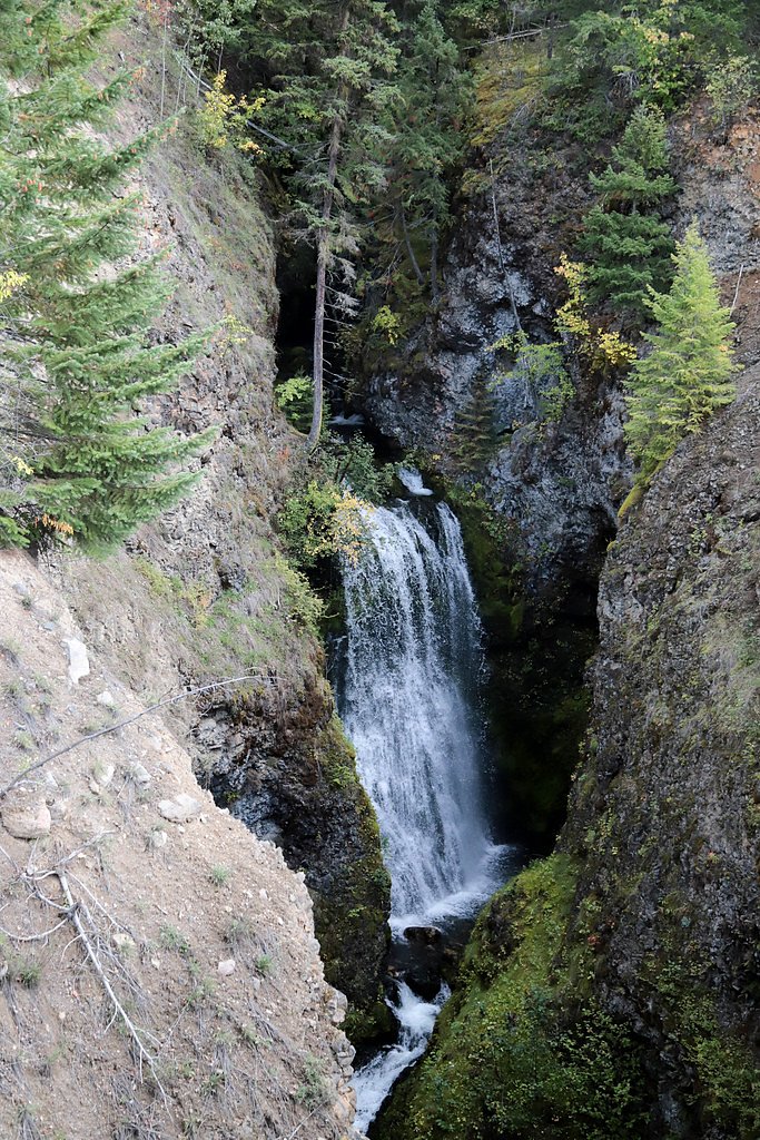
Third Canyon Falls
By Armen Suny · Last verified Jun 2026
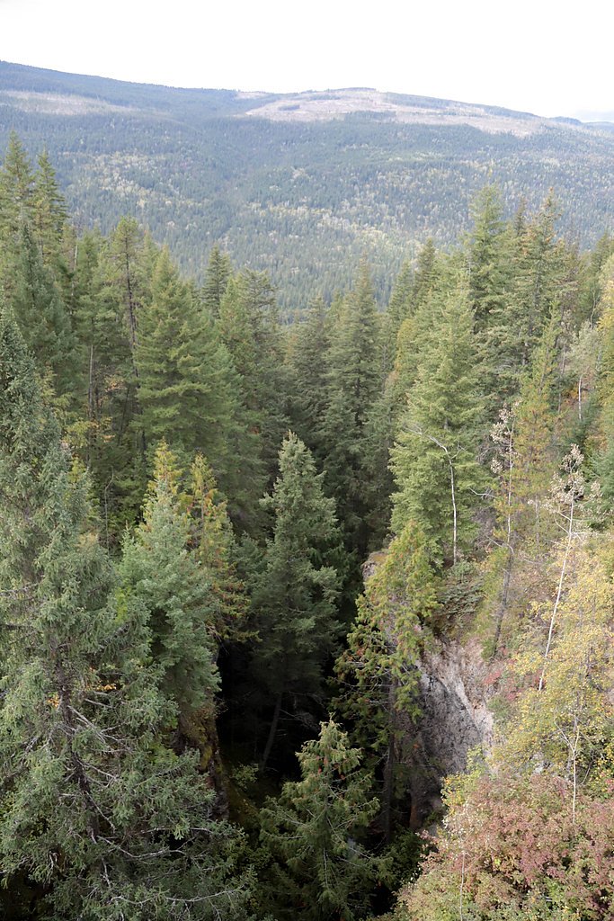
Photo Credits (4)
Difficulty
Drive Up
Trail Length
0.2 km
Trail Type
Out And Back
About Third Canyon Falls
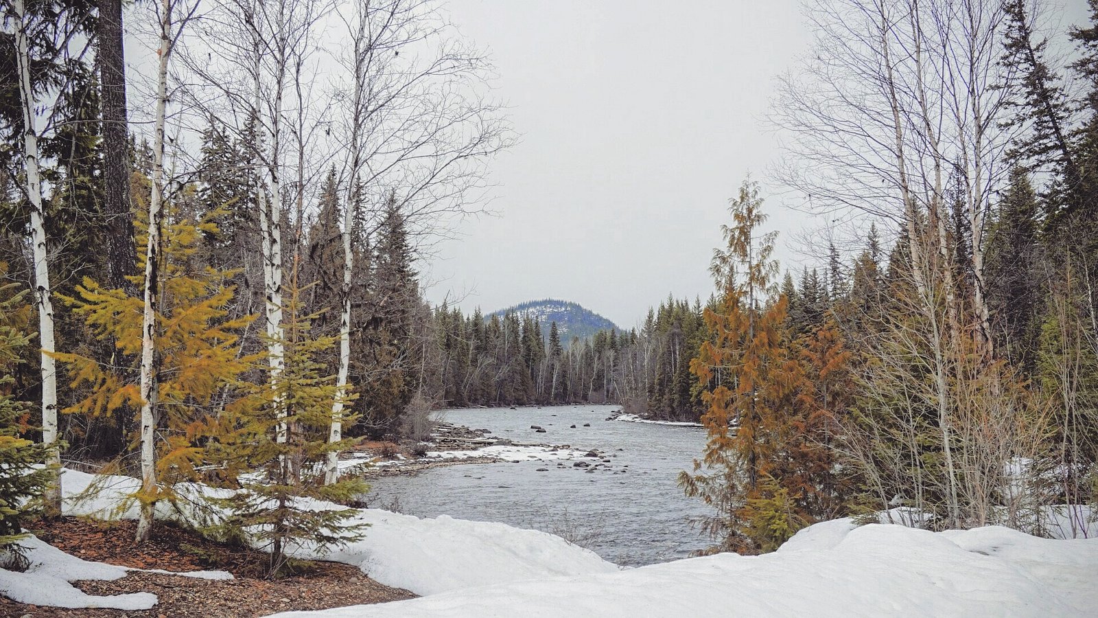
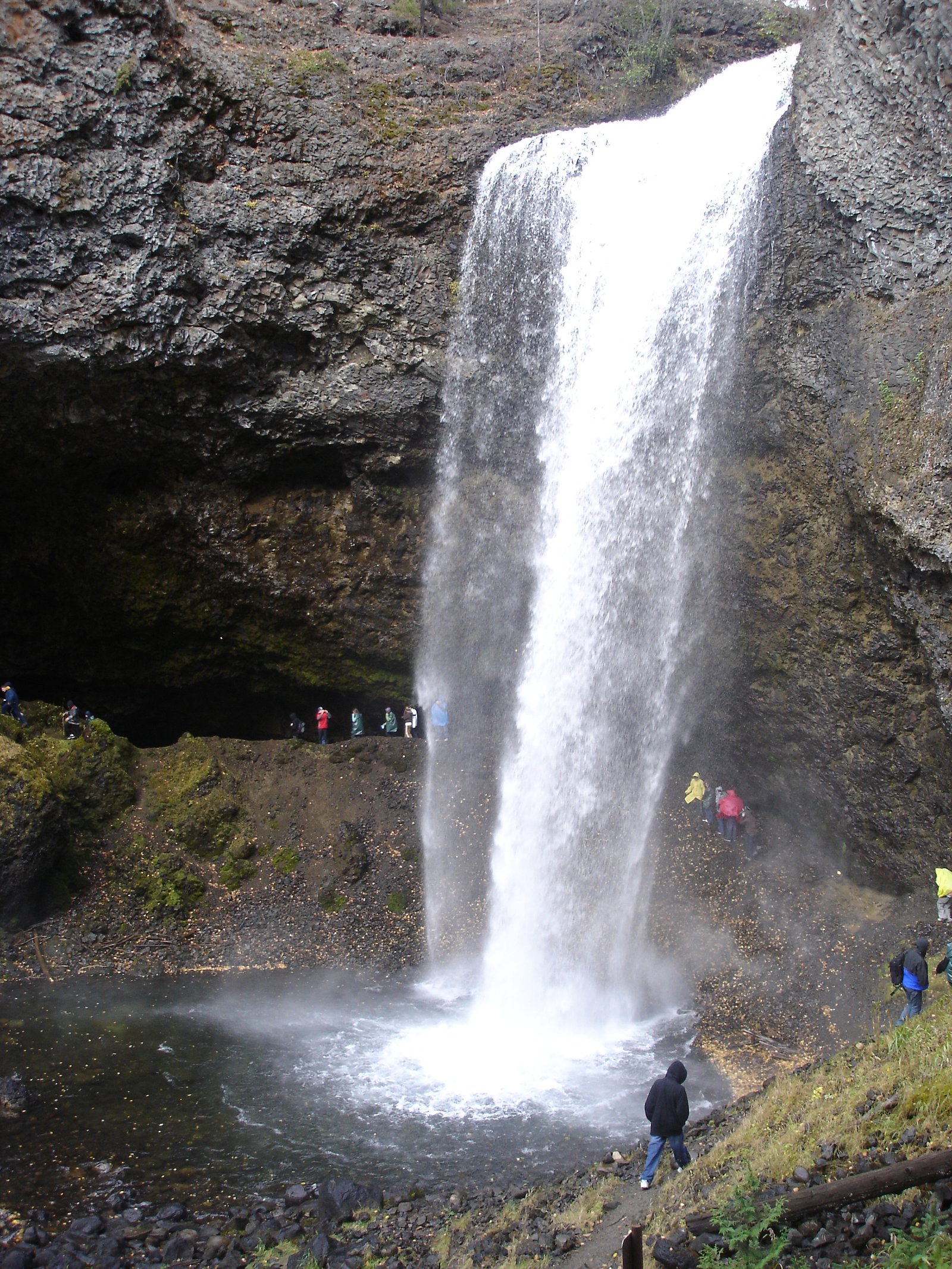
Third Canyon Falls is a small-to-medium waterfall situated in the interior of British Columbia near the coordinates provided (51.7874, -120.0107). The fall sits in a steep, narrow canyon on a tributary stream and is best known for a scenic canyon setting rather than a single large plunge. Specific published measurements and an official name entry are scarce; descriptions below are based on regional context and typical canyon-falls in this part of BC and should be treated as provisional.
Why This Waterfall Exists
Third Canyon Falls flows over layered sedimentary rock laid down about 252 million to 1.0 billion years ago. Over time, the stream has worn through these layers at different rates, creating the step that forms the waterfall.
Nearby Falls Worth Visiting
Spahats Falls (60 m) lies 5.6 kilometres to the south. Also nearby: Moul Falls (35 m, 6.0 km) and Second Canyon Falls (15 m, 1.9 km).
Trail & Hike Details
The Approach
No hiking required. Third Canyon Falls is accessible by vehicle with a roadside viewing area.
Trail Description
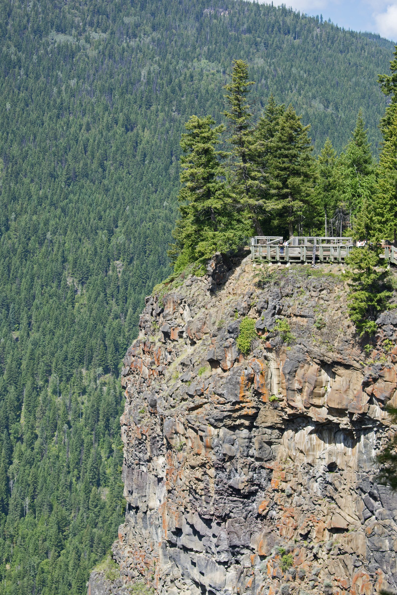
There is no widely published, maintained trail description for Third Canyon Falls. Visitors should expect an unmarked or lightly marked route from a nearby road or pullout, with short but potentially steep and brushy approaches down into the canyon. Route-finding and some scrambling over rocks/roots may be required. If a logging road is used to approach, a final cross-country walk may be necessary to reach good viewpoints.
What to Expect
Expect a canyon setting with exposed rock walls, limited viewpoints from rim and possibly closer views at the canyon floor. Flow varies seasonally, higher in spring/snowmelt and after heavy rain, lower in late summer and fall. There are likely no formal viewpoints, railings, or maintained switchbacks. Terrain may be uneven, steep, and slippery near wet rock and moss. Cell coverage may be limited.
Accessibility
This waterfall is viewable from a vehicle-accessible area. No hiking is required.
Frequently Asked Questions
🐶 Are Dogs Allowed at Third Canyon Falls?
❌ Dogs are not allowed
Are There Any Fees or Permits Required?
🆖 No fees required
🏊 Is There Swimming at Third Canyon Falls?
❌ Swimming is not allowed
When to Visit
Late spring (snowmelt) and early summer typically deliver the best flows and photos. Summer offers easier road access in dry years. Fall can provide good color but lower flows. Winter access may be very difficult or unsafe due to snow, ice, and closed roads; approach only with appropriate winter experience and equipment.
Seasonal Access
The best time to visit is Spring, Summer, Fall, and Winter. Check with the managing park or local authority for current conditions.
Safety Information
Hazards include unstable cliff edges, slippery wet rock, fast-moving water especially during spring runoff, and unmarked trails or steep, brushy approach routes. Logging roads and private roads may be active; obey signage and closures. Cell coverage may be poor, tell someone your plan and expected return time. If you are unfamiliar with backcountry travel, consider going with an experienced companion or local guide.
Current Water Conditions
386.0 m³/s
Current discharge — how much water is flowing
About average for this time of year
Based on 86 years of record
3.71 m
Water depth at gauge
7-Day Discharge Trend
What does this mean for your visit?
Flow is about average for this time of year.
About This Gauge
This gauge is on a nearby waterway and may not reflect exact conditions at the falls.
7-Day Flow Outlook
Based on the WSC gauge CLEARWATER RIVER NEAR CLEARWATER STATION (15 km away).
Today
Moderate
417 m³/s
5/10Tomorrow
Moderate
399 m³/s
6/10Wed
Moderate
370 m³/s
6/10Thu
Moderate
357 m³/s
8/10Fri
Moderate
377 m³/s
5/10Sat
Moderate
349 m³/s
8/10Sun
Moderate
350 m³/s
5/10Best window: Thu — moderate flow, mainly sunny (trip score 8/10).
Best time of year: this gauge typically runs highest from early May to early August, peaking in June.
How we calculate this
This is a transparent outlook, not a precise forecast. We take the waterfall's current flow strength (how it ranks against its historical normal for today, from the nearest WSC stream gauge), carry that ranking forward along the gauge's seasonal curve, and nudge it for forecast rain. Confidence is highest for the next day or two and falls further out. Always check official conditions and your own judgment before visiting — high flows can be dangerous.
Weather Forecast
Location & Access
Getting There
The falls are in a remote/interior-BC setting. Expect to reach the general area by paved secondary highways and then on smaller forest or logging roads. Use a GPS device with the provided coordinates and consult local maps. Some roads may be rough and require a high-clearance vehicle; seasonal washouts and gated logging roads are possible. The nearest larger settlement is in the general Clearwater / North Thompson River region (regional reference only).
Get Directions on Google MapsParking
No formal parking lot or developed day-use area is known for this feature. Parking is likely roadside at a pullout or at the end of a forest access road. Park well clear of traffic lanes and avoid blocking gates or private driveways. Expect no facilities.
Elevation
748 metres above sea level
Coordinates
51.787432° N, -120.010712° W
Visitor Tips & Gear
• Use the provided coordinates, topographic maps, and a GPS; do not rely solely on smartphone mapping in remote areas. • Wear sturdy footwear with good traction; expect scrambling and slippery rock. • Give extra time for rough roads and possible gate closures. • Avoid approaching the edge of the canyon; cliffs can be unstable and undercut. • Check for logging activity or land closures in the area before you go. • Leave no trace: pack out all waste and avoid disturbing vegetation or cultural sites.
Where to Stay
Browse vacation cabins and private rentals nearby
Unique outdoor stays — tents, yurts, and treehouses
Rent a campervan or RV for your waterfall road trip
Some links are affiliate links. We may earn a commission at no extra cost to you.
Nearby Campground
Trophy Mountain Buffalo Ranch
3.8 km away
Additional Information
Nearby Attractions
This area of interior British Columbia is regionally known for provincial parks, rivers, and forested landscapes. Wells Gray Provincial Park and the North Thompson River corridor are regional attractions in the broader area (use local maps to confirm proximity).
Wildlife
Typical interior-BC wildlife may be present: black bears, deer, moose, small mammals, and birds. Practice standard wildlife safety (store food securely, carry bear spray where appropriate, keep distance).
Nearby Waterfalls
Writing about Third Canyon Falls? Embed this waterfall on your site for free.