Spahats Falls
British Columbia • Wells Gray Park • 60 m
By Armen Suny · Last verified Jun 2026
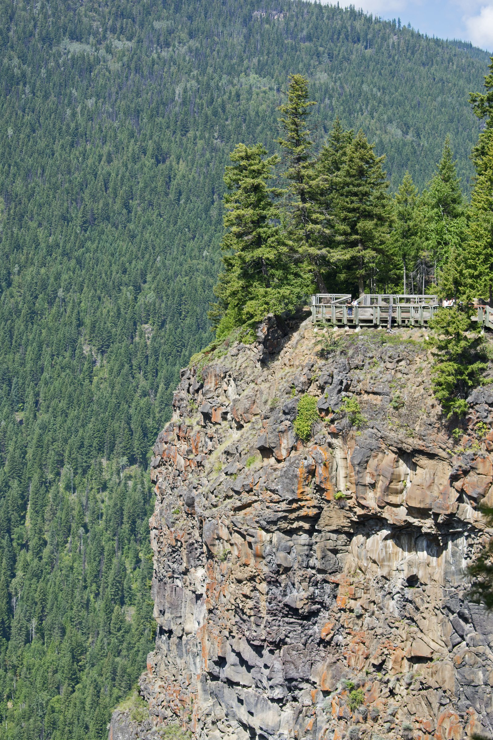
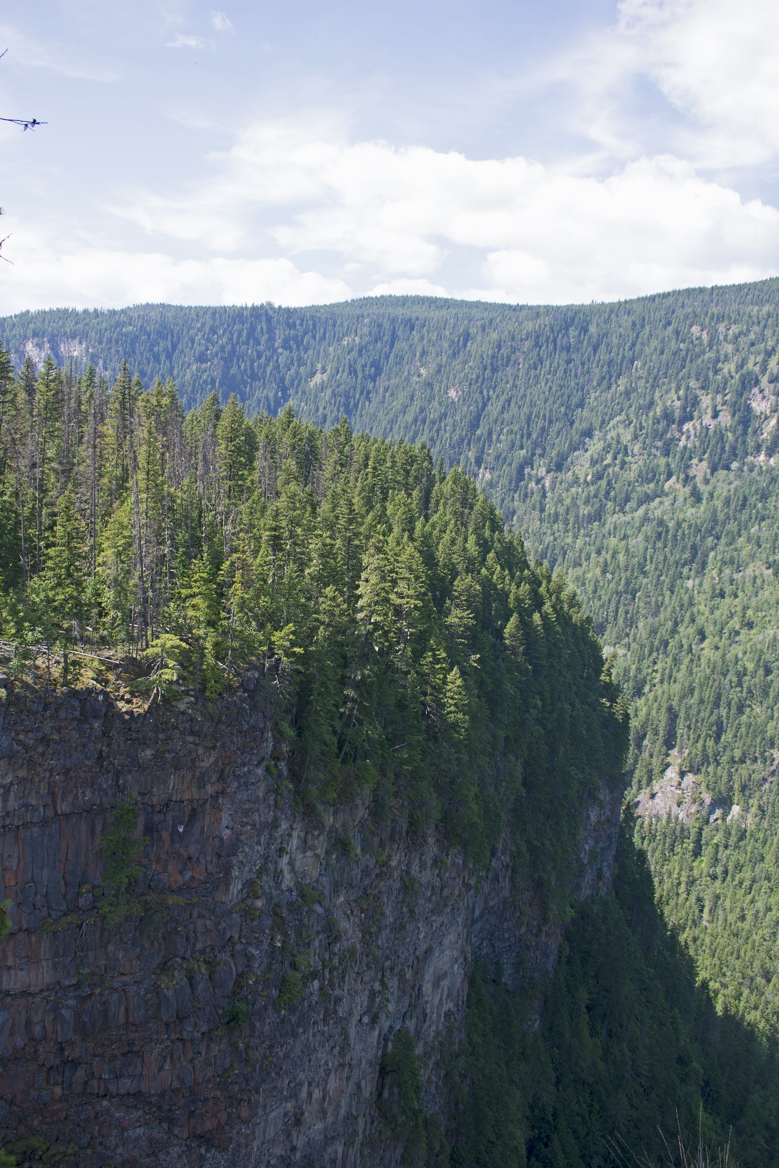
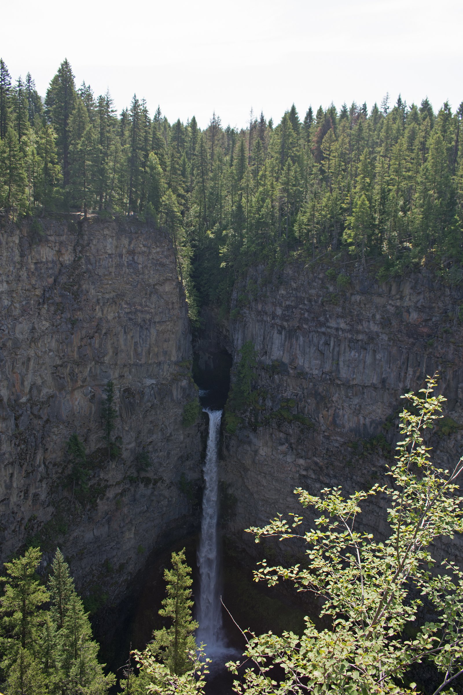
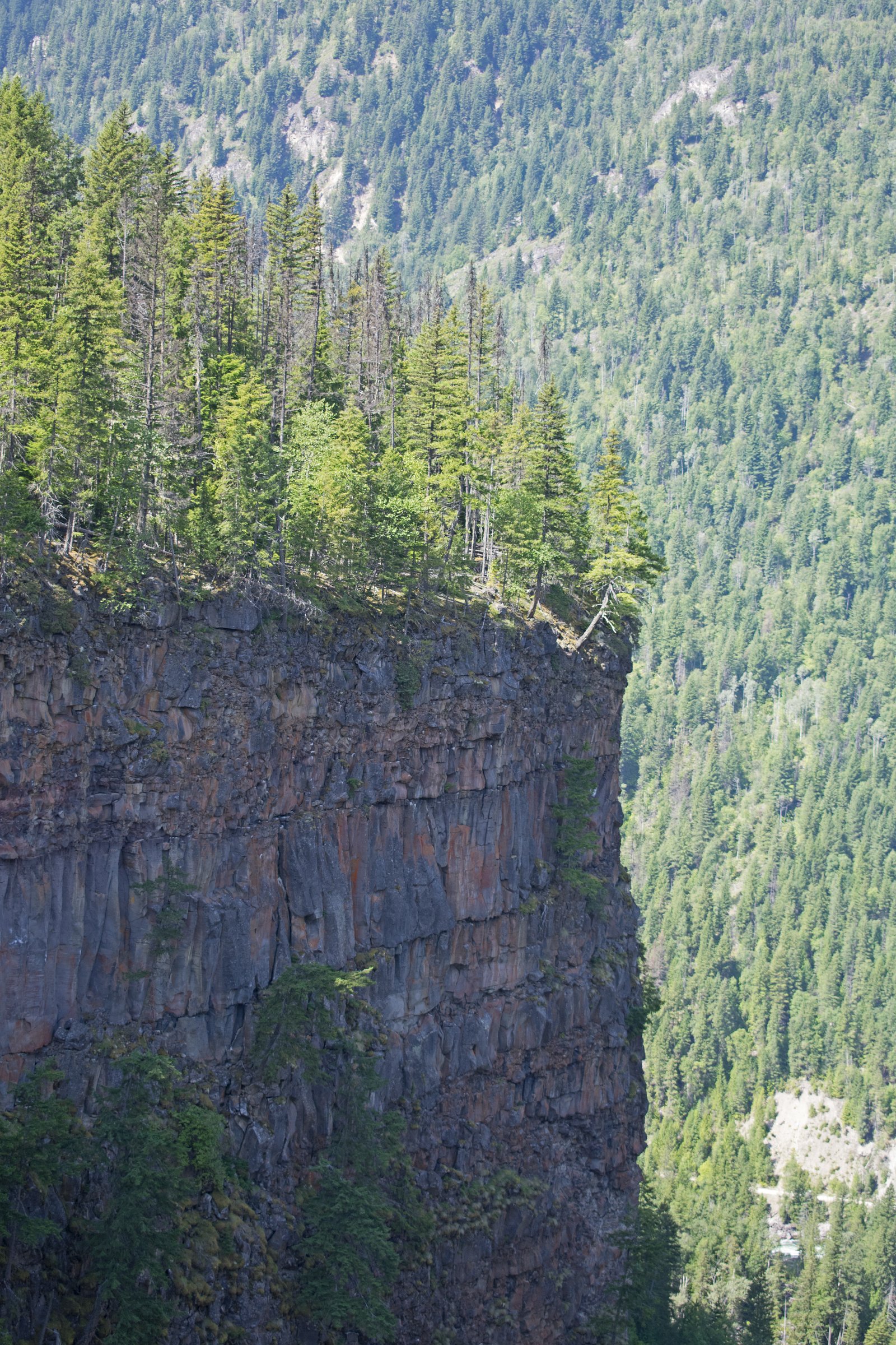
Photo Credits (5)
Difficulty
Drive Up
Trail Length
0.3 km
Trail Type
Out And Back
Elevation Gain
6 m
About Spahats Falls
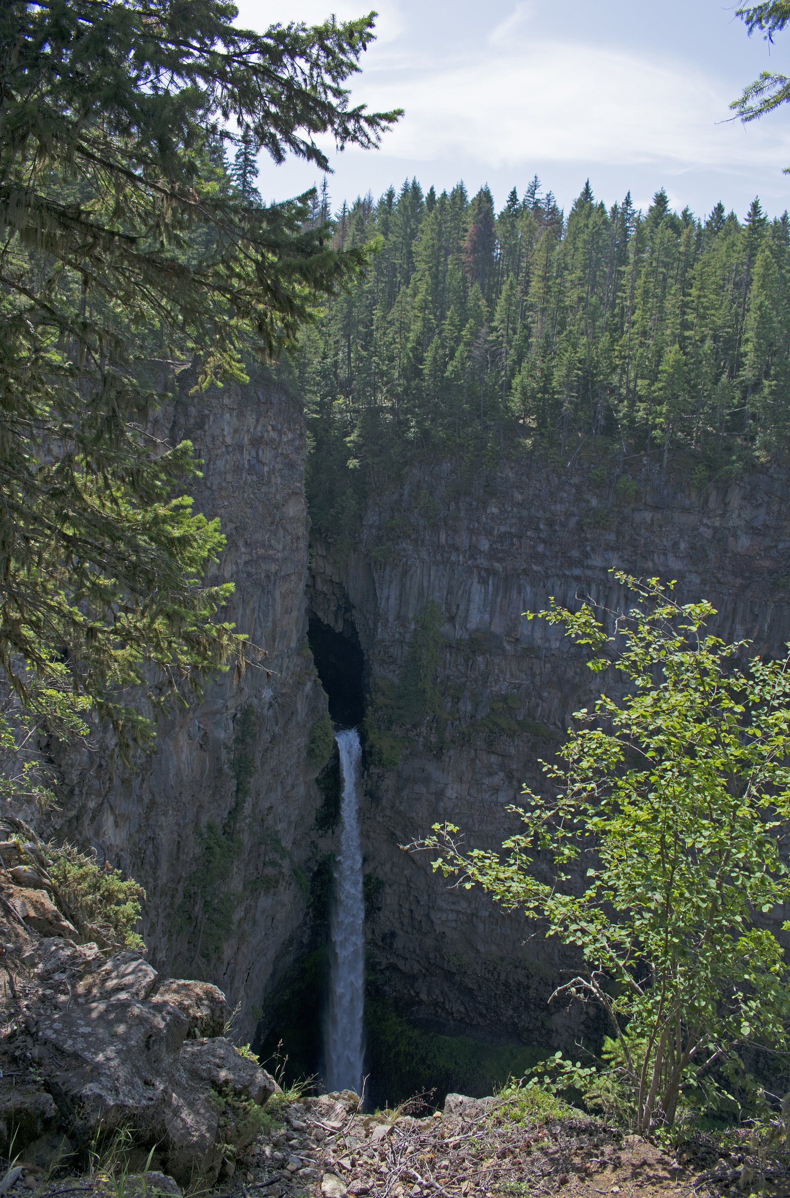
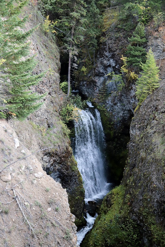
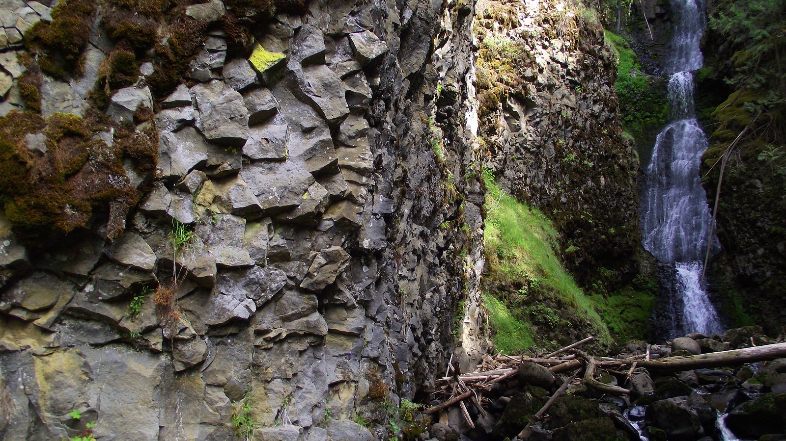
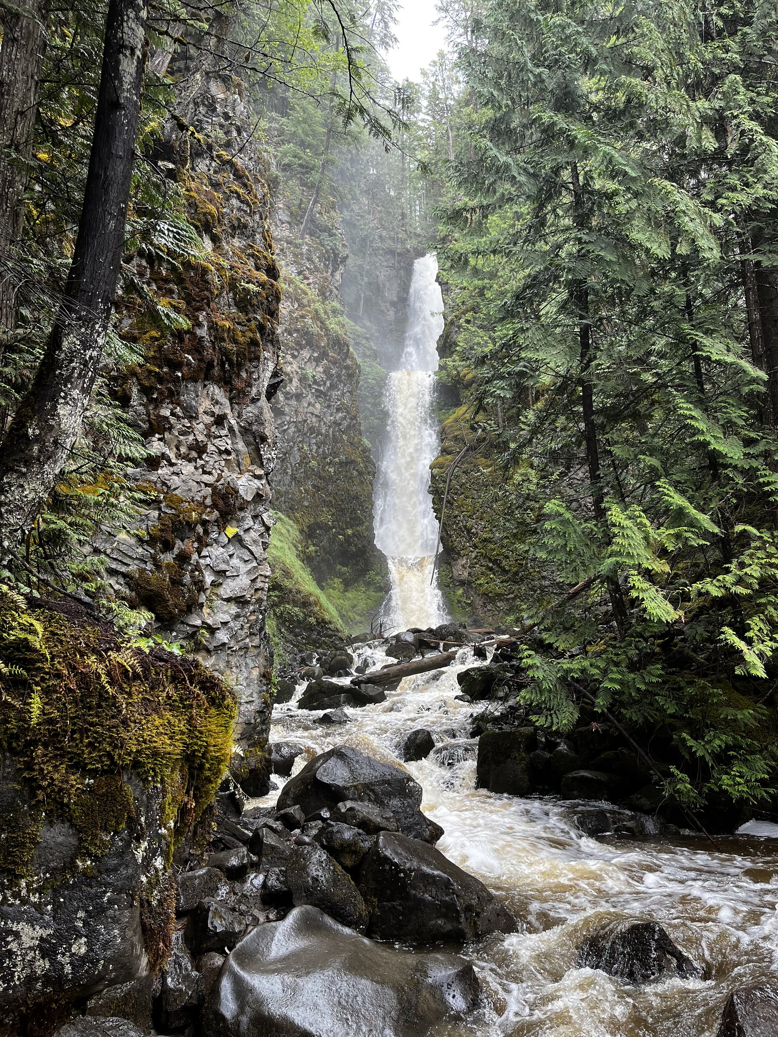
Spahats Falls is a dramatic, single-drop waterfall on the Clearwater River in Wells Gray Provincial Park, British Columbia. The falls plunge over a basalt cliff into a deep, scenic canyon with turquoise water and steep, forested walls. A roadside parking area and short boardwalk lead to one or more viewing platforms that provide excellent vantage points for photography and sightseeing. Flow is typically highest in spring and early summer during snowmelt and can be much reduced late in summer.
The Setting
Spahats Falls sits at 731 metres within Wells Gray Park, in the hills of British Columbia. At 60 metres, it is among the taller waterfalls in British Columbia.
Why This Waterfall Exists
Spahats Falls flows over layered sedimentary rock laid down about 252 million to 1.0 billion years ago. Over time, the stream has worn through these layers at different rates, creating a 197-foot drop that forms the waterfall.
Nearby Falls Worth Visiting
Second Canyon Falls (15 m) lies 3.7 kilometres to the north.
Trail & Hike Details
The Approach
No hiking required. Spahats Falls is accessible by vehicle with a roadside viewing area.
Trail Description
From the parking area a short paved/boardwalk path leads to one or more overlooks at the rim of the canyon. The main viewpoint is a brief, mostly paved walk suitable for most visitors; there may be stairs to a lower viewpoint in places and unimproved surfaces near the canyon edge. The short trail is easy and intended primarily as an overlook rather than a long hike.
What to Expect
The falls plunge 60 metres over layered sedimentary rock.
Accessibility
This waterfall is viewable from a vehicle-accessible area. No hiking is required.
Frequently Asked Questions
🐶 Are Dogs Allowed at Spahats Falls?
❌ Dogs are not allowed
Are There Any Fees or Permits Required?
🆖 No fees required
🏊 Is There Swimming at Spahats Falls?
❌ Swimming is not allowed
When to Visit
Late spring to early summer for highest flows and dramatic viewing. Summer and fall offer easier access and milder weather. Winter provides opportunities for frozen-water photography but can present icy, slippery conditions and limited services.
Seasonal Access
The best time to visit is Spring, Summer, Fall, and Winter. Check with Wells Gray Park for current conditions.
Safety Information
Hazards: steep cliffs and drop-offs, slippery or icy boardwalks and stairs (especially in winter), strong river currents, and falling rocks in portions of the canyon. Stay on designated paths and behind guardrails, supervise children and pets closely, and avoid going below the falls or approaching the canyon edge. Limited cell coverage in some areas; have a plan for emergencies. Weather and road conditions can change rapidly, carry appropriate clothing and equipment.
Current Water Conditions
382.0 m³/s
Current discharge — how much water is flowing
About average for this time of year
Based on 87 years of record
3.70 m
Water depth at gauge
7-Day Discharge Trend
What does this mean for your visit?
Flow is about average for this time of year.
About This Gauge
This gauge is on a nearby waterway and may not reflect exact conditions at the falls.
7-Day Flow Outlook
Based on the WSC gauge CLEARWATER RIVER NEAR CLEARWATER STATION (10 km away).
Today
Moderate
407 m³/s
5/10Tomorrow
Moderate
390 m³/s
8/10Tue
Moderate
373 m³/s
6/10Wed
Moderate
360 m³/s
6/10Thu
Moderate
347 m³/s
6/10Fri
Moderate
366 m³/s
5/10Sat
Moderate
366 m³/s
5/10Best window: Tomorrow — moderate flow, sunny (trip score 8/10).
Best time of year: this gauge typically runs highest from early May to early August, peaking in June.
How we calculate this
This is a transparent outlook, not a precise forecast. We take the waterfall's current flow strength (how it ranks against its historical normal for today, from the nearest WSC stream gauge), carry that ranking forward along the gauge's seasonal curve, and nudge it for forecast rain. Confidence is highest for the next day or two and falls further out. Always check official conditions and your own judgment before visiting — high flows can be dangerous.
Weather Forecast
Location & Access
Getting There
Spahats Falls is located in Wells Gray Provincial Park near Highway 5 (the Yellowhead Highway) in central British Columbia, north of Clearwater. The falls are signed from the highway and are reached by a short drive from the main road to a small parking area and viewpoint. Road access may be affected by winter conditions.
Get Directions on Google MapsParking
Small paved parking lot at the Spahats Falls viewpoint directly off Highway 5. Parking can fill during peak season; larger vehicles and RVs should use caution in the lot.
Elevation
731 metres above sea level
Coordinates
51.736242° N, -120.014154° W
Land Management
Managed by Government of British Columbia
Visitor Tips & Gear
Arrive early in peak season to secure parking. Stay behind safety barriers and keep children and pets closely supervised, cliff edges are steep. Wear sturdy shoes for icy or muddy conditions, especially in shoulder seasons. Cell service may be limited; plan accordingly. If you are visiting in winter, dress for cold and icy surfaces and use extra caution on boardwalks and stairs.
As an Amazon Associate, we earn from qualifying purchases.
For this easy 0.3 km trail, lightweight trail shoes and a water bottle are usually sufficient. Icy conditions are common in winter — traction cleats are a smart addition.

Columbia Watertight II Rain Jacket
Packs into its own pocket, seam-sealed, and keeps you dry from spray and surprise rain.

Polarized Sunglasses (Knockaround)
Cuts glare off the water so you actually see the falls — and your photos turn out better too.

Earth Pak Waterproof Dry Bag
Keeps your phone and gear dry when waterfall mist soaks everything else.

Waterproof Phone Pouch (AiRunTech)
Cheap insurance — take photos right next to the falls without killing your phone.

Kahtoola MICROspikes
Cult-favorite traction cleats that grip ice and wet rock — essential for winter waterfall hikes.

JOBY GorillaPod Starter Kit
Wraps around railings and rocks for long-exposure waterfall shots — no flat surface needed.
Where to Stay
Browse vacation cabins and private rentals nearby
Unique outdoor stays — tents, yurts, and treehouses
Rent a campervan or RV for your waterfall road trip
Some links are affiliate links. We may earn a commission at no extra cost to you.
Nearby Campground
Spahats Creek Resort
1.3 km away
Additional Information
Nearby Attractions
Wells Gray Provincial Park offers several other notable waterfalls nearby, including Helmcken Falls (one of Canada's tallest), Dawson Falls, and Moul Falls. The small community of Clearwater provides services and is the main gateway to the park.
Wildlife
Wildlife in the area can include black bears, moose, deer, coyotes, small mammals, and a variety of birds. Keep a respectful distance and store food securely. Bear encounters are possible; carry bear spray where appropriate and know how to use it.
Nearby Waterfalls
Writing about Spahats Falls? Embed this waterfall on your site for free.