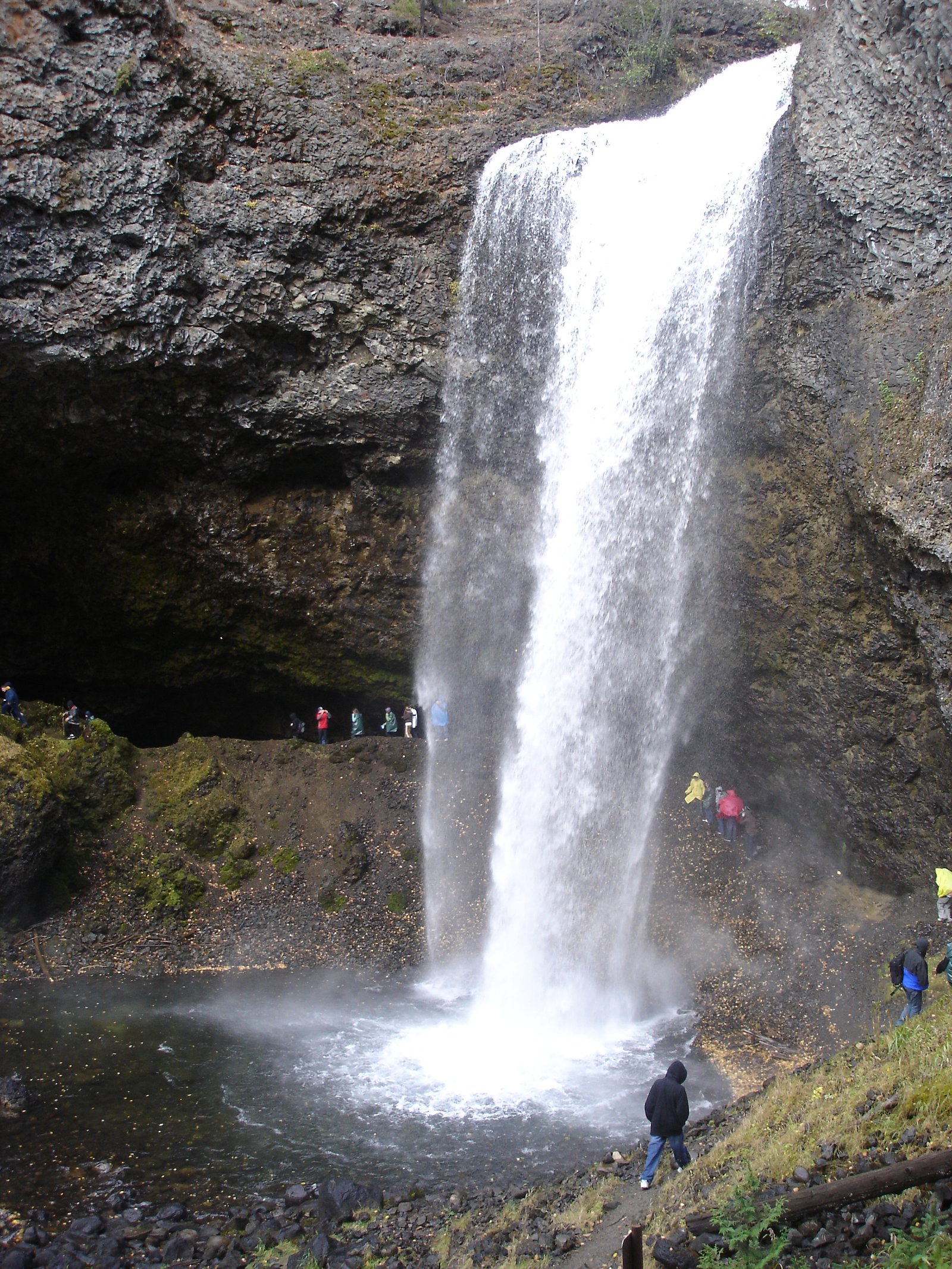
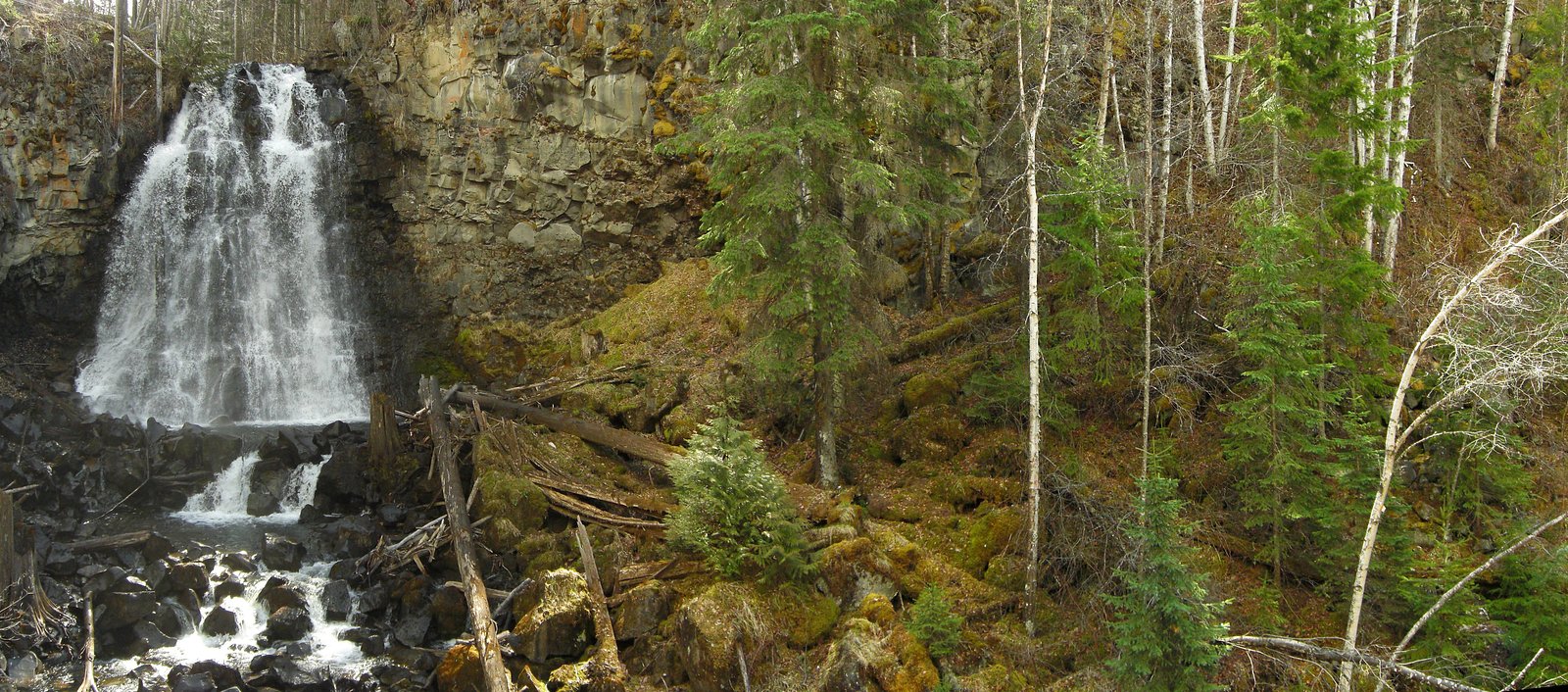
Moul Falls
British Columbia • Wells Gray Park • 35 m
By Armen Suny · Last verified Jun 2026
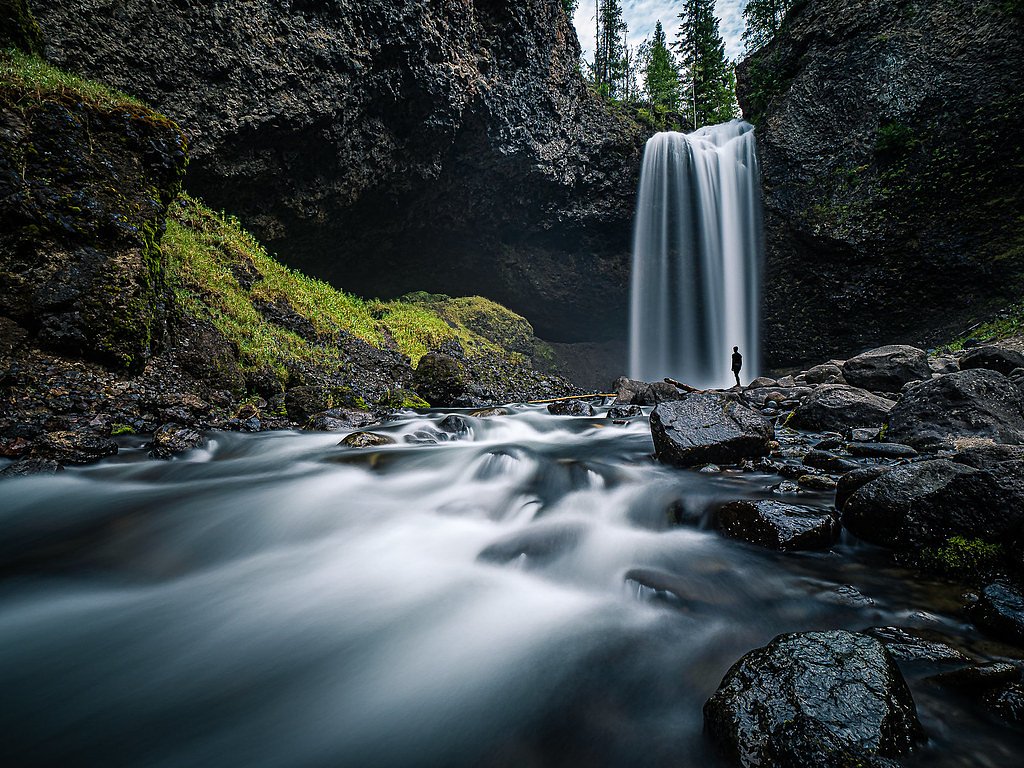
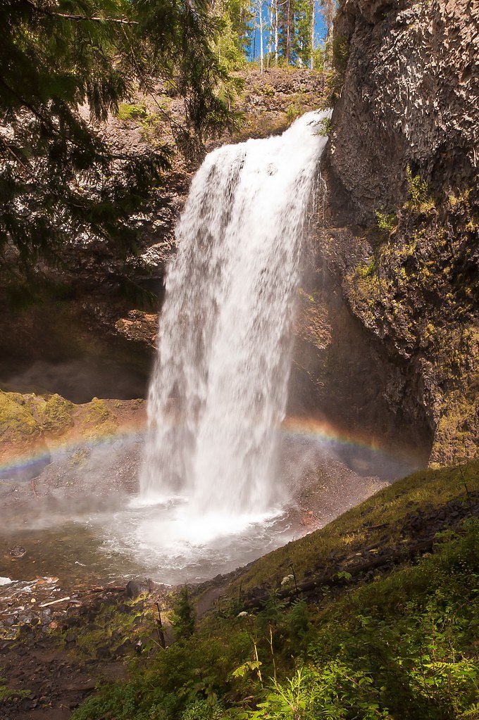
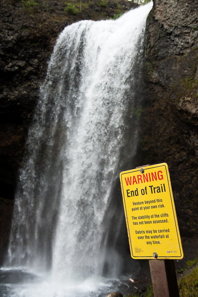

Photo Credits (4)
Difficulty
Moderate
Trail Length
5.5 km
Trail Type
Out And Back
Elevation Gain
195 m
About Moul Falls
Moul Falls is a waterfall on Grouse Creek in Wells Gray Provincial Park, east-central British Columbia, Canada. It is one of the park's most popular short hiking trails. It is the only waterfall in the park that one can stand behind. Moul Falls is the third highest waterfall in the park, measured as a straight, unbroken drop.
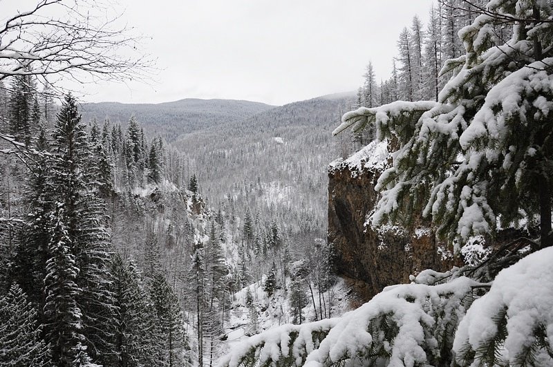
The Setting
Moul Falls sits at 608 metres within Wells Gray Park, in the hills of British Columbia. At 35 metres, it is among the taller waterfalls in British Columbia.
Height: 115 feet
Nearby Falls Worth Visiting
McDiarmid Falls (10 m) lies 0.2 kilometres to the southwest.
Trail & Hike Details
The Approach
The moderate 5.5-km out-and-back trail gains 195 metres of elevation on the way to the falls.
Trail Description
The trail to Moul Falls is a relatively short, forested path that descends toward the waterfall. Expect tree-rooted and uneven sections, a series of stairs or sloped switchbacks approaching the falls, and a short scramble to reach the area behind the falls. The trail is well-used but can be muddy and slippery, especially after rain or during spring melt. Trail markers are present but bring a map or GPS if unfamiliar with the area.
What to Expect
The falls cascade 35 metres.
Accessibility
The trail is not wheelchair accessible. Uneven terrain and elevation changes require steady footing.
Frequently Asked Questions
🐶 Are Dogs Allowed at Moul Falls?
❌ Dogs are not allowed
Are There Any Fees or Permits Required?
🆖 No fees required
🏊 Is There Swimming at Moul Falls?
❌ Swimming is not allowed
When to Visit
Late spring to early summer for higher flow and dramatic falls; summer for easier access and warmer weather; fall for fewer crowds and autumn colors. Winter visits are possible but can be icy and hazardous, special gear and caution required.
Seasonal Access
The best time to visit is Spring, Summer, and Fall. Winter access may be limited. Check with Wells Gray Park for current conditions.
Safety Information
Hazards include slippery, wet rocks and trails, heavy spray that can reduce visibility, cold water temperatures, and limited cell service. Fall and spring conditions can be muddy; winter brings ice and snow. Watch footing near edges and behind the falls, supervise children closely, and be bear-aware (make noise, carry bear spray where locally recommended). Check road and trail conditions before travel.
Current Water Conditions
383.0 m³/s
Current discharge — how much water is flowing
About average for this time of year
Based on 86 years of record
3.70 m
Water depth at gauge
7-Day Discharge Trend
What does this mean for your visit?
Flow is about average for this time of year.
About This Gauge
This gauge is on a nearby waterway and may not reflect exact conditions at the falls.
7-Day Flow Outlook
Based on the WSC gauge CLEARWATER RIVER NEAR CLEARWATER STATION (20 km away).
Today
Moderate
414 m³/s
5/10Tomorrow
Moderate
396 m³/s
6/10Wed
Moderate
367 m³/s
8/10Thu
Moderate
354 m³/s
6/10Fri
Moderate
374 m³/s
5/10Sat
Moderate
373 m³/s
5/10Sun
Moderate
360 m³/s
5/10Best window: Wed — moderate flow, mainly sunny (trip score 8/10).
Best time of year: this gauge typically runs highest from early May to early August, peaking in June.
How we calculate this
This is a transparent outlook, not a precise forecast. We take the waterfall's current flow strength (how it ranks against its historical normal for today, from the nearest WSC stream gauge), carry that ranking forward along the gauge's seasonal curve, and nudge it for forecast rain. Confidence is highest for the next day or two and falls further out. Always check official conditions and your own judgment before visiting — high flows can be dangerous.
Weather Forecast
Location & Access
Getting There
Moul Falls is accessed from Clearwater, BC. From Clearwater take Clearwater Valley Road (Highway 24) into Wells Gray Provincial Park. Follow park roads toward Spahats/Moul Falls; the Moul Falls trailhead is at a small parking area off the park road. Road and parking access may be seasonal or affected by weather, drive carefully and check BC Parks or local sources for current conditions.
Get Directions on Google MapsParking
Small gravel parking lot at the trailhead; spaces are limited and can fill on busy summer days. Park responsibly (no blocking) and expect no formal services (toilets may be seasonal or limited).
Elevation
608 metres above sea level
Coordinates
51.834953° N, -120.049908° W
Land Management
Managed by Government of British Columbia
Visitor Tips & Gear
Wear sturdy, non-slip footwear; expect wet and slippery rock surfaces. Bring a waterproof layer and protect camera equipment from spray. Arrive early in summer to secure parking. Use insect repellent in warmer months. Stay off unstable edges and avoid climbing on wet rocks near the falls. Pack out all trash and follow Leave No Trace. Check BC Parks updates for road or trail advisories before traveling.
As an Amazon Associate, we earn from qualifying purchases.
With 5.5 km and 195 m of elevation gain, sturdy boots and trekking poles will help on this moderate trail. Sun exposure on the trail makes good sun protection a must in summer.

Polarized Sunglasses (Knockaround)
Cuts glare off the water so you actually see the falls — and your photos turn out better too.

Columbia Watertight II Rain Jacket
Packs into its own pocket, seam-sealed, and keeps you dry from spray and surprise rain.

Earth Pak Waterproof Dry Bag
Keeps your phone and gear dry when waterfall mist soaks everything else.

Waterproof Phone Pouch (AiRunTech)
Cheap insurance — take photos right next to the falls without killing your phone.

Timberland Euro Sprint Mid Waterproof
Trusted waterproof boot with premium leather and grippy rubber sole — reliable on rocky, wet trails.

TrailBuddy Trekking Poles
Lightweight aluminum, cork grips, and flip-locks that actually hold — a best-seller for good reason.
Where to Stay
Browse vacation cabins and private rentals nearby
Unique outdoor stays — tents, yurts, and treehouses
Rent a campervan or RV for your waterfall road trip
Some links are affiliate links. We may earn a commission at no extra cost to you.
Nearby Campground
Trophy Mountain Buffalo Ranch
2.1 km away
Additional Information
Nearby Attractions
Helmcken Falls (major viewpoint in Wells Gray Provincial Park), Spahats Falls, Clearwater Lake, Mahood Falls, scenic trails and backcountry access in Wells Gray Provincial Park.
Wildlife
Typical interior-BC wildlife: black bears, deer, moose, cougars, small mammals and abundant birdlife. Insects (mosquitoes, black flies) can be numerous in warmer months. Maintain safe distance and store food properly.
Nearby Waterfalls
Writing about Moul Falls? Embed this waterfall on your site for free.