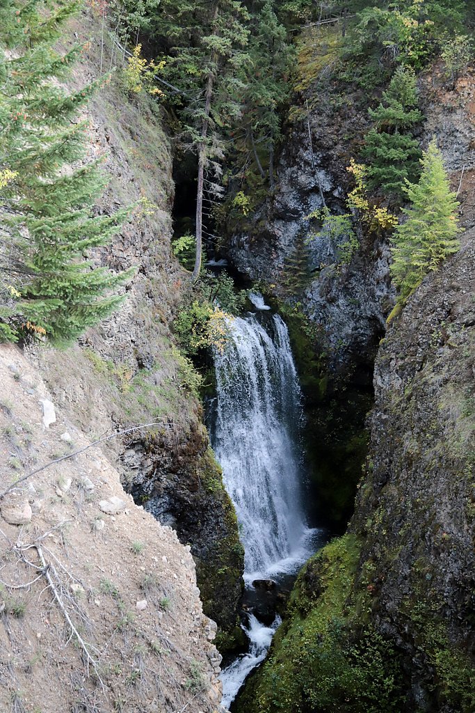
Second Canyon Falls
British Columbia • Wells Gray Park • 15 m
By Armen Suny · Last verified Jun 2026
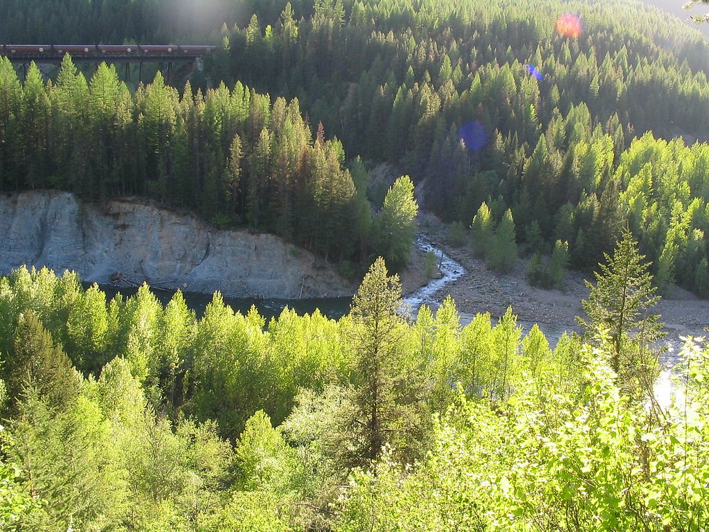
Photo Credits (2)
Difficulty
Easy
Trail Length
1.6 km
Trail Type
Out And Back
About Second Canyon Falls
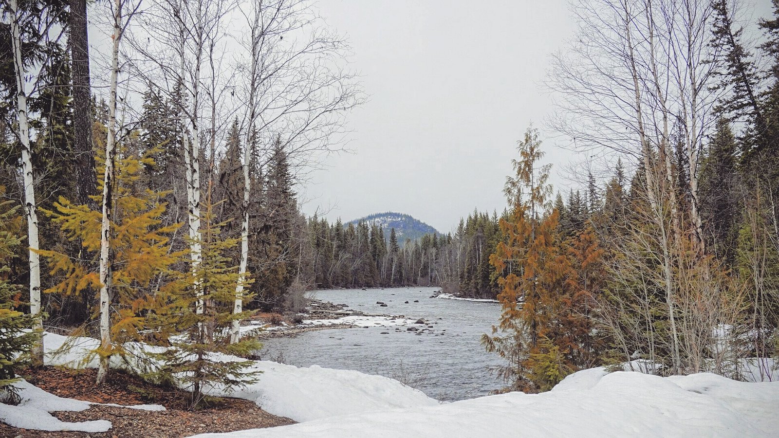
Second Canyon Falls is listed by local sources and visible on maps near coordinates 51.7696, -120.0118 in central British Columbia. It appears as a canyon-bound cascade on a tributary/section of the North Thompson River corridor. There is limited official, detailed documentation for this feature; many visitor reports indicate viewing is most commonly done from a short roadside viewpoint or an informal trail rather than a developed park facility. Exact height and formal measurements are not readily available in authoritative trail databases.
The Setting
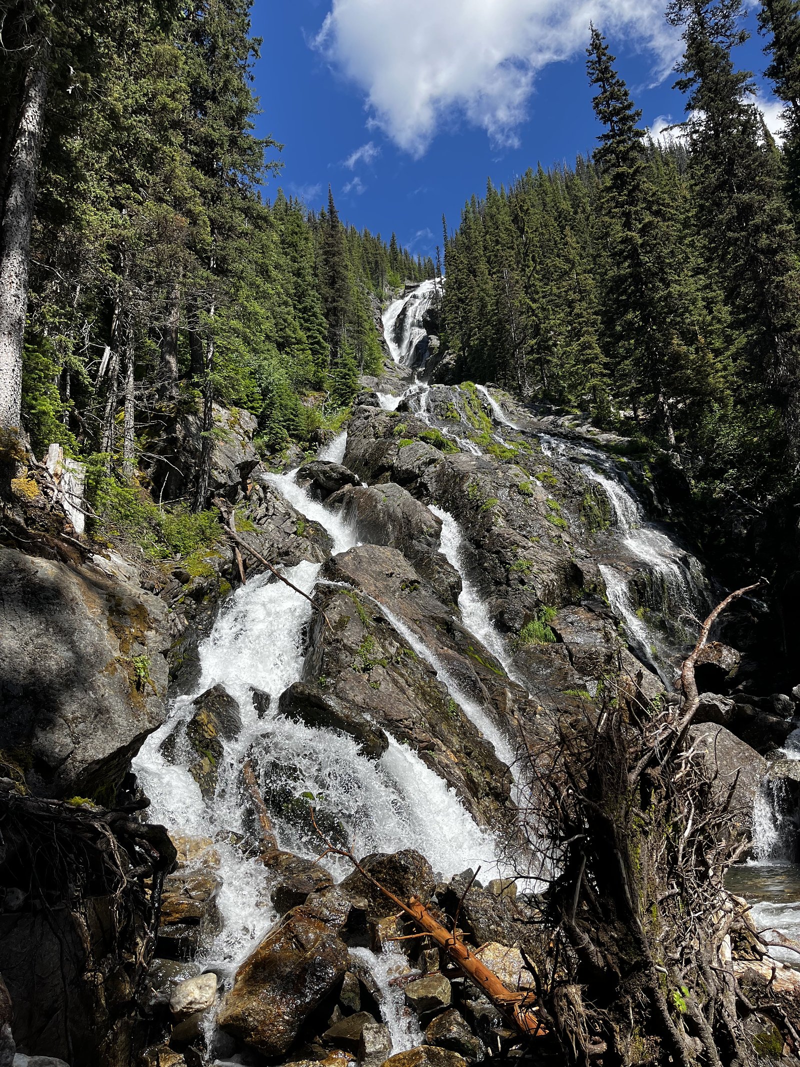
Second Canyon Falls sits at 644 metres within Wells Gray Park, in the hills of British Columbia. The falls drop 15 metres.
Why This Waterfall Exists
Second Canyon Falls flows over layered sedimentary rock laid down about 252 million to 1.0 billion years ago. Over time, the stream has worn through these layers at different rates, creating a 50-foot drop that forms the waterfall.
Nearby Falls Worth Visiting
Silvertip Falls (168 m) lies 6.4 kilometres to the east. Also nearby: Spahats Falls (60 m, 3.7 km).
Trail & Hike Details
Trail Description
There is no consistently documented maintained trail in official park literature for Second Canyon Falls. Many accounts describe either a short, informal path from a roadside pullout to a viewpoint above the canyon or a steeper scramble down to stream level. Expect uneven footing, rock steps, and possibly steep drop-offs near viewpoints. If a formal trail exists locally it is likely short (under a few miles round trip), unmarked, and subject to seasonal washouts.
What to Expect
The falls drop 15 metres over layered sedimentary rock.
Accessibility
The trail is not wheelchair accessible. Uneven terrain and elevation changes require steady footing.
Frequently Asked Questions
🐶 Are Dogs Allowed at Second Canyon Falls?
❌ Dogs are not allowed
Are There Any Fees or Permits Required?
🆖 No fees required
🏊 Is There Swimming at Second Canyon Falls?
❌ Swimming is not allowed
When to Visit
Late spring through early summer typically provides the highest flows and best visuals (snowmelt). Late summer and fall offer easier access and lower water levels but reduced flow. Winter access may be difficult or unsafe due to snow, ice, and limited visibility.
Seasonal Access
The best time to visit is Spring, Summer, and Fall. Winter access may be limited. Check with Wells Gray Park for current conditions.
Safety Information
Hazards include steep and unstable canyon edges, slippery wet rocks, fast-flowing water, sudden changes in flow after rain or snowmelt, limited cell service, and wildlife encounters (including bears). Wear appropriate footwear, keep a safe distance from edges, never climb unstable rock, supervise children closely, and carry bear spray where appropriate. If uncertain about conditions, seek local advice before attempting approaches into the canyon.
Current Water Conditions
382.0 m³/s
Current discharge — how much water is flowing
About average for this time of year
Based on 87 years of record
3.70 m
Water depth at gauge
7-Day Discharge Trend
What does this mean for your visit?
Flow is about average for this time of year.
About This Gauge
This gauge is on a nearby waterway and may not reflect exact conditions at the falls.
7-Day Flow Outlook
Based on the WSC gauge CLEARWATER RIVER NEAR CLEARWATER STATION (13 km away).
Today
Moderate
407 m³/s
5/10Tomorrow
Moderate
390 m³/s
8/10Tue
Moderate
373 m³/s
6/10Wed
Moderate
360 m³/s
6/10Thu
Moderate
347 m³/s
6/10Fri
Moderate
366 m³/s
5/10Sat
Moderate
366 m³/s
5/10Best window: Tomorrow — moderate flow, sunny (trip score 8/10).
Best time of year: this gauge typically runs highest from early May to early August, peaking in June.
How we calculate this
This is a transparent outlook, not a precise forecast. We take the waterfall's current flow strength (how it ranks against its historical normal for today, from the nearest WSC stream gauge), carry that ranking forward along the gauge's seasonal curve, and nudge it for forecast rain. Confidence is highest for the next day or two and falls further out. Always check official conditions and your own judgment before visiting — high flows can be dangerous.
Weather Forecast
Location & Access
Getting There
The falls are located in central British Columbia near Highway 5 (Yellowhead/Coquihalla corridor region). Nearest service towns are Clearwater and Barriere; access is typically from a roadside pullout or an informal trail off a nearby forest service road or highway turnout. Exact, signed trailheads and official approach routes are not well documented; use topographic maps or a recent local trip report for precise parking points.
Get Directions on Google MapsParking
Parking is likely limited to highway pullouts or informal gravel turnouts. There is no widely reported official lot, toilet, or developed visitor facility. Park legally and avoid blocking roadways. Expect uneven surfaces and limited room for multiple vehicles.
Elevation
644 metres above sea level
Coordinates
51.769573° N, -120.011848° W
Land Management
Managed by Government of British Columbia
Visitor Tips & Gear
• Check recent trip reports or local ranger/forest service updates before visiting. • Park in designated pullouts; avoid blocking shoulders. • Wear sturdy footwear, approaches may be rocky and slippery. • Keep dogs on leash where present and be prepared to control them near cliffs and water. • Do not approach canyon edges; rocks can be unstable. • Carry bear spray and know how to use it; this is bear country. • Respect private property and posted closures; some approaches may cross resource roads.
Where to Stay
Browse vacation cabins and private rentals nearby
Unique outdoor stays — tents, yurts, and treehouses
Rent a campervan or RV for your waterfall road trip
Some links are affiliate links. We may earn a commission at no extra cost to you.
Nearby Campground
Spahats Creek Resort
3.8 km away
Additional Information
Nearby Attractions
The broader region includes the North Thompson River corridor and, further afield, attractions such as Wells Gray Provincial Park (noted for its many waterfalls) and provincial forest recreation areas. Exact distances to named parks vary; consult local maps for planning.
Wildlife
Typical central-BC wildlife: black bears, possibly grizzly bears in some regions, deer, moose, cougars, smaller mammals and many bird species. Take standard wildlife precautions and store food securely.
Nearby Waterfalls
Writing about Second Canyon Falls? Embed this waterfall on your site for free.