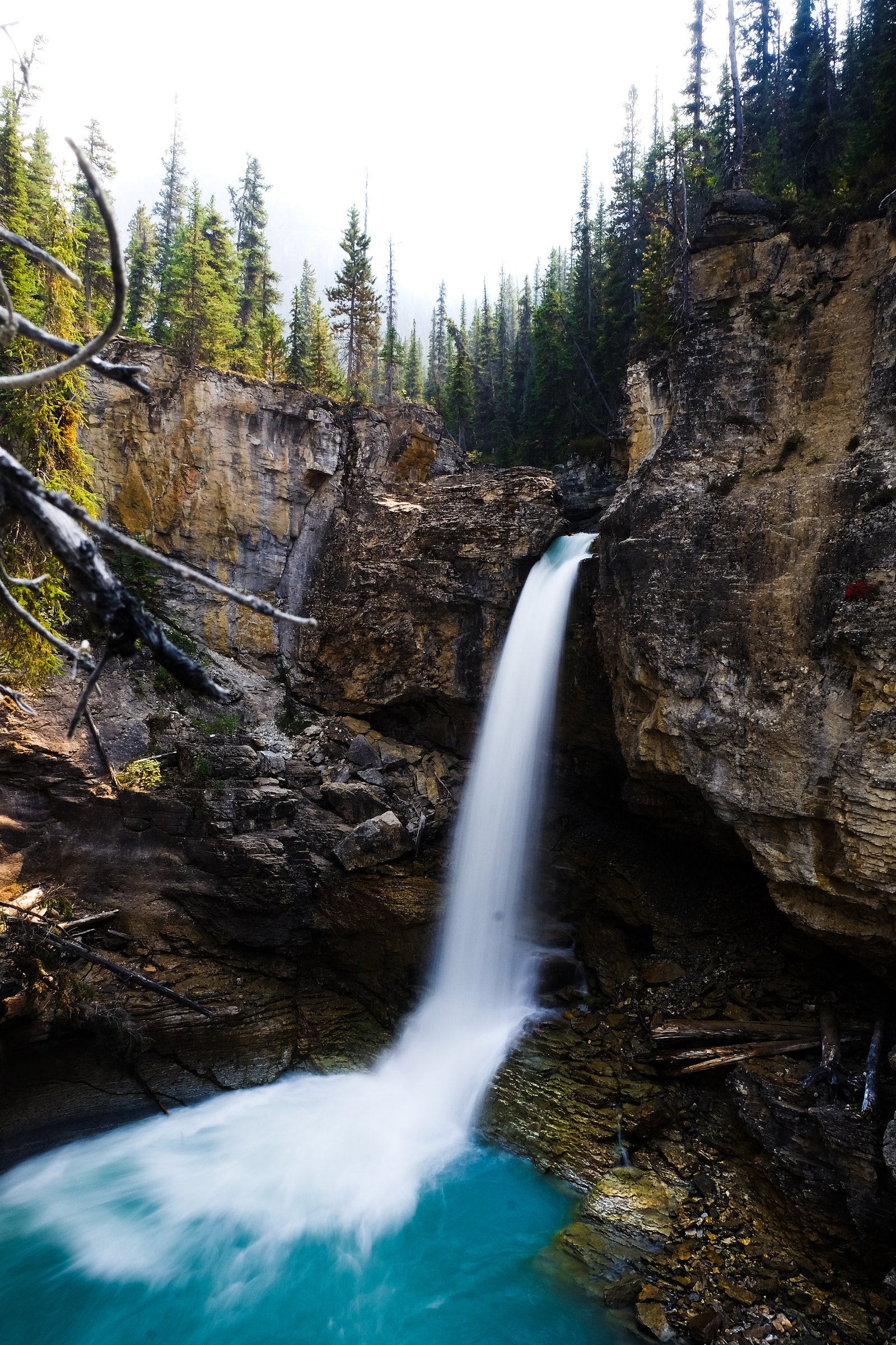
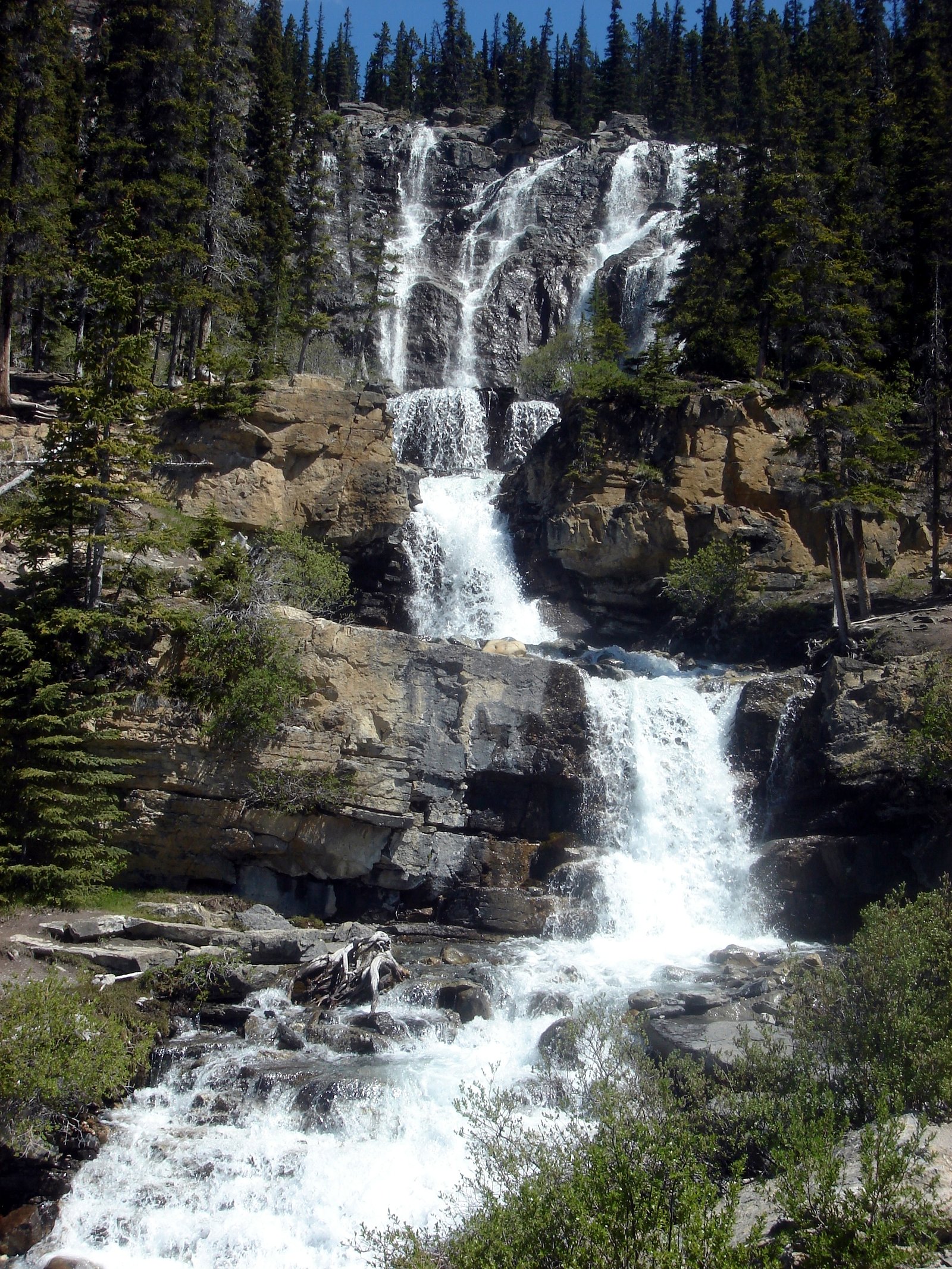
Stanley falls
Alberta • Jasper National Park • 12 m
By Armen Suny · Last verified Jun 2026
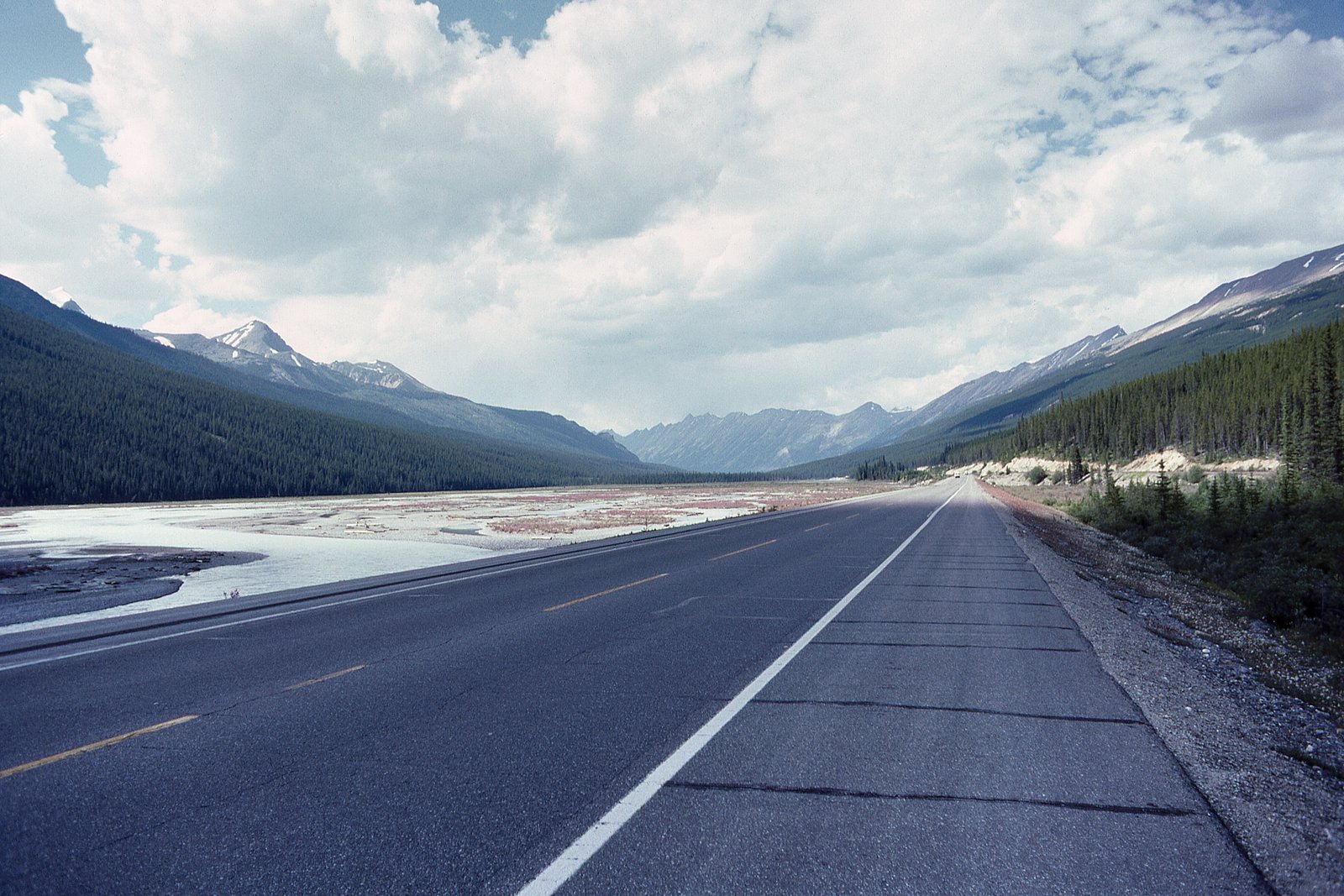
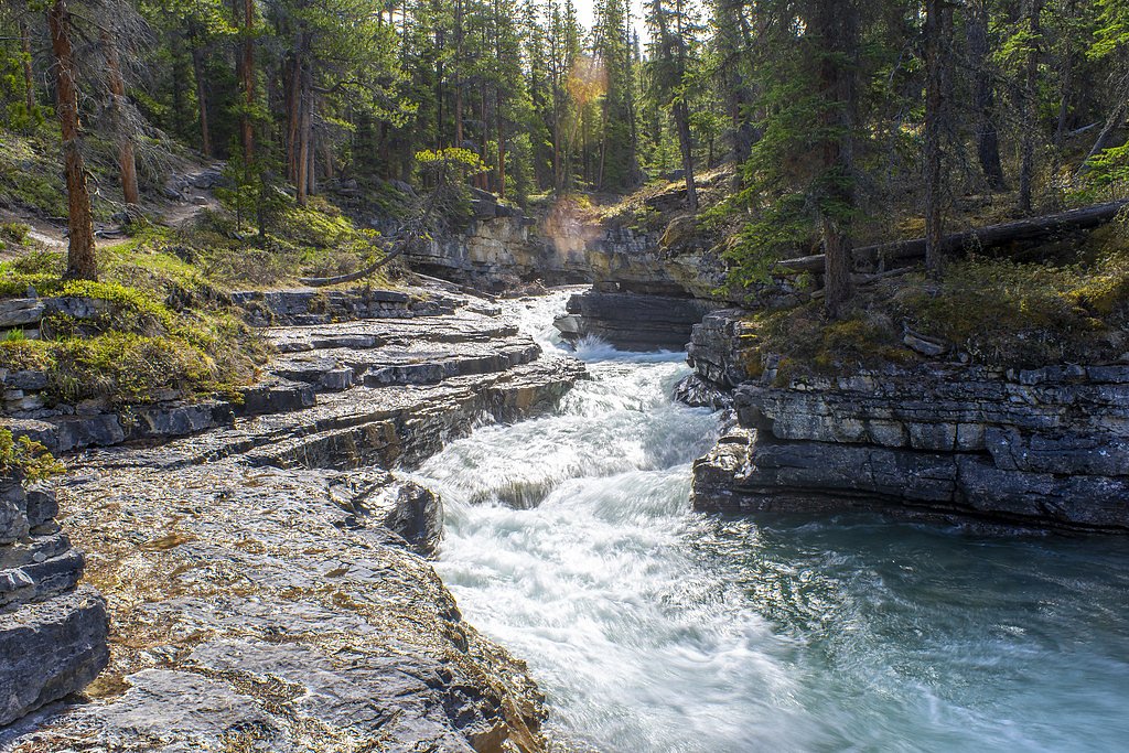
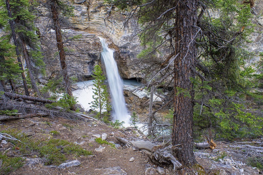
Photo Credits (5)
Difficulty
Moderate
Trail Length
3.9 km
Trail Type
Out And Back
Elevation Gain
136 m
About Stanley falls
Stanley Falls (coordinates 52.3227, -117.3158) is a mountain waterfall in the general Jasper/Yellowhead corridor of western Alberta/British Columbia border country. Publicly available detailed guidebook or official park descriptions for this exact named feature are limited; the waterfall appears to be in a remote, forested river valley reached by secondary roads and short backcountry approaches. Expect a natural, rugged setting with variable flow depending on snowmelt and seasonal rainfall. Exact measured height is not confirmed.
The Setting
Stanley falls sits at 1,670 metres within Jasper National Park, in the high mountains of Alberta. The falls drop 12 metres.
Why This Waterfall Exists
Stanley falls flows over layered carbonate rock, primarily dolomite, laid down about 497-509 million years ago. These soft rocks erode readily, allowing the stream to carve a 40-foot drop into the landscape.
Trail & Hike Details
The Approach
The moderate 3.9-km out-and-back trail gains 136 metres of elevation on the way to the falls.
Trail Description
Definitive published trail descriptions for Stanley Falls at these coordinates are limited or not readily available. Access likely involves a short hike from a nearby turnout or roadside pullout, possibly on an unmaintained path or creek-side scramble. Trails in this region can be steep and uneven, with wet / slippery rocks near the water. If you plan to hike in, prepare for minimal signage and potentially cross small streams; route-finding skills and a topographic map or GPS are recommended.
What to Expect
The falls drop 12 metres over soft fine-grained rock.
Accessibility
The trail is not wheelchair accessible. Uneven terrain and elevation changes require steady footing.
Frequently Asked Questions
🐶 Are Dogs Allowed at Stanley falls?
❌ Dogs are not allowed
Are There Any Fees or Permits Required?
🆖 No fees required
🏊 Is There Swimming at Stanley falls?
❌ Swimming is not allowed
When to Visit
Late spring through early summer for the highest flows (snowmelt). Summer offers the most reliable access on roads and trails; fall can be pleasant for color and fewer visitors but flows may be lower. Winter access is often difficult and hazardous; only recommended for experienced winter backcountry travelers with appropriate gear.
Seasonal Access
The best time to visit is Spring, Summer, and Fall. Access roads and trails may close during winter due to snow. Check with Jasper National Park for current conditions.
Safety Information
Hazards may include slippery rocks, steep drop-offs, fast cold water, sudden changes in weather, limited cell coverage, seasonal road closures, and wildlife encounters (bears). Use caution near cliff edges and riverbanks, do not climb wet rocks, and avoid approaching the lip or immediately below powerful cascades. In winter, ice and avalanche risk can be present. Check local advisories and prepare appropriately.
Current Water Conditions
8.4 m³/s
Current discharge — how much water is flowing
Much higher than usual for this time of year
Based on 67 years of record
1.17 m
Water depth at gauge
7-Day Discharge Trend
What does this mean for your visit?
The water is flowing much higher than usual, expect an impressive display.
About This Gauge
This gauge is on a nearby waterway and may not reflect exact conditions at the falls.
7-Day Flow Outlook
Based on the WSC gauge SUNWAPTA RIVER AT ATHABASCA GLACIER (13 km away).
Today
Roaring
11 m³/s
6/10Tomorrow
Roaring
10 m³/s
6/10Tue
Roaring
10 m³/s
6/10Wed
Roaring
11 m³/s
6/10Thu
Roaring
10 m³/s
8/10Fri
Roaring
10 m³/s
6/10Sat
Roaring
9.7 m³/s
9/10Best window: Sat — roaring flow, mainly sunny (trip score 9/10).
Best time of year: this gauge typically runs highest from early July to mid August, peaking in July.
How we calculate this
This is a transparent outlook, not a precise forecast. We take the waterfall's current flow strength (how it ranks against its historical normal for today, from the nearest WSC stream gauge), carry that ranking forward along the gauge's seasonal curve, and nudge it for forecast rain. Confidence is highest for the next day or two and falls further out. Always check official conditions and your own judgment before visiting — high flows can be dangerous.
Know when to go.
Get a free email alert when waterfalls near Jasper hit peak flow. We only send when conditions are worth the trip — no weekly newsletters, no spam.
Weather Forecast
Location & Access
Getting There
Location is approximately 59.9 miles (by road) from the town of Jasper. The site is best reached via the Yellowhead Highway (Hwy 16) and local forest or park access roads; final approach may require driving on gravel or forest roads and a short hike. Use detailed maps, current park/road reports, and GPS coordinates (52.3227, -117.3158) to plan travel. Cell service may be intermittent.
Get Directions on Google MapsParking
Parking details are not well documented. Expect limited or unmarked pullouts; parking may be informal on a shoulder or at a small turnout. In some seasons or locations parking areas may be closed or muddy. If visiting within a provincial or national park, use designated parking areas when provided.
Elevation
1,670 metres above sea level
Coordinates
52.322711° N, -117.315822° W
Land Management
Managed by Parks Canada Agency
Visitor Tips & Gear
1) Check current road and trail conditions with provincial park or forest service offices before you go. 2) Practice bear safety: carry bear spray where appropriate and know how to use it; make noise on the trail. 3) Wear sturdy, waterproof footwear; approach to viewpoints may be wet and slippery. 4) Expect limited facilities: no toilets, no potable water; pack out all trash. 5) If unfamiliar with backcountry navigation, go with someone who has experience or hire a guide. 6) Leave precise itinerary with someone and expect limited cell coverage.
This trail sits at 5,479 ft above sea level
Elevated TrailUV radiation is roughly 22% stronger at this elevation than at sea level, and the dry air accelerates dehydration. Extra sun protection and fluids go a long way.
As an Amazon Associate, we earn from qualifying purchases.

Coppertone Sport SPF 50 Sunscreen
UV intensity jumps ~4% per 1,000 ft — at this elevation you can burn in half the time.

Sun Bum SPF 30 Lip Balm (3-Pack)
Lips have almost no natural UV protection and burn fast in thin, dry mountain air.

Liquid I.V. Electrolyte Packets
You lose moisture ~2x faster at elevation — electrolytes help you absorb water efficiently.

ROCKNIGHT Polarized UV400 Sunglasses
High-altitude glare off rock and water is intense — UV400 lenses block 99%+ of UVA/UVB.
As an Amazon Associate, we earn from qualifying purchases.
With 3.9 km and 136 m of elevation gain, sturdy boots and trekking poles will help on this moderate trail. Sun exposure on the trail makes good sun protection a must in summer.

Polarized Sunglasses (Knockaround)
Cuts glare off the water so you actually see the falls — and your photos turn out better too.

Columbia Watertight II Rain Jacket
Packs into its own pocket, seam-sealed, and keeps you dry from spray and surprise rain.

Earth Pak Waterproof Dry Bag
Keeps your phone and gear dry when waterfall mist soaks everything else.

Waterproof Phone Pouch (AiRunTech)
Cheap insurance — take photos right next to the falls without killing your phone.

Timberland Euro Sprint Mid Waterproof
Trusted waterproof boot with premium leather and grippy rubber sole — reliable on rocky, wet trails.

TrailBuddy Trekking Poles
Lightweight aluminum, cork grips, and flip-locks that actually hold — a best-seller for good reason.
Where to Stay
Browse vacation cabins and private rentals nearby
Unique outdoor stays — tents, yurts, and treehouses
Rent a campervan or RV for your waterfall road trip
Some links are affiliate links. We may earn a commission at no extra cost to you.
Nearby Campground
Jonas Cutoff
10.9 km away
Additional Information
Nearby Attractions
The general Yellowhead/Highway 16 corridor and the Jasper / Mount Robson region offer multiple attractions (scenic viewpoints, trails, provincial and national parks). Use local visitor centres (Jasper or nearby) to find officially managed attractions and trailheads.
Wildlife
Black bear and possibly grizzly bear, elk, moose, mule deer, mountain goats in nearby high country, small mammals and many bird species. Maintain distance and follow wildlife safety guidelines.
Cities near Stanley falls
Nearby Waterfalls
Writing about Stanley falls? Embed this waterfall on your site for free.