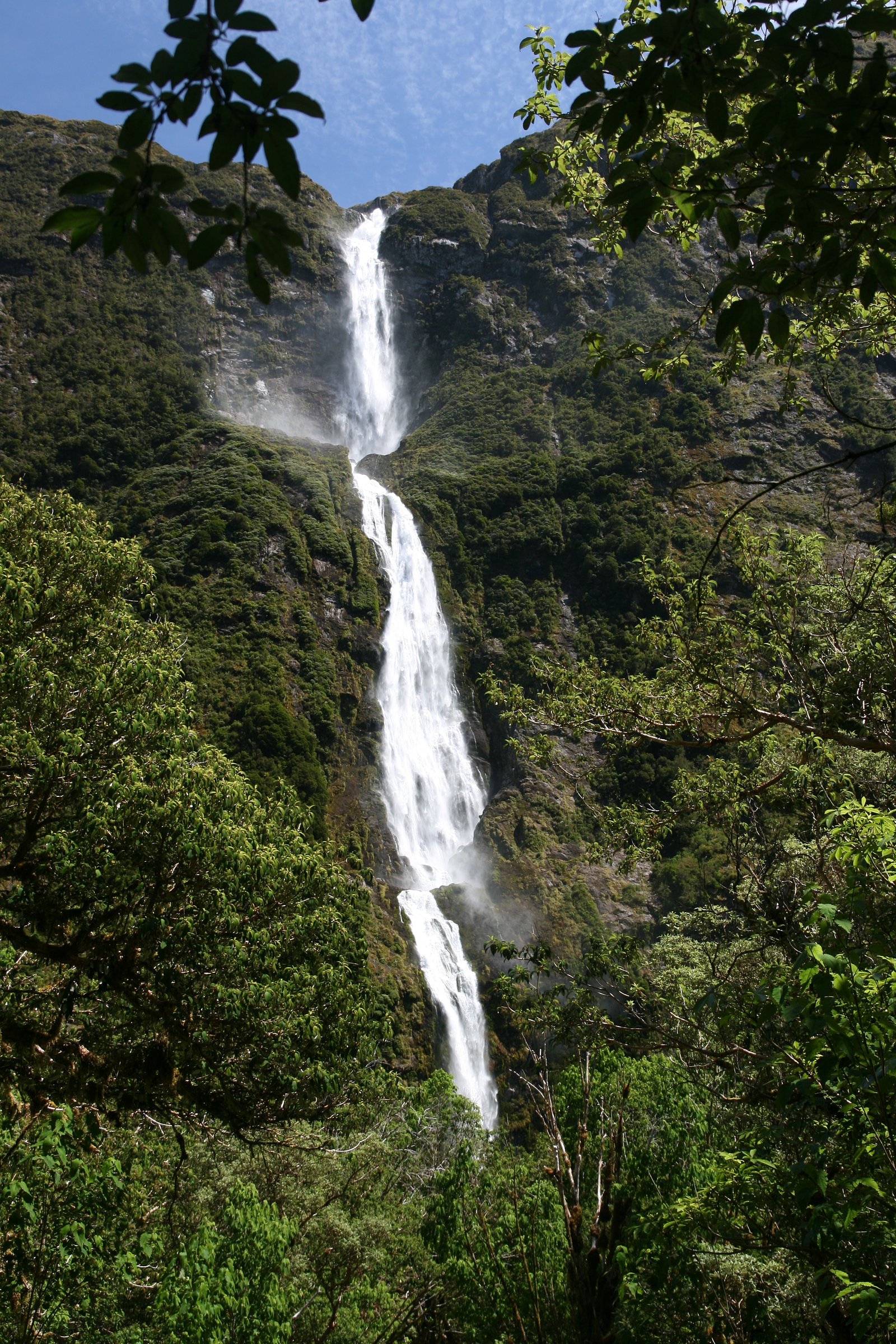
Sutherland Falls
British Columbia • 14 m
By Armen Suny · Last verified Jun 2026
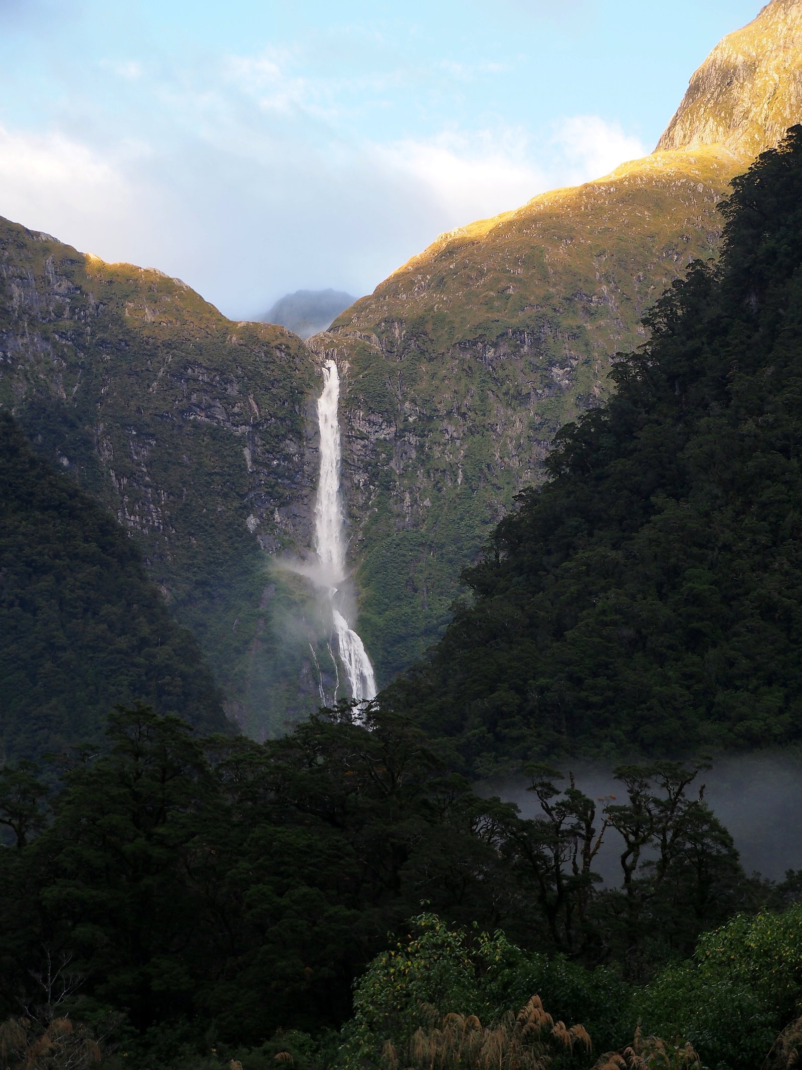
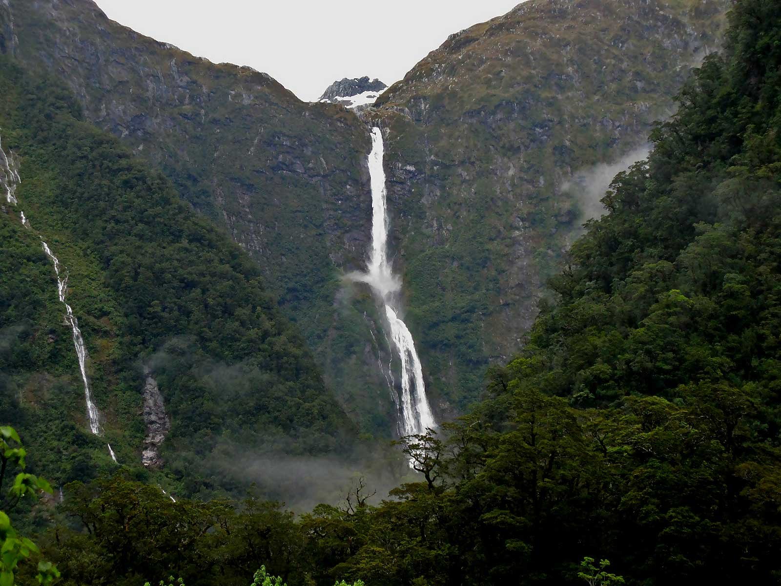
Photo Credits (5)
Difficulty
Easy
Trail Length
0.5 km
Trail Type
Out And Back
Elevation Gain
19 m
About Sutherland Falls
Sutherland Falls is a forested, likely seasonal waterfall located about 12.1 miles (approx. 19.5 km) from Revelstoke, British Columbia (coordinates 50.8335, -118.0904). It sits in a rugged mountain landscape typical of the Revelstoke area and is most impressive during spring melt and after heavy rains. Specific published details about official trailheads, height, and amenities are limited; this entry uses conservative, general guidance for visitors.
The Setting
Sutherland Falls sits at 491 metres within BLANKET CREEK PARK, in the hills of British Columbia. The falls drop 14 metres.
Why This Waterfall Exists
Sutherland Falls flows over Monashee Complex, a extremely hard metamorphic rock layer deposited about 419 million to 2.5 billion years ago. These resistant rocks form a durable ledge that water cannot easily wear away, creating a 45-foot drop where softer material downstream has already eroded.
Nearby Falls Worth Visiting
Mulvehill Creek Fall (100 m) lies 2.9 kilometres to the northwest.
Trail & Hike Details
The Approach
The easy 0.5-km out-and-back trail gains 19 metres of elevation on the way to the falls.
Trail Description
Publicly available, authoritative trail descriptions for Sutherland Falls (near Revelstoke) are limited. Approaches may follow informal or lightly maintained forest trails and could involve stream crossings, steep sections, or off-trail scrambling to reach overlooks. Expect a backcountry-style approach rather than a developed interpretive trail. Confirm route details with recent trip reports, local rangers, or park/forest service offices before going.
What to Expect
The falls drop 14 metres over extremely hard metamorphic rock.
Accessibility
The trail is short and relatively flat, but the surface may be uneven. Contact the managing agency for accessibility details.
Frequently Asked Questions
🐶 Are Dogs Allowed at Sutherland Falls?
❌ Dogs are not allowed
Are There Any Fees or Permits Required?
🆖 No fees required
🏊 Is There Swimming at Sutherland Falls?
❌ Swimming is not allowed
When to Visit
Late spring (snowmelt) for highest flows and dramatic water volume. Early summer for good access while flows remain strong. Late summer and fall may have lower flows but typically easier, drier access. Winter visits may be possible but expect ice, snow, and potentially hazardous conditions.
Seasonal Access
The best time to visit is Spring, Summer, Fall, and Winter. Check with the managing park or local authority for current conditions.
Safety Information
Hazards can include slippery rocks, steep cliffs, unstable banks, fast currents, cold water, hypothermia risk, and limited cell coverage. In winter expect ice and avalanche risks in steep terrain. Always use caution near the water and do not climb on wet or moss-covered rocks. Tell someone your plans and estimated return time before heading into remote areas.
Current Water Conditions
6.4 m³/s
Current discharge — how much water is flowing
About average for this time of year
Based on 19 years of record
24.55 m
Water depth at gauge
7-Day Discharge Trend
What does this mean for your visit?
Flow is about average for this time of year.
About This Gauge
7-Day Flow Outlook
Based on the WSC gauge CRANBERRY CREEK ABOVE B.C. HYDRO INTAKE (4 km away).
Today
Moderate
6.4 m³/s
8/10Tomorrow
Moderate
5.8 m³/s
6/10Tue
Moderate
5.5 m³/s
6/10Wed
Moderate
5.5 m³/s
6/10Thu
Moderate
5.7 m³/s
5/10Fri
Moderate
6.3 m³/s
5/10Sat
Moderate
5.7 m³/s
6/10Best window: Today — moderate flow, mainly sunny (trip score 8/10).
Best time of year: this gauge typically runs highest from early May to early August, peaking in June.
How we calculate this
This is a transparent outlook, not a precise forecast. We take the waterfall's current flow strength (how it ranks against its historical normal for today, from the nearest WSC stream gauge), carry that ranking forward along the gauge's seasonal curve, and nudge it for forecast rain. Confidence is highest for the next day or two and falls further out. Always check official conditions and your own judgment before visiting — high flows can be dangerous.
Know when to go.
Get a free email alert when waterfalls near Revelstoke hit peak flow. We only send when conditions are worth the trip — no weekly newsletters, no spam.
Weather Forecast
Location & Access
Getting There
From Revelstoke head toward the general coordinates (50.8335, -118.0904) using the Trans-Canada Highway (Highway 1) and local forest service or logging roads as needed. The waterfall is in a backcountry/forested setting; exact signed trailheads may be limited or unmarked. Use a reliable map or GPS and check recent local trip reports for the latest approach information.
Get Directions on Google MapsParking
Parking may be limited to a roadside turnout or small informal parking area. Park only in designated pullouts where provided and avoid blocking roads. If accessing via a forest service road, use official parking areas where available. Expect minimal facilities (no restrooms or maintained parking lot in many cases).
Elevation
491 metres above sea level
Coordinates
50.833525° N, -118.090408° W
Land Management
Managed by Government of British Columbia
Visitor Tips & Gear
• Check recent trip reports, AllTrails, and local forest service or park information before you go. • Wear sturdy, waterproof boots and expect slippery rocks near the falls. • Bring a paper map or reliable GPS; approach may be unmarked. • Park legally in designated areas and avoid blocking roads or driveways. • Carry bear spray and know how to use it; make noise in thick brush. • Respect private property and posted closures; access may cross Crown land, seasonal logging roads, or private land, confirm access beforehand. • If visiting in winter, be prepared for icy trails, avalanche hazard in steeper terrain, and very limited services.
As an Amazon Associate, we earn from qualifying purchases.
For this easy 0.5 km trail, lightweight trail shoes and a water bottle are usually sufficient. Icy conditions are common in winter — traction cleats are a smart addition.

Columbia Watertight II Rain Jacket
Packs into its own pocket, seam-sealed, and keeps you dry from spray and surprise rain.

Polarized Sunglasses (Knockaround)
Cuts glare off the water so you actually see the falls — and your photos turn out better too.

Earth Pak Waterproof Dry Bag
Keeps your phone and gear dry when waterfall mist soaks everything else.

Waterproof Phone Pouch (AiRunTech)
Cheap insurance — take photos right next to the falls without killing your phone.

Kahtoola MICROspikes
Cult-favorite traction cleats that grip ice and wet rock — essential for winter waterfall hikes.

JOBY GorillaPod Starter Kit
Wraps around railings and rocks for long-exposure waterfall shots — no flat surface needed.
Where to Stay
Browse vacation cabins and private rentals nearby
Unique outdoor stays — tents, yurts, and treehouses
Rent a campervan or RV for your waterfall road trip
Some links are affiliate links. We may earn a commission at no extra cost to you.
Nearby Campground
Blanket Creek Campground
0.7 km away
Additional Information
Nearby Attractions
Revelstoke offers multiple established attractions nearby, including Mount Revelstoke National Park, Revelstoke Mountain Resort, the Giant Cedars boardwalks and hiking, local hot springs and scenic viewpoints. Glacier National Park (BC) and Eagle Pass trail areas are also in the broader region.
Wildlife
Area may host black bears, deer, moose, small mammals, and potentially cougars. Birdlife and mountain rodents are common. Carry bear spray and follow wildlife safety practices.
Cities near Sutherland Falls
Nearby Waterfalls
Other waterfalls named Sutherland Falls
1 other waterfall shares this name across Canada.
Writing about Sutherland Falls? Embed this waterfall on your site for free.