Mulvehill Creek Fall
British Columbia • 100 m
By Armen Suny · Last verified Jun 2026
About Mulvehill Creek Fall
Mulvehill Creek Fall is a small creek-fed waterfall located in the Revelstoke area of British Columbia (coordinates: 50.8517, -118.1188). The feature appears to be a natural cascade on Mulvehill Creek set in typical Interior Cedar–Hemlock/Engelmann spruce forest. Detailed, published information about this specific fall is limited; descriptions below are conservative and reflect conditions commonly found at similar creek waterfalls in the Revelstoke region.
The Setting
Mulvehill Creek Fall sits at 478 metres in the hills of British Columbia. At 100 metres, it is among the taller waterfalls in British Columbia.
Why This Waterfall Exists
Mulvehill Creek Fall flows over Monashee Complex, a extremely hard metamorphic rock layer deposited about 419 million to 2.5 billion years ago. These resistant rocks form a durable ledge that water cannot easily wear away, creating a 328-foot drop where softer material downstream has already eroded.
Nearby Falls Worth Visiting
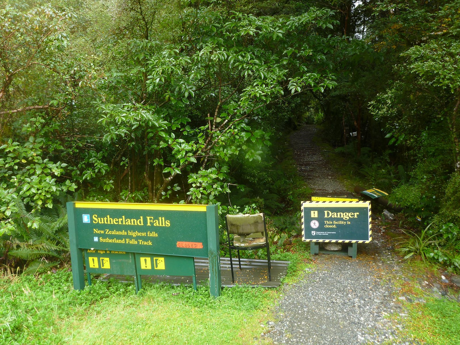
Sutherland Falls (14 m) lies 2.9 kilometres to the southeast.
Trail & Hike Details
Trail Description
Specific trail descriptions for Mulvehill Creek Fall are limited. Approaches to similar creek waterfalls near Revelstoke often involve short, informal paths from a road or a moderate hike along forest service roads and singletrack. Trails can be narrow, uneven, and may follow steeper sections near the creek. Expect natural surfaces, roots, and rocks; route-finding may be required if the site is not a posted viewpoint.
What to Expect
The falls plunge a dramatic 100 metres over extremely hard metamorphic rock.
Accessibility
Likely not wheelchair accessible. Approach routes are expected to be natural tread with roots, rocks, and uneven terrain. If a drive-up viewpoint exists, accessibility may be better, but this is not confirmed.
Frequently Asked Questions
🐶 Are Dogs Allowed at Mulvehill Creek Fall?
❌ Dogs are not allowed
Are There Any Fees or Permits Required?
🆖 No fees required
🏊 Is There Swimming at Mulvehill Creek Fall?
❌ Swimming is not allowed
When to Visit
Late spring (snowmelt) and early summer for highest water flow and fuller cascades. Fall can offer lower flows but attractive foliage. Winter visits may be possible but can be hazardous due to ice, deep snow, and closed forest roads.
Seasonal Access
The best time to visit is Spring, Summer, Fall, and Winter. Check with the managing park or local authority for current conditions.
Safety Information
• Slippery, wet rocks and steep banks create fall hazards, stay back from edges. • Water flows can rise quickly after rain or during snowmelt; avoid low crossings during high water. • Winter conditions can produce ice and deep snow; avalanche risk may be present off established roads and trails. • Road conditions on forest service roads can change rapidly; use appropriate vehicles and reduce speed. • Emergency services and cell coverage may be limited, carry a map, tell someone your route, and consider a personal locator beacon for remote outings.
Current Water Conditions
6.2 m³/s
Current discharge — how much water is flowing
About average for this time of year
Based on 19 years of record
24.54 m
Water depth at gauge
7-Day Discharge Trend
What does this mean for your visit?
Flow is about average for this time of year.
About This Gauge
7-Day Flow Outlook
Based on the WSC gauge CRANBERRY CREEK ABOVE B.C. HYDRO INTAKE (7 km away).
Today
Moderate
6.4 m³/s
8/10Tomorrow
Moderate
5.8 m³/s
6/10Tue
Moderate
5.5 m³/s
6/10Wed
Moderate
5.5 m³/s
6/10Thu
Moderate
5.7 m³/s
5/10Fri
Moderate
6.3 m³/s
5/10Sat
Moderate
5.7 m³/s
6/10Best window: Today — moderate flow, mainly sunny (trip score 8/10).
Best time of year: this gauge typically runs highest from early May to early August, peaking in June.
How we calculate this
This is a transparent outlook, not a precise forecast. We take the waterfall's current flow strength (how it ranks against its historical normal for today, from the nearest WSC stream gauge), carry that ranking forward along the gauge's seasonal curve, and nudge it for forecast rain. Confidence is highest for the next day or two and falls further out. Always check official conditions and your own judgment before visiting — high flows can be dangerous.
Know when to go.
Get a free email alert when waterfalls near Revelstoke hit peak flow. We only send when conditions are worth the trip — no weekly newsletters, no spam.
Weather Forecast
Location & Access
Getting There
The waterfall is roughly 10 miles (driving distance) from the town of Revelstoke (coordinates provided above). Access likely requires travel on secondary or forest service roads and possibly short offshoots from a main road. Visitors should use the coordinates in a reliable GPS device or mapping app for the final approach. Road and seasonal conditions can change; a high-clearance vehicle may be advisable for unpaved/rough forest roads.
Get Directions on Google MapsParking
There may be informal roadside pullouts or limited parking at a trailhead or turnoff. Expect minimal or no developed parking facilities. Park clear of traffic lanes and do not block gates or driveways. If unsure about public access, verify before parking on private property.
Elevation
478 metres above sea level
Coordinates
50.851674° N, -118.118832° W
Visitor Tips & Gear
• Use the provided coordinates and a reliable mapping/GPS tool. • Check current road and weather conditions before heading out, forest roads can become impassable after heavy rain or snow. • Wear sturdy, waterproof footwear with good traction and be prepared for wet, muddy conditions. • Avoid walking on wet rocks near the falls; banks and rocks can be very slippery. • Respect private property, if access crosses private land, obtain permission. • Pack out all trash and follow Leave No Trace principles. • Cell service may be limited; bring a physical map or offline map data and tell someone your plans.
Where to Stay
Browse vacation cabins and private rentals nearby
Unique outdoor stays — tents, yurts, and treehouses
Rent a campervan or RV for your waterfall road trip
Some links are affiliate links. We may earn a commission at no extra cost to you.
Nearby Campground
Blanket Creek Campground
3.4 km away
Additional Information
Nearby Attractions
Revelstoke town center (restaurants, services), Mount Revelstoke National Park (scenic drives, hiking trails), Revelstoke Mountain Resort (recreation), Revelstoke Dam and visitor facilities, Giant Cedars Trail. Distances and directions vary, use local maps for planning.
Wildlife
Typical interior-British Columbia wildlife may be present: black bears, mule deer, white-tailed deer, moose, cougars, small mammals, and various bird species. Practice wildlife safety and store food properly.
Cities near Mulvehill Creek Fall
Nearby Waterfalls
Writing about Mulvehill Creek Fall? Embed this waterfall on your site for free.