Photo Credits (5)
Difficulty
Easy
Trail Length
1.8 km
Trail Type
Loop
Elevation Gain
48 m
About Roberts Creek Waterfall
Roberts Creek Waterfall is a small coastal/forested waterfall located on or near Roberts Creek on the Sunshine Coast of British Columbia (coordinates: 49.4395, -123.6278). It sits in a coastal temperate rainforest setting with alder, cedar and fir and is typically reached by a short trail or roadside access. Flow can be highly seasonal: highest in late winter and spring after rain or snowmelt and lower in late summer. The waterfall is near the communities of Roberts Creek and the Sunshine Coast towns (Gibsons/Sechelt) and is roughly the distances provided from Nanaimo, Vancouver and Point Roberts.
Why This Waterfall Exists
Roberts Creek Waterfall flows over loose river sediment, primarily alluvium, laid down about 3 million years ago. These soft rocks erode readily, allowing the stream to carve a vertical drop into the landscape.
Nearby Falls Worth Visiting
Langdale Falls (15 m) lies 8.2 kilometres to the east. Also nearby: Burnett Falls (14 m, 10.5 km).
Trail & Hike Details
The Approach
The easy 1.8-km loop trail gains 48 metres of elevation on the way to the falls.
Trail Description
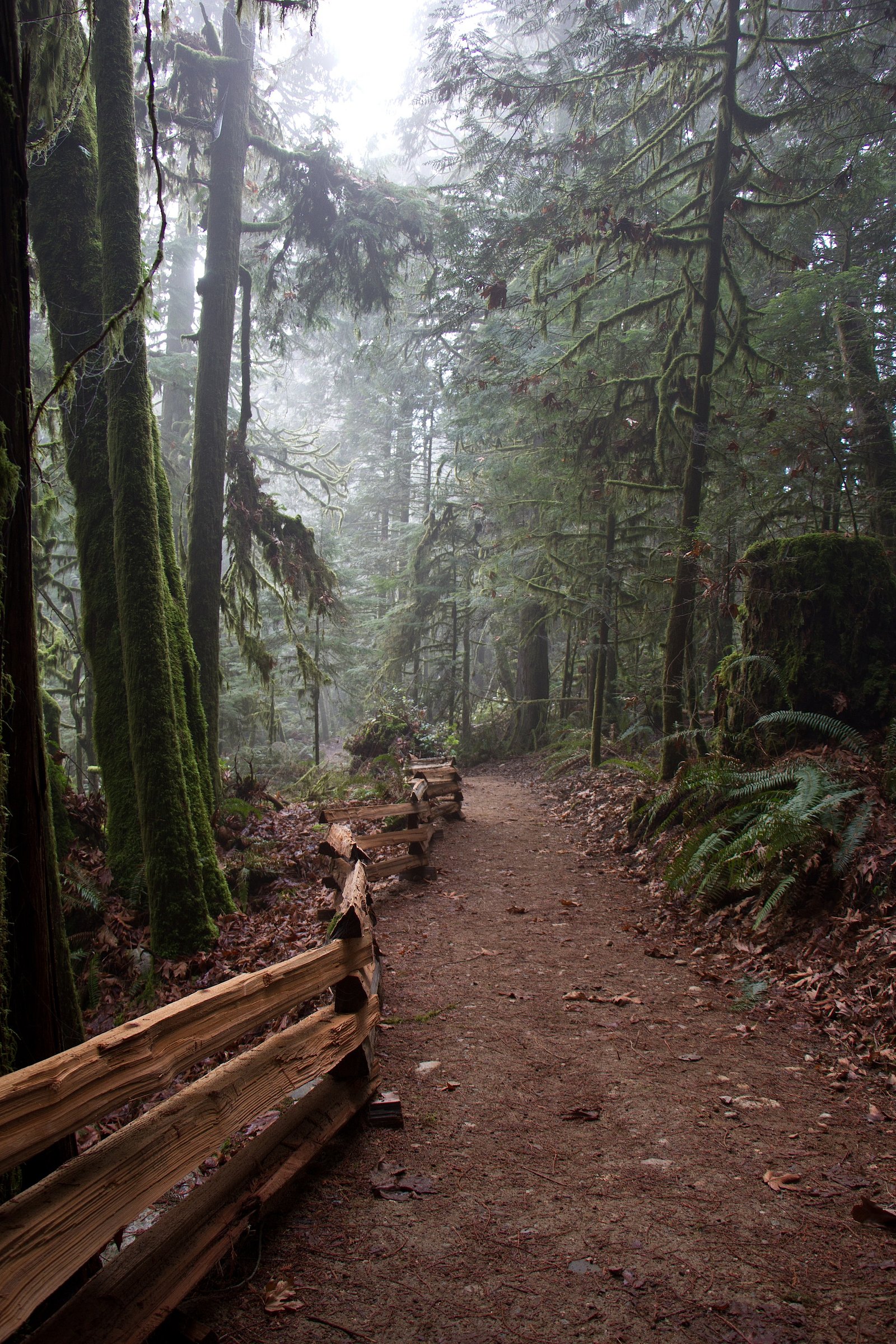
Approaches to small coastal waterfalls in the Roberts Creek area are commonly short but can be steep, muddy and rooted. Expect a short forested trail descending to a creek valley with one or more viewing spots; some routes may require scrambling on rocks or crossing small streams. Trails may be unmaintained or indistinct in places, follow cairns, blazed trees, or obvious use-paths and watch for private property signs.
What to Expect
A forested coastal environment with mossy logs, ferns and dense understory. The waterfall may be a multi-step cascade or a single drop depending on the specific creek channel and season. There are likely no developed facilities (no restrooms, picnic tables or signage) at the immediate site. Rock and trail surfaces will be slippery when wet. Water will be cold year-round.
Accessibility
The trail is not wheelchair accessible. Uneven terrain and elevation changes require steady footing.
Frequently Asked Questions
🐶 Are Dogs Allowed at Roberts Creek Waterfall?
❌ Dogs are not allowed
Are There Any Fees or Permits Required?
🆖 No fees required
🏊 Is There Swimming at Roberts Creek Waterfall?
❌ Swimming is not allowed
When to Visit
Late winter to spring for highest flows and a more dramatic waterfall. Summer and early fall are best for easier trail conditions and less mud but flows may be reduced. After heavy rain events the falls and approaches can be hazardous due to high water and slippery conditions.
Seasonal Access
The best time to visit is Spring, Summer, Fall, and Winter. Check with the managing park or local authority for current conditions.
Safety Information
Hazards include slippery and unstable rock, steep or eroding trail sections, sudden water-level rises after rain, cold water temperatures and limited cell coverage. Wear appropriate footwear, do not climb on wet rocks above or below the falls, and avoid visiting alone in remote conditions. Respect private property and posted closure signs. Be especially cautious in winter when trails can be icy.
7-Day Flow Outlook
Based on the WSC gauge ROBERTS CREEK AT ROBERTS CREEK (2 km away).
Today
Barely Flowing
0.1 m³/s
5/10Tomorrow
Barely Flowing
0.1 m³/s
4/10Tue
Barely Flowing
0.1 m³/s
4/10Wed
Barely Flowing
0.1 m³/s
4/10Thu
Barely Flowing
0.1 m³/s
4/10Fri
Barely Flowing
0.1 m³/s
4/10Sat
Barely Flowing
0.1 m³/s
3/10Best window: Today — barely flowing flow, sunny (trip score 5/10).
Best time of year: this gauge typically runs highest from early January to late January, peaking in November.
How we calculate this
This is a transparent outlook, not a precise forecast. We take the waterfall's current flow strength (how it ranks against its historical normal for today, from the nearest WSC stream gauge), carry that ranking forward along the gauge's seasonal curve, and nudge it for forecast rain. Confidence is highest for the next day or two and falls further out. Always check official conditions and your own judgment before visiting — high flows can be dangerous.
Know when to go.
Get a free email alert when waterfalls near Nanaimo hit peak flow. We only send when conditions are worth the trip — no weekly newsletters, no spam.
Weather Forecast
Location & Access
Getting There
The waterfall is reached from the Roberts Creek area on the Sunshine Coast of British Columbia. If coming from Vancouver most visitors reach the Sunshine Coast by BC Ferries (Horseshoe Bay to Langdale) and then drive north on Highway 101/Sunshine Coast Highway. Expect local roads and possibly short forestry or municipal access roads near the creek. Exact trailhead/turnoff locations vary; confirm with local maps or park signage before setting out.
Get Directions on Google MapsParking
Parking is typically limited to a small pullout, roadside parking or a small trailhead lot. There may be no formal parking facilities and roadside parking could be restricted, park legally and avoid blocking driveways or gates. Expect limited overnight or long-term parking options.
Elevation
223 metres above sea level
Coordinates
49.439525° N, -123.627756° W
Visitor Tips & Gear
• Wear good footwear with traction; trails and rocks are slippery when wet. • Bring insect repellent in spring/summer; ticks are possible but less common than in interior BC. • Stay off unstable banks and do not climb wet rocks above or below the falls. • Parking can be limited, arrive early and avoid blocking roads. • Respect private property; if access crosses private land, follow posted rules and leave no trace. • Use local maps or contact Sunshine Coast visitor information for exact trailhead directions and recent conditions. • Cell service may be spotty; tell someone your plan and expected return time.
As an Amazon Associate, we earn from qualifying purchases.
This easy 1.8 km hike is straightforward — comfortable trail shoes and plenty of water should do. Icy conditions are common in winter — traction cleats are a smart addition.

Columbia Watertight II Rain Jacket
Packs into its own pocket, seam-sealed, and keeps you dry from spray and surprise rain.

Polarized Sunglasses (Knockaround)
Cuts glare off the water so you actually see the falls — and your photos turn out better too.

Earth Pak Waterproof Dry Bag
Keeps your phone and gear dry when waterfall mist soaks everything else.

Waterproof Phone Pouch (AiRunTech)
Cheap insurance — take photos right next to the falls without killing your phone.

Kahtoola MICROspikes
Cult-favorite traction cleats that grip ice and wet rock — essential for winter waterfall hikes.

JOBY GorillaPod Starter Kit
Wraps around railings and rocks for long-exposure waterfall shots — no flat surface needed.
Where to Stay
Browse vacation cabins and private rentals nearby
Unique outdoor stays — tents, yurts, and treehouses
Rent a campervan or RV for your waterfall road trip
Some links are affiliate links. We may earn a commission at no extra cost to you.
Nearby Campground
Roberts Creek Campground
3.3 km away
Additional Information
Nearby Attractions
Sunshine Coast communities (Gibsons, Sechelt), local beaches, the Sunshine Coast Trail, and local parks/reserves. BC Ferry terminals at Langdale provide the main vehicle access from the Lower Mainland.
Wildlife
Typical coastal BC wildlife may include black-tailed deer, black bear (occasional), small mammals (squirrels, raccoons), and many coastal bird species. Practice bear-aware behaviour in remote or forested areas and store food securely.
Cities near Roberts Creek Waterfall
Nearby Waterfalls
Writing about Roberts Creek Waterfall? Embed this waterfall on your site for free.