Photo Credits (5)
Difficulty
Easy
Trail Length
1.0 km
Trail Type
Out And Back
Elevation Gain
18 m
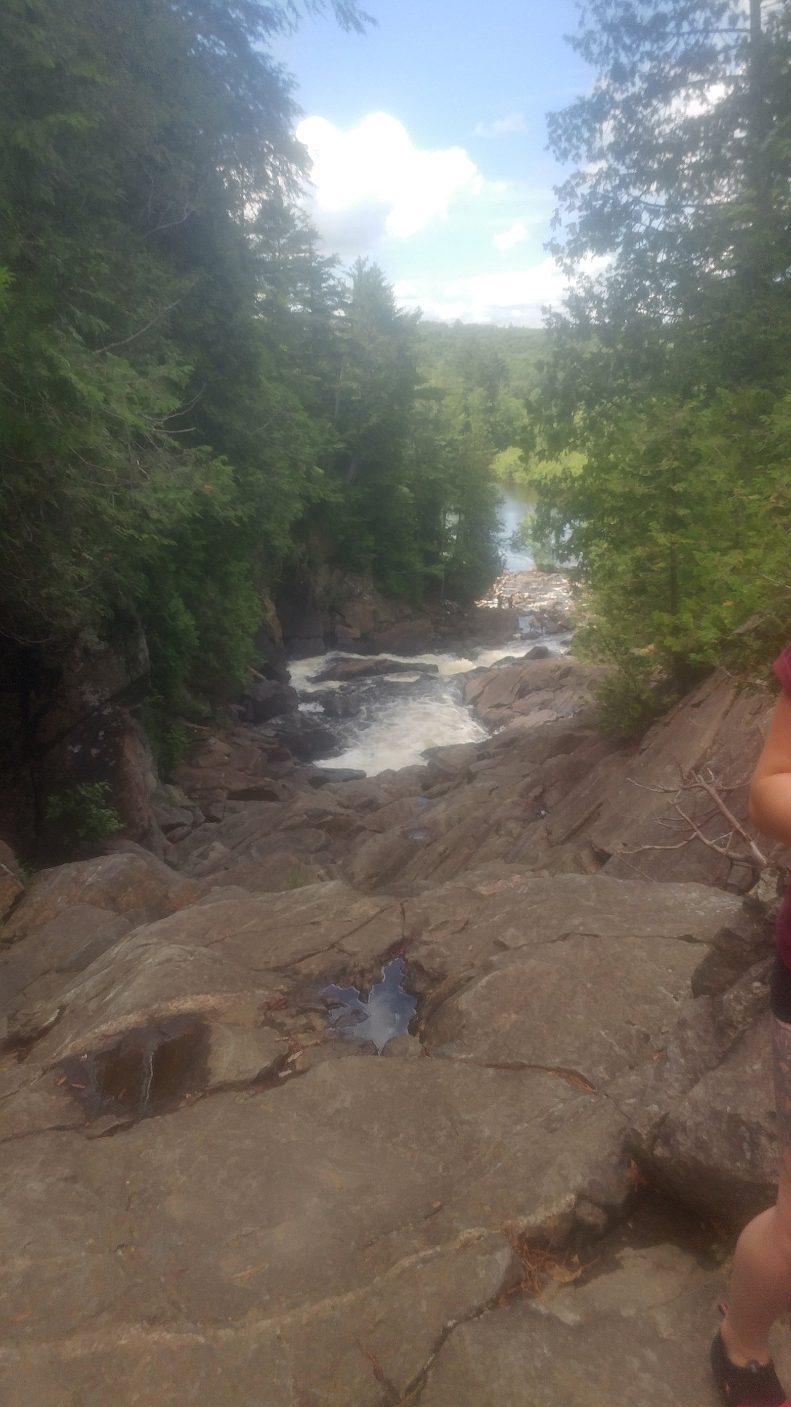
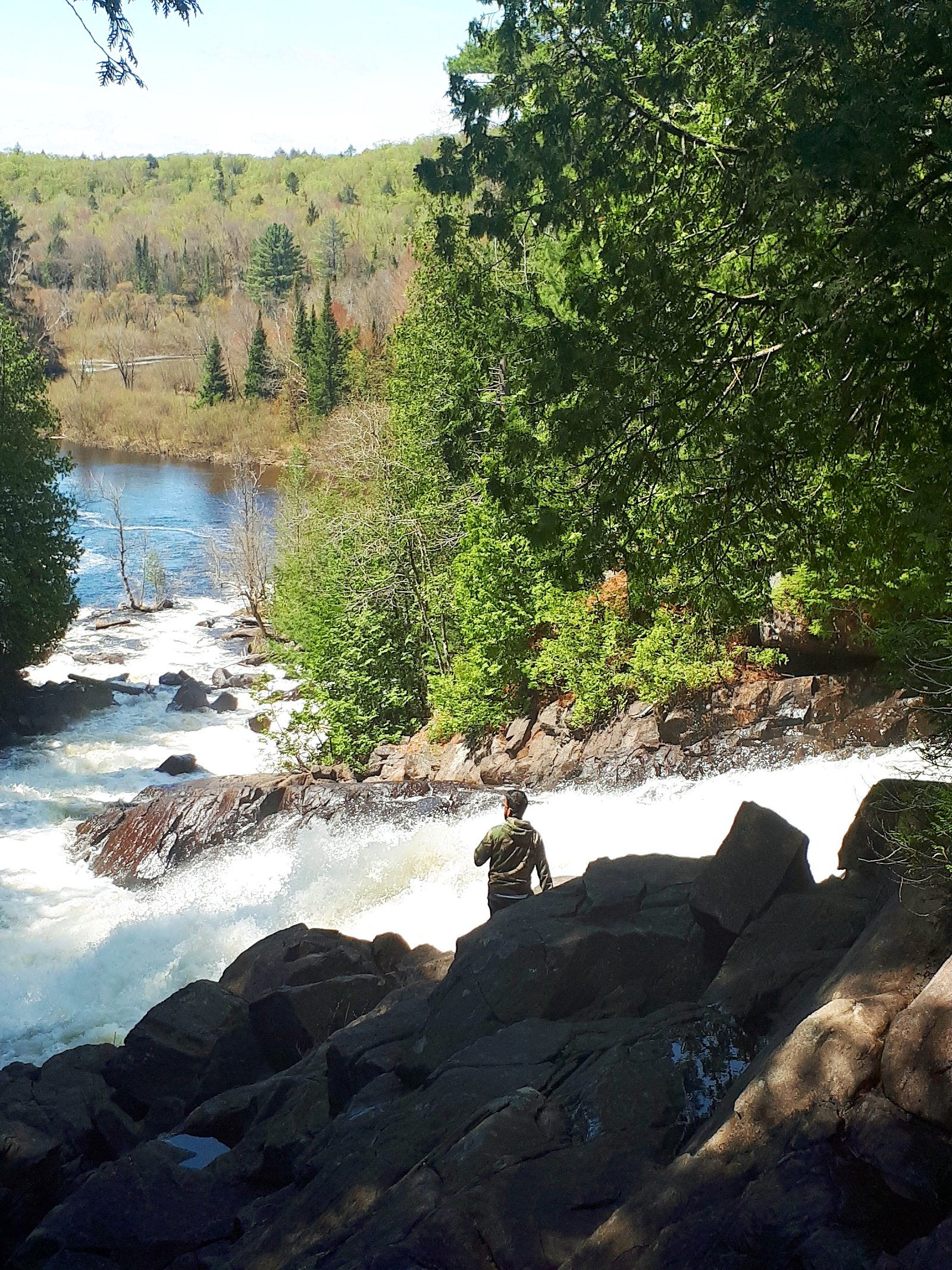
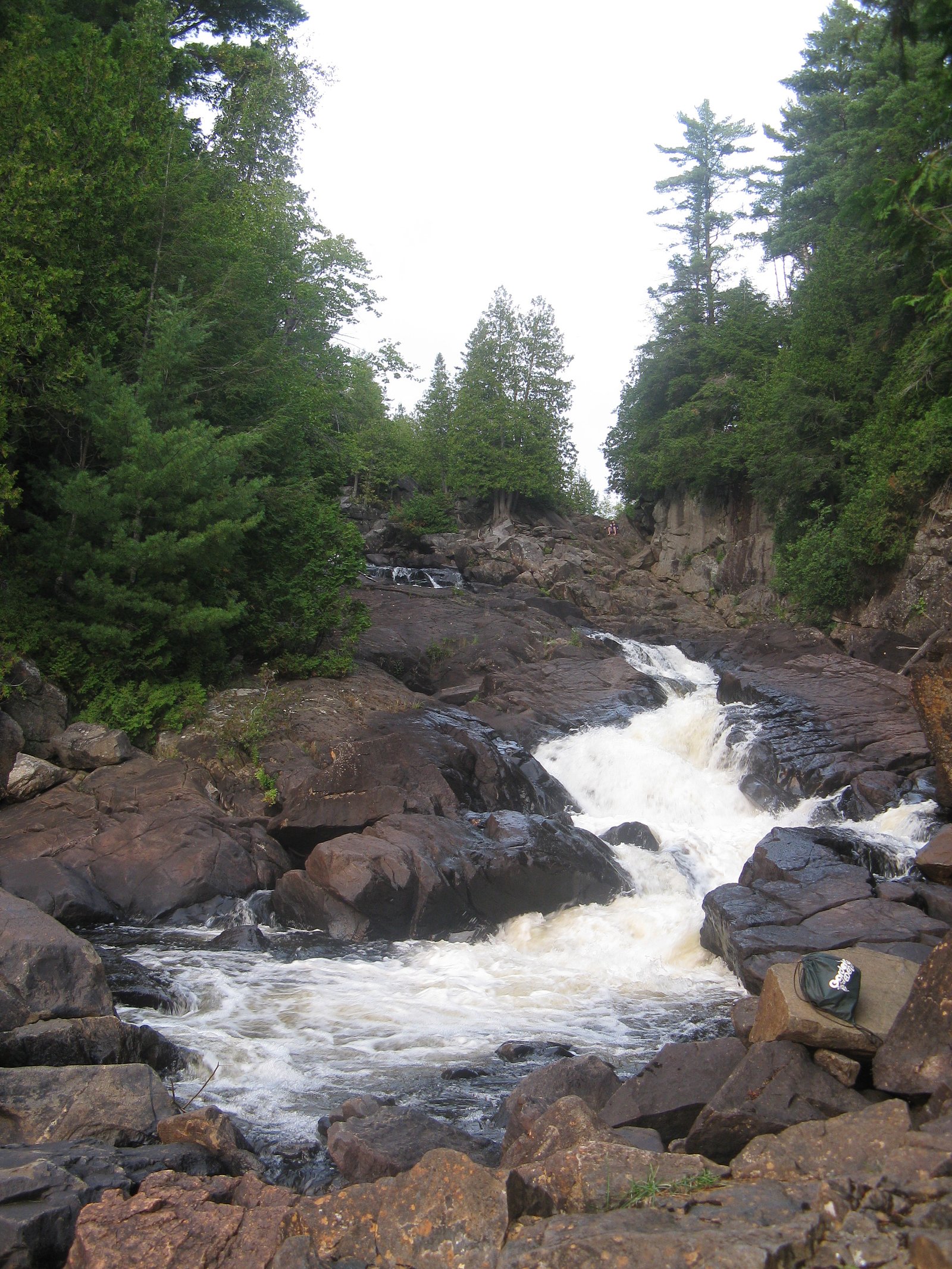
About Ragged Falls
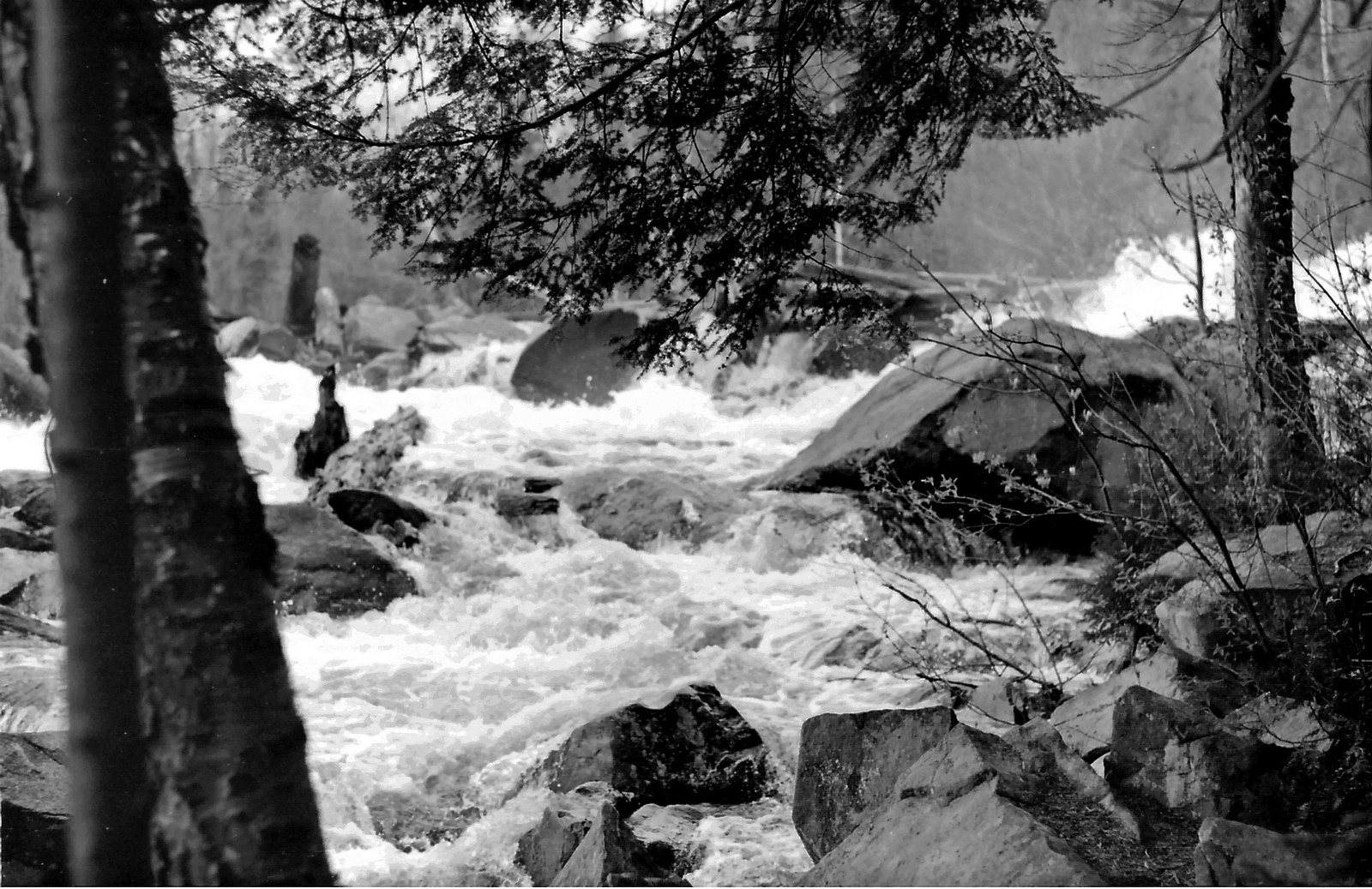
Ragged Falls is a scenic cascade and rocky gorge feature in eastern Ontario. The falls are characterized by broken ledges and rapids running through exposed Precambrian rock with mixed forest on the banks. Flow and appearance vary seasonally, typically highest in spring runoff and after heavy rains. The site is a popular short outing for photographers and day hikers and may be inside or adjacent to a small provincial or conservation area; specific management (park name, exact boundaries) may vary by map source.
The Setting
Ragged Falls sits at 402 metres within Oxtongue River-Ragged Falls Provincial Park (Waterway Class), in the foothills of Ontario. The falls drop 25 metres.
Why This Waterfall Exists
Ragged Falls flows over hard crystalline rock laid down over 1.4-1.8 billion years ago. These resistant rocks form a durable ledge that water cannot easily wear away, creating a 82-foot drop where softer material downstream has already eroded.
Trail & Hike Details
The Approach
The easy 1.0-km out-and-back trail gains 18 metres of elevation on the way to the falls.
Trail Description
A short out-and-back route from a nearby parking area leads to viewpoints of the cascades and gorge. The path is generally short (under 2 miles round trip) and relatively easy under normal conditions, but the surface can be uneven, rocky and rooted. There may be short sections of packed dirt, exposed bedrock, and informal viewpoints close to the water. Trails and access points may include wooden steps or simple viewing platforms at some locations, but such infrastructure is not guaranteed.
What to Expect
The falls cascade 25 metres over hard crystalline rock.
Accessibility
The trail is short and relatively flat, but the surface may be uneven. Contact the managing agency for accessibility details.
Frequently Asked Questions
🐶 Are Dogs Allowed at Ragged Falls?
❌ Dogs are not allowed
Are There Any Fees or Permits Required?
🆖 No fees required
🏊 Is There Swimming at Ragged Falls?
❌ Swimming is not allowed
When to Visit
Spring (late March–May) for highest flows and dramatic water; fall for foliage colors and comfortable temperatures; early morning or weekday visits reduce crowds and provide better light for photography. Winter can offer ice-formed cascades but expect icy, slippery conditions and limited access.
Seasonal Access
The best time to visit is Spring, Summer, Fall, and Winter. Check with the managing park or local authority for current conditions.
Safety Information
Hazards include slippery wet or icy rock surfaces, steep edges, fast currents, cold water, and variable trail conditions. Do not climb on wet ledges or enter swift water. Keep children and pets under close supervision. Check weather forecasts and trail conditions before visiting. In winter, expect ice hazards and shorter daylight hours. If unsure about conditions, contact local park or conservation authorities. Cell service may be limited, plan accordingly.
7-Day Flow Outlook
Based on the WSC gauge OXTONGUE RIVER NEAR DWIGHT (11 km away).
Best time of year: this gauge typically runs highest from late March to late May, peaking in April.
How we calculate this
This is a transparent outlook, not a precise forecast. We take the waterfall's current flow strength (how it ranks against its historical normal for today, from the nearest WSC stream gauge), carry that ranking forward along the gauge's seasonal curve, and nudge it for forecast rain. Confidence is highest for the next day or two and falls further out. Always check official conditions and your own judgment before visiting — high flows can be dangerous.
Weather Forecast
Location & Access
Getting There
Located in eastern Ontario (coordinates ~45.3917, -78.906). Access is by local paved and/or gravel roads from the nearest regional highways; expect a short drive on secondary roads from nearby towns. There is typically signage on a local road and a small parking area near the trailhead. Exact driving directions and road conditions should be checked on a current map or with local authorities before travel.
Get Directions on Google MapsParking
Small day-use parking area near the trailhead. Parking may be limited and seasonal (snow/ice) and may not have formal facilities (no guaranteed restrooms or potable water). Some sections of access road may be narrow or unpaved.
Elevation
402 metres above sea level
Coordinates
45.391666° N, -78.906047° W
Land Management
Managed by Ontario Parks
Visitor Tips & Gear
• Wear sturdy footwear with good traction; rocks and roots are common. • Stay on designated trails and behind railings/viewing areas where present, cliff edges and wet rocks are hazardous. • Check conditions before you go; water levels and trail access may change after storms or spring thaw. • Parking can be limited on busy days; arrive early or visit on weekdays for fewer crowds. • Leave no trace: carry out all garbage and avoid disturbing vegetation and wildlife. • In winter, bring traction devices (microspikes) and dress for cold/wet conditions.
As an Amazon Associate, we earn from qualifying purchases.
For this easy 1.0 km trail, lightweight trail shoes and a water bottle are usually sufficient. Icy conditions are common in winter — traction cleats are a smart addition.

Columbia Watertight II Rain Jacket
Packs into its own pocket, seam-sealed, and keeps you dry from spray and surprise rain.

Polarized Sunglasses (Knockaround)
Cuts glare off the water so you actually see the falls — and your photos turn out better too.

Earth Pak Waterproof Dry Bag
Keeps your phone and gear dry when waterfall mist soaks everything else.

Waterproof Phone Pouch (AiRunTech)
Cheap insurance — take photos right next to the falls without killing your phone.

Kahtoola MICROspikes
Cult-favorite traction cleats that grip ice and wet rock — essential for winter waterfall hikes.

JOBY GorillaPod Starter Kit
Wraps around railings and rocks for long-exposure waterfall shots — no flat surface needed.
Where to Stay
Browse vacation cabins and private rentals nearby
Unique outdoor stays — tents, yurts, and treehouses
Rent a campervan or RV for your waterfall road trip
Some links are affiliate links. We may earn a commission at no extra cost to you.
Nearby Campground
Maple Leaf 1
9.7 km away
Additional Information
Nearby Attractions
Other rivers, lakes and provincial/conservation areas in the Ottawa Valley region may be nearby. Local towns may offer services, supplies and other outdoor recreation opportunities. Confirm specific nearby attractions with regional tourism resources.
Wildlife
Typical eastern Ontario wildlife may be present: white-tailed deer, beavers, a variety of birds, small mammals, and occasionally moose or black bear depending on the area. Ticks can be active in warmer months; take appropriate precautions.
Nearby Waterfalls

Other waterfalls named Ragged Falls
1 other waterfall shares this name across Canada.
Writing about Ragged Falls? Embed this waterfall on your site for free.