
Photo Credits (5)
Difficulty
Easy
Trail Length
2.7 km
Trail Type
Out And Back
Elevation Gain
51 m
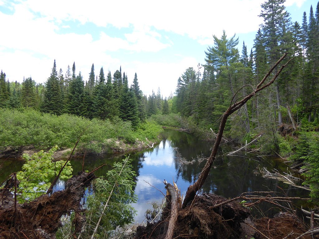
About Tea Falls
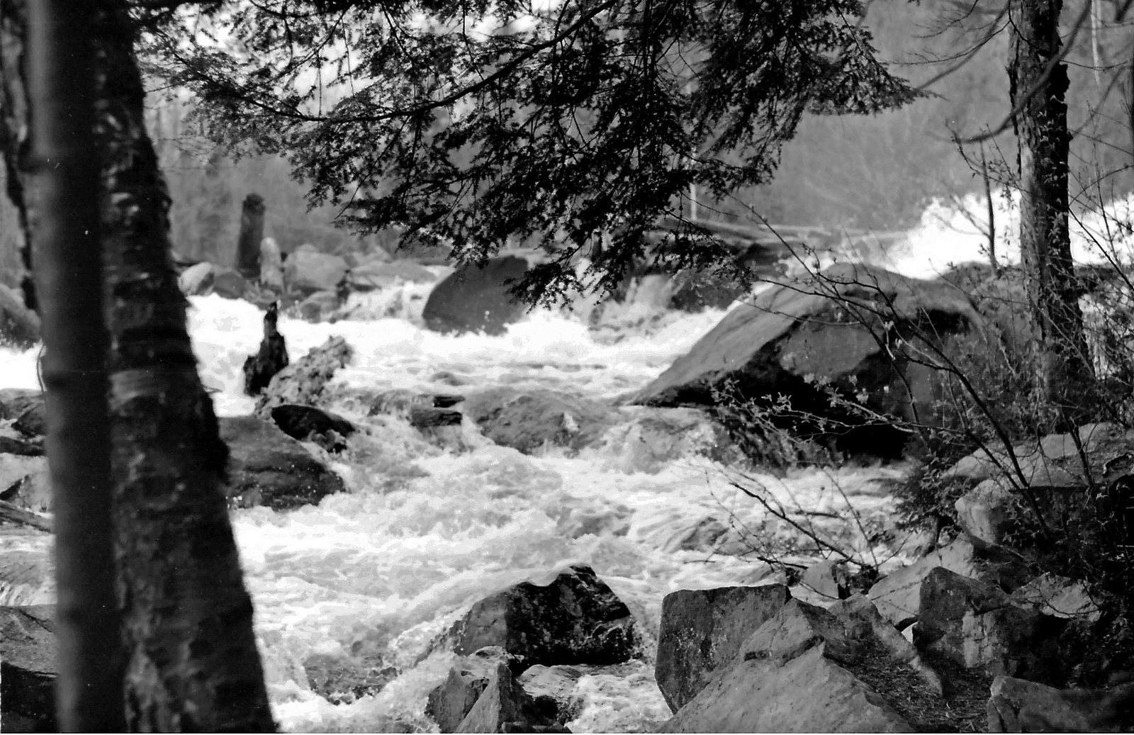
Tea Falls is a small, locally known waterfall located at the provided coordinates in central Ontario (Almaguin Highlands region). It appears as a modest cascade on a local stream or river and is most notable for seasonal flow variation, high in spring and after heavy rain, reduced in mid-to-late summer, and often partially or fully frozen in winter. Exact documented details (official name usage, ownership of surrounding land, and measured height) are limited, so some specifics may be uncertain.
The Setting
Tea Falls sits at 419 metres within Algonquin Provincial Park, in the foothills of Ontario.
Why This Waterfall Exists
Tea Falls flows over hard crystalline rock, primarily gneiss, laid down over 1.0-2.5 billion years ago. These resistant rocks form a durable ledge that water cannot easily wear away, creating the falls where softer material downstream has already eroded.
Trail & Hike Details
The Approach
The easy 2.7-km out-and-back trail gains 51 metres of elevation on the way to the falls.
Trail Description
Trail info is not well documented. Where present, the approach is typically a short, unmarked path from a roadside pullout to the falls. Trails may be uneven, muddy, or rocky with tree roots and native vegetation; there may be a short scramble to reach a good viewpoint. Expect limited or no built trail infrastructure such as boardwalks or steps.
What to Expect
Expect a modest, scenic cascade with variable flow. Surroundings are mixed forest typical of central Ontario. There are likely no visitor facilities (restrooms, picnic tables, or marked viewpoints). Cell service may be limited. Water levels vary seasonally, highest in spring and after heavy rain, lower in summer. In winter surfaces can be icy and the waterfall may form ice features.
Accessibility
The trail is not wheelchair accessible. Uneven terrain and elevation changes require steady footing.
Frequently Asked Questions
🐶 Are Dogs Allowed at Tea Falls?
❌ Dogs are not allowed
Are There Any Fees or Permits Required?
🆖 No fees required
🏊 Is There Swimming at Tea Falls?
❌ Swimming is not allowed
When to Visit
Late spring (high flows) and fall (foliage) are often the most rewarding. Summer can have lower flows but warmer weather; winter offers ice formations but greater slip and exposure hazards.
Seasonal Access
The best time to visit is Spring, Summer, Fall, and Winter. Check with Algonquin Provincial Park for current conditions.
Safety Information
Hazards may include slippery rocks and banks, fast or cold water, unstable edges, low or no guardrails, seasonal ice, and limited cell service. Weather and water levels can change rapidly. Exercise caution near the water, avoid alcohol, and supervise children closely. If visiting in black bear country, follow recommended food storage and wildlife-safety practices.
7-Day Flow Outlook
Based on the WSC gauge OXTONGUE RIVER NEAR DWIGHT (27 km away).
Best time of year: this gauge typically runs highest from late March to late May, peaking in April.
How we calculate this
This is a transparent outlook, not a precise forecast. We take the waterfall's current flow strength (how it ranks against its historical normal for today, from the nearest WSC stream gauge), carry that ranking forward along the gauge's seasonal curve, and nudge it for forecast rain. Confidence is highest for the next day or two and falls further out. Always check official conditions and your own judgment before visiting — high flows can be dangerous.
Weather Forecast
Location & Access
Getting There
The falls are reached by driving on local paved and/or forestry roads in the Almaguin Highlands region. Final approach may require travel on unpaved roads or a short footpath from a roadside pullout. Visitors should consult local maps or landowners and check recent visitor reports for condition of access roads.
Get Directions on Google MapsParking
Parking is likely informal (small pullout or roadside parking). Expect limited or no formal parking lot, signage, or facilities. Park well off the roadway and avoid blocking gates or private driveways.
Elevation
419 metres above sea level
Coordinates
45.491199° N, -78.750445° W
Land Management
Managed by Ontario Parks
Visitor Tips & Gear
• Check recent trip reports or local resources before going; conditions and access routes may change. • Wear sturdy footwear with good traction; expect mud, wet rock, and roots. • Park well off the road; avoid blocking gates or private entrances. • Respect private property, if access crosses private land, confirm permission. • Be cautious near the water's edge, banks and rocks can be slippery and unstable. • Tell someone your plans and expected return time if hiking in a remote area.
As an Amazon Associate, we earn from qualifying purchases.
This easy 2.7 km hike is straightforward — comfortable trail shoes and plenty of water should do. Icy conditions are common in winter — traction cleats are a smart addition.

Columbia Watertight II Rain Jacket
Packs into its own pocket, seam-sealed, and keeps you dry from spray and surprise rain.

Polarized Sunglasses (Knockaround)
Cuts glare off the water so you actually see the falls — and your photos turn out better too.

Earth Pak Waterproof Dry Bag
Keeps your phone and gear dry when waterfall mist soaks everything else.

Waterproof Phone Pouch (AiRunTech)
Cheap insurance — take photos right next to the falls without killing your phone.

Kahtoola MICROspikes
Cult-favorite traction cleats that grip ice and wet rock — essential for winter waterfall hikes.

JOBY GorillaPod Starter Kit
Wraps around railings and rocks for long-exposure waterfall shots — no flat surface needed.
Where to Stay
Browse vacation cabins and private rentals nearby
Unique outdoor stays — tents, yurts, and treehouses
Rent a campervan or RV for your waterfall road trip
Some links are affiliate links. We may earn a commission at no extra cost to you.
Nearby Campground
Camp Tamakwa
3 km away
Additional Information
Nearby Attractions
Other natural features and trails in the Almaguin Highlands and nearby provincial parks may be within driving distance. For major regional destinations, consult Ontario park guides and local tourism information.
Wildlife
Typical central Ontario wildlife may be present, including white-tailed deer, black bear, moose (in some areas), small mammals, and a variety of birds. Ticks and biting insects (black flies, mosquitoes) can be seasonal nuisances.
Nearby Waterfalls

Writing about Tea Falls? Embed this waterfall on your site for free.