About McArthur Chute
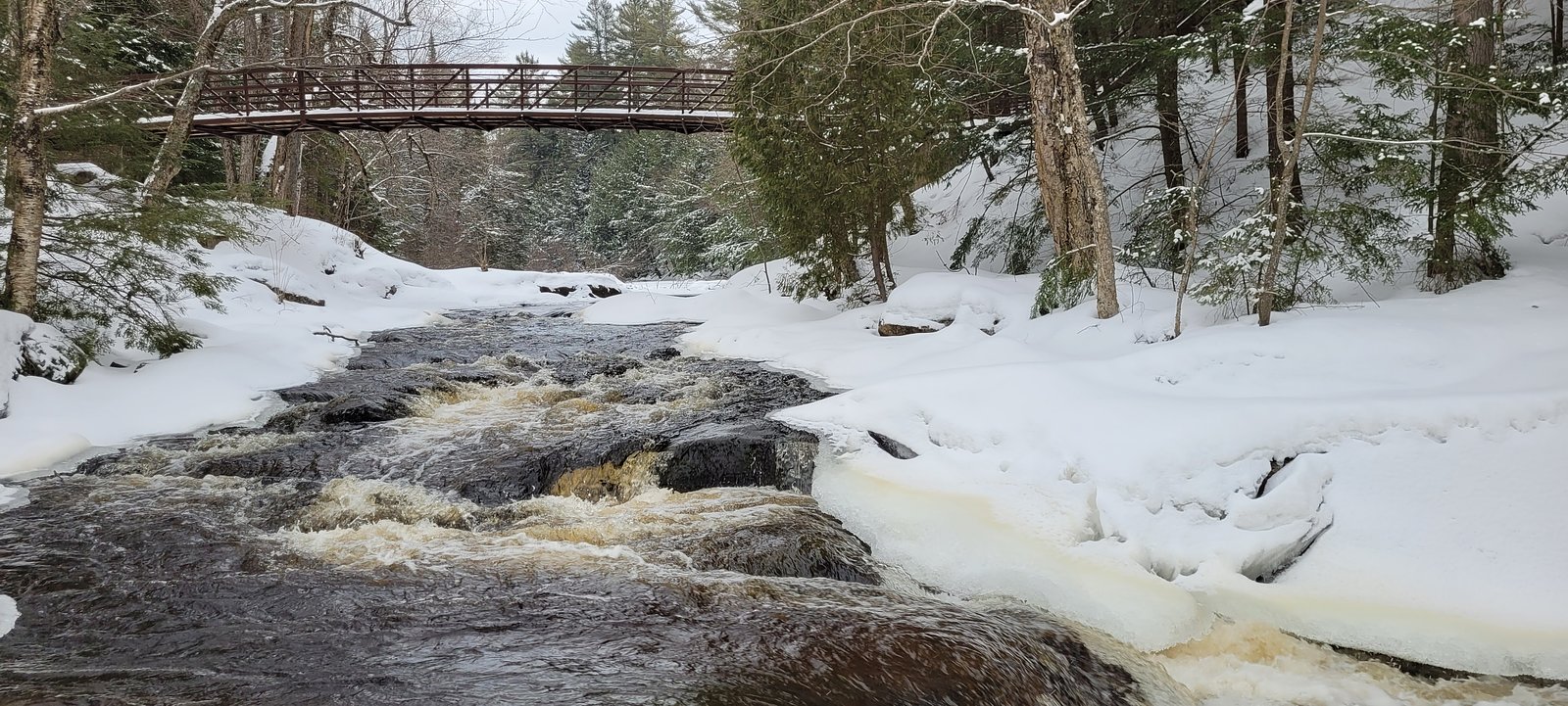
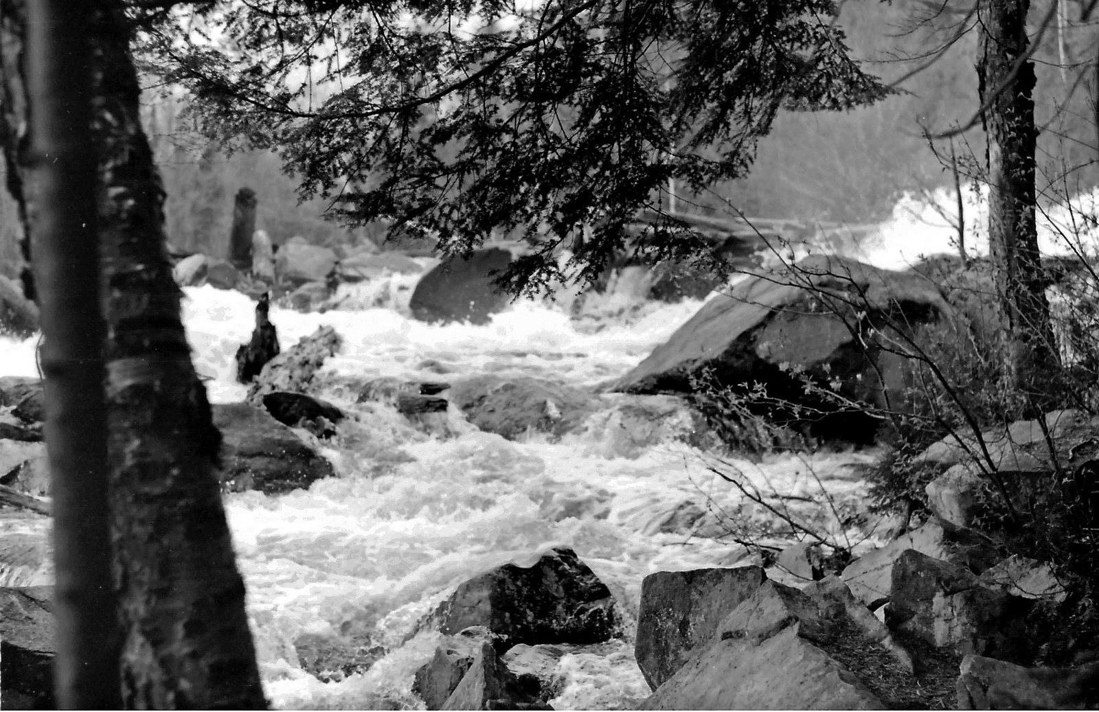
McArthur Chute is a chute-style cascade on a small river/stream in central Ontario. It is a relatively remote, natural feature with rocky ledges that concentrate flow into a narrow, fast-moving channel. The site is best known for its natural, undeveloped character rather than built viewing infrastructure. Specific published measurements and formal management details are limited or not widely documented.
The Setting
McArthur Chute sits at 338 metres within Big East River Provincial Park (Waterway Class), in the foothills of Ontario.
Why This Waterfall Exists
McArthur Chute flows over hard crystalline rock laid down over 1.4-1.8 billion years ago. These resistant rocks form a durable ledge that water cannot easily wear away, creating the falls where softer material downstream has already eroded.
Trail & Hike Details
Trail Description
There is little published, maintained trail information for McArthur Chute. Expect an informal path or short scramble from a roadside pullout through mixed forest and over rocky terrain to reach viewpoints. Trails may be narrow, rooty, and uneven; there may be no signage or constructed viewpoints. Route-finding from the road to the stream may be required.
What to Expect
A natural, undeveloped chute/rapids with variable water flow depending on season. In spring the chute may be at peak flow and more dramatic; late summer can be lower flow. Views are typically from rock ledges and banks above the chute; there are likely no handrails or built viewing platforms. Expect slippery rocks, moss, and possibly muddy approaches after rain. Cell reception may be spotty in some areas.
Accessibility
Likely not accessible to wheelchairs or strollers. Approaches are probably uneven, rocky, and may require short scrambling. No formal accessible infrastructure is known.
Frequently Asked Questions
🐶 Are Dogs Allowed at McArthur Chute?
❌ Dogs are not allowed
Are There Any Fees or Permits Required?
🆖 No fees required
🏊 Is There Swimming at McArthur Chute?
❌ Swimming is not allowed
When to Visit
Spring for highest flows and dramatic water; early fall for lower crowds and fall color. Summer offers easier access but lower flows; winter can be scenic (ice formations) but is slippery and cold, only for experienced winter hikers equipped for icy conditions.
Seasonal Access
The best time to visit is Spring, Summer, Fall, and Winter. Check with the managing park or local authority for current conditions.
Safety Information
Hazards include slippery rock, steep or uneven banks, strong currents in the chute, cold water, and limited or unreliable cell service. There may be no emergency services immediately nearby. Use caution near edges, avoid entering the water near the chute, and travel with others when possible. In winter expect ice and snow hazards and the need for winter-specific gear.
Current Water Conditions
5.7 m³/s
Current discharge — how much water is flowing
About average for this time of year
Based on 52 years of record
5.33 m
Water depth at gauge
7-Day Discharge Trend
What does this mean for your visit?
Flow is about average for this time of year.
About This Gauge
This gauge is on a nearby waterway and may not reflect exact conditions at the falls.
7-Day Flow Outlook
Based on the WSC gauge BIG EAST RIVER NEAR HUNTSVILLE (9 km away).
Today
Moderate
5.6 m³/s
8/10Tomorrow
Moderate
5.5 m³/s
8/10Tue
Strong
6.1 m³/s
7/10Wed
Strong
5.7 m³/s
8/10Thu
Moderate
5.0 m³/s
8/10Fri
Strong
5.5 m³/s
7/10Sat
Strong
5.0 m³/s
9/10Best window: Sat — strong flow, cloudy (trip score 9/10).
Best time of year: this gauge typically runs highest from late March to late May, peaking in April.
How we calculate this
This is a transparent outlook, not a precise forecast. We take the waterfall's current flow strength (how it ranks against its historical normal for today, from the nearest WSC stream gauge), carry that ranking forward along the gauge's seasonal curve, and nudge it for forecast rain. Confidence is highest for the next day or two and falls further out. Always check official conditions and your own judgment before visiting — high flows can be dangerous.
Know when to go.
Get a free email alert when waterfalls near Parry Sound hit peak flow. We only send when conditions are worth the trip — no weekly newsletters, no spam.
Weather Forecast
Location & Access
Getting There
Coordinates: 45.4549, -79.0936. The chute lies in a rural/forest area of central Ontario roughly 45–50 miles (by road) from Parry Sound. Access is typically by local/secondary roads and may require driving on gravel or forestry roads. Exact parking coordinates and turnoff points are not widely published, use the given coordinates in a mapping app and expect a short undeveloped access route.
Get Directions on Google MapsParking
Likely limited or informal roadside pullout(s). There is probably no official parking lot, toilet, or staffed facilities. Park legally and avoid blocking gates or driveways. If unsure, park in a safe pullout and walk in.
Elevation
338 metres above sea level
Coordinates
45.454949° N, -79.093553° W
Land Management
Managed by Ontario Parks
Visitor Tips & Gear
• Wear sturdy, grippy footwear, wet rock surfaces are slippery. • Give the site a wide berth during high flows; currents can be strong. • Check local maps and use GPS coordinates to locate the access point. • Leave no trace: carry out all trash and avoid disturbing vegetation. • If planning to explore off-trail, tell someone your route and expected return time. • Respect private property, if a road or gate is signed as private, do not trespass.
Where to Stay
Browse vacation cabins and private rentals nearby
Unique outdoor stays — tents, yurts, and treehouses
Rent a campervan or RV for your waterfall road trip
Some links are affiliate links. We may earn a commission at no extra cost to you.
Nearby Campground
Tea Kettle Campground
10.8 km away
Additional Information
Nearby Attractions
General region: Parry Sound and the Muskoka/central Ontario lake and forest country. There are provincial parks, hiking areas, and lakes in the broader region, but specific nearby developed attractions for McArthur Chute are not widely documented.
Wildlife
Typical central Ontario wildlife may be present: white-tailed deer, beaver, mink, black bear, moose (less common but possible), small mammals, and a variety of birds. Ticks and biting insects can be common in warm months.
Cities near McArthur Chute
Nearby Waterfalls
Writing about McArthur Chute? Embed this waterfall on your site for free.