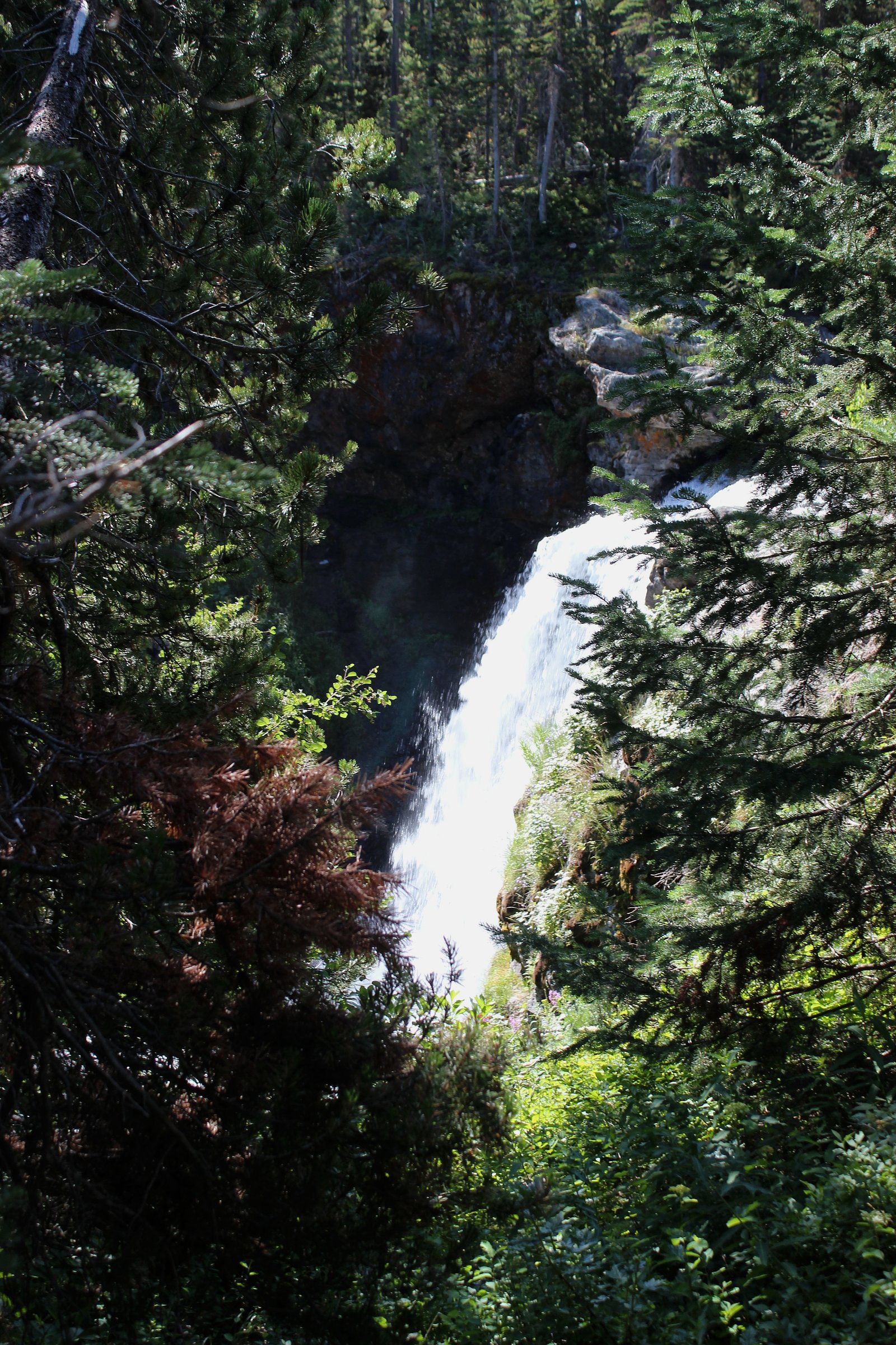
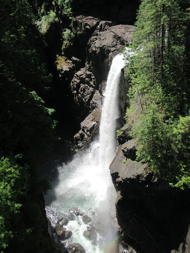
Moose Falls
British Columbia • 12 m
By Armen Suny · Last verified Jun 2026
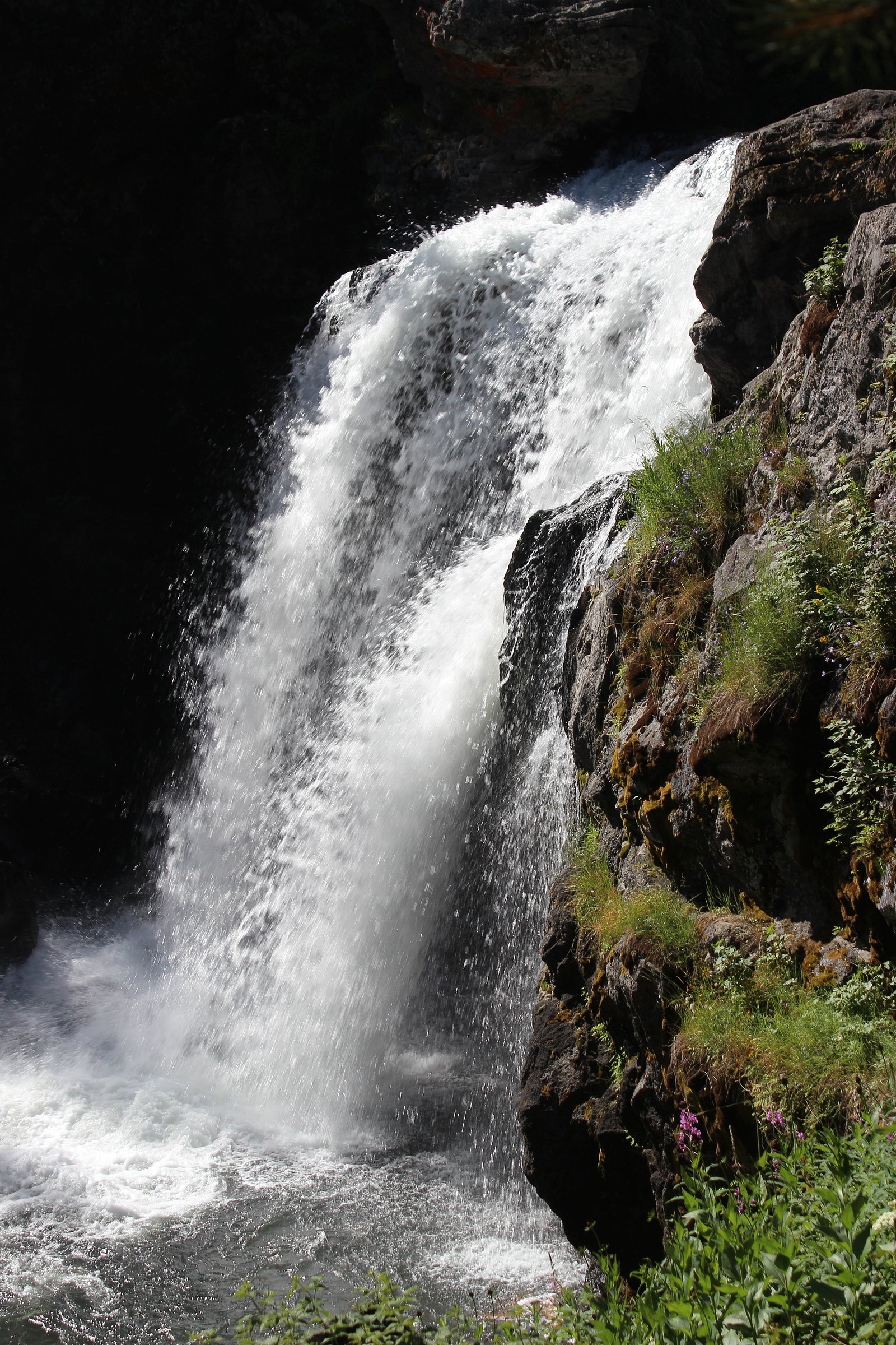
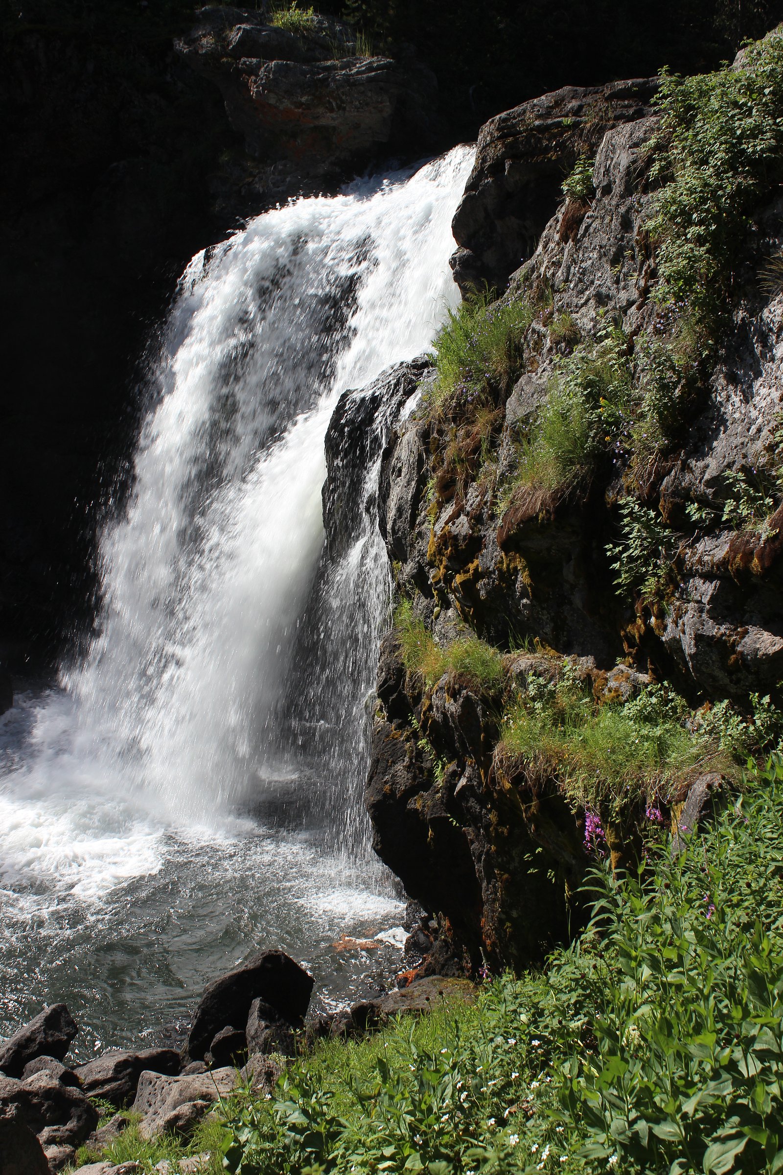
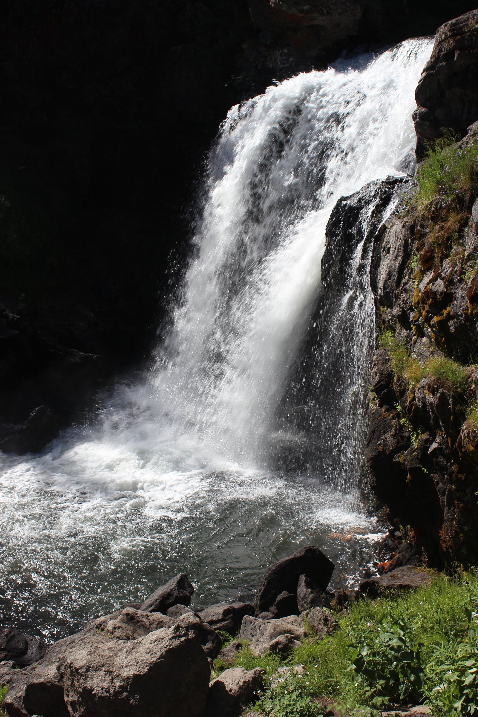
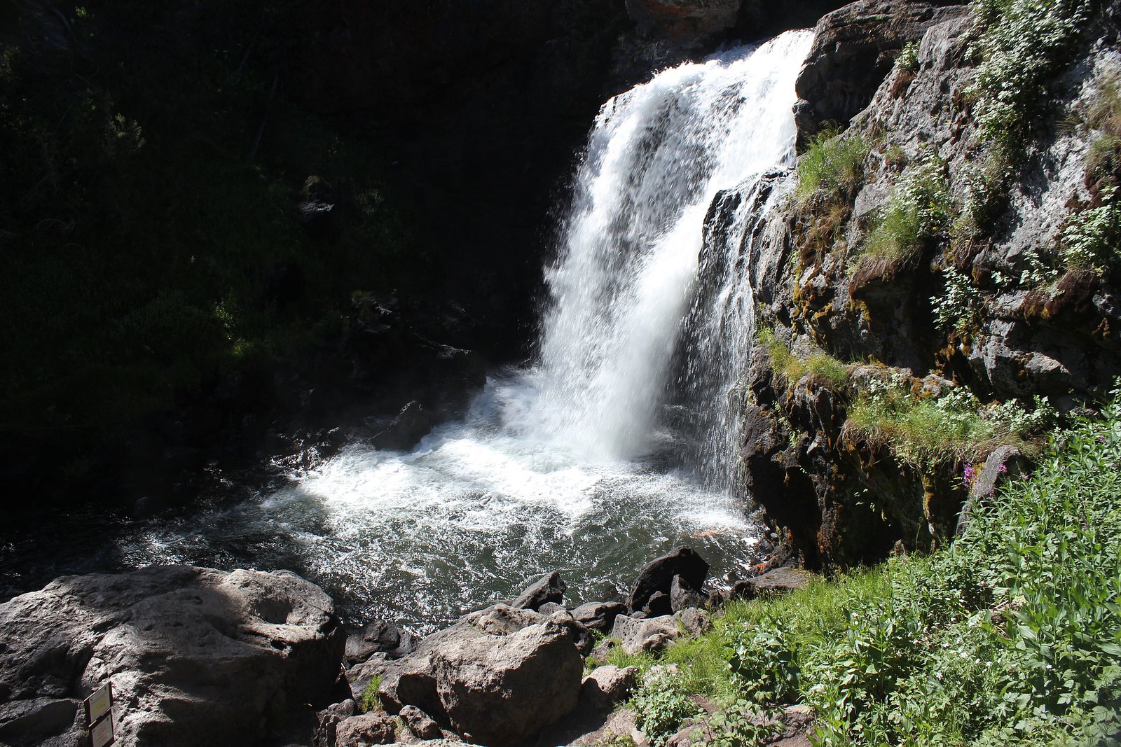
Photo Credits (5)
Difficulty
Easy
Trail Length
4.0 km
Trail Type
Loop
About Moose Falls
Moose Falls is a forested waterfall on northeastern Vancouver Island near Campbell River (approx. 5.0 miles away). The falls sit in a typical coastal temperate rainforest setting with moss-covered trees and bedrock channels. Flow and appearance are seasonal, often fullest in spring and after heavy rains and reduced in late summer. Exact published measurements for height are not confirmed here.
The Setting
Moose Falls sits at 150 metres in the coastal lowlands of British Columbia. The falls drop 12 metres.
Why This Waterfall Exists
Moose Falls flows over volcanic rock laid down about 201-252 million years ago. These resistant rocks form a durable ledge that water cannot easily wear away, creating a 40-foot drop where softer material downstream has already eroded.
Nearby Falls Worth Visiting
Elk Falls (25 m) lies 0.6 kilometres to the east. Also nearby: Deer Falls (1 m, 0.5 km).
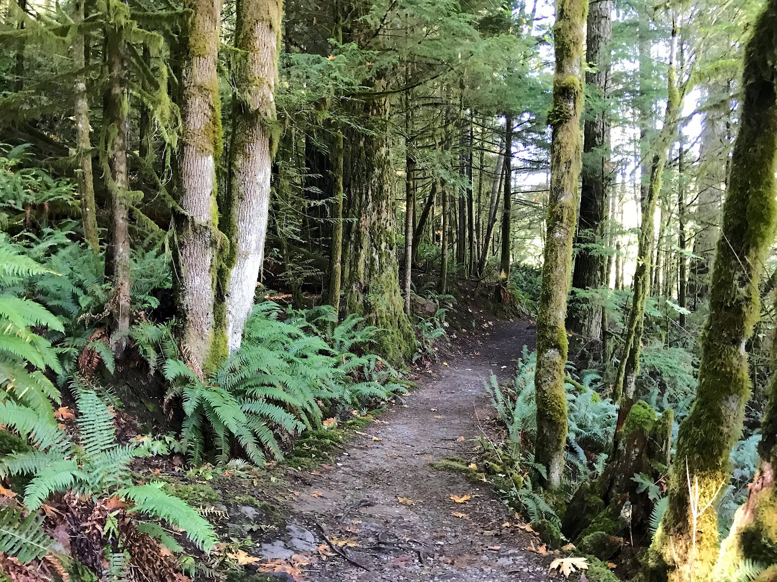
Trail & Hike Details
Trail Description
Approach is through coastal forest with typical understory and variable trail quality. Trail may be a short unmaintained footpath from a road pullout or a slightly longer singletrack through brush and roots. Expect uneven footing, muddy sections after rain, and limited signage in some places. Route-finding may be required in low-use seasons.
What to Expect
The falls drop 12 metres over volcanic rock.
Accessibility
The trail is not wheelchair accessible. Uneven terrain and elevation changes require steady footing.
Frequently Asked Questions
🐶 Are Dogs Allowed at Moose Falls?
❌ Dogs are not allowed
Are There Any Fees or Permits Required?
🆖 No fees required
🏊 Is There Swimming at Moose Falls?
❌ Swimming is not allowed
When to Visit
Late spring for highest flows and lush green surroundings; early summer for good weather and access; fall can offer good water flow after rains but watch for seasonal road work and closures. Late summer often has lower flows.
Seasonal Access
The best time to visit is Spring, Summer, and Fall. Winter access may be limited. Check with the managing park or local authority for current conditions.
Safety Information
Watch for slippery and unstable rocks near the falls; cliff edges and wet surfaces are hazardous. Water flow can increase rapidly after rain, avoid getting too close to the edge. Logging roads may be active, obey signs and keep clear of equipment. Cell service can be unreliable; tell someone your plans and expected return time. Carry bear spray and know local wildlife safety practices.
Current Water Conditions
2.1 m³/s
Current discharge — how much water is flowing
About average for this time of year
Based on 68 years of record
0.73 m
Water depth at gauge
7-Day Discharge Trend
What does this mean for your visit?
Flow is about average for this time of year.
About This Gauge
7-Day Flow Outlook
Based on the WSC gauge QUINSAM RIVER NEAR CAMPBELL RIVER (3 km away).
Today
Moderate
2.1 m³/s
6/10Tomorrow
Moderate
2.0 m³/s
8/10Tue
Moderate
2.0 m³/s
8/10Wed
Moderate
2.0 m³/s
6/10Thu
Moderate
2.0 m³/s
6/10Fri
Moderate
2.1 m³/s
5/10Sat
Moderate
2.2 m³/s
5/10Best window: Tomorrow — moderate flow, sunny (trip score 8/10).
Best time of year: this gauge typically runs highest from early January to mid February, peaking in December.
How we calculate this
This is a transparent outlook, not a precise forecast. We take the waterfall's current flow strength (how it ranks against its historical normal for today, from the nearest WSC stream gauge), carry that ranking forward along the gauge's seasonal curve, and nudge it for forecast rain. Confidence is highest for the next day or two and falls further out. Always check official conditions and your own judgment before visiting — high flows can be dangerous.
Know when to go.
Get a free email alert when waterfalls near Campbell River hit peak flow. We only send when conditions are worth the trip — no weekly newsletters, no spam.
Weather Forecast
Location & Access
Getting There
Coordinates: 50.0429, -125.3388. The falls are located on Vancouver Island, roughly 5 miles from Campbell River, ~31.9 miles from Courtenay and ~41.2 miles from Powell River (as-the-crow-flies distances provided). Access is typically via local and forest service/logging roads off the main highways near Campbell River and then a short trail; exact parking and approach can vary by season and by road conditions. Visitors should consult local maps, the Campbell River visitor centre, or recent trip reports for up-to-date driving directions and road status.
Get Directions on Google MapsParking
Likely limited roadside parking or a small informal pullout near the trailhead. Expect no paved, staffed parking lot, check recent visitor reports for the current parking situation.
Elevation
150 metres above sea level
Coordinates
50.042945° N, -125.338765° W
Visitor Tips & Gear
1) Check recent trip reports or contact local visitor centres for current access and road conditions. 2) Wear good traction footwear; expect slippery rocks and muddy trail sections. 3) Bring layers and rain gear, coastal weather can change quickly. 4) Be prepared for limited or informal parking. 5) Respect private land and posted signs; many roads in the area are logging roads. 6) Carry out all trash and follow Leave No Trace. 7) If travelling in bear country, carry bear spray and know how to use it.
Where to Stay
Browse vacation cabins and private rentals nearby
Unique outdoor stays — tents, yurts, and treehouses
Rent a campervan or RV for your waterfall road trip
Some links are affiliate links. We may earn a commission at no extra cost to you.
Nearby Campground
Parkside Campground
1.6 km away
Additional Information
Nearby Attractions
Campbell River attractions (riverfront, fishing), Elk Falls Provincial Park (waterfall and suspension bridge nearby), Strathcona Provincial Park for backcountry options. Check local visitor resources for up-to-date lists and distances.
Wildlife
Typical Vancouver Island species may include black bears, cougars, deer, elk, raccoons, salmon in nearby streams (seasonal), and abundant birdlife. Mosquitoes and biting insects can be common in wet seasons.
Cities near Moose Falls
Nearby Waterfalls
Other waterfalls named Moose Falls
2 other waterfalls share this name across Canada.
Writing about Moose Falls? Embed this waterfall on your site for free.