Photo Credits (1)
Difficulty
Moderate
Trail Length
4.0 km
Trail Type
Out And Back
Elevation Gain
190 m
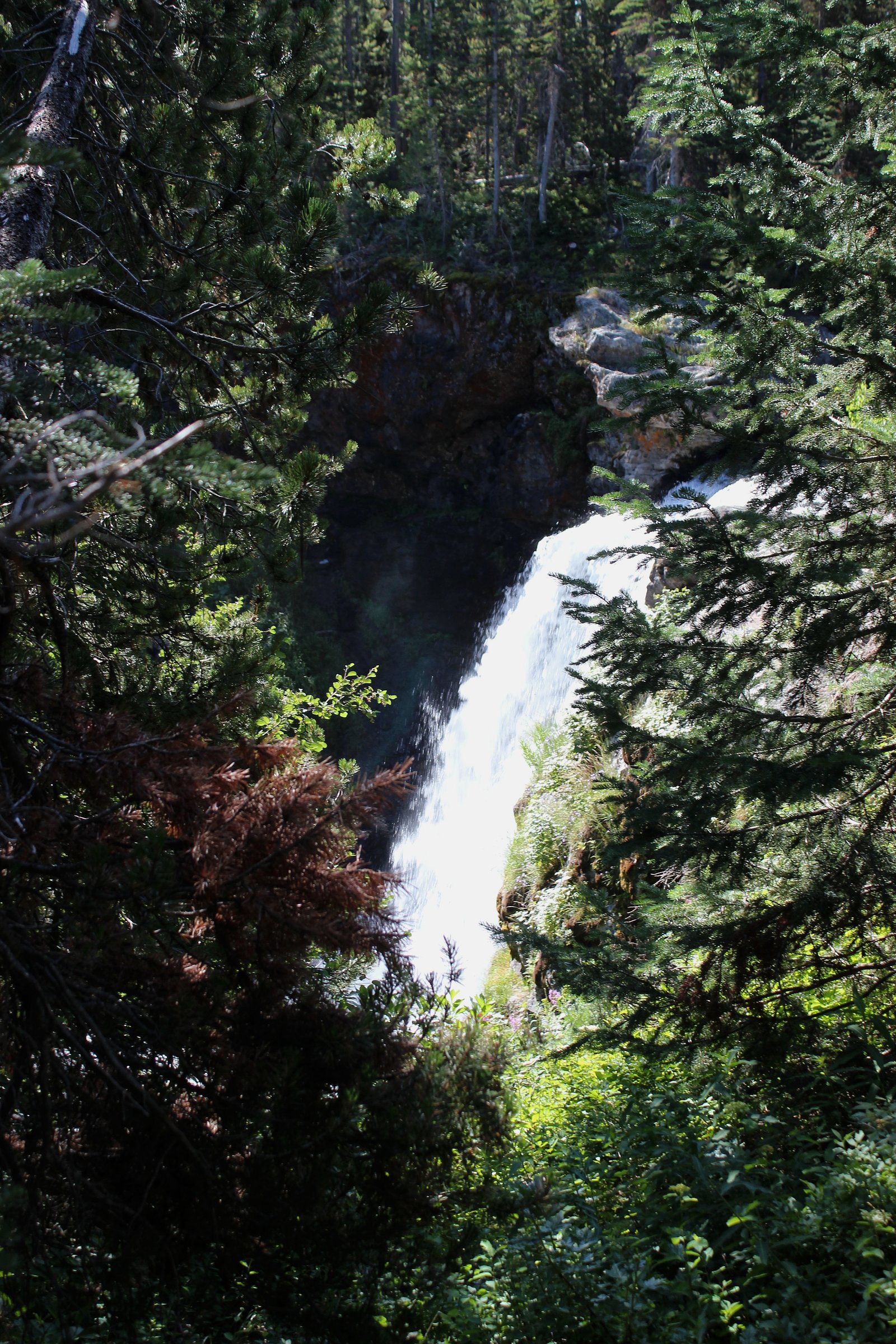
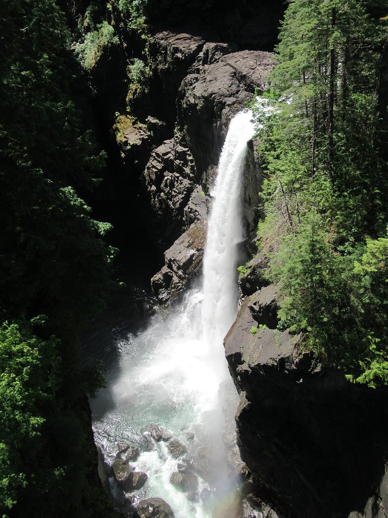
About Trout Creek Falls
Trout Creek Falls is a small forested waterfall on Vancouver Island near Campbell River, British Columbia (coordinates ~50.0975, -125.4258). It appears to be a seasonal/variable-flow cascade set in typical coastal temperate rainforest, conifers, ferns and moss, and is most notable to local hikers and anglers. Precise published information about official trail infrastructure and measured height is limited; access may involve forestry roads and an unmarked footpath or short bushwhack from a parking pullout.
Why This Waterfall Exists
Trout Creek Falls flows over volcanic rock laid down about 201-252 million years ago. These resistant rocks form a durable ledge that water cannot easily wear away, creating the falls where softer material downstream has already eroded.
Nearby Falls Worth Visiting
Elk Falls (25 m) lies 9.3 kilometres to the southeast. Also nearby: Moose Falls (12 m, 8.7 km) and Deer Falls (1 m, 9.0 km).
Trail & Hike Details
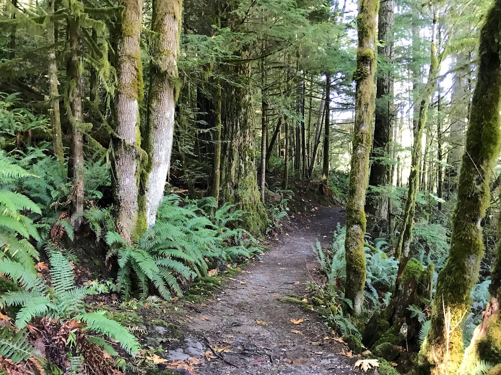
The Approach
The moderate 4.0-km out-and-back trail gains 190 metres of elevation on the way to the falls.
Trail Description
Published, maintained trail information for Trout Creek Falls is scarce. Expect either a very short walk from a roadside pullout or an unmarked, primitive path through forest. The approach may cross uneven, muddy or rooty terrain and could require route-finding. If there is a short constructed path it is likely unsurfaced and minimally developed.
What to Expect
Typical coastal temperate rainforest: Douglas-fir/cedar/hemlock, dense understory of ferns and mosses, and a creek channel with cascades and plunge pools. Flow will be highest in spring and after heavy rain; in late summer the flow may be reduced. There are likely no formal viewpoints, guardrails or interpretive signage. Expect limited cell reception in some spots.
Accessibility
The trail is not wheelchair accessible. Uneven terrain and elevation changes require steady footing.
Frequently Asked Questions
🐶 Are Dogs Allowed at Trout Creek Falls?
❌ Dogs are not allowed
Are There Any Fees or Permits Required?
🆖 No fees required
🏊 Is There Swimming at Trout Creek Falls?
❌ Swimming is not allowed
When to Visit
Spring to early summer for highest water flow and lush vegetation; fall can offer lower flows but good colours. Winter visits are possible but may be hazardous due to wet, icy conditions and limited daylight.
Seasonal Access
The best time to visit is Spring, Summer, Fall, and Winter. Check with the managing park or local authority for current conditions.
Safety Information
Hazards may include slippery rocks and banks, strong currents during high flow, unstable or steep banks, uneven/muddy trail surfaces, limited or no cell reception, and potential logging activity on access roads. Weather on Vancouver Island can change quickly, be prepared for rain and cooler temperatures. If there are active forestry operations in the area, obey signs and avoid entering work zones. Leave numeric trail measurements null if planning relies on exact distances, confirm with local sources.
Current Water Conditions
2.1 m³/s
Current discharge — how much water is flowing
About average for this time of year
Based on 68 years of record
0.73 m
Water depth at gauge
7-Day Discharge Trend
What does this mean for your visit?
Flow is about average for this time of year.
About This Gauge
This gauge is on a nearby waterway and may not reflect exact conditions at the falls.
7-Day Flow Outlook
Based on the WSC gauge QUINSAM RIVER NEAR CAMPBELL RIVER (12 km away).
Today
Moderate
2.1 m³/s
6/10Tomorrow
Moderate
2.0 m³/s
8/10Tue
Moderate
2.0 m³/s
8/10Wed
Moderate
2.0 m³/s
6/10Thu
Moderate
2.0 m³/s
6/10Fri
Moderate
2.1 m³/s
5/10Sat
Moderate
2.2 m³/s
5/10Best window: Tomorrow — moderate flow, sunny (trip score 8/10).
Best time of year: this gauge typically runs highest from early January to mid February, peaking in December.
How we calculate this
This is a transparent outlook, not a precise forecast. We take the waterfall's current flow strength (how it ranks against its historical normal for today, from the nearest WSC stream gauge), carry that ranking forward along the gauge's seasonal curve, and nudge it for forecast rain. Confidence is highest for the next day or two and falls further out. Always check official conditions and your own judgment before visiting — high flows can be dangerous.
Know when to go.
Get a free email alert when waterfalls near Campbell River hit peak flow. We only send when conditions are worth the trip — no weekly newsletters, no spam.
Weather Forecast
Location & Access
Getting There
General location: near Campbell River on Vancouver Island (approx. 50.0975, -125.4258). Access is typically by driving on local roads and possibly forestry/logging roads; the final approach may be via an informal trail or short bushwhack from a roadside parking/pullout. A high-clearance vehicle may be useful if travelling on rough forest roads. Confirm recent access conditions locally before travelling.
Get Directions on Google MapsParking
Parking is likely informal (small pullouts or roadside parking). There may be no developed parking lot, signage or facilities. Park safely off the shoulder where permitted and avoid blocking gates or private driveways.
Elevation
117 metres above sea level
Coordinates
50.097505° N, -125.425827° W
Visitor Tips & Gear
• Check local forestry road conditions and recent trip reports before going. • Wear sturdy, waterproof footwear and prepare for muddy, uneven terrain. • Bring a map/GPS and note the coordinates (approx. 50.0975, -125.4258). • Be prepared to park on a roadside pullout and walk a short distance; don't trespass on private property. • Avoid slippery rocks near the falls and strong currents during high water. • Leave no trace: pack out all waste. • If planning to use logging roads, be aware they can be gated or seasonally closed.
As an Amazon Associate, we earn from qualifying purchases.
With 4.0 km and 190 m of elevation gain, sturdy boots and trekking poles will help on this moderate trail. Icy conditions are common in winter — traction cleats are a smart addition.

Columbia Watertight II Rain Jacket
Packs into its own pocket, seam-sealed, and keeps you dry from spray and surprise rain.

Polarized Sunglasses (Knockaround)
Cuts glare off the water so you actually see the falls — and your photos turn out better too.

Earth Pak Waterproof Dry Bag
Keeps your phone and gear dry when waterfall mist soaks everything else.

Waterproof Phone Pouch (AiRunTech)
Cheap insurance — take photos right next to the falls without killing your phone.

Timberland Euro Sprint Mid Waterproof
Trusted waterproof boot with premium leather and grippy rubber sole — reliable on rocky, wet trails.

TrailBuddy Trekking Poles
Lightweight aluminum, cork grips, and flip-locks that actually hold — a best-seller for good reason.
Where to Stay
Browse vacation cabins and private rentals nearby
Unique outdoor stays — tents, yurts, and treehouses
Rent a campervan or RV for your waterfall road trip
Some links are affiliate links. We may earn a commission at no extra cost to you.
Nearby Campground
Mary Lake Campsite
1.4 km away
Additional Information
Nearby Attractions
Campbell River (town services), Elk Falls Provincial Park (well-known waterfall and suspension bridge near Campbell River), Strathcona Provincial Park (mountain scenery and trails). Powell River and Courtenay are regional centers within driving distance.
Wildlife
Typical Vancouver Island wildlife: black bears, deer, small mammals, varied birdlife (including songbirds and raptors). Salmon may use nearby streams seasonally. Take standard wildlife precautions (store food, keep distance, be bear-aware).
Cities near Trout Creek Falls
Nearby Waterfalls
Writing about Trout Creek Falls? Embed this waterfall on your site for free.