Difficulty
Moderate
Trail Length
4.0 km
Trail Type
Out And Back
Elevation Gain
190 m
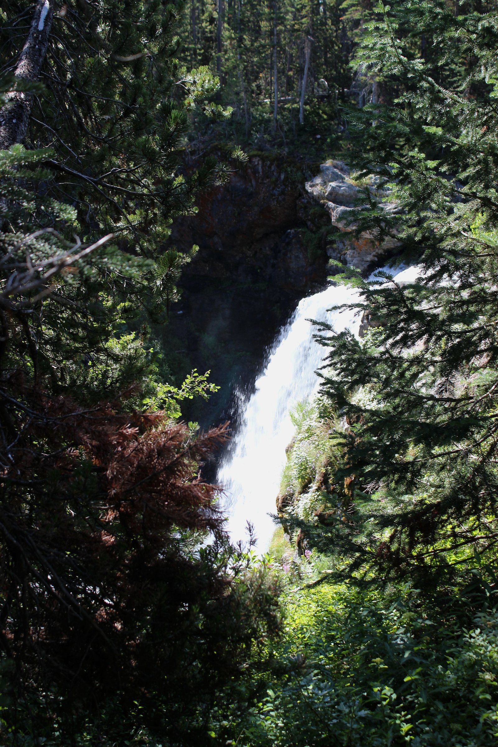
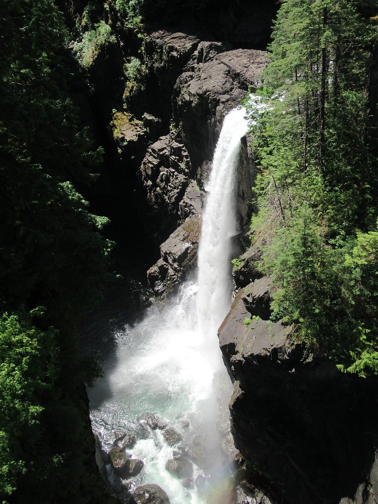
About Mohun Creek Falls
Mohun Creek Falls is a creek-fed waterfall on Mohun Creek on northeastern Vancouver Island, British Columbia. It sits in a forested, relatively remote area northwest of the city of Campbell River (approx. 12.0 miles from Campbell River; nearby towns include Courtenay ~38.8 miles and Powell River ~48.1 miles by general travel routes). The falls are reached via forest/secondary roads and a short trail or informal bushwhack in places; visitor reports indicate the route is rustic and not a heavily developed tourist site. Flow is seasonal and typically highest in spring during snowmelt and after heavy rains.
Why This Waterfall Exists
Mohun Creek Falls flows over volcanic rock laid down about 201-252 million years ago. These resistant rocks form a durable ledge that water cannot easily wear away, creating the falls where softer material downstream has already eroded.
Nearby Falls Worth Visiting
Elk Falls (25 m) lies 10.1 kilometres to the southeast. Also nearby: Moose Falls (12 m, 9.7 km) and Deer Falls (1 m, 9.8 km).
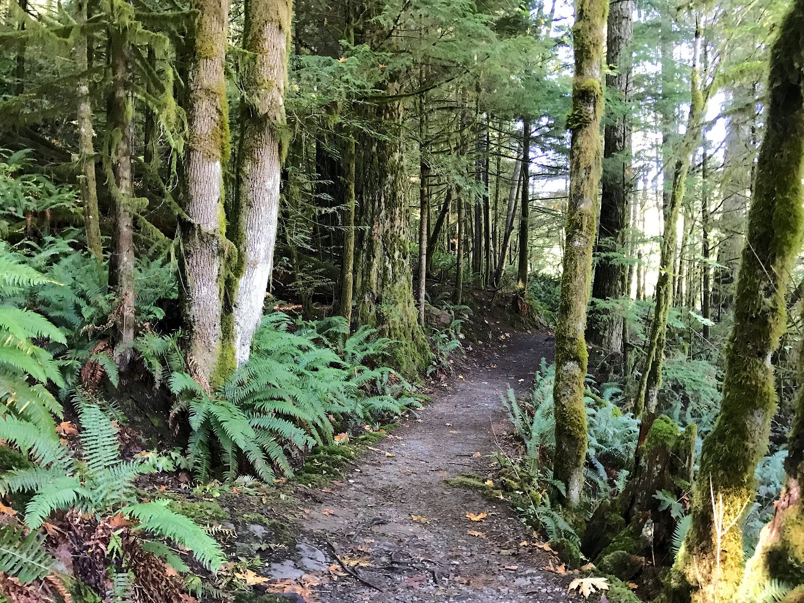
Trail & Hike Details
The Approach
The moderate 4.0-km out-and-back trail gains 190 metres of elevation on the way to the falls.
Trail Description
Routes to Mohun Creek Falls are not universally documented as a maintained trail on major guide sites and appear to follow a mix of forest/management roads and informal footpaths. Expect sections of rough trail, possible short bushwhacks, wet/steep banks near the creek, and limited signage. Footing can be uneven, muddy, or slippery, and route-finding may be required. Those uncomfortable with remote, minimally maintained routes should plan accordingly or seek local guidance.
What to Expect
A forested setting with a creek-fed waterfall that can form a small cascade and plunge pool or rocky chute depending on seasonal flow. Spring (snowmelt/after rains) usually brings strongest flows; summer can reduce flow to a trickle in drier years. Surroundings are typical coastal temperate rainforest, moss-covered rocks, ferns, and conifer stands. The immediate area may have slick rocks, steep banks, and downed trees from previous storms or forestry activity.
Accessibility
The trail is not wheelchair accessible. Uneven terrain and elevation changes require steady footing.
Frequently Asked Questions
🐶 Are Dogs Allowed at Mohun Creek Falls?
❌ Dogs are not allowed
Are There Any Fees or Permits Required?
🆖 No fees required
🏊 Is There Swimming at Mohun Creek Falls?
❌ Swimming is not allowed
When to Visit
Late spring is typically best for highest water flow (snowmelt). Early summer offers a balance of good flow and easier access. Late summer and early fall may have lower flow but warmer weather and fewer insects. Winter can be very wet, icy, or snowy and access roads may be impassable or closed, only attempt in winter with appropriate experience and equipment.
Seasonal Access
The best time to visit is Spring, Summer, and Fall. Winter access may be limited. Check with the managing park or local authority for current conditions.
Safety Information
Hazards include slippery rocks, steep or unstable banks, swift or deceptively strong creek currents, limited or no cell coverage, seasonal closure or impassable logging roads, and potential wildlife encounters (bears). Do not climb on wet rock near the edge of the falls, check weather and road conditions before traveling, tell someone your route and expected return time, and carry appropriate gear for changing conditions. If unsure about access or conditions, consult local visitor centres or experienced local guides.
Current Water Conditions
2.1 m³/s
Current discharge — how much water is flowing
About average for this time of year
Based on 68 years of record
0.73 m
Water depth at gauge
7-Day Discharge Trend
What does this mean for your visit?
Flow is about average for this time of year.
About This Gauge
This gauge is on a nearby waterway and may not reflect exact conditions at the falls.
7-Day Flow Outlook
Based on the WSC gauge QUINSAM RIVER NEAR CAMPBELL RIVER (13 km away).
Today
Moderate
2.1 m³/s
6/10Tomorrow
Moderate
2.0 m³/s
8/10Tue
Moderate
2.0 m³/s
8/10Wed
Moderate
2.0 m³/s
6/10Thu
Moderate
2.0 m³/s
6/10Fri
Moderate
2.1 m³/s
5/10Sat
Moderate
2.2 m³/s
5/10Best window: Tomorrow — moderate flow, sunny (trip score 8/10).
Best time of year: this gauge typically runs highest from early January to mid February, peaking in December.
How we calculate this
This is a transparent outlook, not a precise forecast. We take the waterfall's current flow strength (how it ranks against its historical normal for today, from the nearest WSC stream gauge), carry that ranking forward along the gauge's seasonal curve, and nudge it for forecast rain. Confidence is highest for the next day or two and falls further out. Always check official conditions and your own judgment before visiting — high flows can be dangerous.
Know when to go.
Get a free email alert when waterfalls near Campbell River hit peak flow. We only send when conditions are worth the trip — no weekly newsletters, no spam.
Weather Forecast
Location & Access
Getting There
Coordinates: 50.1072, -125.4282. From Campbell River the site is roughly a 12-mile drive into more rural/forested areas; access commonly uses secondary/forest service roads and may require driving on gravel/unstable surfaces. Exact approach routes vary and can include poorly signed turns and private or resource roads, confirm current access with local visitor centres, maps, or forestry offices before setting out. Expect limited cell service near the falls.
Get Directions on Google MapsParking
There is likely no formal parking lot or staffed trailhead. Visitors commonly park at a roadside pullout or informal clearing near the end of a forestry road or trail. Park well off the travel surface and avoid blocking gates, driveways, or logging operations. Availability of parking and safety of leaving vehicles unattended can vary; use caution and plan accordingly.
Elevation
185 metres above sea level
Coordinates
50.107205° N, -125.428248° W
Visitor Tips & Gear
• Check local conditions before you go (forestry road status, recent visitor reports, and weather). • Use a high-clearance vehicle for rough forest roads and be cautious of soft shoulders and washboard surfaces. • Park well off the road and avoid leaving valuables visible. • Wear sturdy, waterproof footwear; expect wet and slippery terrain near the falls. • Bring navigation (map, GPS), routes may be unsigned and cell coverage limited. • Practice Leave No Trace: pack out all garbage and avoid damaging riparian vegetation. • Be bear-aware: make noise on approach, carry bear deterrent per local advice, and store food securely. • Avoid getting onto wet rocks near the lip or plunge pool, falls and currents can be deceptively strong.
As an Amazon Associate, we earn from qualifying purchases.
With 4.0 km and 190 m of elevation gain, sturdy boots and trekking poles will help on this moderate trail. Sun exposure on the trail makes good sun protection a must in summer.

Columbia Watertight II Rain Jacket
Packs into its own pocket, seam-sealed, and keeps you dry from spray and surprise rain.

Earth Pak Waterproof Dry Bag
Keeps your phone and gear dry when waterfall mist soaks everything else.

Waterproof Phone Pouch (AiRunTech)
Cheap insurance — take photos right next to the falls without killing your phone.

Timberland Euro Sprint Mid Waterproof
Trusted waterproof boot with premium leather and grippy rubber sole — reliable on rocky, wet trails.

TrailBuddy Trekking Poles
Lightweight aluminum, cork grips, and flip-locks that actually hold — a best-seller for good reason.

Polarized Sunglasses (Knockaround)
Cuts glare off the water so you actually see the falls — and your photos turn out better too.
Where to Stay
Browse vacation cabins and private rentals nearby
Unique outdoor stays — tents, yurts, and treehouses
Rent a campervan or RV for your waterfall road trip
Some links are affiliate links. We may earn a commission at no extra cost to you.
Nearby Campground
Mary Lake Campsite
0.7 km away
Additional Information
Nearby Attractions
Campbell River (services, guides), Elk Falls Provincial Park (well-known nearby waterfall and viewpoints), Strathcona Provincial Park (hiking and alpine areas), various coastal access points and smaller recreation areas on northeastern Vancouver Island. Exact distances vary by route; verify travel times locally.
Wildlife
Typical Vancouver Island fauna: black bears, black-tailed deer, small mammals, and diverse birdlife (including raptors and water-associated species). Salmon runs may occur in some local creeks/streams in season. Take usual precautions for bear country and ticks.
Cities near Mohun Creek Falls
Nearby Waterfalls
Writing about Mohun Creek Falls? Embed this waterfall on your site for free.