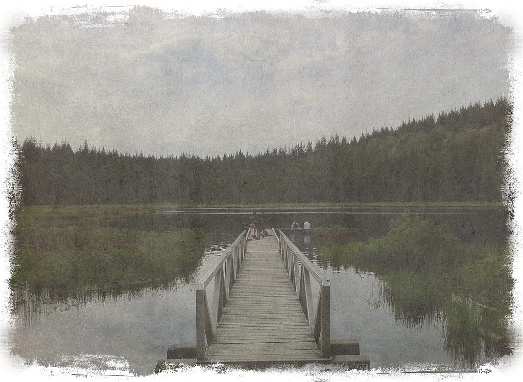
Mike Falls
British Columbia • Golden Ears Park • 5 m
By Armen Suny · Last verified Jun 2026
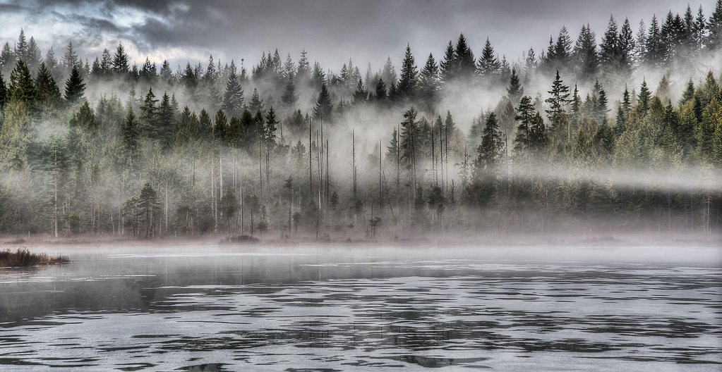
Photo Credits (3)
Difficulty
Easy
Trail Length
3.4 km
Trail Type
Out And Back
Elevation Gain
60 m
About Mike Falls
Mike Falls is a small, likely seasonal cascade located at the coordinates 49.2541, -122.5289 on the British Columbia / Washington border region. It sits roughly within driving distance of Lynden (≈18.0 miles), Abbotsford (≈19.7 miles) and Custer (≈21.3 miles). Publicly available, detailed trail and hydrological information for this specific named feature is limited; reports suggest it is not a major developed tourist site and access may be via unmaintained logging/forest roads or short, unmarked trails. Visitors should expect limited infrastructure, minimal signage, and variable water flow depending on season.
The Setting
Mike Falls sits at 139 metres within Golden Ears Park, in the coastal lowlands of British Columbia. The falls drop 5 metres.
Why This Waterfall Exists
Mike Falls flows over loose river sediment, primarily alluvium, laid down about 3 million years ago. These soft rocks erode readily, allowing the stream to carve a 16-foot drop into the landscape.
Nearby Falls Worth Visiting
Whispering Falls (10 m) lies 3.7 kilometres to the southeast. Also nearby: Cliff Falls (9 m, 4.8 km) and Anderson Creek Waterfalls (1 m, 4.0 km).
Trail & Hike Details
The Approach
The easy 3.4-km out-and-back trail gains 60 metres of elevation on the way to the falls.
Trail Description
There is no well-documented, maintained trail to Mike Falls known in major trail databases. Approach commonly involves a short bushwhack or use of undeveloped forest roads followed by a scramble to view the cascade. Terrain may include muddy sections, loose rock, and steep banks near the stream. Because route details vary and may cross private or industrial forest land, plan conservatively and confirm access locally before attempting.
What to Expect
The falls drop a gentle 5 metres over loose river sediment.
Accessibility
The trail is not wheelchair accessible. Uneven terrain and elevation changes require steady footing.
Frequently Asked Questions
🐶 Are Dogs Allowed at Mike Falls?
❌ Dogs are not allowed
Are There Any Fees or Permits Required?
🆖 No fees required
🏊 Is There Swimming at Mike Falls?
❌ Swimming is not allowed
When to Visit
Late spring (snowmelt period) often provides the best flow and most dramatic appearance. Early summer can still have good flow while offering more stable access. Late summer and early fall may have reduced flow. Avoid high-rain events that can cause flooding or unstable banks.
Seasonal Access
The best time to visit is Spring, Summer, and Fall. Winter access may be limited. Check with Golden Ears Park for current conditions.
Safety Information
Hazards include slippery rocks, steep and unstable banks, seasonal high water, sudden flow increases after rain, possible active logging operations, and private property boundaries. Cell coverage may be poor; tell someone your route and expected return time. Use caution near edges and avoid attempting technical climbs without proper gear and experience. Check for posted closures or advisories before visiting.
Current Water Conditions
0.2 m³/s
Current discharge — how much water is flowing
Much lower than usual for this time of year
Based on 67 years of record
0.13 m
Water depth at gauge
7-Day Discharge Trend
What does this mean for your visit?
Flow is well below normal for this time of year, so the waterfall may be a trickle.
About This Gauge
7-Day Flow Outlook
Based on the WSC gauge NORTH ALOUETTE RIVER AT 232ND STREET, MAPLE RIDGE (4 km away).
Today
Barely Flowing
0.2 m³/s
4/10Tomorrow
Barely Flowing
0.2 m³/s
4/10Tue
Barely Flowing
0.2 m³/s
4/10Wed
Barely Flowing
0.2 m³/s
4/10Thu
Barely Flowing
0.2 m³/s
3/10Fri
Barely Flowing
0.2 m³/s
4/10Sat
Barely Flowing
0.2 m³/s
3/10Best window: Today — barely flowing flow, cloudy (trip score 4/10).
Best time of year: this gauge typically runs highest from early November to mid November, peaking in November.
How we calculate this
This is a transparent outlook, not a precise forecast. We take the waterfall's current flow strength (how it ranks against its historical normal for today, from the nearest WSC stream gauge), carry that ranking forward along the gauge's seasonal curve, and nudge it for forecast rain. Confidence is highest for the next day or two and falls further out. Always check official conditions and your own judgment before visiting — high flows can be dangerous.
Know when to go.
Get a free email alert when waterfalls near Abbotsford hit peak flow. We only send when conditions are worth the trip — no weekly newsletters, no spam.
Weather Forecast
Location & Access
Getting There
Coordinates: 49.2541, -122.5289. The fall is in a rural/wooded area near the BC–Washington border. Nearest population centers by road are Lynden (~18.0 miles), Abbotsford (~19.7 miles) and Custer (~21.3 miles). Access likely requires driving on secondary or logging roads and then hiking or scrambling from a roadside pullout. Some routes may cross private property or active forestry land; verify land status before travel. Cell coverage may be intermittent; carry an offline map and GPS.
Get Directions on Google MapsParking
There may be no formal parking lot. Expect roadside pullouts or informal parking on gravel shoulders. Park clear of gates, private driveways, and any signage indicating no trespassing. Use caution on soft shoulders and avoid blocking logging operations. If unsure, treat parking as limited and prepare to park further away and walk.
Elevation
139 metres above sea level
Coordinates
49.254077° N, -122.528852° W
Land Management
Managed by Government of British Columbia
Visitor Tips & Gear
1) Confirm land ownership and access before visiting, parts of the area may be on private or working forest land. 2) Wear sturdy, waterproof footwear; expect mud and slippery rock. 3) Bring a map, GPS coordinates, and offline navigation, cell signal may be unreliable. 4) Avoid approaching ledges when wet; rocks and banks can be unstable. 5) Pack out all trash and follow Leave No Trace principles. 6) Check recent trip reports or local hiking resources (e.g., AllTrails or regional hiking forums) for up-to-date access info and route descriptions.
As an Amazon Associate, we earn from qualifying purchases.
This easy 3.4 km hike is straightforward — comfortable trail shoes and plenty of water should do. Sun exposure on the trail makes good sun protection a must in summer.

Polarized Sunglasses (Knockaround)
Cuts glare off the water so you actually see the falls — and your photos turn out better too.

Columbia Watertight II Rain Jacket
Packs into its own pocket, seam-sealed, and keeps you dry from spray and surprise rain.

Earth Pak Waterproof Dry Bag
Keeps your phone and gear dry when waterfall mist soaks everything else.

Waterproof Phone Pouch (AiRunTech)
Cheap insurance — take photos right next to the falls without killing your phone.

JOBY GorillaPod Starter Kit
Wraps around railings and rocks for long-exposure waterfall shots — no flat surface needed.

Osprey Daylite Daypack
Light, organized, and just the right size for a day hike — fits water, snacks, and layers.
Where to Stay
Browse vacation cabins and private rentals nearby
Unique outdoor stays — tents, yurts, and treehouses
Rent a campervan or RV for your waterfall road trip
Some links are affiliate links. We may earn a commission at no extra cost to you.
Nearby Campground
East Beach Marine Campround
5.1 km away
Nearby Hot Springs
Hot springs near Abbotsford, British Columbia
Dorr Fumarole Field
Dorr Fumarole Field reaches 194 degrees at 8,168 feet elevation on Mount Baker's active volcanic slopes, producing superheated ...

Sherman Crater Fumaroles
Sherman Crater Fumaroles register 266 degrees Fahrenheit at 9,463 feet elevation within the active volcanic crater atop Mount B...
Baker Hot Spring
Baker Hot Spring emerges at 108 degrees Fahrenheit on US Forest Service land in Mt. Baker National Forest, flowing 59.5 degrees...
Looking for a soak after your hike? Explore more hot springs near Abbotsford, British Columbia on SoakingSprings.
Explore British Columbia springsAdditional Information
Nearby Attractions
Nearby cities/towns: Abbotsford and Lynden (WA). Region offers other outdoor opportunities such as local regional parks, river trails, and cross-border recreation, check regional park listings for specific sites. Confirm which parks and trails are public before visiting.
Wildlife
Typical lower-mainland wildlife may include deer, black bear, coyote, small mammals, and a variety of birds. Ticks can be present in brushy areas. As with all backcountry travel, store food securely and be aware of wildlife safety practices.
Cities near Mike Falls
Nearby Waterfalls
Writing about Mike Falls? Embed this waterfall on your site for free.