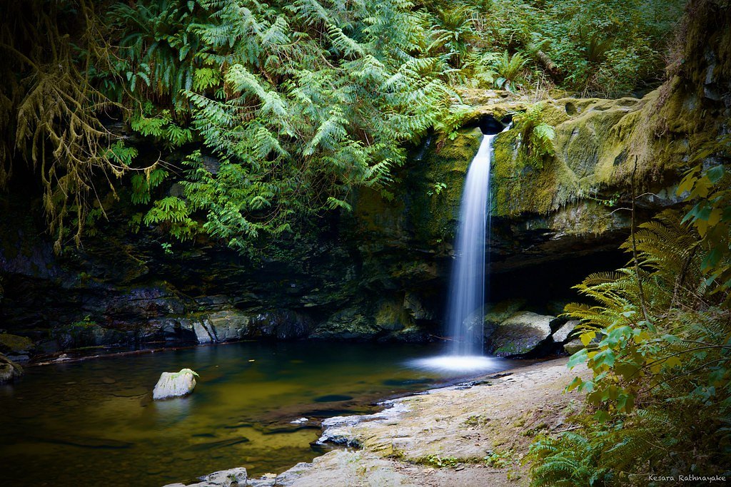
Lower Banon Creek Falls
By Armen Suny · Last verified Jun 2026
Difficulty
Easy
Trail Length
1.9 km
Trail Type
Out And Back
Elevation Gain
30 m
About Lower Banon Creek Falls
Lower Banon Creek Falls is a small, forested cascade on Banon Creek on southern Vancouver Island, British Columbia, located near Nanaimo (approx. 18.7 miles), Point Roberts (approx. 33.8 miles) and Victoria (approx. 39.7 miles). Coordinates: 48.9031, -123.7588. Visitor information is limited; the falls appear to be on or near unmaintained logging/forest access lands and are not a formally developed park attraction. Expect a natural, undeveloped site with limited signage and few if any built viewpoints. Flow is seasonal and typically highest in spring and after heavy rain.
Why This Waterfall Exists
Lower Banon Creek Falls flows over Nanaimo Group, a layered sedimentary rock layer deposited about 66-101 million years ago. Over time, the stream has worn through these layers at different rates, creating the step that forms the waterfall.
Nearby Falls Worth Visiting
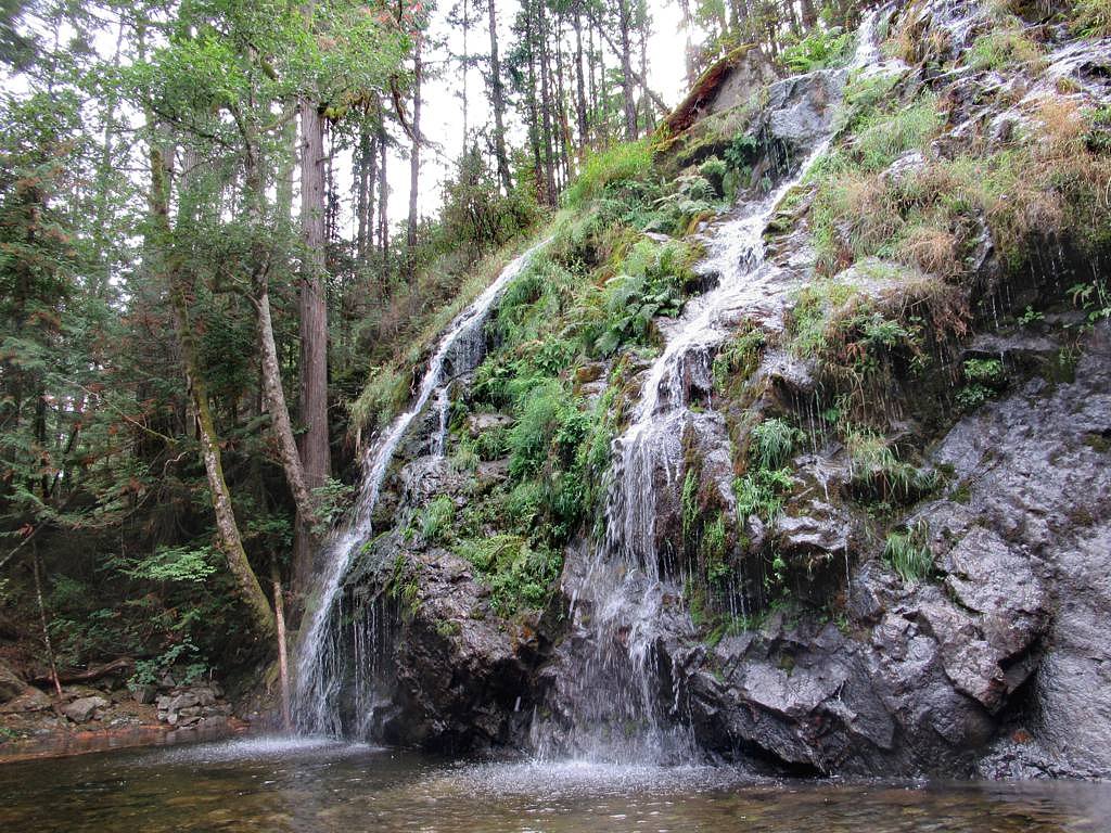
Stocking Creek Falls (15 m) lies 6.0 kilometres to the north. Also nearby: Skutz Falls (6 m, 19.6 km).
Trail & Hike Details
The Approach
The easy 1.9-km out-and-back trail gains 30 metres of elevation on the way to the falls.
Trail Description
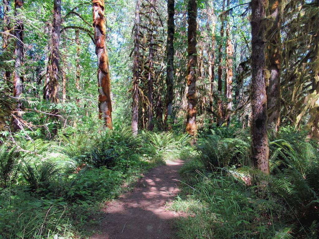
There does not appear to be a maintained or signed trail specifically to Lower Banon Creek Falls. Reaching the creek and falls may require walking over unmarked terrain, short bushwhacks, or following informal boot paths along forested slopes. Terrain may be steep, uneven, muddy, and slippery near the water. Expect minimal to no trail infrastructure (no boardwalks, railings, or constructed viewpoints). Use a map or GPS and plan for route-finding through forested areas; consider local logging activity that can alter roads and access.
What to Expect
A small, natural cascade set in coastal temperate rainforest typical of southern Vancouver Island, conifers such as Douglas-fir and western red cedar, ferns, mosses and undergrowth. The waterfall is likely most impressive in spring and after heavy rain; summer flows may be reduced. There are likely limited viewpoints and no formal safety barriers. Cell coverage may be patchy. Wildlife commonly found in the region includes black-tailed deer, black bears, cougars (rare), raccoons, and a variety of songbirds and raptors.
Accessibility
The trail is not wheelchair accessible. Uneven terrain and elevation changes require steady footing.
Frequently Asked Questions
🐶 Are Dogs Allowed at Lower Banon Creek Falls?
❌ Dogs are not allowed
Are There Any Fees or Permits Required?
🆖 No fees required
🏊 Is There Swimming at Lower Banon Creek Falls?
❌ Swimming is not allowed
When to Visit
Spring is generally the best time for higher flows and more impressive conditions. Late spring to early summer often balances good flow with better trail conditions. Summer can be drier and easier for access but the waterfall may have reduced flow. Avoid visiting during or immediately after heavy storms due to slippery terrain and high water.
Seasonal Access
The best time to visit is Spring, Summer, Fall, and Winter. Check with the managing park or local authority for current conditions.
Safety Information
Hazards may include slippery rocks and banks, steep or unstable streamside terrain, seasonal high flows, and limited or no cell coverage. Logging roads and active forestry work can create additional hazards and change access quickly, obey closures and signage. Avoid approaching cliff edges and fast-moving water. If you are unfamiliar with route-finding in forested areas, consider going with a more experienced companion or hiring a local guide.
Current Water Conditions
0.4 m³/s
Current discharge — how much water is flowing
Much lower than usual for this time of year
Based on 75 years of record
0.55 m
Water depth at gauge
7-Day Discharge Trend
What does this mean for your visit?
Flow is well below normal for this time of year, so the waterfall may be a trickle.
About This Gauge
7-Day Flow Outlook
Based on the WSC gauge CHEMAINUS RIVER NEAR WESTHOLME (5 km away).
Today
Barely Flowing
0.4 m³/s
4/10Tomorrow
Barely Flowing
0.4 m³/s
4/10Tue
Barely Flowing
0.4 m³/s
4/10Wed
Barely Flowing
0.3 m³/s
4/10Thu
Barely Flowing
0.3 m³/s
4/10Fri
Barely Flowing
0.3 m³/s
4/10Sat
Barely Flowing
0.3 m³/s
4/10Best window: Today — barely flowing flow, cloudy (trip score 4/10).
Best time of year: this gauge typically runs highest from early January to late January, peaking in December.
How we calculate this
This is a transparent outlook, not a precise forecast. We take the waterfall's current flow strength (how it ranks against its historical normal for today, from the nearest WSC stream gauge), carry that ranking forward along the gauge's seasonal curve, and nudge it for forecast rain. Confidence is highest for the next day or two and falls further out. Always check official conditions and your own judgment before visiting — high flows can be dangerous.
Know when to go.
Get a free email alert when waterfalls near Nanaimo hit peak flow. We only send when conditions are worth the trip — no weekly newsletters, no spam.
Weather Forecast
Location & Access
Getting There
From Nanaimo or Victoria, travel by vehicle toward the general area shown by the coordinates (48.9031, -123.7588). Access likely involves secondary/forest/logging roads and/or short unofficial trails from the nearest road or pullout. Exact public access points are not well documented, check current forest service maps, regional district resources, or local hiking guides prior to travel. Some approaches may cross private land or active forestry operations; obtain permission where required and follow posted signage.
Get Directions on Google MapsParking
Parking is likely informal (roadside pullout or small, unpaved turnout). There are probably no developed parking lots, restrooms, or visitor facilities. Park legally and avoid blocking gates or private driveways; if in doubt, seek local information before arriving.
Elevation
64 metres above sea level
Coordinates
48.903147° N, -123.758811° W
Visitor Tips & Gear
1) Plan routes ahead and bring a detailed map or GPS with the coordinates. 2) Expect unmaintained access: wear sturdy, waterproof hiking boots and bring trekking poles for slippery sections. 3) Check local forestry/park notices for logging activity or road closures. 4) Respect private land and posted closures, obtain permission if access crosses private property. 5) Pack out all trash and follow Leave No Trace principles. 6) Be cautious near stream edges and wet rocks, falls and currents can be hazardous. 7) If in bear country, carry bear spray and know how to use it.
As an Amazon Associate, we earn from qualifying purchases.
This easy 1.9 km hike is straightforward — comfortable trail shoes and plenty of water should do. Icy conditions are common in winter — traction cleats are a smart addition.

Columbia Watertight II Rain Jacket
Packs into its own pocket, seam-sealed, and keeps you dry from spray and surprise rain.

Earth Pak Waterproof Dry Bag
Keeps your phone and gear dry when waterfall mist soaks everything else.

Waterproof Phone Pouch (AiRunTech)
Cheap insurance — take photos right next to the falls without killing your phone.

Kahtoola MICROspikes
Cult-favorite traction cleats that grip ice and wet rock — essential for winter waterfall hikes.

Polarized Sunglasses (Knockaround)
Cuts glare off the water so you actually see the falls — and your photos turn out better too.

Osprey Daylite Daypack
Light, organized, and just the right size for a day hike — fits water, snacks, and layers.
Where to Stay
Browse vacation cabins and private rentals nearby
Unique outdoor stays — tents, yurts, and treehouses
Rent a campervan or RV for your waterfall road trip
Some links are affiliate links. We may earn a commission at no extra cost to you.
Nearby Campground
Campers Corner
6.2 km away
Additional Information
Nearby Attractions
The falls are on southern Vancouver Island near Nanaimo and within driving distance of other regional attractions such as coastal viewpoints, regional parks and trail systems on Vancouver Island. For specific nearby trails and developed parks, consult Nanaimo and Vancouver Island visitor resources.
Wildlife
Potential wildlife includes black-tailed deer, black bears, cougars (rare), raccoons, small mammals, and a variety of birds including raptors and songbirds. Take standard wildlife precautions: store food securely, make noise while hiking, and carry bear spray where recommended.
Cities near Lower Banon Creek Falls
Nearby Waterfalls
Writing about Lower Banon Creek Falls? Embed this waterfall on your site for free.