Stocking Creek Falls
British Columbia • 15 m
By Armen Suny · Last verified Jun 2026

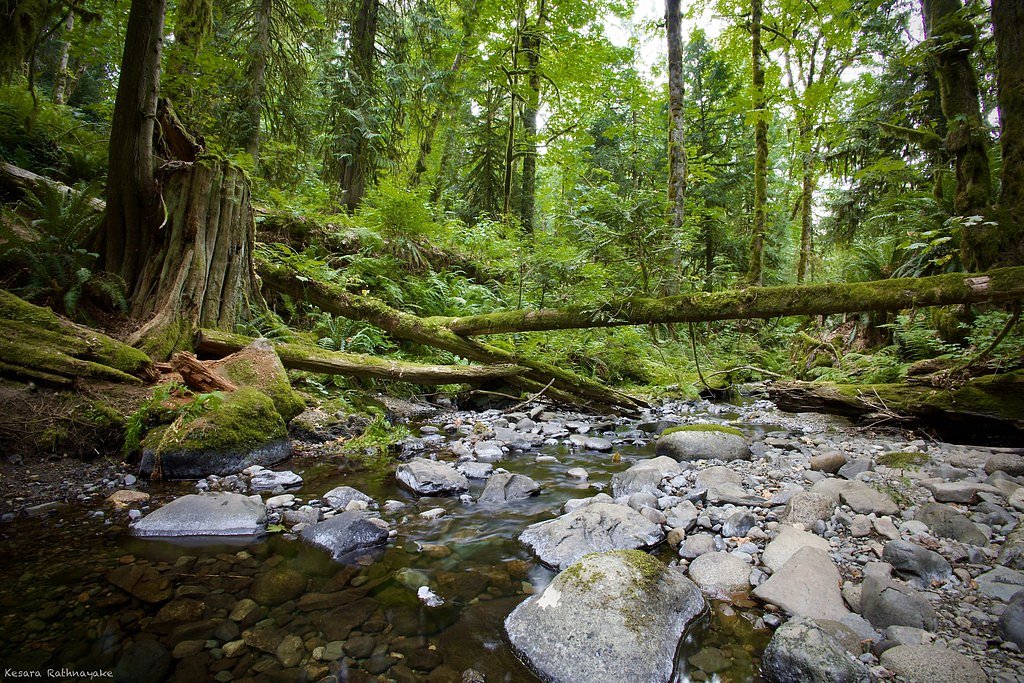
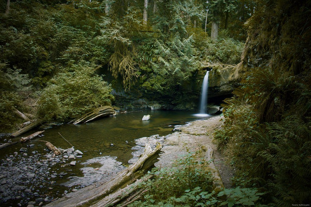
Photo Credits (4)
Difficulty
Easy
Trail Length
2.4 km
Trail Type
Loop
Elevation Gain
29 m
About Stocking Creek Falls
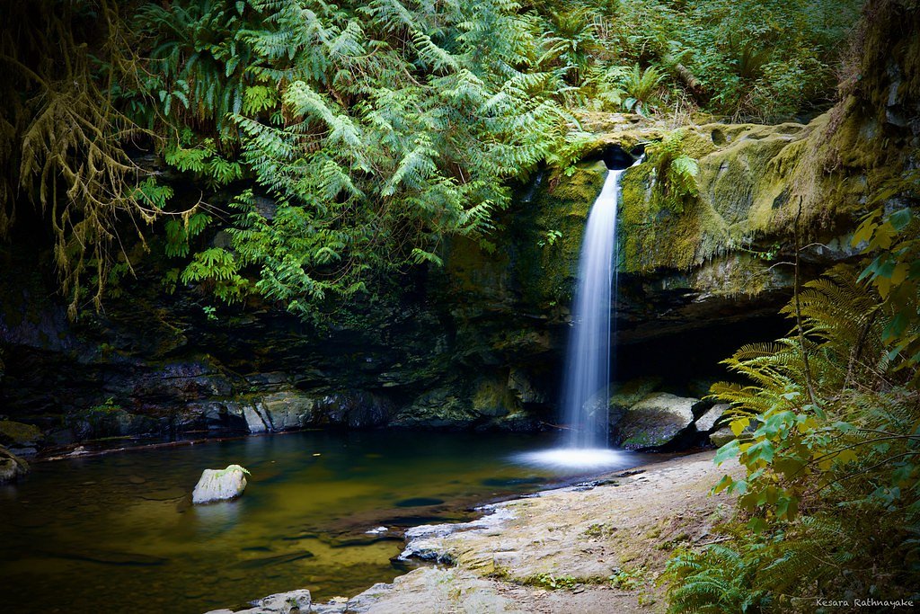
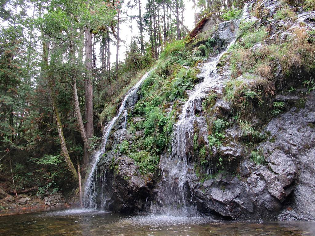
Stocking Creek Falls is a small forested cascade on southern Vancouver Island, near Nanaimo, British Columbia (approximate coordinates 48.9562, -123.7737). The falls sit in a mixed forest setting and appear to be best after winter/spring runoff and during rainy periods. Specific published details about the waterfall (exact height, officially maintained trail, or formal amenities) are limited; descriptions below are based on typical conditions for small coastal Vancouver Island falls and visitor reports in the region.
The Setting
Stocking Creek Falls sits at 57 metres in the coastal lowlands of British Columbia. The falls drop 15 metres.
Why This Waterfall Exists
Stocking Creek Falls flows over loose river sediment, primarily alluvium, laid down about 3 million years ago. These soft rocks erode readily, allowing the stream to carve a 49-foot drop into the landscape.
Trail & Hike Details
The Approach
The easy 2.4-km loop trail gains 29 metres of elevation on the way to the falls.
Trail Description
Trail information for Stocking Creek Falls is not well-documented in major trail databases. Expect an informal, likely short forest trail through second-growth or mixed forest. Trails to similar small falls on Vancouver Island are often unpaved, narrow, possibly muddy, and may include short steep sections or log/rock steps near the falls. Footing can be slippery and route-finding may be required where signage is absent.
What to Expect
The falls drop 15 metres over loose river sediment.
Accessibility
The trail is not wheelchair accessible. Uneven terrain and elevation changes require steady footing.
Frequently Asked Questions
🐶 Are Dogs Allowed at Stocking Creek Falls?
❌ Dogs are not allowed
Are There Any Fees or Permits Required?
🆖 No fees required
🏊 Is There Swimming at Stocking Creek Falls?
❌ Swimming is not allowed
When to Visit
Late winter through late spring for the strongest flows; fall can also produce high flow during rainy periods. Summer visits will typically have lower flow but can be more accessible for hiking. Aim for weekdays or early morning to avoid local recreational traffic and to have quieter conditions.
Seasonal Access
The best time to visit is Spring, Summer, and Fall. Winter access may be limited. Check with the managing park or local authority for current conditions.
Safety Information
• Slippery rocks and muddy trails increase the risk of falls, wear appropriate footwear. • River/stream currents and plunge pools can be deceptively strong and cold; avoid swimming near the falls. • Cliffs and steep banks near the waterfall may be unstable, stay on established trails and maintain a safe distance from edges. • Wildlife encounters (including bears) are possible, carry bear-aware supplies and know local protocols. • Cell coverage may be limited; tell someone your plan and expected return time. • Private property and forestry operations exist in the region, respect signage and do not cross locked gates or posted private land.
Current Water Conditions
0.4 m³/s
Current discharge — how much water is flowing
Much lower than usual for this time of year
Based on 75 years of record
0.55 m
Water depth at gauge
7-Day Discharge Trend
What does this mean for your visit?
Flow is well below normal for this time of year, so the waterfall may be a trickle.
About This Gauge
This gauge is on a nearby waterway and may not reflect exact conditions at the falls.
7-Day Flow Outlook
Based on the WSC gauge CHEMAINUS RIVER NEAR WESTHOLME (10 km away).
Today
Barely Flowing
0.4 m³/s
4/10Tomorrow
Barely Flowing
0.4 m³/s
4/10Tue
Barely Flowing
0.4 m³/s
4/10Wed
Barely Flowing
0.3 m³/s
4/10Thu
Barely Flowing
0.3 m³/s
4/10Fri
Barely Flowing
0.3 m³/s
4/10Sat
Barely Flowing
0.3 m³/s
4/10Best window: Today — barely flowing flow, cloudy (trip score 4/10).
Best time of year: this gauge typically runs highest from early January to late January, peaking in December.
How we calculate this
This is a transparent outlook, not a precise forecast. We take the waterfall's current flow strength (how it ranks against its historical normal for today, from the nearest WSC stream gauge), carry that ranking forward along the gauge's seasonal curve, and nudge it for forecast rain. Confidence is highest for the next day or two and falls further out. Always check official conditions and your own judgment before visiting — high flows can be dangerous.
Know when to go.
Get a free email alert when waterfalls near Nanaimo hit peak flow. We only send when conditions are worth the trip — no weekly newsletters, no spam.
Weather Forecast
Location & Access
Getting There
The falls are located on southern Vancouver Island near Nanaimo (approx. 15.5 miles by road according to the reported context) at coordinates 48.9562, -123.7737. Access is likely by local secondary roads and a short forest trail. Visitors should use a reliable mapping app or GPS coordinates to locate the nearest public road or trailhead. Some approaches in the area may use forestry or unpaved roads; low-clearance vehicles could be problematic in wet conditions.
Get Directions on Google MapsParking
Parking is likely limited to a small pullout or roadside area near the trail access. There may not be a formal parking lot or facilities. Expect minimal infrastructure and use caution when parking on narrow shoulders.
Elevation
57 metres above sea level
Coordinates
48.956215° N, -123.773704° W
Visitor Tips & Gear
• Use GPS coordinates to locate access; trails may be unsigned. • Wear sturdy, waterproof footwear, rocks and roots get slippery. • Avoid scrambling on wet rocks near the falls; edges can be unstable. • Bring insect repellent in summer; ticks and mosquitoes may be present. • Leave no trace: pack out all garbage and avoid trampling vegetation. • If bringing dogs, keep them leashed and under control; check local rules. • Check local forestry or park websites for any access advisories or closures before visiting.
As an Amazon Associate, we earn from qualifying purchases.
This easy 2.4 km hike is straightforward — comfortable trail shoes and plenty of water should do. Sun exposure on the trail makes good sun protection a must in summer.

Polarized Sunglasses (Knockaround)
Cuts glare off the water so you actually see the falls — and your photos turn out better too.

Columbia Watertight II Rain Jacket
Packs into its own pocket, seam-sealed, and keeps you dry from spray and surprise rain.

Earth Pak Waterproof Dry Bag
Keeps your phone and gear dry when waterfall mist soaks everything else.

Waterproof Phone Pouch (AiRunTech)
Cheap insurance — take photos right next to the falls without killing your phone.

JOBY GorillaPod Starter Kit
Wraps around railings and rocks for long-exposure waterfall shots — no flat surface needed.

Osprey Daylite Daypack
Light, organized, and just the right size for a day hike — fits water, snacks, and layers.
Where to Stay
Browse vacation cabins and private rentals nearby
Unique outdoor stays — tents, yurts, and treehouses
Rent a campervan or RV for your waterfall road trip
Some links are affiliate links. We may earn a commission at no extra cost to you.
Nearby Campground
Campers Corner
0.4 km away
Additional Information
Nearby Attractions
Nanaimo waterfront and parks, nearby coastal beaches and marine parks (e.g., Newcastle Island/Protection Island access near Nanaimo), and other Vancouver Island outdoor recreation areas. Exact nearby attractions depend on the chosen access route.
Wildlife
Typical Vancouver Island wildlife: black-tailed deer, black bears, small mammals (squirrels, raccoons), a variety of forest birds, and insects (mosquitoes, ticks). Be bear-aware and store food securely.
Cities near Stocking Creek Falls
Nearby Waterfalls
Writing about Stocking Creek Falls? Embed this waterfall on your site for free.