Lower 2nd Falls
By Armen Suny · Last verified Jun 2026
About Lower 2nd Falls
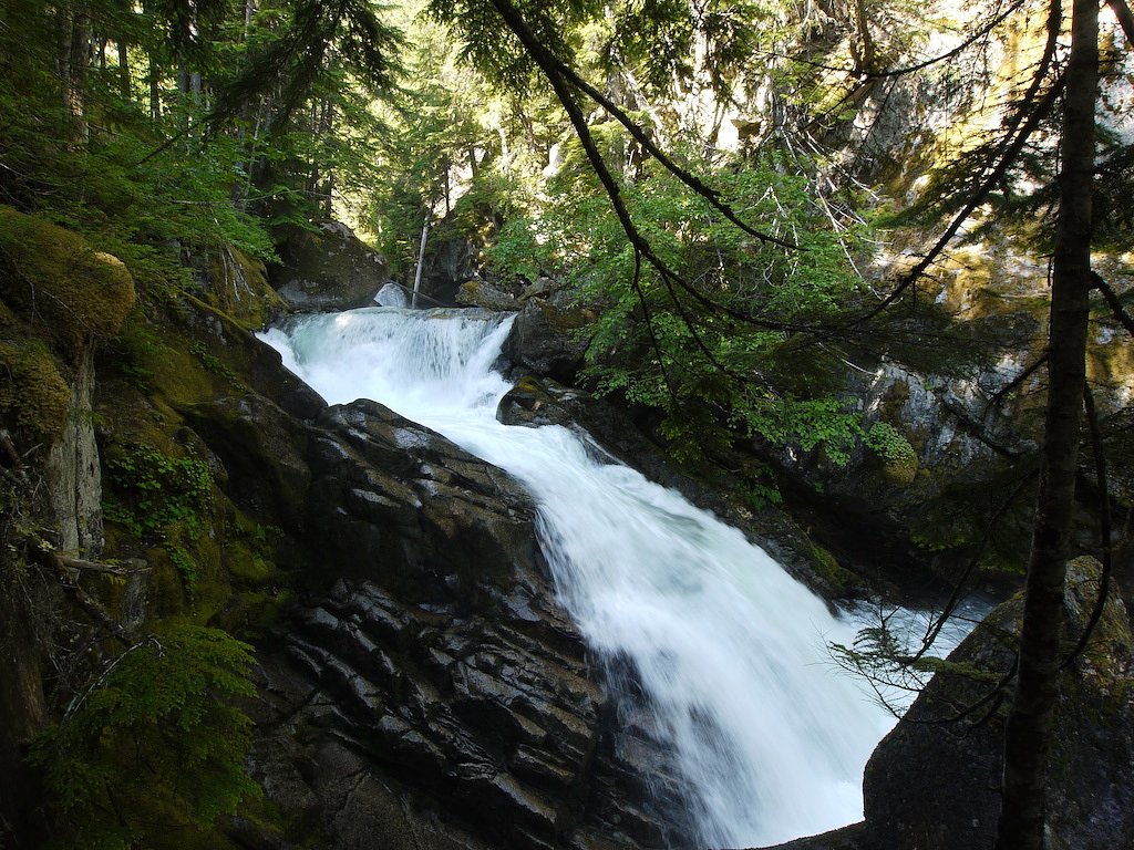
Lower 2nd Falls is a forested, likely multi-step cascade located in the Fraser Valley region of British Columbia at coordinates 49.5057, -121.4577. It lies in the general vicinity of Chilliwack (≈37 mi), Glacier (≈50 mi) and Maple Falls (≈56 mi). Specific published guide information for this particular named fall is limited; the falls appear to be a smaller, seasonal waterfall best visited when streamflow is higher (spring snowmelt/after rain). Access may require travel on forestry/unsurfaced roads and an unmarked or lightly maintained trail and could include short scrambling near the stream.
Why This Waterfall Exists
Lower 2nd Falls flows over cemented gravel rock, primarily conglomerate and sandstone, laid down about 145-299 million years ago. These soft rocks erode readily, allowing the stream to carve a vertical drop into the landscape.
Nearby Falls Worth Visiting
Yale Creek Falls (15 m) lies 7.7 kilometres to the north.
Trail & Hike Details
Trail Description
There is limited formal information about an established maintained trail specifically named for Lower 2nd Falls. Approaches to similar small falls in this region commonly involve driving on gravel or logging roads followed by a short, unmarked footpath or bushwhack down to the creek. Terrain can be steep and slippery near the stream; expect roots, rocks, and unstable surfaces. If a maintained trail exists locally it is likely short (under a few miles round-trip) but may not be well-signed.
What to Expect
Expect a relatively small, forested cascade or tier of falls rather than a large vertical drop. Flow is seasonal and may be much stronger during spring snowmelt or after heavy rain. The approach is likely through mixed second-growth forest with muddy sections and possible blowdown following storm events. Cell coverage may be intermittent in valley or canyon sections.
Accessibility
Access is likely not wheelchair accessible. Expect uneven, muddy, and possibly steep terrain; the site may require scrambling and route-finding.
Frequently Asked Questions
🐶 Are Dogs Allowed at Lower 2nd Falls?
❌ Dogs are not allowed
Are There Any Fees or Permits Required?
🆖 No fees required
🏊 Is There Swimming at Lower 2nd Falls?
❌ Swimming is not allowed
When to Visit
Late spring (snowmelt) for highest flows, early summer for good weather and still decent flow, and fall for lower crowds and fall colors. Winter may be wet, icy, or inaccessible depending on local road and weather conditions.
Seasonal Access
The best time to visit is Spring, Summer, and Fall. Winter access may be limited. Check with the managing park or local authority for current conditions.
Safety Information
Hazards may include slippery wet rock, unstable cliff edges, fast or cold water, falling rock or loose ground near stream banks, and limited cell service. Use caution near the edge of falls, avoid crossing fast-flowing streams, and check recent trip reports or local authorities about road and trail conditions before visiting. Tell someone your plans and expected return time.
Current Water Conditions
These readings come from the Water Survey of Canada gauge on Fraser River, 13.3 km away, not on Lower 2nd Falls's own stream. Use them as a sign of whether the area is running wet or dry.
1,600.0 m³/s
Current discharge — how much water is flowing
About average for this time of year
Based on 113 years of record
3.91 m
Water depth at gauge
7-Day Discharge Trend
What does this mean for your visit?
Flow is about average for this time of year.
About This Gauge
This gauge is on a nearby waterway and may not reflect exact conditions at the falls.
7-Day Flow Outlook
Based on the WSC gauge FRASER RIVER AT HOPE (13 km away).
Today
Moderate
1600 m³/s
6/10Tomorrow
Moderate
1609 m³/s
6/10Sat
Moderate
1839 m³/s
5/10Sun
Moderate
1927 m³/s
6/10Mon
Moderate
1761 m³/s
6/10Tue
Moderate
1859 m³/s
5/10Wed
Moderate
1732 m³/s
6/10Best window: Today — moderate flow, cloudy (trip score 6/10).
Best time of year: this gauge typically runs highest from early May to early August, peaking in June.
How we calculate this
This is a transparent outlook, not a precise forecast. We take the waterfall's current flow strength (how it ranks against its historical normal for today, from the nearest WSC stream gauge), carry that ranking forward along the gauge's seasonal curve, and nudge it for forecast rain. Confidence is highest for the next day or two and falls further out. Always check official conditions and your own judgment before visiting — high flows can be dangerous.
Know when to go.
Get a free email alert when waterfalls near Chilliwack hit peak flow. We only send when conditions are worth the trip — no weekly newsletters, no spam.
Weather Forecast
Location & Access
Getting There
The falls are in the Fraser Valley near the communities listed above. Use the provided coordinates (49.5057, -121.4577) in a reliable GPS or mapping app to locate the feature. Final access may be via secondary/forest service roads and a rough or unmarked trail; expect limited signage. Obtain up-to-date directions from local trail resources, visitor centres, or recent trip reports before travel.
Get Directions on Google MapsParking
Parking is likely limited to a roadside pullout or informal parking near a trailhead or forestry road. Some access may cross or run near private land, respect signage and do not block gates or driveways. Expect no formal lot, toilets, or trash facilities.
Elevation
243 metres above sea level
Coordinates
49.505686° N, -121.457716° W
Visitor Tips & Gear
• Confirm current access and conditions with local ranger offices, visitor centres, or recent trip reports before heading out. • Use the exact coordinates and a topographic map or GPS unit, trails may be unmarked. • Wear sturdy, grippy footwear and be prepared for muddy/rocky terrain. • Stay off slippery rocks and avoid getting too close to the edge, wet rock and algae are hazardous. • Park legally and avoid blocking gates or private driveways. • Carry out all trash and leave no trace. • If unsure about route-finding, consider going with a local hiking group or guide.
Where to Stay
Browse vacation cabins and private rentals nearby
Unique outdoor stays — tents, yurts, and treehouses
Rent a campervan or RV for your waterfall road trip
Some links are affiliate links. We may earn a commission at no extra cost to you.
Nearby Campground
FVDRA Campground
1.7 km away
Nearby Hot Springs
Hot springs near Chilliwack, British Columbia
Looking for a soak after your hike? Explore more hot springs near Chilliwack, British Columbia on SoakingSprings.
Explore British Columbia springsAdditional Information
Nearby Attractions
Fraser Valley attractions such as Chilliwack and Chilliwack Lake Provincial Park are in the broader region; local hiking and river recreation opportunities exist. Use local visitor centres for confirmed nearby sights and trail suggestions.
Wildlife
Typical Fraser Valley/Coast Range wildlife may be present: black bear, cougar (rare but possible), deer, small mammals, and numerous songbirds. Insect hazards include mosquitoes and ticks in warmer months. Carry bear-aware precautions where appropriate.
Cities near Lower 2nd Falls
Nearby Waterfalls
Writing about Lower 2nd Falls? Embed this waterfall on your site for free.