5th Falls
By Armen Suny · Last verified Jun 2026
Photo Credits (5)
About 5th Falls
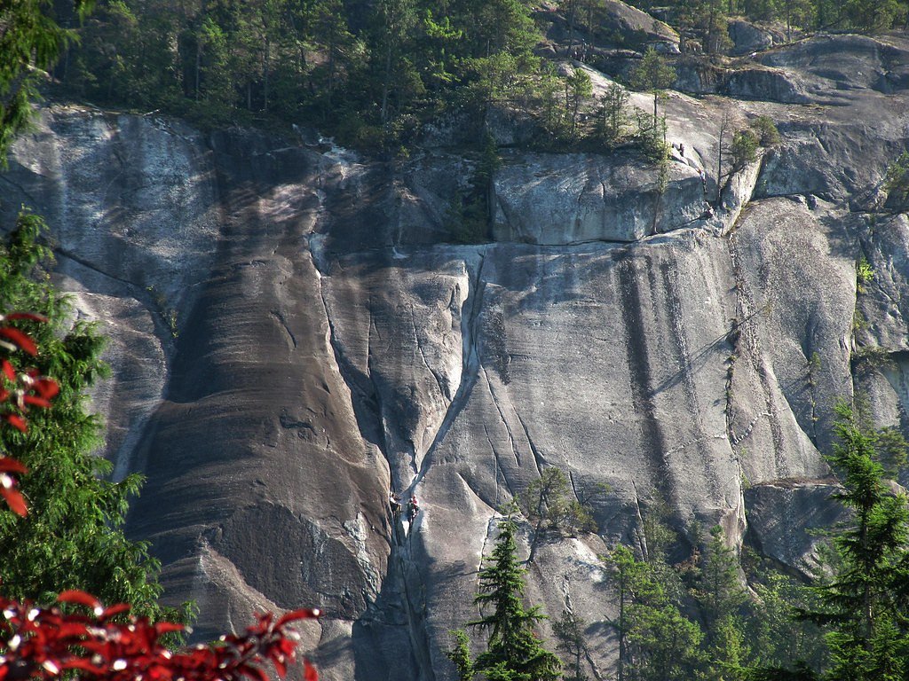
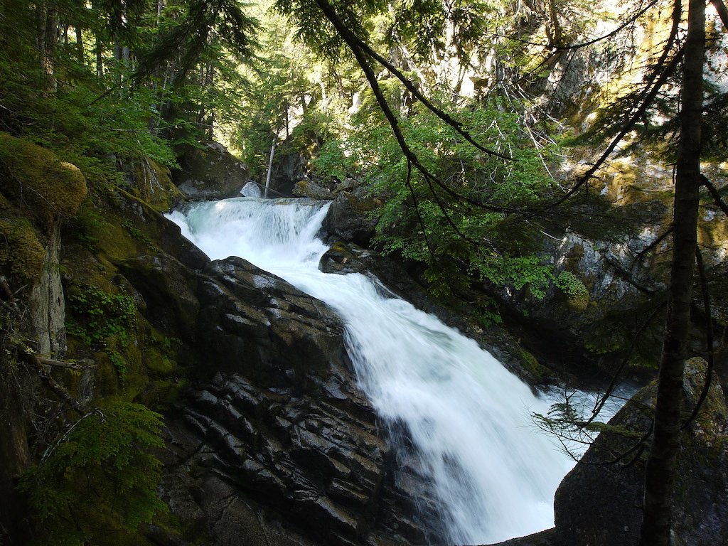
5th Falls (sometimes written "Fifth Falls") is a forested, canyon-type waterfall located in the eastern Fraser Valley region of British Columbia, Canada (approximate coordinates 49.5037, -121.4677). The falls sit in a rugged, heavily treed area and are best visited by hikers familiar with local logging/forest roads and informal trail access. Seasonal flow is typically highest in spring runoff and can be reduced in late summer and early fall. Precise published information about the falls is limited; recent trip reports and local trail resources should be consulted before visiting.
Why This Waterfall Exists
5th Falls flows over cemented gravel rock, primarily conglomerate and sandstone, laid down about 145-299 million years ago. These soft rocks erode readily, allowing the stream to carve a vertical drop into the landscape.
Nearby Falls Worth Visiting
Yale Creek Falls (15 m) lies 8.2 kilometres to the northeast.
Trail & Hike Details
Trail Description
Published trail information for 5th Falls is limited. Approaches reported by visitors may include a mix of short established trails, rough singletrack, or informal bushwhacks from logging roads. Expect uneven terrain, roots, rocks, and possibly wet or muddy sections. There may not be a maintained viewpoint or safety railings; viewing often requires getting close to the creek on steep, slippery ground.
What to Expect
A natural, forested waterfall in a canyon setting with likely multiple drops or steep cascades. Flow varies seasonally, highest in spring snowmelt and after heavy rain. Limited facilities: no bathrooms, signage, or maintained viewing platforms typically. Cell service and emergency response times may be limited. Wildlife is present in the region.
Accessibility
Access is likely not wheelchair accessible and may be unsuitable for people with limited mobility due to uneven terrain, steep approaches, and lack of maintained trails or viewing platforms.
Frequently Asked Questions
🐶 Are Dogs Allowed at 5th Falls?
❌ Dogs are not allowed
Are There Any Fees or Permits Required?
🆖 No fees required
🏊 Is There Swimming at 5th Falls?
❌ Swimming is not allowed
When to Visit
Late spring (snowmelt) for highest flow and scenic water volume. Early summer can offer easier access as roads dry out. Avoid peak winter storm periods if roads are impassable or when trails are iced; fall can be pleasant for lower flows and fewer bugs.
Seasonal Access
The best time to visit is Spring, Summer, and Fall. Winter access may be limited. Check with the managing park or local authority for current conditions.
Safety Information
Hazards include steep and slippery rock, unstable edges, strong currents near the falls, changing water levels after rain, poor or no cell coverage, and active forestry operations on access roads. Wear appropriate footwear, avoid cliff edges, do not climb wet rocks, and do not attempt to cross swollen streams. Check for current road closures or logging activity before travel.
Current Water Conditions
3,710.0 m³/s
Current discharge — how much water is flowing
Much lower than usual for this time of year
Based on 113 years of record
5.68 m
Water depth at gauge
7-Day Discharge Trend
What does this mean for your visit?
Flow is well below normal for this time of year, so the waterfall may be a trickle.
About This Gauge
This gauge is on a nearby waterway and may not reflect exact conditions at the falls.
7-Day Flow Outlook
Based on the WSC gauge FRASER RIVER AT HOPE (13 km away).
Today
Barely Flowing
3710 m³/s
4/10Tomorrow
Barely Flowing
3623 m³/s
4/10Tue
Barely Flowing
3601 m³/s
4/10Wed
Barely Flowing
3543 m³/s
4/10Thu
Barely Flowing
3463 m³/s
4/10Fri
Barely Flowing
3419 m³/s
4/10Sat
Barely Flowing
3339 m³/s
4/10Best window: Today — barely flowing flow, partly cloudy (trip score 4/10).
Best time of year: this gauge typically runs highest from early May to early August, peaking in June.
How we calculate this
This is a transparent outlook, not a precise forecast. We take the waterfall's current flow strength (how it ranks against its historical normal for today, from the nearest WSC stream gauge), carry that ranking forward along the gauge's seasonal curve, and nudge it for forecast rain. Confidence is highest for the next day or two and falls further out. Always check official conditions and your own judgment before visiting — high flows can be dangerous.
Know when to go.
Get a free email alert when waterfalls near Chilliwack hit peak flow. We only send when conditions are worth the trip — no weekly newsletters, no spam.
Weather Forecast
Location & Access
Getting There
General access is by driving on local paved roads followed by secondary/unpaved forestry or logging roads and then hiking. Exact approach routes vary and may not be signed. Expect limited or no cell coverage in places; check recent trip reports, forest service notices, or local park pages for road conditions. The falls are roughly within driving distance of Chilliwack and Hope, use the coordinates (49.5037, -121.4677) for GPS navigation.
Get Directions on Google MapsParking
There may be informal pullouts or small parking areas near trailheads or forestry road junctions. Do not block gates or private driveways. Parking conditions can change with logging activity; when in doubt, park well off the road and follow posted restrictions.
Elevation
366 metres above sea level
Coordinates
49.503659° N, -121.467655° W
Visitor Tips & Gear
• Check recent trip reports (AllTrails, local hiking forums, or provincial forest service notices) for road and trail conditions before you go. • Wear sturdy, waterproof footwear with good traction; approach areas will be slippery and uneven. • Bring a topo map or GPS with the provided coordinates; trails may be unmarked. • Tell someone your route and expected return time; cell coverage can be unreliable. • Be prepared for muddy or rutted forestry roads; a high-clearance vehicle or 4WD may be helpful but confirm current road condition. • Pack out all trash and follow Leave No Trace principles. • Exercise extreme caution near cliff edges and fast water; rocks are slippery and currents can be stronger than they look.
Where to Stay
Browse vacation cabins and private rentals nearby
Unique outdoor stays — tents, yurts, and treehouses
Rent a campervan or RV for your waterfall road trip
Some links are affiliate links. We may earn a commission at no extra cost to you.
Nearby Campground
FVDRA Campground
1.7 km away
Nearby Hot Springs
Hot springs near Chilliwack, British Columbia
Looking for a soak after your hike? Explore more hot springs near Chilliwack, British Columbia on SoakingSprings.
Explore British Columbia springsAdditional Information
Nearby Attractions
The falls are in the eastern Fraser Valley region; nearby towns and attractions within driving distance include communities such as Chilliwack and Hope and various provincial parks, hiking routes, and lakes. Confirm local points of interest and distances using a map app before travel.
Wildlife
Typical regional wildlife may include black bears, cougars, deer, small mammals, and numerous bird species. Ticks and biting insects can be common in warmer months. Store food securely and follow bear-safety practices.
Cities near 5th Falls
Nearby Waterfalls
Writing about 5th Falls? Embed this waterfall on your site for free.