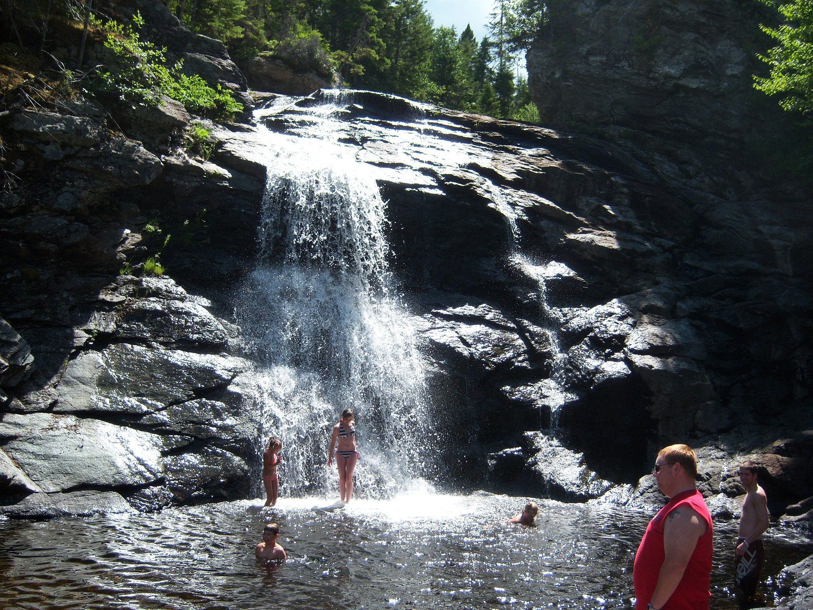
Laverty Falls
New Brunswick • Fundy National Park • 12 m
By Armen Suny · Last verified Jun 2026
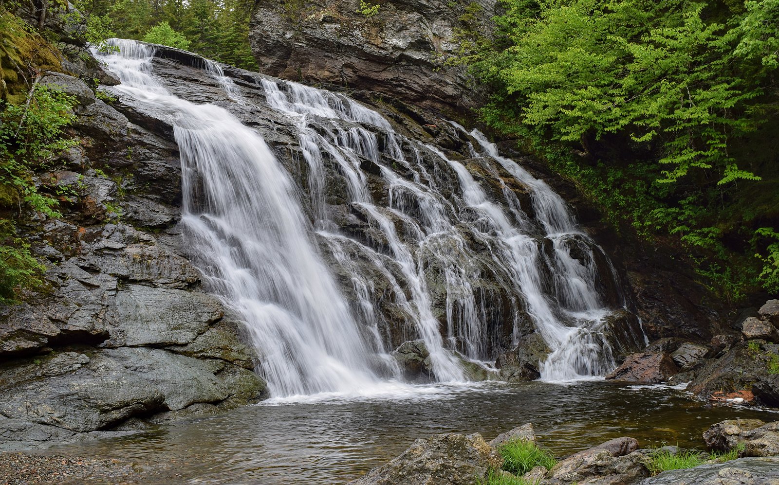
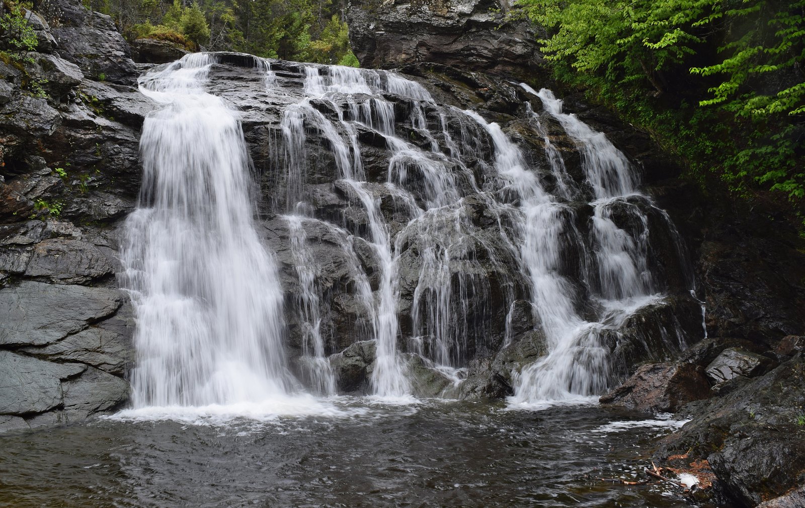
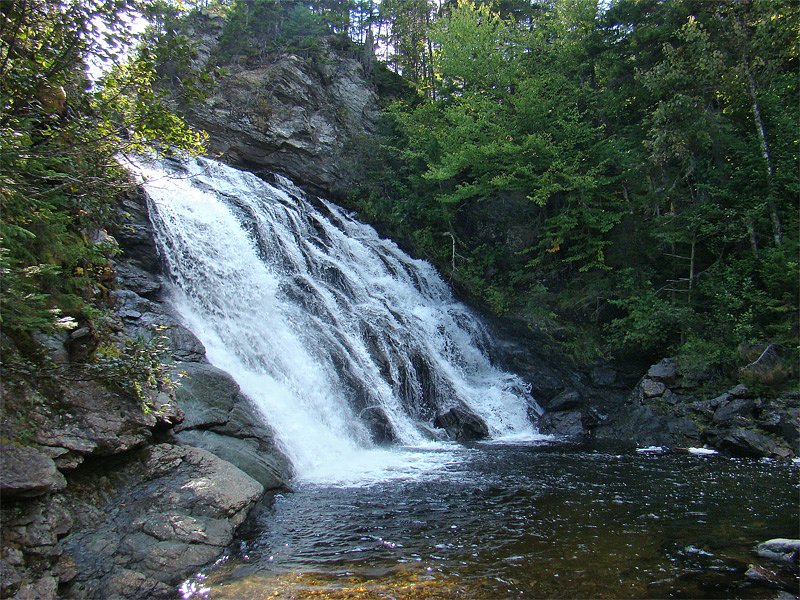
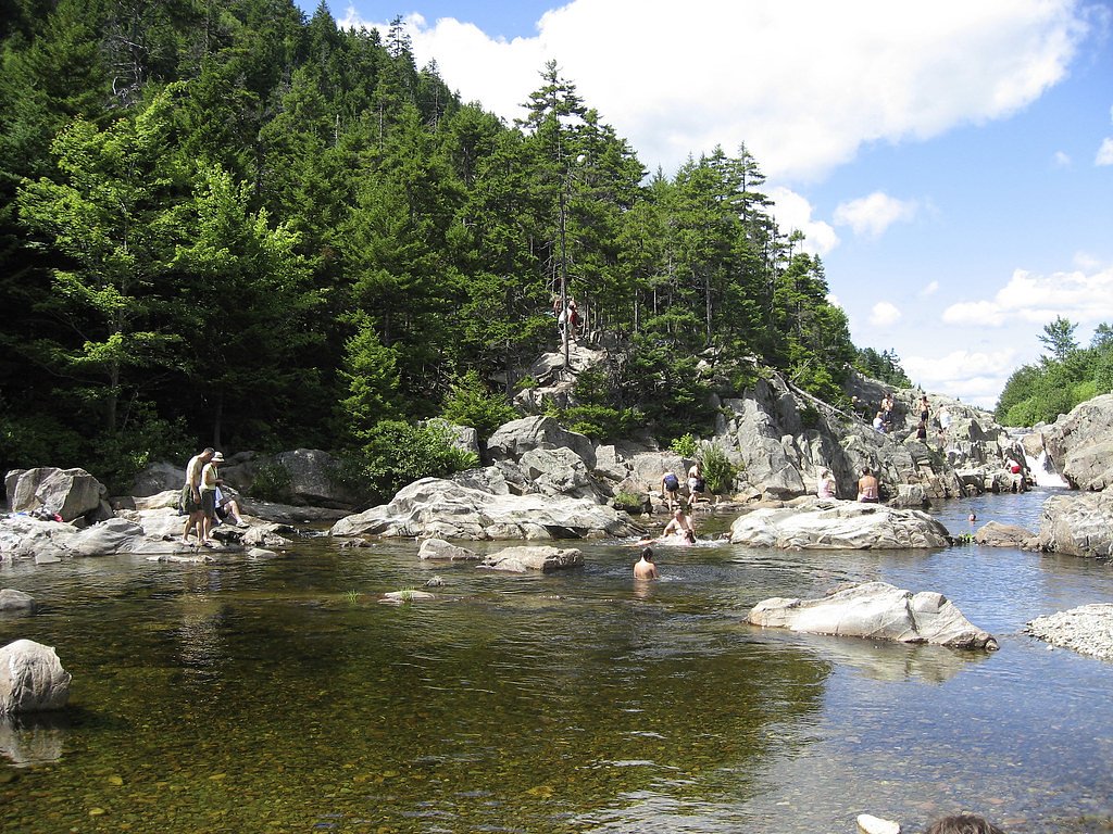
Photo Credits (5)
Difficulty
Easy
Trail Length
0.6 km
Trail Type
Out And Back
Elevation Gain
12 m
About Laverty Falls
Laverty Falls is a small, multi-tiered woodland cascade in southeastern New Brunswick. It is reached by a short, informal trail from a roadside parking/pullout and is best known for its scenic rocky ledges and seasonal flow variations (typically higher in spring). Facilities are minimal and the setting is primarily natural/undeveloped.
The Setting
Laverty Falls sits at 224 metres within Fundy National Park, in the foothills of New Brunswick. The falls drop 12 metres.
Why This Waterfall Exists
Laverty Falls flows over hard volcanic rock laid down about 539 million to 1.0 billion years ago. These resistant rocks form a durable ledge that water cannot easily wear away, creating a 39-foot drop where softer material downstream has already eroded.
Nearby Falls Worth Visiting
Dickson Falls (8 m) lies 10.6 kilometres to the southeast. Also nearby: Gordon Falls (6 m, 13.7 km).
Trail & Hike Details
The Approach
The easy 0.6-km out-and-back trail gains 12 metres of elevation on the way to the falls.
Trail Description
A short, likely unmaintained spur trail leads from the roadside pullout down through mixed forest to the stream and falls. The path may be narrow, uneven, and include roots and rocks; in places it may be muddy or steep for short sections. There are likely no formal boardwalks or guardrails. The main viewing is from rock ledges and the stream banks.
What to Expect
The falls drop 12 metres over hard volcanic rock.
Accessibility
The trail is short and relatively flat, but the surface may be uneven. Contact the managing agency for accessibility details.
Frequently Asked Questions
🐶 Are Dogs Allowed at Laverty Falls?
❌ Dogs are not allowed
Are There Any Fees or Permits Required?
🆖 No fees required
🏊 Is There Swimming at Laverty Falls?
❌ Swimming is not allowed
When to Visit
Spring for strongest flow and surrounding greenery; fall for foliage color. Weekdays and mornings tend to be quieter. Avoid visiting immediately after heavy rain if you are not comfortable with slippery conditions.
Seasonal Access
The best time to visit is Spring, Summer, Fall, and Winter. Check with Fundy National Park for current conditions.
Safety Information
Hazards include slippery wet rocks and trails, sudden increases in water flow after rain, cold water temperature, uneven terrain, and limited or no guardrails. Cell service may be limited. Take care near edges, supervise children, wear appropriate footwear, and avoid risky rock-hopping. Consider weather and trail conditions before visiting.
Current Water Conditions
0.6 m³/s
Current discharge — how much water is flowing
Lower than usual for this time of year
Based on 61 years of record
0.28 m
Water depth at gauge
7-Day Discharge Trend
What does this mean for your visit?
Flow is lower than usual for this time of year.
About This Gauge
This gauge is on a nearby waterway and may not reflect exact conditions at the falls.
7-Day Flow Outlook
Based on the WSC gauge POINT WOLFE RIVER AT FUNDY NATIONAL PARK (13 km away).
Today
Barely Flowing
0.4 m³/s
3/10Tomorrow
Barely Flowing
0.3 m³/s
4/10Tue
Barely Flowing
0.4 m³/s
4/10Wed
Barely Flowing
0.5 m³/s
3/10Thu
Low
0.5 m³/s
4/10Fri
Barely Flowing
0.5 m³/s
4/10Sat
Barely Flowing
0.4 m³/s
3/10Best window: Tomorrow — barely flowing flow, cloudy (trip score 4/10).
Best time of year: this gauge typically runs highest from late March to late May, peaking in April.
How we calculate this
This is a transparent outlook, not a precise forecast. We take the waterfall's current flow strength (how it ranks against its historical normal for today, from the nearest WSC stream gauge), carry that ranking forward along the gauge's seasonal curve, and nudge it for forecast rain. Confidence is highest for the next day or two and falls further out. Always check official conditions and your own judgment before visiting — high flows can be dangerous.
Know when to go.
Get a free email alert when waterfalls near Moncton hit peak flow. We only send when conditions are worth the trip — no weekly newsletters, no spam.
Weather Forecast
Location & Access
Getting There
Coordinates: 45.6769, -65.0117. The falls are reached by driving on local secondary roads off the nearest regional highways; from Moncton (about 30 miles) head toward local municipal roads in the area and follow signage or map/GPS to the coordinates. Expect gravel or narrow paved access roads near the site. Exact turn-by-turn directions depend on your starting point, use the coordinates in a mapping app. Some sections of the final approach may be unpaved.
Get Directions on Google MapsParking
No formal lot is known; visitors typically use a small roadside pullout or shoulder parking. Parking may be limited and vehicles should be well off the travel lane. There may be no marked parking area or amenities.
Elevation
224 metres above sea level
Coordinates
45.676936° N, -65.011692° W
Land Management
Managed by Parks Canada Agency
Visitor Tips & Gear
Wear sturdy, waterproof footwear with good traction, rocks and trails can be wet and slippery. Stay off unstable ledges and avoid crossing fast-flowing sections. Pack out all trash and respect any posted private property signs. Check local weather and recent visitor reports before visiting, especially after heavy rain or during freeze-thaw conditions.
As an Amazon Associate, we earn from qualifying purchases.
For this easy 0.6 km trail, lightweight trail shoes and a water bottle are usually sufficient. Icy conditions are common in winter — traction cleats are a smart addition.

Columbia Watertight II Rain Jacket
Packs into its own pocket, seam-sealed, and keeps you dry from spray and surprise rain.

Polarized Sunglasses (Knockaround)
Cuts glare off the water so you actually see the falls — and your photos turn out better too.

Earth Pak Waterproof Dry Bag
Keeps your phone and gear dry when waterfall mist soaks everything else.

Waterproof Phone Pouch (AiRunTech)
Cheap insurance — take photos right next to the falls without killing your phone.

Kahtoola MICROspikes
Cult-favorite traction cleats that grip ice and wet rock — essential for winter waterfall hikes.

JOBY GorillaPod Starter Kit
Wraps around railings and rocks for long-exposure waterfall shots — no flat surface needed.
Where to Stay
Browse vacation cabins and private rentals nearby
Unique outdoor stays — tents, yurts, and treehouses
Rent a campervan or RV for your waterfall road trip
Some links are affiliate links. We may earn a commission at no extra cost to you.
Nearby Campground
Tracey Lake BackCountry Site 2
5.3 km away
Additional Information
Nearby Attractions
Regional towns such as Moncton (approximately 30 miles) and Amherst (approximately 41 miles) provide services and other attractions. Local rivers, scenic countryside drives, and small provincial parks are found in the broader region, consult regional tourism resources for options.
Wildlife
Typical maritime forest and riparian wildlife may be observed: songbirds, waterfowl, beaver activity, white-tailed deer, and insects (black flies, mosquitoes). Black bears occur in parts of New Brunswick; encounters are uncommon near small roadside falls but remain a possibility in more remote areas.
Cities near Laverty Falls
Nearby Waterfalls

Writing about Laverty Falls? Embed this waterfall on your site for free.