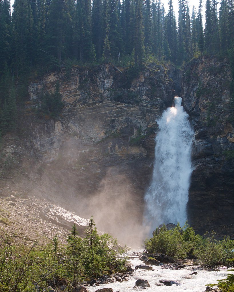
Laughing Falls
British Columbia • Yoho National Park • 30 m
By Armen Suny · Last verified Jun 2026
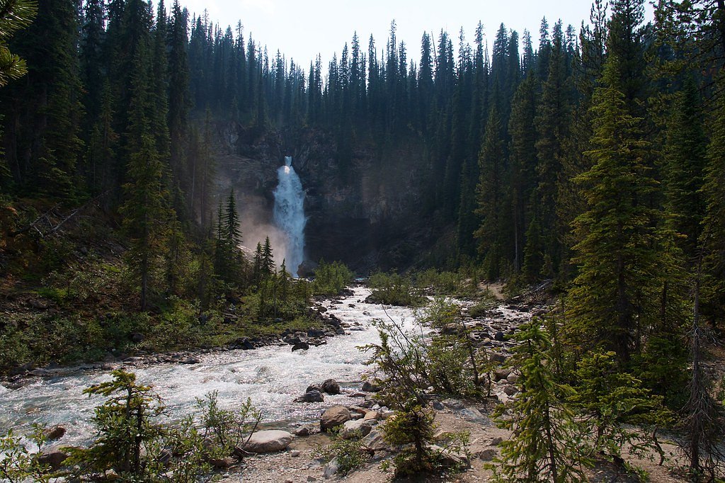
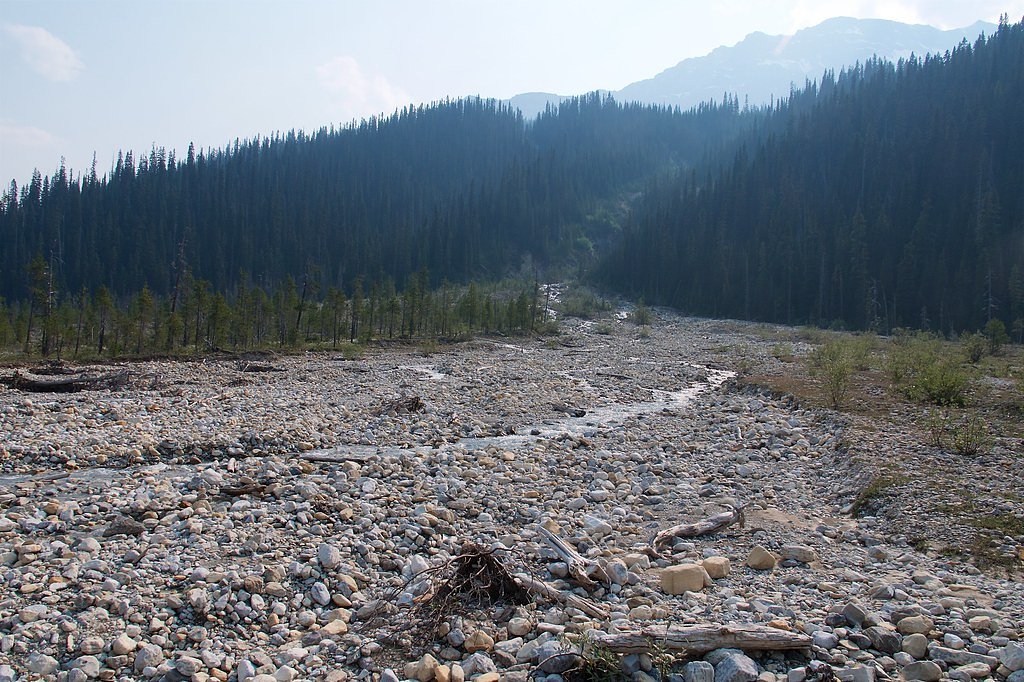
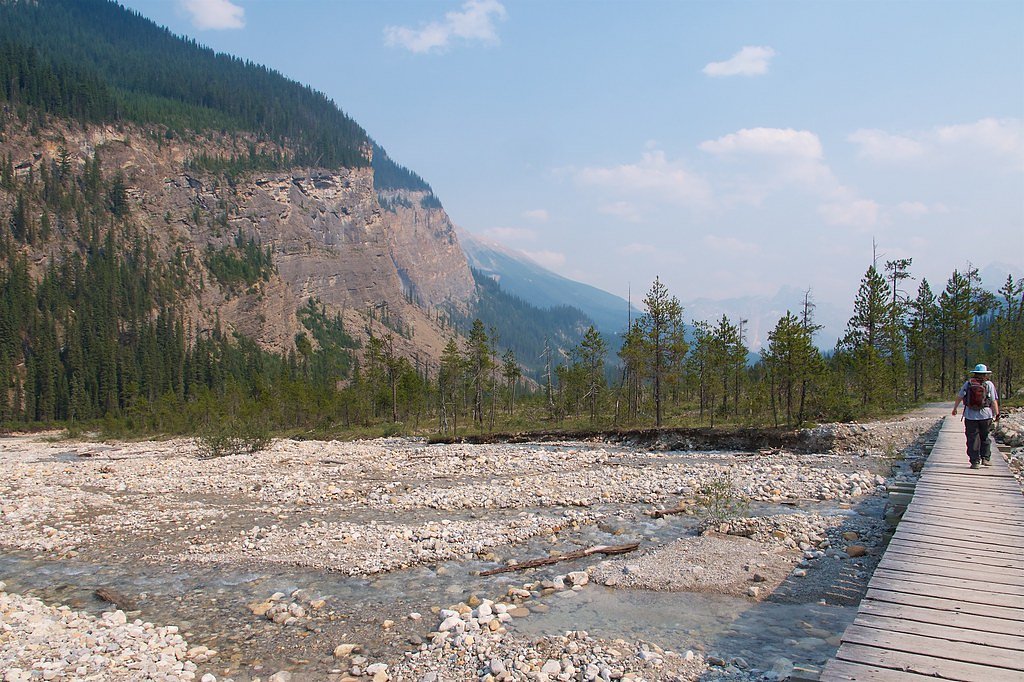
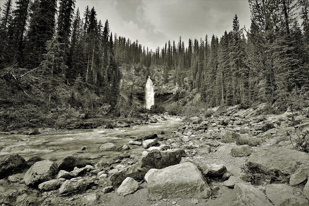
Photo Credits (5)
Difficulty
Moderate
Trail Length
8.0 km
Trail Type
Out And Back
Elevation Gain
170 m
About Laughing Falls
Laughing Falls is a waterfall in the Canadian Rockies, located roughly 18.5 miles from Lake Louise and about 57.6 miles from Banff (coordinates 51.5306, -116.5081). It sits in a subalpine/montane setting and is typically reached by a forested trail. Seasonal flows vary: higher in spring from snowmelt and lower in late summer and fall. Specifics about official park boundaries and the waterfall's exact measured height are not confirmed here.
The Setting
Laughing Falls sits at 1,654 metres within Yoho National Park, in the high mountains of British Columbia. At 30 metres, it is among the taller waterfalls in British Columbia.
Why This Waterfall Exists
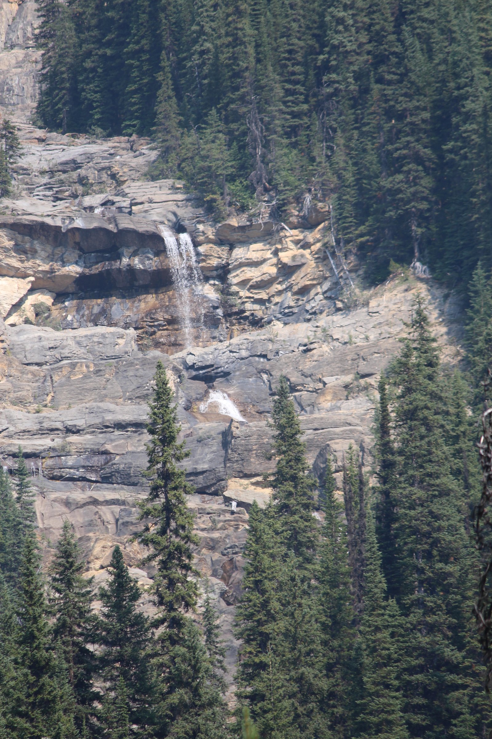
Laughing Falls flows over Sullivan Formation, a layered sedimentary rock layer deposited about 497-509 million years ago. These soft rocks erode readily, allowing the stream to carve a 100-foot drop into the landscape.
Nearby Falls Worth Visiting
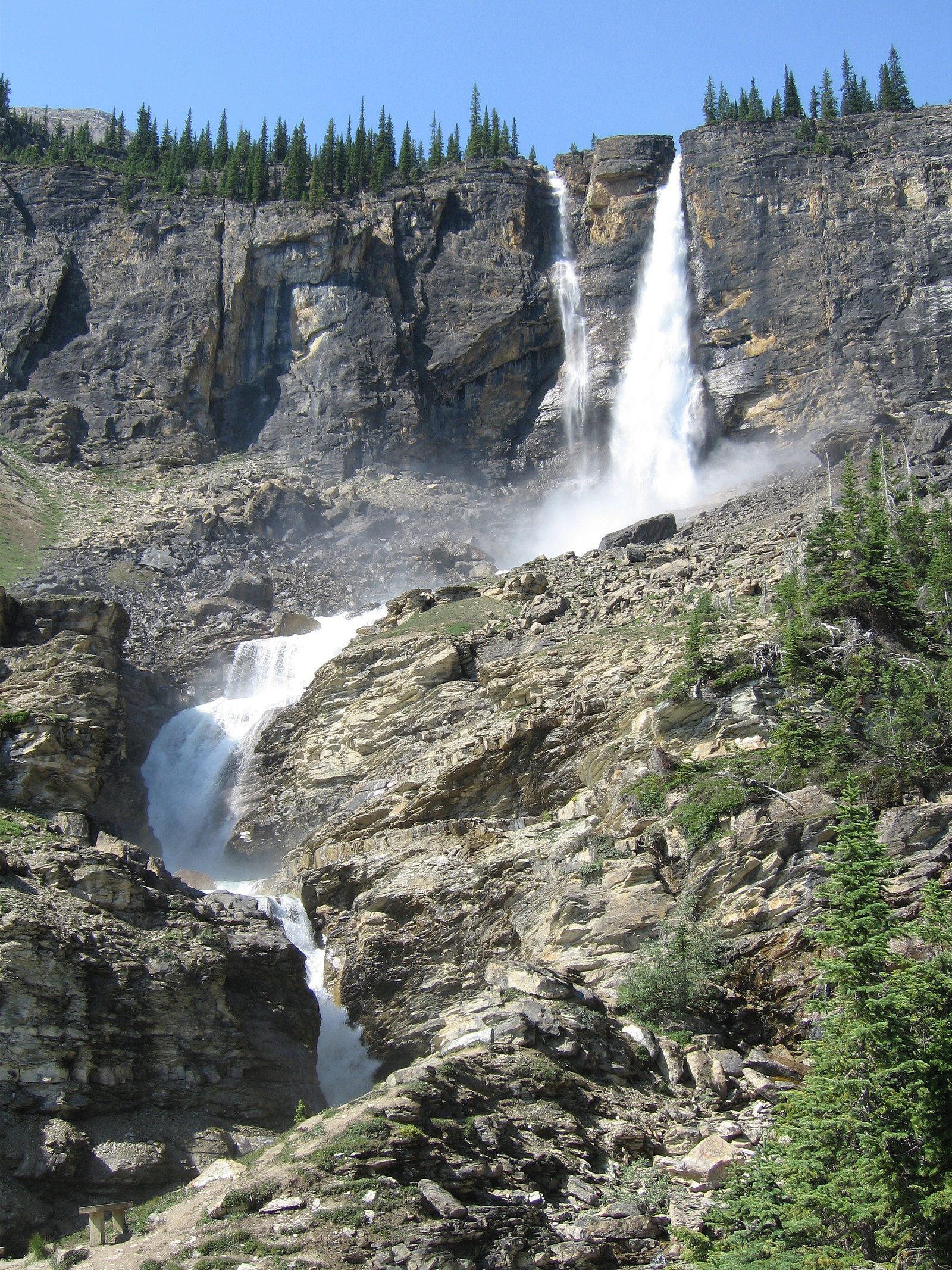
Angel's Staircase Falls (305 m) lies 2.1 kilometres to the southeast. Also nearby: Twin Falls (180 m, 2.6 km) and Waves (91 m, 5.5 km).
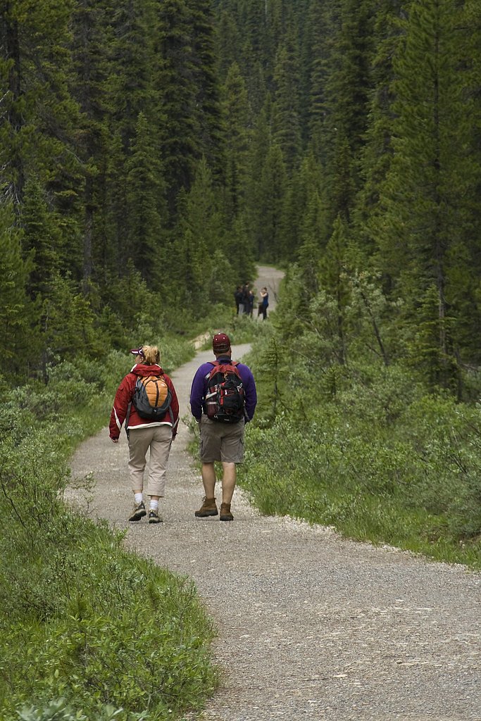
Trail & Hike Details
The Approach
The moderate 8.0-km out-and-back trail gains 170 metres of elevation on the way to the falls.
Trail Description
Trail descriptions for Laughing Falls vary in published and visitor reports. Expect a single-track or lightly used trail through mixed forest with some roots and rocks; the final viewpoint may require a short scramble to get a good look. Trail conditions may be muddy or snowy depending on season. Exact mileage and elevation gain are not confirmed here, consult local trail guides or AllTrails-type resources for up-to-date routing and maps.
What to Expect
The falls cascade 30 metres over soft fine-grained rock.
Accessibility
The trail is not wheelchair accessible. Uneven terrain and elevation changes require steady footing.
Frequently Asked Questions
🐶 Are Dogs Allowed at Laughing Falls?
❌ Dogs are not allowed
Are There Any Fees or Permits Required?
🆖 No fees required
🏊 Is There Swimming at Laughing Falls?
❌ Swimming is not allowed
When to Visit
Spring (snowmelt) for highest flows; summer for easiest access and stable trails; fall for lower crowds and fall color. Winter access may be possible but trails can be icy, snow-covered, and potentially hazardous, use caution and winter gear.
Seasonal Access
The best time to visit is Spring, Summer, Fall, and Winter. Check with Yoho National Park for current conditions.
Safety Information
Hazards can include slippery wet rocks, steep drop-offs near the falls, sudden changes in weather, deep snow in shoulder seasons, and wildlife encounters. Flashy streams can rise quickly during heavy rain or rapid snowmelt. Always tell someone your plan, carry a map/GPS, and be prepared for changing conditions. When in national/provincial parks, follow posted safety guidance and regulations.
Current Water Conditions
Based on a Water Survey of Canada gauge 24.8 km away
37.2 m³/s
Current discharge — how much water is flowing
Higher than usual for this time of year
Based on 70 years of record
1.92 m
Water depth at gauge
7-Day Discharge Trend
What does this mean for your visit?
The water is flowing higher than usual for this time of year.
About This Gauge
This gauge is on a regional waterway. Conditions at the falls may differ, especially after local rain.
7-Day Flow Outlook
Based on the WSC gauge BOW RIVER AT LAKE LOUISE (25 km away).
Today
Strong
40 m³/s
8/10Tomorrow
Strong
42 m³/s
8/10Tue
Strong
41 m³/s
8/10Wed
Strong
42 m³/s
8/10Thu
Strong
41 m³/s
8/10Fri
Strong
41 m³/s
8/10Sat
Strong
41 m³/s
8/10Best window: Today — strong flow, light drizzle (trip score 8/10).
Best time of year: this gauge typically runs highest from late May to late August, peaking in July.
How we calculate this
This is a transparent outlook, not a precise forecast. We take the waterfall's current flow strength (how it ranks against its historical normal for today, from the nearest WSC stream gauge), carry that ranking forward along the gauge's seasonal curve, and nudge it for forecast rain. Confidence is highest for the next day or two and falls further out. Always check official conditions and your own judgment before visiting — high flows can be dangerous.
Know when to go.
Get a free email alert when waterfalls near Lake Louise hit peak flow. We only send when conditions are worth the trip — no weekly newsletters, no spam.
Weather Forecast
Location & Access
Getting There
Located in the Rockies near Lake Louise (approx. 18.5 miles) and Banff (approx. 57.6 miles). Access typically requires driving to a nearby trailhead and hiking on an unpaved forest trail. Exact trailhead directions and road names can vary; check local park or trail resources before traveling.
Get Directions on Google MapsParking
Parking is often limited at small trailheads in this region. In high season (summer) parking lots may fill early. If the waterfall lies within a national or provincial park, a park pass or entry fee may be required, confirm with Parks Canada or the relevant provincial agency before visiting.
Elevation
1,654 metres above sea level
Coordinates
51.530632° N, -116.508116° W
Land Management
Managed by Parks Canada Agency
Visitor Tips & Gear
• Check current trail and road conditions with Parks Canada or local authorities before you go. • Expect limited parking and bring a park pass if visiting a national/provincial park. • Wear sturdy, waterproof footwear, rocks near the falls are slippery. • Bring insect repellent in summer and traction devices in winter. • Maintain distance from wildlife and store food securely. • Avoid getting too close to the edge of the falls or climbing on wet rocks.
This trail sits at 5,427 ft above sea level
Elevated TrailUV radiation is roughly 22% stronger at this elevation than at sea level, and the dry air accelerates dehydration. Extra sun protection and fluids go a long way.
As an Amazon Associate, we earn from qualifying purchases.

Coppertone Sport SPF 50 Sunscreen
UV intensity jumps ~4% per 1,000 ft — at this elevation you can burn in half the time.

Sun Bum SPF 30 Lip Balm (3-Pack)
Lips have almost no natural UV protection and burn fast in thin, dry mountain air.

Liquid I.V. Electrolyte Packets
You lose moisture ~2x faster at elevation — electrolytes help you absorb water efficiently.

ROCKNIGHT Polarized UV400 Sunglasses
High-altitude glare off rock and water is intense — UV400 lenses block 99%+ of UVA/UVB.
As an Amazon Associate, we earn from qualifying purchases.
With 8.0 km and 170 m of elevation gain, sturdy boots and trekking poles will help on this moderate trail. Icy conditions are common in winter — traction cleats are a smart addition.

Columbia Watertight II Rain Jacket
Packs into its own pocket, seam-sealed, and keeps you dry from spray and surprise rain.

Polarized Sunglasses (Knockaround)
Cuts glare off the water so you actually see the falls — and your photos turn out better too.

Earth Pak Waterproof Dry Bag
Keeps your phone and gear dry when waterfall mist soaks everything else.

Waterproof Phone Pouch (AiRunTech)
Cheap insurance — take photos right next to the falls without killing your phone.

Timberland Euro Sprint Mid Waterproof
Trusted waterproof boot with premium leather and grippy rubber sole — reliable on rocky, wet trails.

TrailBuddy Trekking Poles
Lightweight aluminum, cork grips, and flip-locks that actually hold — a best-seller for good reason.
Where to Stay
Browse vacation cabins and private rentals nearby
Unique outdoor stays — tents, yurts, and treehouses
Rent a campervan or RV for your waterfall road trip
Some links are affiliate links. We may earn a commission at no extra cost to you.
Nearby Campground
Laughing Falls Campground
0.2 km away
Additional Information
Nearby Attractions
Lake Louise and other Banff-area attractions are within driving distance. The broader region offers many alpine lakes, viewpoints, and day hikes, confirm proximity and routing with local trail resources for current conditions.
Wildlife
Bears, elk, deer, small mammals, and typical mountain bird species may be present. Take standard wildlife precautions: make noise on the trail, store food properly, and carry bear spray where recommended.
Cities near Laughing Falls
Nearby Waterfalls
Other waterfalls named Laughing Falls
1 other waterfall shares this name across Canada.
Writing about Laughing Falls? Embed this waterfall on your site for free.