Angel's Staircase Falls
British Columbia • Yoho National Park • 305 m
By Armen Suny · Last verified Jun 2026
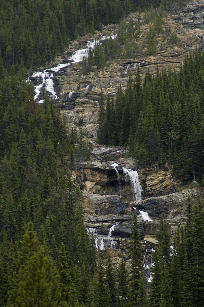
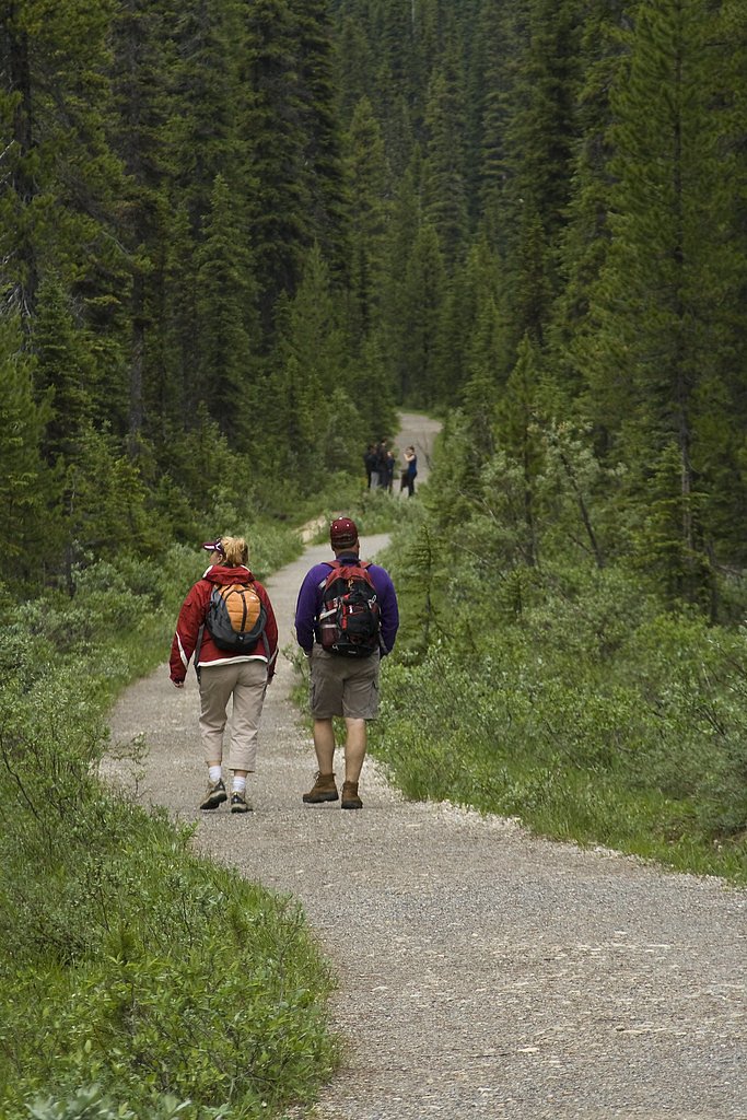
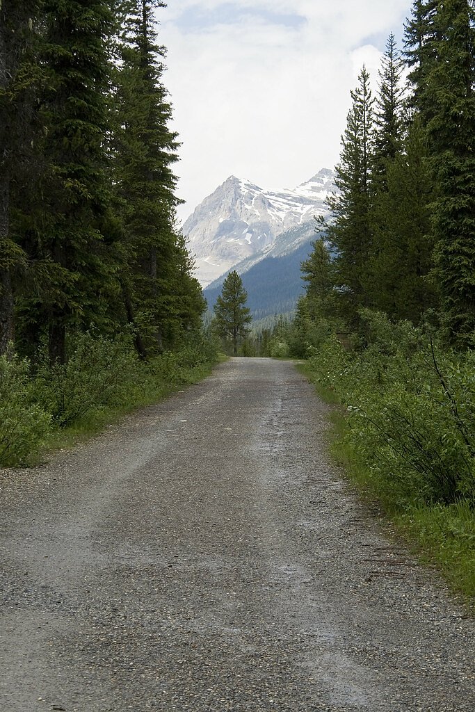

Photo Credits (5)
Difficulty
Easy
Trail Length
5.5 km
Trail Type
Out And Back
Elevation Gain
197 m
About Angel's Staircase Falls
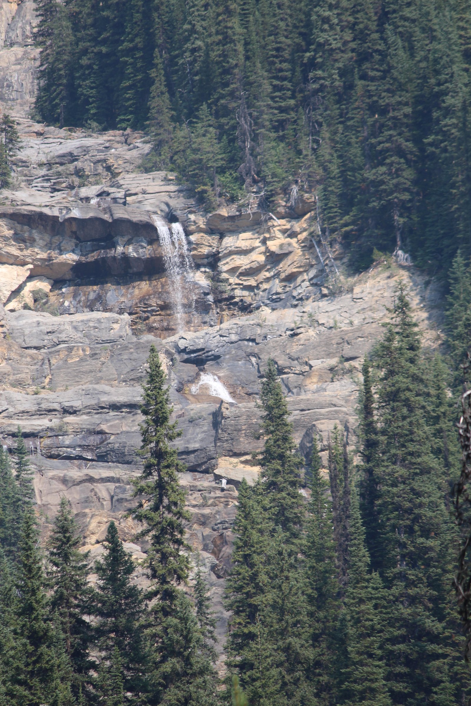
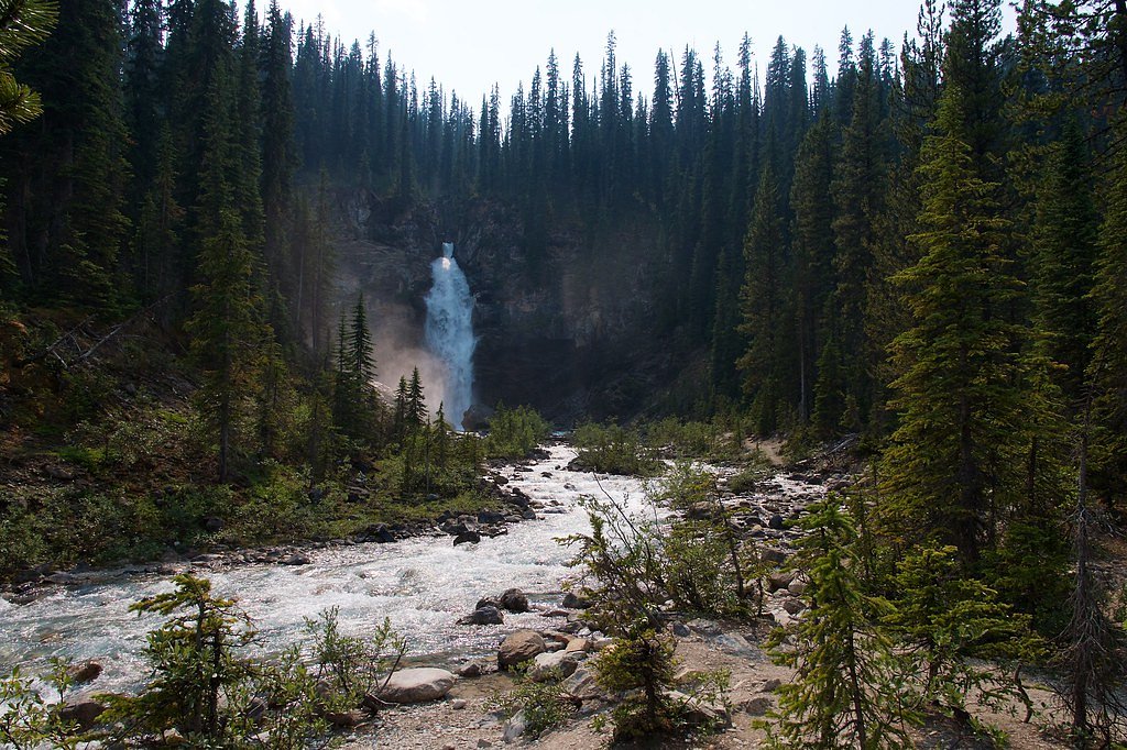
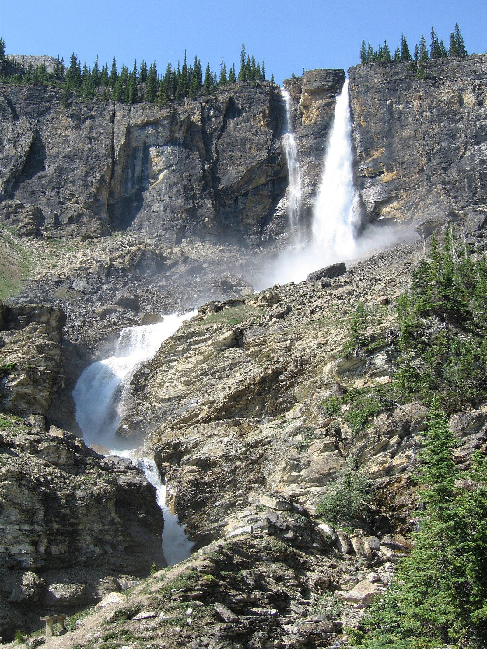
Angel's Staircase Falls is a tall cascade on an unnamed tributary of the Yoho River in British Columbia's Yoho National Park. It drops approximately 1000 feet down to its confluence with the river. A short spur off the Yoho Valley Trail leads to a viewpoint of the views situated at the banks of the Yoho River. The view is distant, and the entire falls can not be seen because of the twisting nature of the falls themselves.
The Setting
Angel's Staircase Falls sits at 1,666 metres within Yoho National Park, in the high mountains of British Columbia. At 305 metres, it is among the taller waterfalls in British Columbia.
Why This Waterfall Exists
Angel's Staircase Falls flows over layered sedimentary rock laid down about 485-539 million years ago. Over time, the stream has worn through these layers at different rates, creating a 1000-foot drop that forms the waterfall.
Nearby Falls Worth Visiting
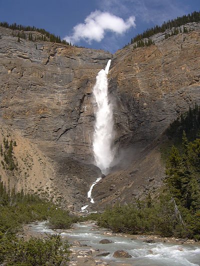
Takakkaw Falls (373 m) lies 2.3 kilometres to the southeast. Also nearby: Twin Falls (180 m, 4.5 km) and Laughing Falls (30 m, 2.1 km).
Trail & Hike Details
The Approach
The easy 5.5-km out-and-back trail gains 197 metres of elevation on the way to the falls.
Trail Description
There is no widely published, maintained trail description for Angel's Staircase Falls. Access commonly involves a short walk from a roadside pullout across uneven, possibly steep and rocky ground to a viewpoint. Trails, if present, may be unmaintained and can be muddy, snowy, or icy depending on season. Visitors should expect limited or no trail infrastructure, no railings, and variable footing.
What to Expect
The falls plunge a dramatic 305 metres over layered sedimentary rock.
Accessibility
The trail is not wheelchair accessible. Uneven terrain and elevation changes require steady footing.
Frequently Asked Questions
🐶 Are Dogs Allowed at Angel's Staircase Falls?
❌ Dogs are not allowed
Are There Any Fees or Permits Required?
🆖 No fees required
🏊 Is There Swimming at Angel's Staircase Falls?
❌ Swimming is not allowed
When to Visit
Late spring to early summer for highest flows (snowmelt). Summer for more reliable trail/road conditions and milder weather. Fall can offer fewer crowds and good light, but early snow is possible. Winter provides frozen/icefall views but is the most hazardous and requires winter travel skills and equipment.
Seasonal Access
The best time to visit is Spring, Summer, Fall, and Winter. Check with Yoho National Park for current conditions.
Safety Information
Hazards include slippery wet rock, steep drop-offs, unmarked/unmaintained approaches, high flows during spring melt, cold water, hypothermia risk, limited cell service, and wildlife encounters (including bears). In winter expect ice, deep snow, avalanche risk in some areas, and closed/limited road access. Always prioritize personal safety: stay well back from edges, avoid cliff-side selfies, check local conditions, and carry emergency supplies.
Current Water Conditions
38.2 m³/s
Current discharge — how much water is flowing
Higher than usual for this time of year
Based on 70 years of record
1.94 m
Water depth at gauge
7-Day Discharge Trend
What does this mean for your visit?
The water is flowing higher than usual for this time of year.
About This Gauge
This gauge is on a nearby waterway and may not reflect exact conditions at the falls.
7-Day Flow Outlook
Based on the WSC gauge BOW RIVER AT LAKE LOUISE (23 km away).
Today
Strong
41 m³/s
8/10Tomorrow
Roaring
43 m³/s
6/10Tue
Roaring
42 m³/s
6/10Wed
Strong
40 m³/s
9/10Thu
Strong
38 m³/s
9/10Fri
Strong
40 m³/s
8/10Sat
Roaring
42 m³/s
6/10Best window: Wed — strong flow, cloudy (trip score 9/10).
Best time of year: this gauge typically runs highest from late May to late August, peaking in July.
How we calculate this
This is a transparent outlook, not a precise forecast. We take the waterfall's current flow strength (how it ranks against its historical normal for today, from the nearest WSC stream gauge), carry that ranking forward along the gauge's seasonal curve, and nudge it for forecast rain. Confidence is highest for the next day or two and falls further out. Always check official conditions and your own judgment before visiting — high flows can be dangerous.
Know when to go.
Get a free email alert when waterfalls near Lake Louise hit peak flow. We only send when conditions are worth the trip — no weekly newsletters, no spam.
Weather Forecast
Location & Access
Getting There
The falls are near the Icefields Parkway (Highway 93) roughly northwest of Lake Louise (approximate distance 17 miles from Lake Louise per the provided context). Access is typically from a roadside pullout or short unmarked spur off the highway; GPS coordinates (51.518, -116.4871) should be used to locate the best parking/pullout. Expect limited signage and minimal facilities. Travel on the Icefields Parkway can be remote; plan for limited services.
Get Directions on Google MapsParking
Parking is likely limited to a small pullout or unofficial roadside area. There may be no formal parking lot, signage, or amenities. In winter or during peak season parking may be reduced or icy; park legally and avoid blocking the shoulder of the highway.
Elevation
1,666 metres above sea level
Coordinates
51.518015° N, -116.487112° W
Land Management
Managed by Parks Canada Agency
Visitor Tips & Gear
• Use the provided GPS coordinates; pullouts on the Icefields Parkway can be small and fill quickly. • Check road and weather conditions before you go (Parks Canada and Alberta/B.C. highway reports). • Wear sturdy, traction-capable footwear; bring microspikes in icy conditions. • There are likely no facilities, bring water, snacks, and pack out trash. • Keep a safe distance from the edge of cliffs and wet rock; wet rock can be very slippery. • Carry bear spray and know how to use it; make noise while hiking in dense cover. • Cell coverage may be limited; tell someone your plan and expected return time.
This trail sits at 5,466 ft above sea level
Elevated TrailUV radiation is roughly 22% stronger at this elevation than at sea level, and the dry air accelerates dehydration. Extra sun protection and fluids go a long way.
As an Amazon Associate, we earn from qualifying purchases.

Coppertone Sport SPF 50 Sunscreen
UV intensity jumps ~4% per 1,000 ft — at this elevation you can burn in half the time.

Sun Bum SPF 30 Lip Balm (3-Pack)
Lips have almost no natural UV protection and burn fast in thin, dry mountain air.

Liquid I.V. Electrolyte Packets
You lose moisture ~2x faster at elevation — electrolytes help you absorb water efficiently.

ROCKNIGHT Polarized UV400 Sunglasses
High-altitude glare off rock and water is intense — UV400 lenses block 99%+ of UVA/UVB.
As an Amazon Associate, we earn from qualifying purchases.
This easy 5.5 km hike is straightforward — comfortable trail shoes and plenty of water should do. Icy conditions are common in winter — traction cleats are a smart addition.

Columbia Watertight II Rain Jacket
Packs into its own pocket, seam-sealed, and keeps you dry from spray and surprise rain.

Polarized Sunglasses (Knockaround)
Cuts glare off the water so you actually see the falls — and your photos turn out better too.

Earth Pak Waterproof Dry Bag
Keeps your phone and gear dry when waterfall mist soaks everything else.

Waterproof Phone Pouch (AiRunTech)
Cheap insurance — take photos right next to the falls without killing your phone.

Kahtoola MICROspikes
Cult-favorite traction cleats that grip ice and wet rock — essential for winter waterfall hikes.

Sawyer Squeeze Water Filter
The backcountry standard — filters 99.9% of bacteria and weighs just 3 oz.
Where to Stay
Browse vacation cabins and private rentals nearby
Unique outdoor stays — tents, yurts, and treehouses
Rent a campervan or RV for your waterfall road trip
Some links are affiliate links. We may earn a commission at no extra cost to you.
Nearby Campground
Takakkaw Falls Campground
1.8 km away
Additional Information
Nearby Attractions
Lake Louise, Moraine Lake, Bow Lake, Peyto Lake, other Icefields Parkway viewpoints and cascades, and general Banff/Lake Louise attractions. Distances vary, use a map for planning.
Wildlife
Area is habitat for bears (black and grizzly), elk, deer, mountain goats, bighorn sheep, and smaller mammals. Observe from a distance and carry bear spray where appropriate.
Cities near Angel's Staircase Falls
Nearby Waterfalls

Writing about Angel's Staircase Falls? Embed this waterfall on your site for free.