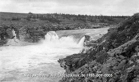
Fat Man Falls
Ontario • Lady Evelyn-Smoothwater Provincial Park
By Armen Suny · Last verified Jun 2026
About Fat Man Falls
Fat Man Falls is a small, forested cascade in northeastern Ontario, located roughly 33 miles from Cobalt and 39.4 miles from New Liskeard (coordinates 47.2614, -80.3232). The falls sit in a rocky, wooded setting typical of the Temiskaming/Timiskaming region and may be most impressive in spring runoff or after heavy rain. Specifics on formal infrastructure, signage, or an established viewpoint are not well documented and access may require travel on secondary forest roads and unmarked trails.
The Setting
Fat Man Falls sits at 302 metres within Lady Evelyn-Smoothwater Provincial Park, in the foothills of Ontario.
Why This Waterfall Exists
Fat Man Falls flows over Nipissing Diabase, a hard intrusive rock layer deposited over 2.3-2.5 billion years ago. These resistant rocks form a durable ledge that water cannot easily wear away, creating the falls where softer material downstream has already eroded.
Nearby Falls Worth Visiting
Helen Falls (25 m) lies 3.5 kilometres to the north. Also nearby: Centre Falls (17 m, 3.7 km) and Cabin Falls (9 m, 2.9 km).
Trail & Hike Details
Trail Description
There is no widely published, maintained trail description for Fat Man Falls. Expect an unmarked or lightly used path, possibly requiring short bushwhacking from a nearby forestry road or informal parking area. Terrain is likely uneven, with roots, rocks, and possibly wet or muddy sections. Trail conditions can change seasonally and after storms or logging activity.
What to Expect
A quiet, natural setting with forest, exposed bedrock and a small cascade or series of drops. Flow is seasonal, highest in spring and after heavy rains, lower in late summer. Facilities (toilets, benches, signage) are unlikely. Cell service may be intermittent. Wildlife common to northern Ontario (insects, deer, moose, black bears) may be present. Expect slippery rock surfaces near the water and limited formal viewpoints or safety railings.
Accessibility
Access is likely not accessible for people with limited mobility. Expect rough, uneven terrain, natural steps, and slippery rock surfaces with no constructed viewing platforms.
Frequently Asked Questions
🐶 Are Dogs Allowed at Fat Man Falls?
❌ Dogs are not allowed
Are There Any Fees or Permits Required?
🆖 No fees required
🏊 Is There Swimming at Fat Man Falls?
❌ Swimming is not allowed
When to Visit
Spring (snowmelt and higher flows) for the most dramatic water flow; late spring to early fall for easier access and milder weather. Fall also provides good color. Winter can offer frozen cascades for experienced winter hikers or snowmobilers but requires winter safety gear.
Seasonal Access
The best time to visit is Spring, Summer, Fall, and Winter. Check with Lady Evelyn-Smoothwater Provincial Park for current conditions.
Safety Information
Hazards include slippery rocks and edges, steep or unstable cliff sections, cold and fast-moving water, seasonal high flows, limited or no cell coverage, changing weather, insects, and wildlife encounters (including bears). Use caution near water, avoid climbing on wet ledges, wear appropriate footwear, and carry emergency supplies. Check local conditions (road/forest access) before traveling and be prepared for limited emergency response times in remote areas.
Current Water Conditions
Based on a Water Survey of Canada gauge 34 km away
5.8 m³/s
Current discharge — how much water is flowing
About average for this time of year
Based on 39 years of record
4.57 m
Water depth at gauge
7-Day Discharge Trend
What does this mean for your visit?
Flow is about average for this time of year.
About This Gauge
This gauge is on a regional waterway. Conditions at the falls may differ, especially after local rain.
7-Day Flow Outlook
Based on the WSC gauge STURGEON RIVER AT UPPER GOOSE FALLS (34 km away).
Today
Moderate
5.7 m³/s
6/10Tomorrow
Moderate
6.0 m³/s
5/10Tue
Moderate
6.2 m³/s
5/10Wed
Moderate
5.5 m³/s
6/10Thu
Moderate
5.5 m³/s
5/10Fri
Moderate
5.4 m³/s
5/10Sat
Moderate
5.1 m³/s
6/10Best window: Today — moderate flow, cloudy (trip score 6/10).
Best time of year: this gauge typically runs highest from early April to mid June, peaking in May.
How we calculate this
This is a transparent outlook, not a precise forecast. We take the waterfall's current flow strength (how it ranks against its historical normal for today, from the nearest WSC stream gauge), carry that ranking forward along the gauge's seasonal curve, and nudge it for forecast rain. Confidence is highest for the next day or two and falls further out. Always check official conditions and your own judgment before visiting — high flows can be dangerous.
Know when to go.
Get a free email alert when waterfalls near Cobalt hit peak flow. We only send when conditions are worth the trip — no weekly newsletters, no spam.
Weather Forecast
Location & Access
Getting There
Use the provided coordinates (47.2614, -80.3232) in a GPS device or mapping app as the primary guide. The falls are in a relatively remote area reached via local/secondary roads and likely some forest or logging roads. Expect narrow, unpaved approaches and limited signage. If you are unfamiliar with backcountry navigation in northern Ontario, plan carefully and consider contacting local tourism offices in Cobalt or Temiskaming Shores for up-to-date access tips.
Get Directions on Google MapsParking
No formal parking lot is known. Parking may be a roadside pullout or an informal area near a trailhead or logging road. Vehicles should be parked off the roadway, locked, and avoid blocking gates or private driveways. If unsure, return to the nearest town to ask local authorities.
Elevation
302 metres above sea level
Coordinates
47.261437° N, -80.323237° W
Land Management
Managed by Ontario Parks
Visitor Tips & Gear
• Use the GPS coordinates and bring a detailed map and compass, or an offline mapping app. • Wear sturdy, grippy footwear, rocks near the falls can be slippery. • Bring insect repellent in spring/summer and check for ticks after the visit. • Tell someone your route and expected return time; cell coverage may be unreliable. • Do not climb on unstable ledges; keep children close to the trail. • Respect private property and posted signs; many approaches in this region cross Crown land, logging roads, or private parcels. • If accessing via winter routes, be prepared for snow, ice, and cold conditions and check local winter road advisories.
Where to Stay
Browse vacation cabins and private rentals nearby
Unique outdoor stays — tents, yurts, and treehouses
Rent a campervan or RV for your waterfall road trip
Some links are affiliate links. We may earn a commission at no extra cost to you.
Nearby Campground
Ranger Point
18.8 km away
Additional Information
Nearby Attractions
Nearby towns include Cobalt (historic mining town with museums and silver-mining heritage sites) and New Liskeard/Temiskaming Shores (regional services, lakes, and recreational opportunities). Local scenic drives, fishing lakes, and historic sites in the Temiskaming area may be of interest.
Wildlife
Typical northern Ontario species: black bear, moose, white-tailed deer, beavers, otters, various songbirds, and biting insects (black flies, mosquitoes). Practice wildlife safety and food storage if camping.
Cities near Fat Man Falls
Nearby Waterfalls
Writing about Fat Man Falls? Embed this waterfall on your site for free.