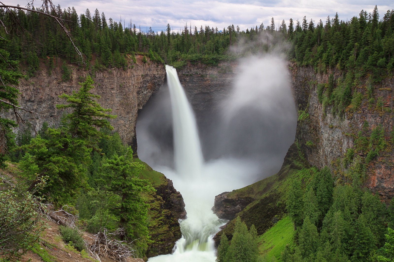
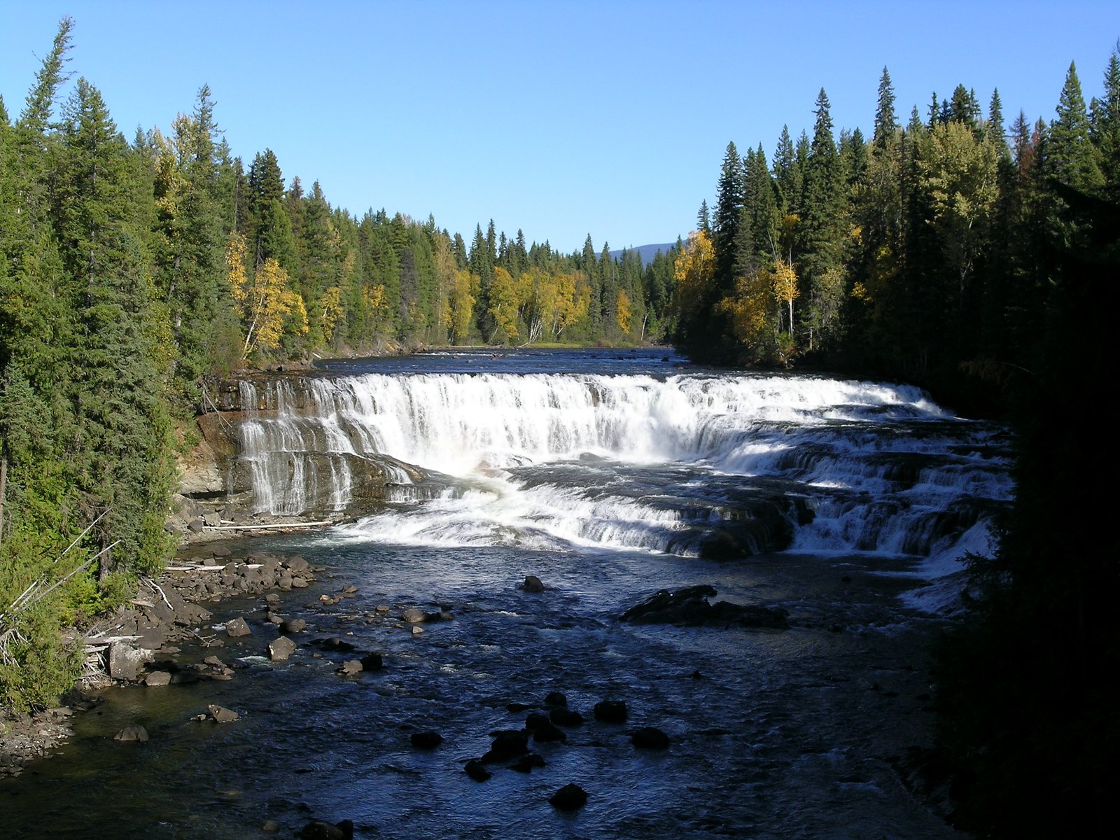
Helmcken Falls
British Columbia • Wells Gray Park • 141 m
By Armen Suny · Last verified Jun 2026
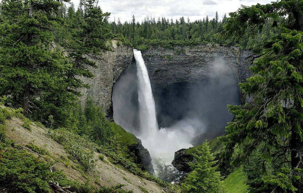
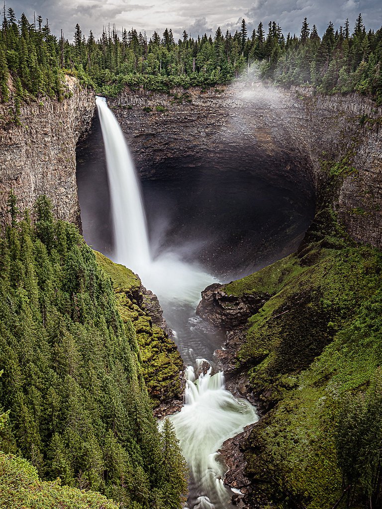
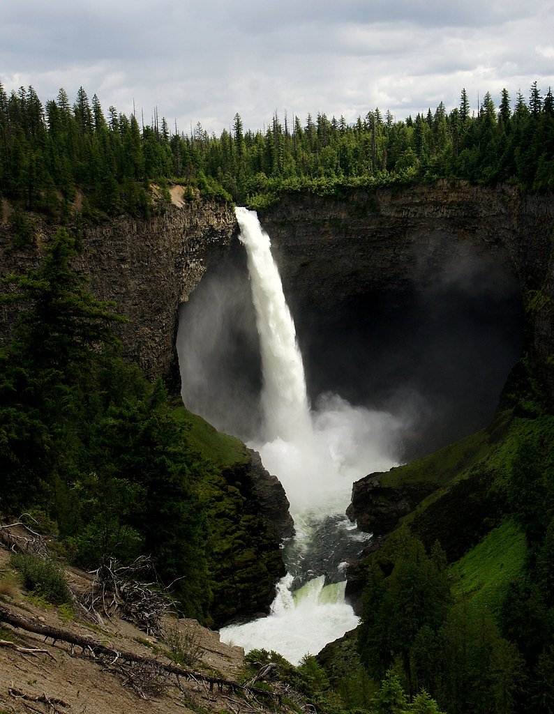
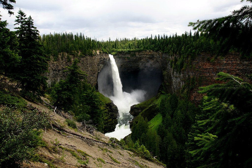
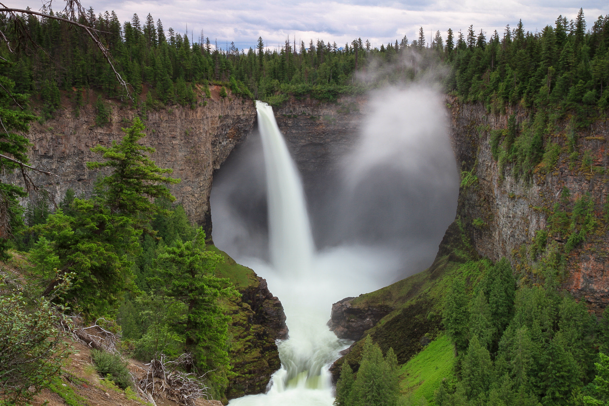
Photo Credits (5)
Difficulty
Easy
Trail Length
1.0 km
Trail Type
Out And Back
Elevation Gain
102 m
About Helmcken Falls
Helmcken Falls is a 141 m (463 ft) waterfall on the Murtle River within Wells Gray Provincial Park in British Columbia, Canada. The protection of Helmcken Falls was one of the reasons for the creation of Wells Gray Provincial Park in 1939.
The Setting
Helmcken Falls sits at 747 metres within Wells Gray Park, in the hills of British Columbia. At 141 metres, it is among the taller waterfalls in British Columbia.
Why This Waterfall Exists
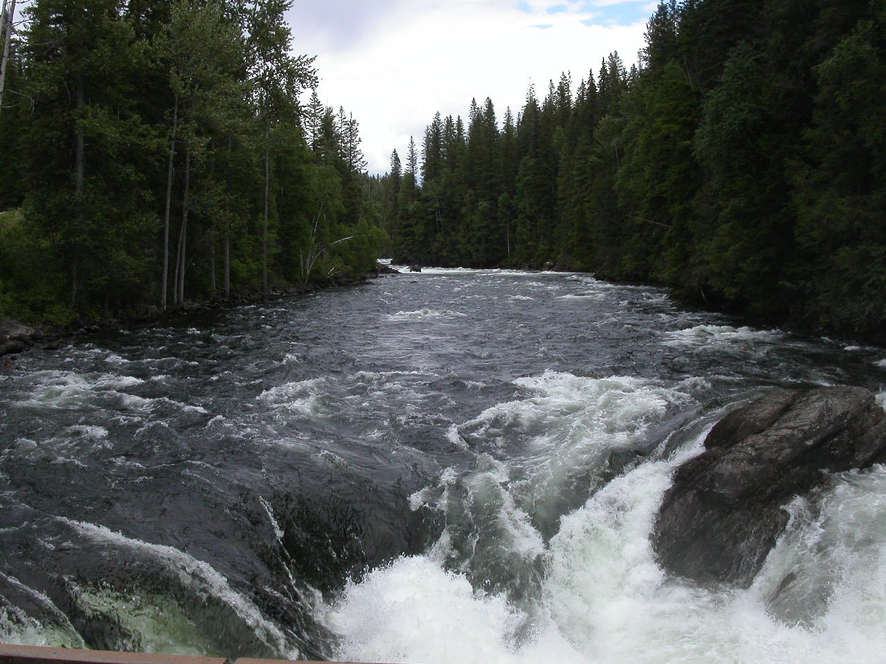
Helmcken Falls flows over hard volcanic rock, primarily basalt, laid down about 3 million years ago. These resistant rocks form a durable ledge that water cannot easily wear away, creating a 462-foot drop where softer material downstream has already eroded.
Nearby Falls Worth Visiting
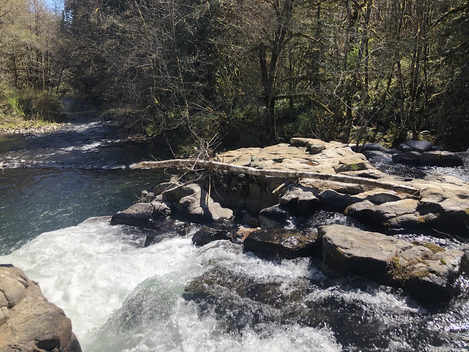
Cougar Falls (20 m) lies 0.2 kilometres to the northwest. Also nearby: Dawson Falls (20 m, 3.9 km) and Mushbowl (6 m, 3.4 km).
Trail & Hike Details
The Approach
The easy 1.0-km out-and-back trail gains 102 metres of elevation on the way to the falls.
Trail Description
From the paved parking area a short, well-marked paved/packed-surface path leads to the main viewing platforms at the canyon rim. The walk is short and easy; multiple viewpoints offer different perspectives of the 463 ft plunge and the canyon. There are additional, longer trails in Wells Gray Park, but the primary Helmcken Falls viewpoint requires minimal walking.
What to Expect
The falls plunge a dramatic 141 metres over hard volcanic rock.
Accessibility
The trail is not wheelchair accessible. Uneven terrain and elevation changes require steady footing.
Frequently Asked Questions
🐶 Are Dogs Allowed at Helmcken Falls?
❌ Dogs are not allowed
Are There Any Fees or Permits Required?
🆖 No fees required
🏊 Is There Swimming at Helmcken Falls?
❌ Swimming is not allowed
When to Visit
Late spring to early summer (May–June) for the highest flows; summer for easy access and milder weather; fall for colors; winter for ice formations and dramatic frozen scenes but expect winter driving and icy viewing conditions.
Seasonal Access
The best time to visit is Spring, Summer, Fall, and Winter. Check with Wells Gray Park for current conditions.
Safety Information
Stay on marked trails and behind guardrails. Cliff edges are steep and unstable; do not climb or approach unprotected edges for photos. Expect slippery, wet, or icy surfaces near the rim, especially in cool months. Watch for strong gusts of wind and spray. Carry basic safety gear, let someone know your plans if you travel in remote areas, and check local conditions before visiting.
Current Water Conditions
Based on a Water Survey of Canada gauge 34 km away
382.0 m³/s
Current discharge — how much water is flowing
About average for this time of year
Based on 87 years of record
3.70 m
Water depth at gauge
7-Day Discharge Trend
What does this mean for your visit?
Flow is about average for this time of year.
About This Gauge
This gauge is on a regional waterway. Conditions at the falls may differ, especially after local rain.
7-Day Flow Outlook
Based on the WSC gauge CLEARWATER RIVER NEAR CLEARWATER STATION (34 km away).
Today
Moderate
430 m³/s
4/10Tomorrow
Moderate
402 m³/s
8/10Tue
Moderate
373 m³/s
8/10Wed
Moderate
360 m³/s
6/10Thu
Moderate
347 m³/s
6/10Fri
Moderate
366 m³/s
5/10Sat
Moderate
385 m³/s
4/10Best window: Tomorrow — moderate flow, mainly sunny (trip score 8/10).
Best time of year: this gauge typically runs highest from early May to early August, peaking in June.
How we calculate this
This is a transparent outlook, not a precise forecast. We take the waterfall's current flow strength (how it ranks against its historical normal for today, from the nearest WSC stream gauge), carry that ranking forward along the gauge's seasonal curve, and nudge it for forecast rain. Confidence is highest for the next day or two and falls further out. Always check official conditions and your own judgment before visiting — high flows can be dangerous.
Weather Forecast
Location & Access
Getting There
Helmcken Falls is in Wells Gray Provincial Park (BC). The falls are accessed from Clearwater, BC via the Wells Gray Park Road/Clearwater Valley Road (signed). Follow park signage to the Helmcken Falls parking area/viewpoint. Coordinates: 51.9541, -120.1769.
Get Directions on Google MapsParking
Designated paved parking lot at the Helmcken Falls viewpoint. Parking is limited during peak periods; vehicles should park in marked spaces only. Check BC Parks or local sources for any seasonal restrictions or closures.
Elevation
747 metres above sea level
Coordinates
51.954058° N, -120.176932° W
Land Management
Managed by Government of British Columbia
Visitor Tips & Gear
Arrive early in peak season to secure parking. Stay behind railings and on marked trails, cliff edges are steep and unstable. Bring layers and windproof clothing; spray can make the rim area cool and wet even on warm days. In winter bring traction devices (microspikes) and be prepared for icy/packed snow surfaces. Respect wildlife and pack out trash. Check BC Parks or local information for current road and parking conditions before travel.
As an Amazon Associate, we earn from qualifying purchases.
For this easy 1.0 km trail, lightweight trail shoes and a water bottle are usually sufficient. Icy conditions are common in winter — traction cleats are a smart addition.

Columbia Watertight II Rain Jacket
Packs into its own pocket, seam-sealed, and keeps you dry from spray and surprise rain.

Polarized Sunglasses (Knockaround)
Cuts glare off the water so you actually see the falls — and your photos turn out better too.

Earth Pak Waterproof Dry Bag
Keeps your phone and gear dry when waterfall mist soaks everything else.

Waterproof Phone Pouch (AiRunTech)
Cheap insurance — take photos right next to the falls without killing your phone.

Kahtoola MICROspikes
Cult-favorite traction cleats that grip ice and wet rock — essential for winter waterfall hikes.

JOBY GorillaPod Starter Kit
Wraps around railings and rocks for long-exposure waterfall shots — no flat surface needed.
Where to Stay
Browse vacation cabins and private rentals nearby
Unique outdoor stays — tents, yurts, and treehouses
Rent a campervan or RV for your waterfall road trip
Some links are affiliate links. We may earn a commission at no extra cost to you.
Nearby Campground
Pyramid Campground
4.6 km away
Additional Information
Nearby Attractions
Other Wells Gray Provincial Park highlights include Spahats Falls, Murtle Lake, Clearwater Lake, and numerous hiking trails and viewpoints throughout the park.
Wildlife
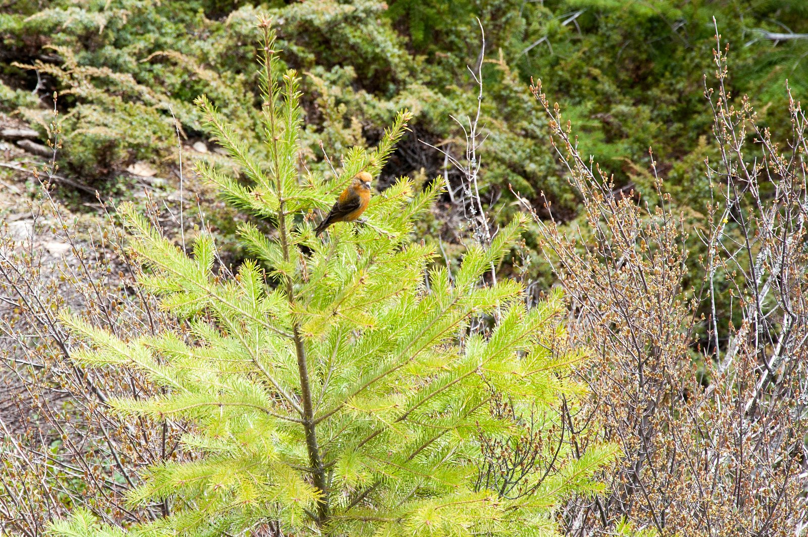
Possible sightings include black bears, moose, deer, grouse, and a variety of songbirds and raptors. Maintain a safe distance from all wildlife and follow park guidelines for food storage.
Nearby Waterfalls
Writing about Helmcken Falls? Embed this waterfall on your site for free.