Photo Credits (5)
Difficulty
Drive Up
Trail Length
0.2 km
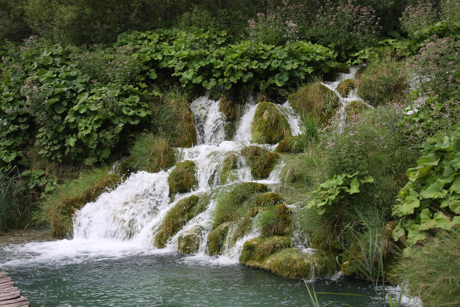
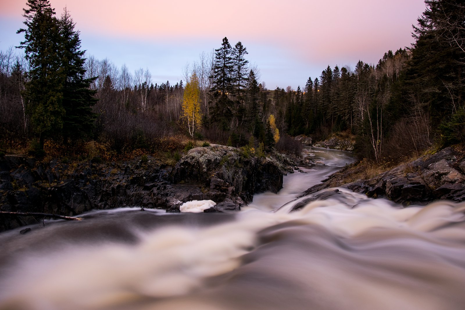
About Cascades
Cascades near Cap-Chat (approx. coordinates 48.814, -66.7558) is a forested, seasonal waterfall on the Gaspé Peninsula. Visitor reports indicate a relatively natural setting with a short access route from a nearby road, but specific infrastructure (boardwalks, formal viewpoints) is uncertain. Flow is typically highest in spring and after heavy rain; in winter the falls may be partially or fully frozen and access can be icy and difficult. Exact height and official name may vary locally, and some details below are conservative where definitive information is not available.
The Setting
Cascades sits at 180 metres within Chic-Chocs Territorial reserve for protected area purposes, in the foothills of Quebec.
Why This Waterfall Exists
Cascades flows over volcanic rock laid down about 485 million to 1.0 billion years ago. These resistant rocks form a durable ledge that water cannot easily wear away, creating the falls where softer material downstream has already eroded.
Trail & Hike Details
The Approach
No hiking required. Cascades is accessible by vehicle with a roadside viewing area.
Trail Description
Trail access appears to be a short, informal path from a roadside pullout into mixed forest to a viewing area near the falls. Expect uneven footing, exposed roots, stones, and possibly muddy or wet sections near the water. There may be short steep sections or informal scrambles to reach the best viewpoints. Information about marked trails, signage, or maintained boardwalks is not confirmed.
What to Expect
A natural, wooded setting with a seasonal cascade that is most impressive in spring and after rainfall. Views may be from a single primary viewpoint; getting close to the water likely requires negotiating wet, slippery rock. Wildlife typical of the Gaspé region (forest birds, small mammals, and possibly moose) may be present. Facilities such as restrooms, trash cans, or interpretive signage are likely minimal or absent.
Accessibility
This waterfall is viewable from a vehicle-accessible area. No hiking is required.
Frequently Asked Questions
🐶 Are Dogs Allowed at Cascades?
❌ Dogs are not allowed
Are There Any Fees or Permits Required?
🆖 No fees required
🏊 Is There Swimming at Cascades?
❌ Swimming is not allowed
When to Visit
Spring for highest flow and dramatic appearance; late spring to early summer for pleasant hiking conditions. Fall offers foliage color but shorter daylight; winter can show frozen formations but is hazardous without winter equipment and local knowledge.
Seasonal Access
The best time to visit is Spring, Summer, Fall, and Winter. Check with the managing park or local authority for current conditions.
Safety Information
Hazards include slippery wet or icy rock near the falls, steep or unstable edges, seasonal high flows, ticks and biting insects in warm months, rapidly changing weather, and limited cell service. Do not approach edges or climb on unstable rock. In winter, trails and roads may be hazardous or impassable without proper equipment and local knowledge.
7-Day Flow Outlook
Based on the WSC gauge SAINTE-ANNE (RIVIERE) A 9,7 KM EN AMONT DU PONT-ROUTE 132 (34 km away).
Best time of year: this gauge typically runs highest from mid April to late June, peaking in May.
How we calculate this
This is a transparent outlook, not a precise forecast. We take the waterfall's current flow strength (how it ranks against its historical normal for today, from the nearest WSC stream gauge), carry that ranking forward along the gauge's seasonal curve, and nudge it for forecast rain. Confidence is highest for the next day or two and falls further out. Always check official conditions and your own judgment before visiting — high flows can be dangerous.
Know when to go.
Get a free email alert when waterfalls near Cap-Chat hit peak flow. We only send when conditions are worth the trip — no weekly newsletters, no spam.
Weather Forecast
Location & Access
Getting There
The falls are located roughly 16.2 miles from Cap-Chat by road (coordinates 48.814, -66.7558). Expect to drive on local provincial roads; the final approach may be a paved or gravel secondary road. Cellular coverage may be limited in places. Use a detailed local map or GPS and check seasonal road conditions before travel.
Get Directions on Google MapsParking
Likely roadside parking or a small pullout near the trailhead. Formal parking lot or facilities are not confirmed; park responsibly and avoid blocking narrow roads. If visiting in winter, parking areas may be snow-covered or reduced.
Elevation
180 metres above sea level
Coordinates
48.813976° N, -66.755829° W
Land Management
Managed by Ministère de l'Environnement, de la Lutte contre les changements climatiques, de la Faune et des Parcs, Direction des aires protégées
Visitor Tips & Gear
• Wear sturdy, non-slip footwear and expect wet/muddy conditions near the falls. • Check recent trip reports or local park/municipal sources for access updates and road conditions. • Cell service may be intermittent; bring a map and inform someone of your plans. • Practice Leave No Trace: pack out trash and avoid disturbing vegetation and stream banks. • Exercise caution near edges and on icy surfaces in cold seasons.
Where to Stay
Browse vacation cabins and private rentals nearby
Unique outdoor stays — tents, yurts, and treehouses
Rent a campervan or RV for your waterfall road trip
Some links are affiliate links. We may earn a commission at no extra cost to you.
Nearby Campground
Le Petit-Sault
0.5 km away
Additional Information
Nearby Attractions
Cap-Chat town (coastal scenery, local services), regional scenic drives on the Gaspé Peninsula, nearby mountains and forested areas for hiking. Specific nearby trailheads or named park facilities are not confirmed.
Wildlife
May include forest birds, small mammals, white-tailed deer, and occasionally moose. Black bears are present in parts of the Gaspé region, use normal bear-awareness precautions (store food securely, keep distance).
Cities near Cascades
Nearby Waterfalls
Other waterfalls named Cascades
1 other waterfall shares this name across Canada.
Writing about Cascades? Embed this waterfall on your site for free.