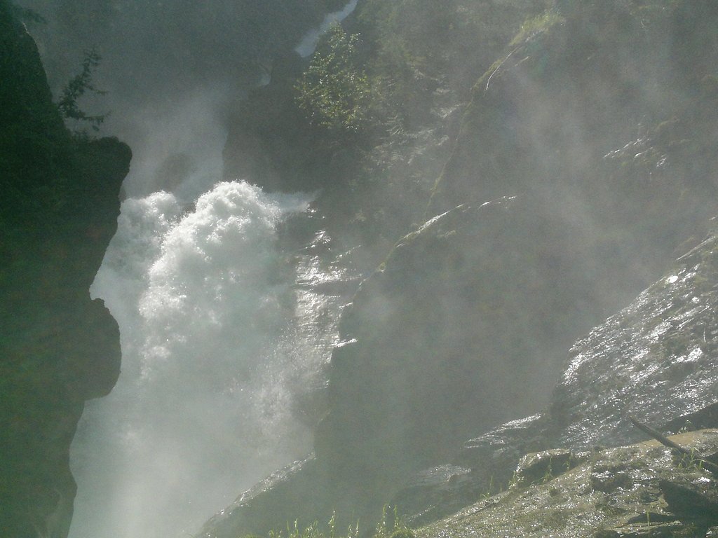
Bear Creek Falls
British Columbia • 55 m
By Armen Suny · Last verified Jun 2026
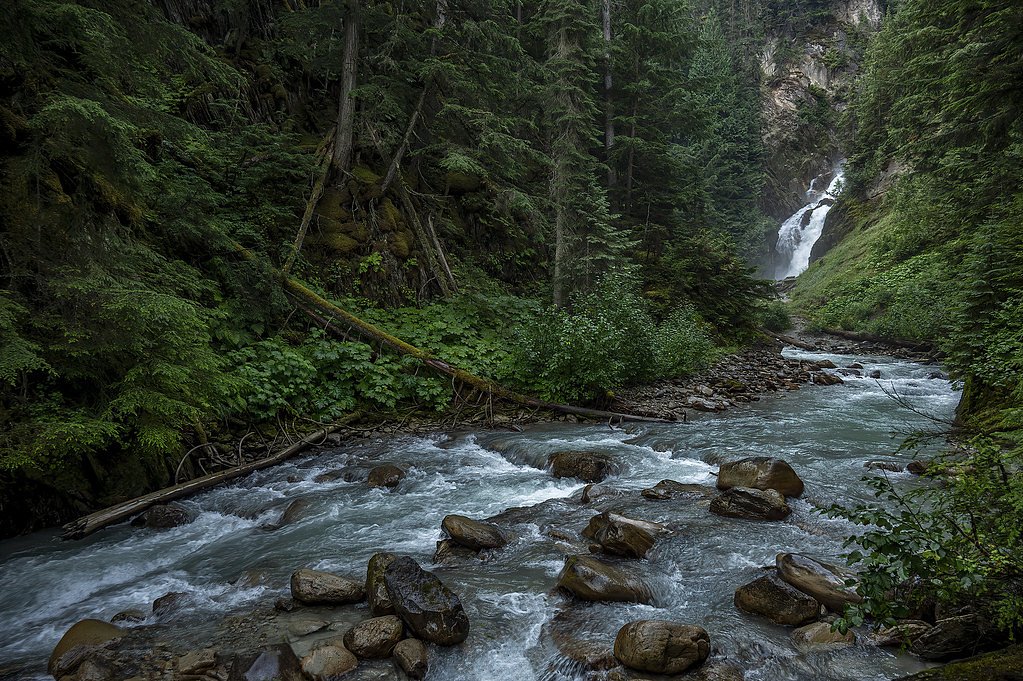
Photo Credits (3)
Difficulty
Easy
Trail Length
1.1 km
Trail Type
Out And Back
Elevation Gain
36 m
About Bear Creek Falls
Bear Creek Falls is a forested creek waterfall located in southeastern British Columbia, approximately 48–50 miles (by road) from Revelstoke. The falls sit near coordinates 51.35, -117.4342 and are in a relatively remote, mountainous area. There does not appear to be an established developed viewpoint or visitor infrastructure; visits typically involve travel on secondary or forest service roads and an unmaintained approach. Water flow is likely highest in spring snowmelt and after heavy rains and lower in late summer and early fall. Exact height and official naming details are not well documented in major waterfall registries and trail guides, so specifics below are conservative and may vary.
The Setting
Bear Creek Falls sits at 968 metres within Glacier National Park Of Canada, in the mountains of British Columbia. At 55 metres, it is among the taller waterfalls in British Columbia.
Why This Waterfall Exists
Bear Creek Falls flows over loose river sediment, primarily alluvium, laid down about 3 million years ago. These soft rocks erode readily, allowing the stream to carve a 181-foot drop into the landscape.
Trail & Hike Details
The Approach
The easy 1.1-km out-and-back trail gains 36 metres of elevation on the way to the falls.
Trail Description
There does not appear to be a widely maintained or signed trail to Bear Creek Falls. Approaches reported for similar remote falls in the region often involve a short bushwhack from a road or stream crossing and travel over uneven, rooty, and potentially steep terrain. Expect unmarked use paths, muddy conditions, and the need to route around blowdown or dense understory. If you plan to approach the creek, bring a map/GPS and be prepared for route-finding.
What to Expect
The falls plunge 55 metres over loose river sediment.
Accessibility
The trail is short and relatively flat, but the surface may be uneven. Contact the managing agency for accessibility details.
Frequently Asked Questions
🐶 Are Dogs Allowed at Bear Creek Falls?
❌ Dogs are not allowed
Are There Any Fees or Permits Required?
🆖 No fees required
🏊 Is There Swimming at Bear Creek Falls?
❌ Swimming is not allowed
When to Visit
Late spring (snowmelt) for highest flows and dramatic water volume. Early summer through early fall for easier access on dry roads and trails. Avoid deep winter unless you are equipped and experienced with winter/backcountry travel, roads and approaches may be impassable or avalanche-prone.
Seasonal Access
The best time to visit is Spring, Summer, and Fall. Winter access may be limited. Check with the managing park or local authority for current conditions.
Safety Information
Hazards include unstable or slippery banks, fast cold water, hidden rocks, logjams, seasonal high flows and flashy creek behavior after heavy rain or rapid snowmelt, poor or no cell reception, and the potential for encounters with wildlife. Roads and forest service routes can be rough and may have seasonal gates. Use cautious route-finding, avoid getting too close to cliff edges or overhangs, and do not attempt technical descents without proper gear and experience. Carry appropriate safety equipment and tell someone your plan.
Current Water Conditions
107.0 m³/s
Current discharge — how much water is flowing
2.73 m
Water depth at gauge
7-Day Discharge Trend
About This Gauge
This gauge is on a nearby waterway and may not reflect exact conditions at the falls.
7-Day Flow Outlook
Based on the WSC gauge BEAVER RIVER ABOVE CUPOLA CREEK (16 km away).
Today
Moderate
116 m³/s
6/10Tomorrow
Moderate
120 m³/s
6/10Tue
Moderate
111 m³/s
8/10Wed
Moderate
107 m³/s
8/10Thu
Moderate
107 m³/s
8/10Fri
Moderate
116 m³/s
6/10Sat
Moderate
111 m³/s
9/10Best window: Sat — moderate flow, mainly sunny (trip score 9/10).
How we calculate this
This is a transparent outlook, not a precise forecast. We take the waterfall's current flow strength (how it ranks against its historical normal for today, from the nearest WSC stream gauge), carry that ranking forward along the gauge's seasonal curve, and nudge it for forecast rain. Confidence is highest for the next day or two and falls further out. Always check official conditions and your own judgment before visiting — high flows can be dangerous.
Know when to go.
Get a free email alert when waterfalls near Revelstoke hit peak flow. We only send when conditions are worth the trip — no weekly newsletters, no spam.
Weather Forecast
Location & Access
Getting There
Access generally requires driving from Revelstoke toward the east/northeast along main highways and then turning onto secondary/forest service roads. Roads in the area may be gravel, rough, and seasonally gated or washed out. There may be no official trailhead signage; a topographic map, satellite imagery, or a detailed local map is recommended. Expect limited or no cell coverage in parts of the approach.
Get Directions on Google MapsParking
Parking is likely informal at a road pullout or at the end of a forest service road. There is probably no developed parking lot, restrooms, or facilities. Park well off the travel lane and avoid blocking gates.
Elevation
968 metres above sea level
Coordinates
51.350029° N, -117.434246° W
Land Management
Managed by Parks Canada Agency
Visitor Tips & Gear
1) Confirm current road and trail conditions with local land management (BC Parks, local forest service) or recent trip reports before you go. 2) Use high-clearance or 4WD if taking forest service roads, many are rough. 3) Carry a map, GPS, or offline map tiles; cell service may be unreliable. 4) Wear sturdy, waterproof footwear and bring trekking poles for stream crossings and slippery banks. 5) Practice Leave No Trace and pack out all waste. 6) Tell someone your route and expected return time.
As an Amazon Associate, we earn from qualifying purchases.
For this easy 1.1 km trail, lightweight trail shoes and a water bottle are usually sufficient. Sun exposure on the trail makes good sun protection a must in summer.

Polarized Sunglasses (Knockaround)
Cuts glare off the water so you actually see the falls — and your photos turn out better too.

Columbia Watertight II Rain Jacket
Packs into its own pocket, seam-sealed, and keeps you dry from spray and surprise rain.

Earth Pak Waterproof Dry Bag
Keeps your phone and gear dry when waterfall mist soaks everything else.

Waterproof Phone Pouch (AiRunTech)
Cheap insurance — take photos right next to the falls without killing your phone.

JOBY GorillaPod Starter Kit
Wraps around railings and rocks for long-exposure waterfall shots — no flat surface needed.

Osprey Daylite Daypack
Light, organized, and just the right size for a day hike — fits water, snacks, and layers.
Where to Stay
Browse vacation cabins and private rentals nearby
Unique outdoor stays — tents, yurts, and treehouses
Rent a campervan or RV for your waterfall road trip
Some links are affiliate links. We may earn a commission at no extra cost to you.
Nearby Campground
Hermit Campground
7.1 km away
Additional Information
Nearby Attractions
Revelstoke town (services, accommodations), Mount Revelstoke National Park, Glacier National Park (BC), Revelstoke Mountain Resort, and various scenic drives and hiking opportunities in the Columbia Mountains region. Exact distances and driving times vary by route.
Wildlife
Typical interior BC species may be present: black bear, deer, moose, small mammals, and birds. Also be aware of ticks, and occasional cougar or wolf presence in remote areas. Practice food storage and bear-aware behavior.
Cities near Bear Creek Falls
Other waterfalls named Bear Creek Falls
5 other waterfalls share this name across Canada.
Writing about Bear Creek Falls? Embed this waterfall on your site for free.