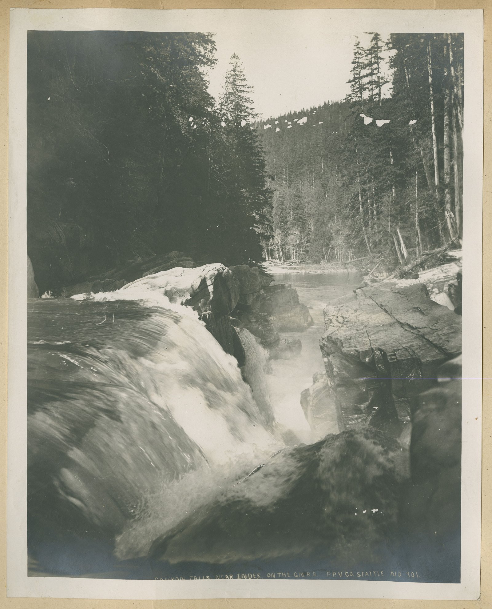
About Bald Rock Falls
Bald Rock Falls is a natural waterfall located in northern Ontario (coordinates: 48.3066, -91.0752). The waterfall sits in a remote, forested landscape typical of the region and is most often visited by people seeking short nature stops or local hikes. Specific published descriptions and measured statistics for this waterfall appear to be limited; visitors report a scenic, rocky setting and variable water flow depending on season and recent precipitation.
The Setting
Bald Rock Falls sits at 416 metres within Quetico Provincial Park, in the foothills of Ontario.
Why This Waterfall Exists
Bald Rock Falls flows over hard intrusive rock, primarily granodiorite and granite, laid down over 2.5-3.2 billion years ago. These resistant rocks form a durable ledge that water cannot easily wear away, creating the falls where softer material downstream has already eroded.
Nearby Falls Worth Visiting
Little Falls (12 m) lies 2.7 kilometres to the west. Also nearby: Canyon Falls (9 m, 3.7 km).
Trail & Hike Details
Trail Description
Trail information for Bald Rock Falls is limited. Reports suggest a short, informal route from a roadside pullout to viewing areas; the path may be over uneven bedrock, roots and forest floor with no established boardwalks or railings. Expect narrow singletrack and potentially wet, slippery sections near the water. Trail markers may be minimal or absent.
What to Expect
Expect a relatively remote, natural setting: mixed boreal/deciduous forest, exposed bedrock slabs, and the sound of the stream/river. Flow can vary by season, spring melt and after heavy rain will produce higher flows. Facilities are likely minimal or absent (no visitor center, toilets, or potable water). Cell coverage may be intermittent or absent.
Accessibility
The site is likely not wheelchair accessible. Expect uneven, rocky terrain, possible short scrambles, and no formal trails or handrails. Visitors with limited mobility should plan for assistance and evaluate conditions on arrival.
Frequently Asked Questions
🐶 Are Dogs Allowed at Bald Rock Falls?
❌ Dogs are not allowed
Are There Any Fees or Permits Required?
🆖 No fees required
🏊 Is There Swimming at Bald Rock Falls?
❌ Swimming is not allowed
When to Visit
Late spring (snowmelt) for the highest flows and fall for colors and cooler weather. Summer typically offers the easiest driving and access. Winter can provide striking frozen scenes but increases risk from ice, snow and cold, use appropriate winter traction and skills.
Seasonal Access
The best time to visit is Spring, Summer, Fall, and Winter. Check with Quetico Provincial Park for current conditions.
Safety Information
Hazards include slippery wet rock near the falls, steep or unstable edges, fast-moving water during high flow, cold water temperatures, remote location with limited cell service, and seasonal road/parking issues. In winter, ice and deep snow increase risk, use appropriate winter gear and experience. Always tell someone your plans, carry a map and emergency supplies, and exercise caution near water and cliff edges.
Know when to go.
Get a free email alert when waterfalls near Atikokan hit peak flow. We only send when conditions are worth the trip — no weekly newsletters, no spam.
Weather Forecast
Location & Access
Getting There
The falls are located at coordinates 48.3066, -91.0752. They are roughly 44–50 miles from nearby communities named in local wayfinding: Atikokan (~44.6 miles), Lutsen (~47.4 miles) and Winton (~49.2 miles) as reference points. Access typically requires driving on rural paved and/or unpaved roads and then following a short trail or footpath from a roadside pullout. Expect remote-road driving and very limited signage; use a reliable GPS device or offline map and verify current road conditions locally before travel.
Get Directions on Google MapsParking
Parking is likely limited to a small unpaved pullout or roadside shoulder near the trailhead. There are probably no formal parking lots, vault toilets, or visitor facilities at the site. Park legally and avoid blocking roads.
Elevation
416 metres above sea level
Coordinates
48.306572° N, -91.075184° W
Land Management
Managed by Ontario Parks
Visitor Tips & Gear
• Wear sturdy, closed-toe footwear with good traction, rocks around falls are slippery. • Check road and weather conditions before traveling; unpaved roads can be rough or muddy. • Carry water, snacks, a map, and extra layers; temperatures can change quickly. • Bring a charged phone and consider downloading offline maps; expect limited cell service. • Pack out all trash and stay on durable surfaces to protect vegetation and prevent erosion. • Be cautious near edges; wet bedrock and steep drops can be hazardous. • If visiting in black fly season (late spring/early summer) or mosquito season, bring insect repellent and long sleeves.
Where to Stay
Browse vacation cabins and private rentals nearby
Unique outdoor stays — tents, yurts, and treehouses
Rent a campervan or RV for your waterfall road trip
Some links are affiliate links. We may earn a commission at no extra cost to you.
Additional Information
Nearby Attractions
The broader region contains lakes, provincial parks, and backcountry recreation opportunities common to northwestern Ontario (canoeing, fishing, hiking). For specific nearby parks or attractions, check local tourism resources for Atikokan and the surrounding district before planning side trips.
Wildlife
Typical northern Ontario wildlife may be present: black bears, moose, white-tailed deer, beavers, small mammals, and a variety of birds. Insects such as mosquitoes and black flies can be abundant in spring and early summer. Take usual wildlife precautions: store food securely, keep distance, and make noise while hiking to avoid surprising animals.
Cities near Bald Rock Falls
Nearby Waterfalls
Writing about Bald Rock Falls? Embed this waterfall on your site for free.