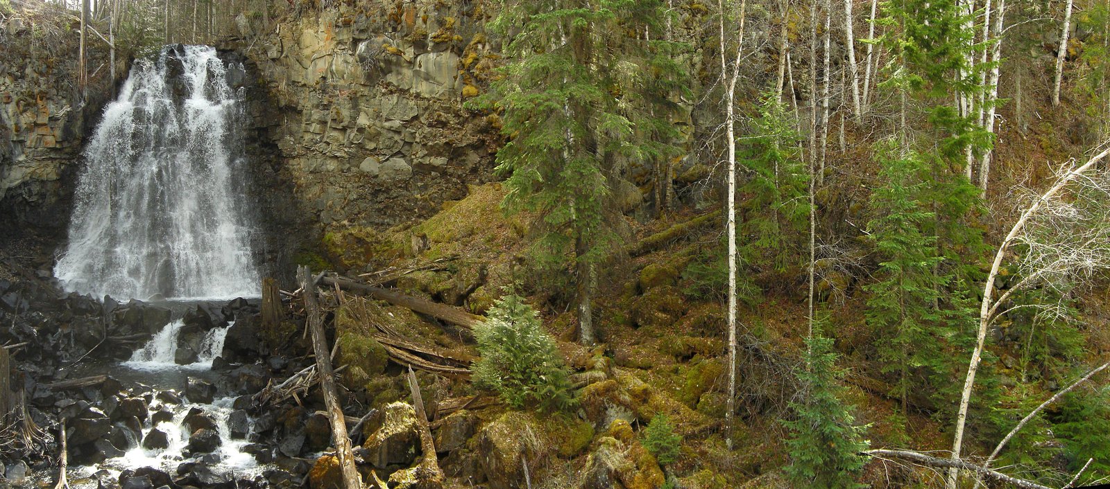
Allison Falls
British Columbia • Wells Gray Park • 15 m
By Armen Suny · Last verified Jun 2026
Difficulty
Hard
Trail Length
8.0 km
Trail Type
Out And Back
Elevation Gain
534 m
About Allison Falls
Allison Falls (coordinates 51.8694, -119.9276) is a waterfall in the Interior of British Columbia. Publicly available information about this specific waterfall is limited; it appears to be a smaller cascade or drop on a local stream or tributary rather than a large, well-known plunging waterfall. Access, official trails, and exact measurements are not well documented in major trail databases. Descriptions below use cautious language where details could not be confirmed.
The Setting
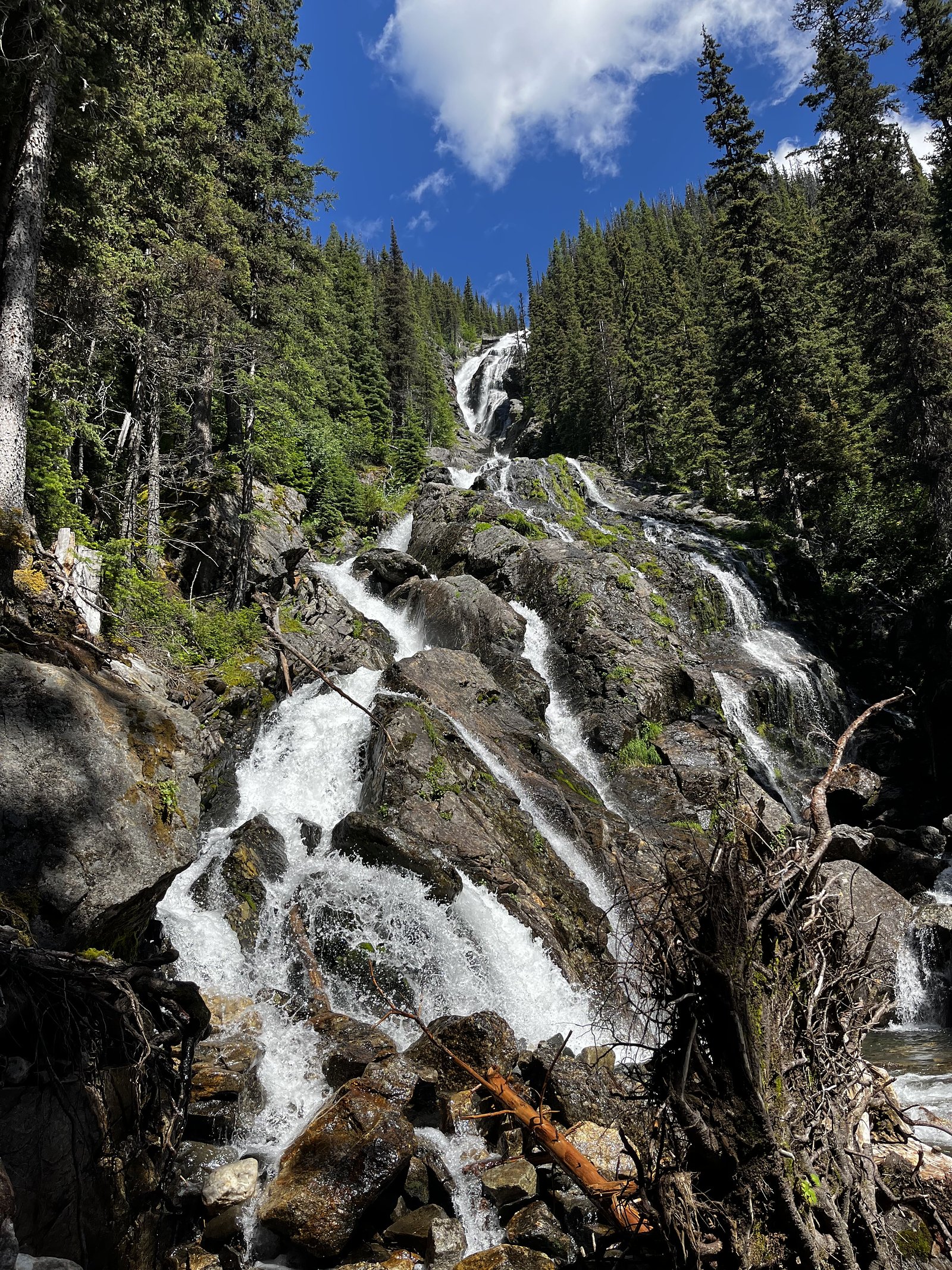
Allison Falls sits at 1,633 metres within Wells Gray Park, in the high mountains of British Columbia. The falls drop 15 metres.
Why This Waterfall Exists
Allison Falls flows over layered sedimentary rock laid down about 252 million to 1.0 billion years ago. Over time, the stream has worn through these layers at different rates, creating a 50-foot drop that forms the waterfall.
Nearby Falls Worth Visiting
Silvertip Falls (168 m) lies 12.1 kilometres to the south.
Trail & Hike Details
The Approach
The hard 8.0-km out-and-back trail gains 534 metres of elevation on the way to the falls.
Trail Description
There is no widely published, maintained trail description for Allison Falls at these coordinates. Access reported in similar remote-BC waterfall visits typically involves driving on secondary/forest roads as close as possible and a short hike or scramble from a roadside pullout. Expect undefined or informal paths, potential brush and uneven ground, and the need to navigate minor creek crossings or talus. If you prefer an established trail, look for better-documented falls in nearby provincial parks or recreation areas.
What to Expect
The falls drop 15 metres over layered sedimentary rock.
Accessibility
The trail involves steep, uneven terrain with significant elevation change and is not accessible to mobility devices.
Frequently Asked Questions
🐶 Are Dogs Allowed at Allison Falls?
❌ Dogs are not allowed
Are There Any Fees or Permits Required?
🆖 No fees required
🏊 Is There Swimming at Allison Falls?
❌ Swimming is not allowed
When to Visit
Late spring (peak snowmelt) for highest flows, or summer for most reliable road access and drier hiking conditions. Fall can provide lower flows but good colors and fewer insects. Winter access may be limited or unsafe due to snow and ice.
Seasonal Access
The best time to visit is Spring, Summer, and Fall. Access roads and trails may close during winter due to snow. Check with Wells Gray Park for current conditions.
Safety Information
Approach and shoreline rocks can be very slippery; strong currents and cold water temperatures may be present even in summer. There may be no guardrails, no cell service, and remote/unmaintained access roads. If traveling alone, tell someone your route and expected return time. Watch for changing weather and potential logging or gated roads; respect private property and posted closures. Check for seasonal road closures and recent trip reports before visiting.
Current Water Conditions
Based on a Water Survey of Canada gauge 25.6 km away
373.0 m³/s
Current discharge — how much water is flowing
About average for this time of year
Based on 87 years of record
3.66 m
Water depth at gauge
7-Day Discharge Trend
What does this mean for your visit?
Flow is about average for this time of year.
About This Gauge
This gauge is on a regional waterway. Conditions at the falls may differ, especially after local rain.
7-Day Flow Outlook
Based on the WSC gauge CLEARWATER RIVER NEAR CLEARWATER STATION (26 km away).
Today
Moderate
403 m³/s
5/10Tomorrow
Moderate
416 m³/s
5/10Tue
Moderate
413 m³/s
5/10Wed
Moderate
370 m³/s
6/10Thu
Moderate
344 m³/s
6/10Fri
Moderate
362 m³/s
5/10Sat
Moderate
381 m³/s
4/10Best window: Wed — moderate flow, cloudy (trip score 6/10).
Best time of year: this gauge typically runs highest from early May to early August, peaking in June.
How we calculate this
This is a transparent outlook, not a precise forecast. We take the waterfall's current flow strength (how it ranks against its historical normal for today, from the nearest WSC stream gauge), carry that ranking forward along the gauge's seasonal curve, and nudge it for forecast rain. Confidence is highest for the next day or two and falls further out. Always check official conditions and your own judgment before visiting — high flows can be dangerous.
Weather Forecast
Location & Access
Getting There
The waterfall is located at the supplied coordinates in interior British Columbia. Exact approach routes are not well-documented in widely available sources; reaching the site may require travel on secondary or forest service roads and a short off-trail walk. Visitors should consult up-to-date topographic maps, local forest service offices, or recent trip reports before attempting access.
Get Directions on Google MapsParking
No formal parking lot is documented. Parking may be roadside on a forest service or logging road; exercise caution and avoid blocking gates or tracks. If unsure, assume minimal parking infrastructure.
Elevation
1,633 metres above sea level
Coordinates
51.869352° N, -119.927619° W
Land Management
Managed by Government of British Columbia
Visitor Tips & Gear
1) Confirm route and access with a current map or local land/park authorities before you go. 2) Wear sturdy, waterproof footwear; approaches may be slippery and uneven. 3) Do not rely on cell service for navigation; bring a GPS unit or offline map. 4) Stay back from cliff edges and slippery rocks. 5) Leave no trace, pack out all trash. 6) If traveling on unmaintained forest roads, a high-clearance vehicle may be helpful; check seasonal road closures.
This trail sits at 5,358 ft above sea level
Elevated TrailUV radiation is roughly 21% stronger at this elevation than at sea level, and the dry air accelerates dehydration. Extra sun protection and fluids go a long way.
As an Amazon Associate, we earn from qualifying purchases.

Coppertone Sport SPF 50 Sunscreen
UV intensity jumps ~4% per 1,000 ft — at this elevation you can burn in half the time.

Sun Bum SPF 30 Lip Balm (3-Pack)
Lips have almost no natural UV protection and burn fast in thin, dry mountain air.

Liquid I.V. Electrolyte Packets
You lose moisture ~2x faster at elevation — electrolytes help you absorb water efficiently.

ROCKNIGHT Polarized UV400 Sunglasses
High-altitude glare off rock and water is intense — UV400 lenses block 99%+ of UVA/UVB.
As an Amazon Associate, we earn from qualifying purchases.
This challenging 8.0 km trail gains 534 m in elevation — come prepared with proper hiking boots and trekking poles. Sun exposure on the trail makes good sun protection a must in summer.

Sawyer Squeeze Water Filter
The backcountry standard — filters 99.9% of bacteria and weighs just 3 oz.

Columbia Watertight II Rain Jacket
Packs into its own pocket, seam-sealed, and keeps you dry from spray and surprise rain.

Earth Pak Waterproof Dry Bag
Keeps your phone and gear dry when waterfall mist soaks everything else.

Waterproof Phone Pouch (AiRunTech)
Cheap insurance — take photos right next to the falls without killing your phone.

Timberland Euro Sprint Mid Waterproof
Trusted waterproof boot with premium leather and grippy rubber sole — reliable on rocky, wet trails.

TrailBuddy Trekking Poles
Lightweight aluminum, cork grips, and flip-locks that actually hold — a best-seller for good reason.
Where to Stay
Browse vacation cabins and private rentals nearby
Unique outdoor stays — tents, yurts, and treehouses
Rent a campervan or RV for your waterfall road trip
Some links are affiliate links. We may earn a commission at no extra cost to you.
Nearby Campground
Phillip Lake Wilderness Campsite
0.6 km away
Additional Information
Nearby Attractions
There is limited specific documentation for nearby named attractions tied to these coordinates. Interior BC contains many lakes, provincial parks, and other waterfalls; consult local tourism resources or a detailed map to identify nearby parks, trails, and viewpoints.
Wildlife
Typical Interior BC wildlife may be present including deer, small mammals, and possibly black bears. Be aware of ticks in warmer months and practice standard wildlife safety. Keep food stored securely.
Nearby Waterfalls
Writing about Allison Falls? Embed this waterfall on your site for free.