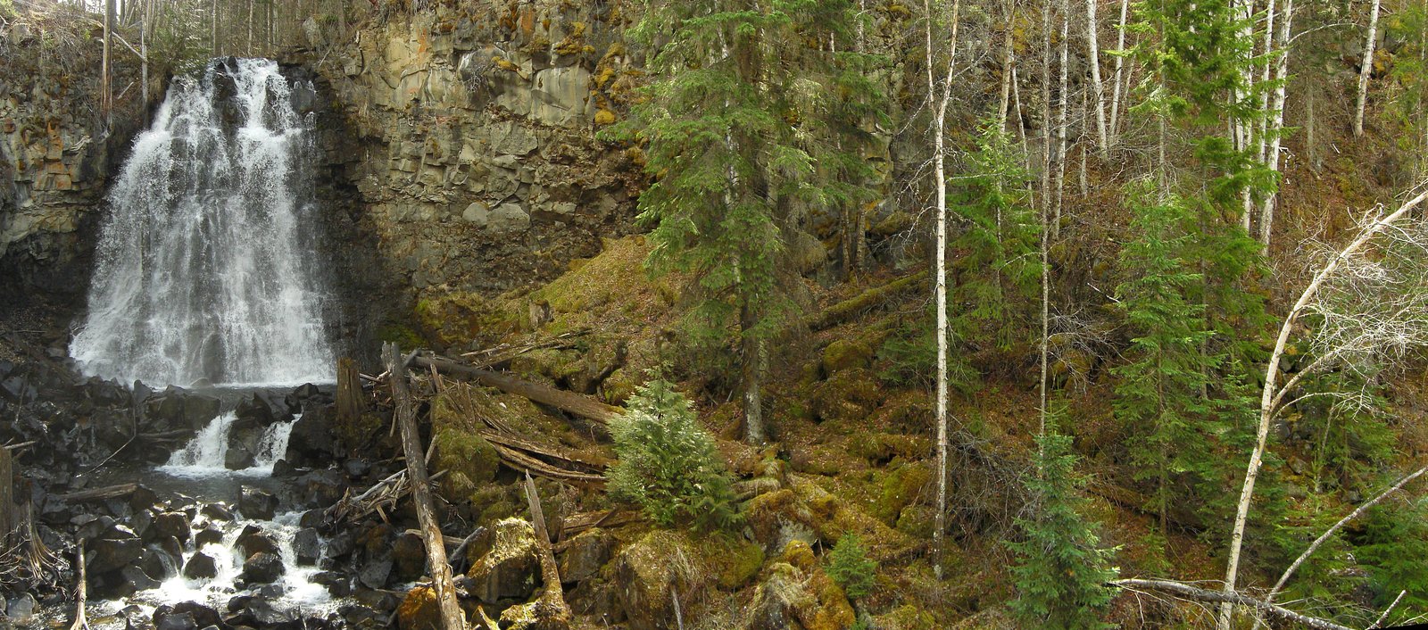
Hemp Falls
British Columbia • Wells Gray Park
By Armen Suny · Last verified Jun 2026
Difficulty
Hard
Trail Length
20.0 km
Trail Type
Out And Back
About Hemp Falls
Hemp Falls is a waterfall located in central British Columbia (approximate coordinates 51.8742, -120.0577). Information on this feature is limited in widely available guide sources; it appears to be a relatively remote, forested waterfall accessed by local forestry roads and a hiking approach. Flow is likely highest in spring and early summer from snowmelt and seasonal rains. Visitors should treat specific access details (roads, trailheads, parking) as subject to change and verify with local land managers or recent trip reports before travel.
The Setting
Hemp Falls sits at 604 metres within Wells Gray Park, in the hills of British Columbia.
Nearby Falls Worth Visiting
Moul Falls (35 m) lies 4.3 kilometres to the south. Also nearby: McDiarmid Falls (10 m, 4.5 km).
Trail & Hike Details
Trail Description
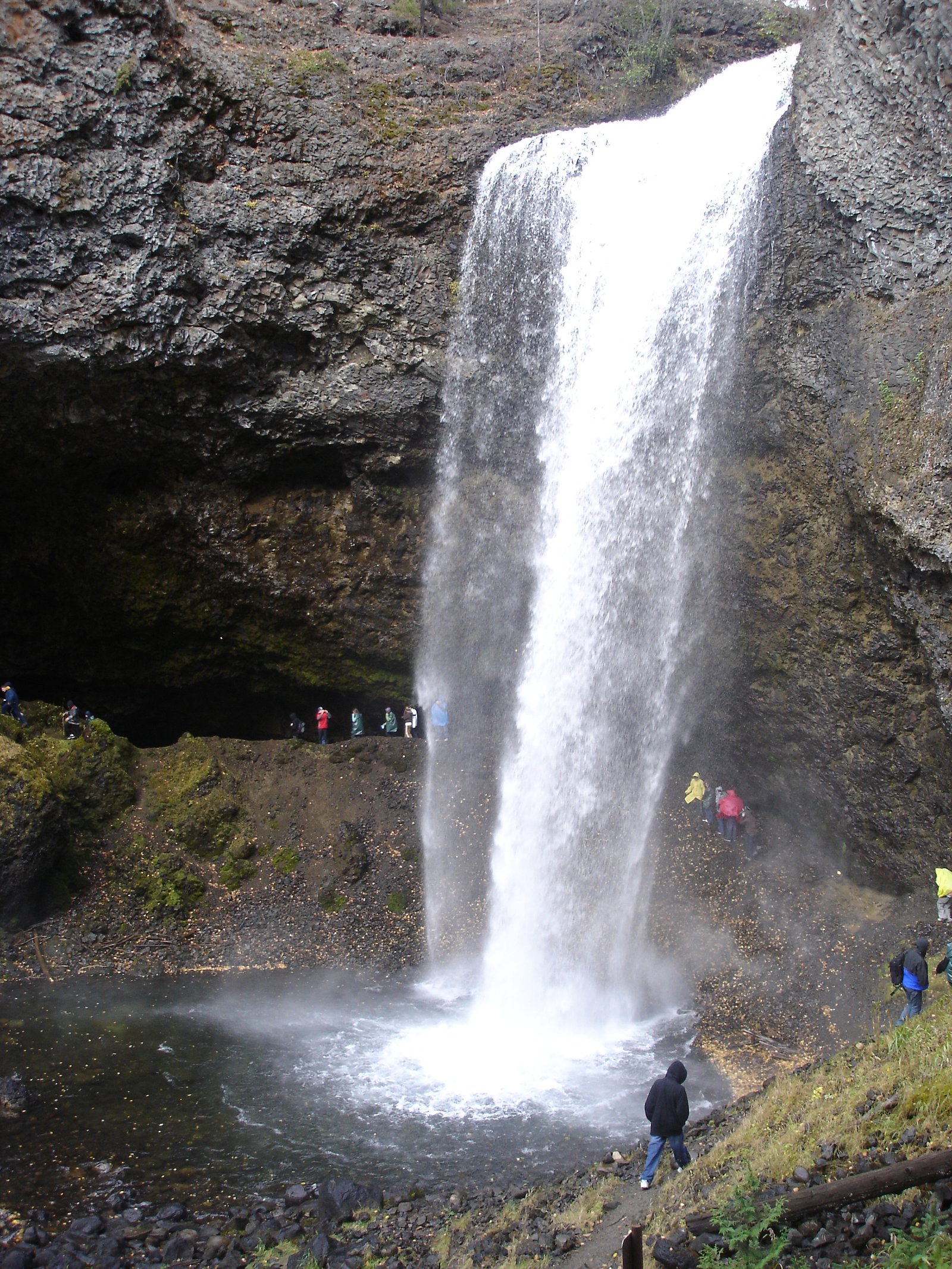
Detailed, reliably documented trail descriptions are not available in major public trail databases for this feature. Approaches that visitors report for remote BC waterfalls often include driving on forest service/logging roads followed by an unmaintained path or bushwhack to the creek or canyon rim. Expect limited or no signage, uneven terrain, and potentially steep, eroded sections near the creek or falls.
What to Expect
Expect a remote, natural setting with limited infrastructure (no railings, viewing platforms, or restrooms). Terrain may include muddy or rocky forest trails, roots, slide-prone banks, and steep drop-offs near the waterfall. Water will likely be cold year-round and flow varies with season, highest in spring. Cell coverage is likely intermittent or absent. Wildlife such as deer, black bears, and smaller mammals may be present.
Accessibility
The trail involves steep, uneven terrain with significant elevation change and is not accessible to mobility devices.
Frequently Asked Questions
🐶 Are Dogs Allowed at Hemp Falls?
❌ Dogs are not allowed
Are There Any Fees or Permits Required?
🆖 No fees required
🏊 Is There Swimming at Hemp Falls?
❌ Swimming is not allowed
When to Visit
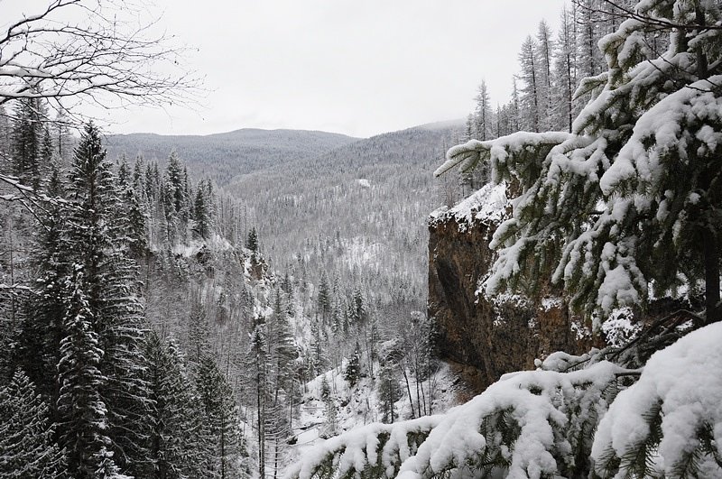
Late spring to early summer for the strongest flows from snowmelt and spring rains. Summer offers more reliable road conditions and safer hiking surfaces. Fall can be pleasant for lower flows and fall foliage, but road and weather conditions may deteriorate later in the season. Winter access may be hazardous or require specialized equipment and experience.
Seasonal Access
The best time to visit is Spring, Summer, and Fall. Winter access may be limited. Check with Wells Gray Park for current conditions.
Safety Information
Hazards may include: slippery or moss-covered rocks, steep or unstable banks, sudden drop-offs, fast and cold water (do not underestimate currents), variable road conditions (deep ruts, washouts), limited cell coverage, and wildlife encounters including bears. In winter and shoulder seasons expect ice, deep snow, and avalanche risk in some areas. Always wear appropriate footwear, avoid getting too close to edges, do not climb wet cliffs, and travel with a companion when possible.
Current Water Conditions
Based on a Water Survey of Canada gauge 24.3 km away
382.0 m³/s
Current discharge — how much water is flowing
About average for this time of year
Based on 87 years of record
3.70 m
Water depth at gauge
7-Day Discharge Trend
What does this mean for your visit?
Flow is about average for this time of year.
About This Gauge
This gauge is on a regional waterway. Conditions at the falls may differ, especially after local rain.
7-Day Flow Outlook
Based on the WSC gauge CLEARWATER RIVER NEAR CLEARWATER STATION (24 km away).
Today
Moderate
407 m³/s
5/10Tomorrow
Moderate
420 m³/s
5/10Tue
Moderate
388 m³/s
8/10Wed
Moderate
360 m³/s
6/10Thu
Moderate
375 m³/s
5/10Fri
Moderate
380 m³/s
5/10Sat
Moderate
385 m³/s
4/10Best window: Tue — moderate flow, sunny (trip score 8/10).
Best time of year: this gauge typically runs highest from early May to early August, peaking in June.
How we calculate this
This is a transparent outlook, not a precise forecast. We take the waterfall's current flow strength (how it ranks against its historical normal for today, from the nearest WSC stream gauge), carry that ranking forward along the gauge's seasonal curve, and nudge it for forecast rain. Confidence is highest for the next day or two and falls further out. Always check official conditions and your own judgment before visiting — high flows can be dangerous.
Weather Forecast
Location & Access
Getting There
The falls are in a remote, forested area of central BC. Access commonly requires driving on unpaved forestry or logging roads that can be rough and seasonally gated. From the nearest paved highway the last stretch may be high-clearance or 4x4 only. Exact road names and turnoffs are not confidently documented here; confirm current road conditions and access with local forestry offices or recent visitor reports before attempting to drive in.
Get Directions on Google MapsParking
There may be informal pullouts or small parking areas near a trailhead or logging road turnout. Expect no formal parking lot, signage, or services. Park well off the road and avoid blocking gates or access for forestry equipment.
Elevation
604 metres above sea level
Coordinates
51.874227° N, -120.057741° W
Land Management
Managed by Government of British Columbia
Visitor Tips & Gear
• Check recent trip reports or contact regional forest service/park offices for current road and trail conditions before travel. • Use a high-clearance vehicle if following forest roads; they can be rough, rutted, or muddy. • Carry a map (offline), GPS, and let someone know your plans; expect limited cell service. • Wear sturdy footwear with good traction and be cautious near wet rocks and cliff edges. • Bring bear spray and know how to use it; keep food secured. • Pack out everything you bring in. There are likely no toilets or trash facilities.
Where to Stay
Browse vacation cabins and private rentals nearby
Unique outdoor stays — tents, yurts, and treehouses
Rent a campervan or RV for your waterfall road trip
Some links are affiliate links. We may earn a commission at no extra cost to you.
Nearby Campground
Trophy Mountain Buffalo Ranch
6.4 km away
Additional Information
Nearby Attractions
Specific nearby named attractions are not confidently documented here. The region generally contains lakes, rivers, forested recreation areas, and logging roads typical of central British Columbia. Consult regional maps for nearby provincial parks, lakes, or other waterfalls.
Wildlife
Black bear, deer, small mammals, and a variety of bird species (including raptors). In riparian areas expect amphibians and aquatic insects. Be aware of potential bear activity and other wildlife encounters.
Nearby Waterfalls
Writing about Hemp Falls? Embed this waterfall on your site for free.