Watson Falls
Oregon • 272 ft
By Armen Suny · Last verified Mar 2026

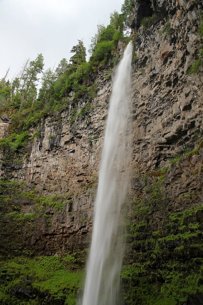

Photo Credits (5)
Difficulty
Easy
Trail Length
0.6 miles
Trail Type
Out And Back
Elevation Gain
300 ft
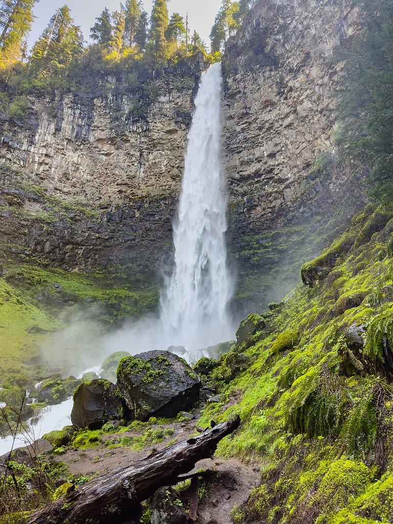
About Watson Falls
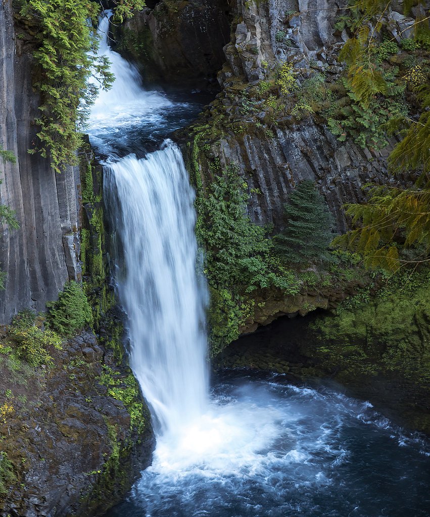
Watson Falls is one of the tallest waterfalls in Oregon, located in the Umpqua National Forest. It cascades dramatically over basalt cliffs, offering a stunning view surrounded by lush greenery.
The Setting
Watson Falls sits at 3,219 feet within Umpqua National Forest, fed by the North Umpqua River, in the mountains of Oregon. At 272 feet, it is among the taller waterfalls in Oregon.
Height: 272 feet
Nearby Falls Worth Visiting
Toketee Falls (113 ft) lies 2.6 miles to the northwest. Also nearby: Lemolo Falls (102 ft, 11.2 mi) and Clearwater Falls (30 ft, 8.2 mi).
Trail & Hike Details
The Approach
The easy hike follows Watson Falls (#1496), a 0.6-mile out-and-back trail over natural surface. Expect 300 feet of elevation gain with grades of 12-20%. The trail is developed (Class 3).
USFS Trail
WATSON FALLS #1496
Trail Class
Developed
Surface
Avg Grade
USFS Segment
0.26 miTrail Description
The trail to Watson Falls is a short and well-maintained path that leads through a forested area. It includes a few switchbacks and a wooden bridge crossing a creek. The trail ends at a viewing platform offering a spectacular view of the waterfall.
What to Expect
The falls plunge 272 feet. Dogs are welcome.
Accessibility
The trail is not wheelchair accessible. Uneven terrain and elevation changes require steady footing.
Frequently Asked Questions
🐶 Are Dogs Allowed at Watson Falls?
✅ Dogs are allowed
Are There Any Fees or Permits Required?
🆖 No fees required
🏊 Is There Swimming at Watson Falls?
❌ Swimming is not allowed
When to Visit
Spring and early summer are ideal times to visit, as the waterfall is at its fullest due to snowmelt. Fall offers beautiful foliage, while winter may bring icy conditions.
Seasonal Access
The best time to visit is Spring, Summer, and Fall. Winter access may be limited. Check with Umpqua National Forest for seasonal road closures.
Safety Information
The trail can be slippery after rain or during winter months. Stay on the designated path and avoid climbing on rocks near the waterfall.
Current Water Conditions
89 ft³/s
Current discharge — how much water is flowing
About average for this time of year
Based on 22 years of record
3.28 ft
Water depth at gauge
7-Day Discharge Trend
What does this mean for your visit?
Flow is about average for this time of year.
About This Gauge
7-Day Flow Outlook
Based on the USGS gauge NORTH UMPQUA RIVER AT TOKETEE FALLS, OR (3 km away).
Today
Moderate
102 cfs
6/10Tomorrow
Moderate
108 cfs
6/10Thu
Moderate
95 cfs
9/10Fri
Moderate
89 cfs
8/10Sat
Moderate
89 cfs
8/10Sun
Moderate
89 cfs
8/10Mon
Moderate
89 cfs
8/10Best window: Thu — moderate flow, sunny (trip score 9/10).
Best time of year: this gauge typically runs highest from early August to early October, peaking in June.
How we calculate this
This is a transparent outlook, not a precise forecast. We take the waterfall's current flow strength (how it ranks against its historical normal for today, from the nearest USGS stream gauge), carry that ranking forward along the gauge's seasonal curve, and nudge it for forecast rain. Confidence is highest for the next day or two and falls further out. Always check official conditions and your own judgment before visiting — high flows can be dangerous.
Know when to go.
Get a free email alert when waterfalls near Chemult hit peak flow. We only send when conditions are worth the trip — no weekly newsletters, no spam.
Weather Forecast
Location & Access
Getting There
Watson Falls is located off Highway 138, also known as the Rogue-Umpqua Scenic Byway. From Roseburg, drive east on Highway 138 for about 60 miles. Look for the Watson Falls trailhead sign near milepost 60.
Get Directions on Google MapsParking
There is a designated parking area at the Watson Falls trailhead, which is free to use. The parking lot is relatively small, so it may fill up during peak times.
Elevation
3,219 feet above sea level
Coordinates
43.241794° N, -122.390967° W
Land Management
Managed by USFS
Visitor Tips & Gear
Arrive early during weekends or holidays to secure parking. Wear sturdy shoes as the trail can be muddy, especially after rain. Bring a camera to capture the beautiful scenery.
As an Amazon Associate, we earn from qualifying purchases.
For this easy 0.6 miles trail, lightweight trail shoes and a water bottle are usually sufficient. Sun exposure on the trail makes good sun protection a must in summer.

Polarized Sunglasses (Knockaround)
Cuts glare off the water so you actually see the falls — and your photos turn out better too.

Columbia Watertight II Rain Jacket
Packs into its own pocket, seam-sealed, and keeps you dry from spray and surprise rain.

Earth Pak Waterproof Dry Bag
Keeps your phone and gear dry when waterfall mist soaks everything else.

Waterproof Phone Pouch (AiRunTech)
Cheap insurance — take photos right next to the falls without killing your phone.

JOBY GorillaPod Starter Kit
Wraps around railings and rocks for long-exposure waterfall shots — no flat surface needed.

Osprey Daylite Daypack
Light, organized, and just the right size for a day hike — fits water, snacks, and layers.
Where to Stay

Umpqua's Last Resort - Wilderness Cabins, RV Park & Glamping

Union Creek Resort
Browse vacation cabins and private rentals nearby
Unique outdoor stays — tents, yurts, and treehouses
Rent a campervan or RV for your waterfall road trip
Some links are affiliate links. We may earn a commission at no extra cost to you.
Nearby Campground
BUNKER HILL CAMPGROUND
11.5 miles away · 5 sites
Overview This campground clings to the northwest shore of Lemolo Lake beneath the heavily wooded Bunker Hill. Bald eagles often soar above the lodgepole pine forest. Bunker Hill Campground is popular with fishermen.Recreation Boating, fishing, swimming, kayaking, canoeing and water skiing top the list of recreational activities at the campground. Lemolo Lake provides outdoor enthusiasts with a multitude of recreational opportunities year round. The forested shoreline and mountainous backdrop prov
Book on Recreation.govNearby Hot Springs
Hot springs near Chemult, Oregon

Umpqua Hot Springs
Umpqua Hot Springs flows at 117°F from multiple geothermal sources along the North Umpqua River in Lane County, forming cascadi...
Kitson Hot Springs
Kitson Hot Springs flows at 109°F within Willamette National Forest at 1,664 feet elevation, positioned just 17 meters from For...

Mccredie Springs
McCredie Springs flows at 163°F along Salt Creek in the Willamette National Forest, creating one of western Oregon's most popul...

Annie Spring
Annie Spring flows at 77°F within Crater Lake National Park at 5,983 feet elevation, discharging 1.71 cubic feet per second at ...
Wall Creek Warm Springs
Wall Creek Warm Springs flows at 106°F deep within Willamette National Forest at 2,362 feet elevation on the western Cascades s...
Looking for a soak after your hike? Explore more hot springs near Chemult, Oregon on SoakingSprings.
Explore Oregon springsAdditional Information
Nearby Attractions
Toketee Falls, Clearwater Falls, and the Umpqua Hot Springs are all located nearby and worth visiting.
Wildlife
The area is home to various wildlife, including birds, deer, and small mammals. Keep an eye out for native flora and fauna along the trail.
Cities near Watson Falls
Nearby Waterfalls
Writing about Watson Falls? Embed this waterfall on your site for free.