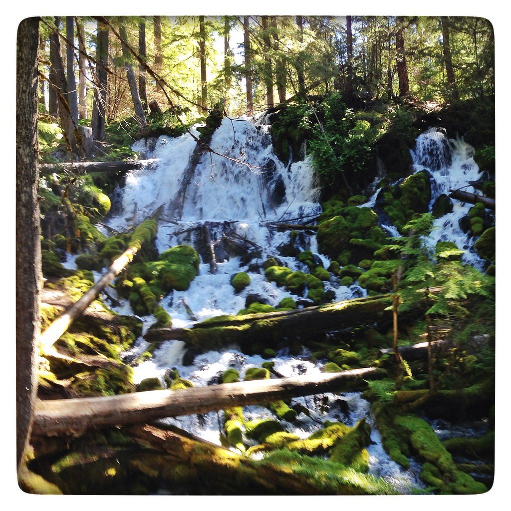
Clearwater Falls
Oregon • 30 ft
By Armen Suny · Last verified Mar 2026
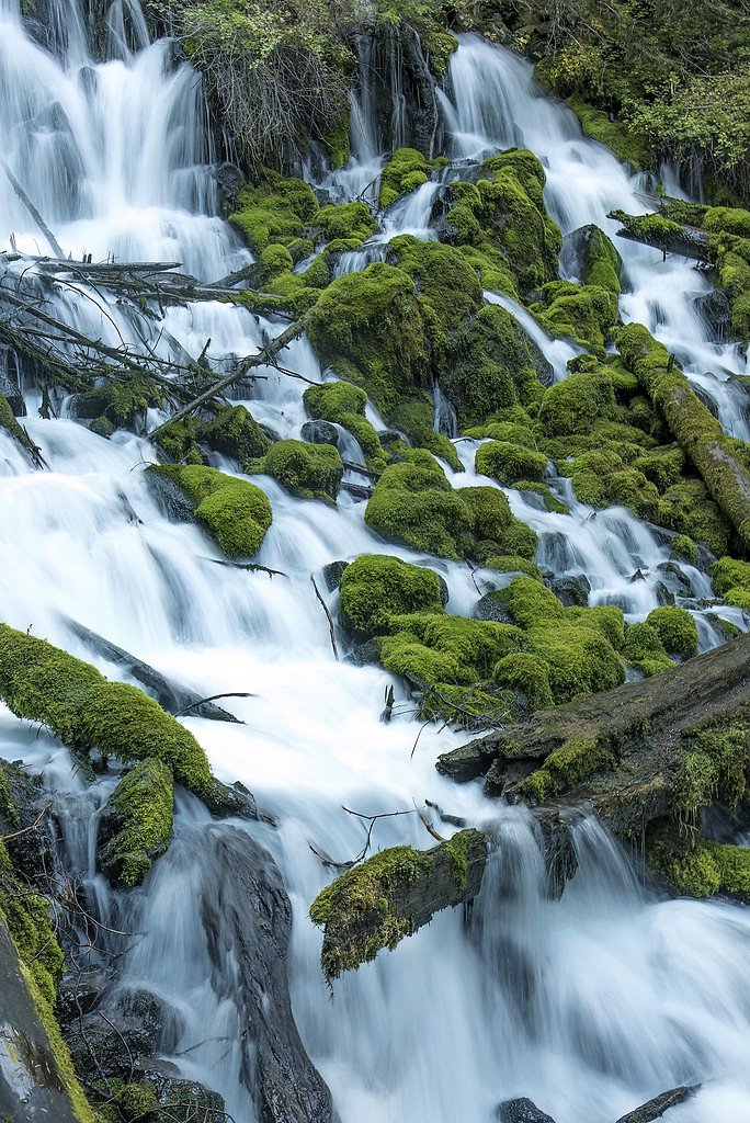
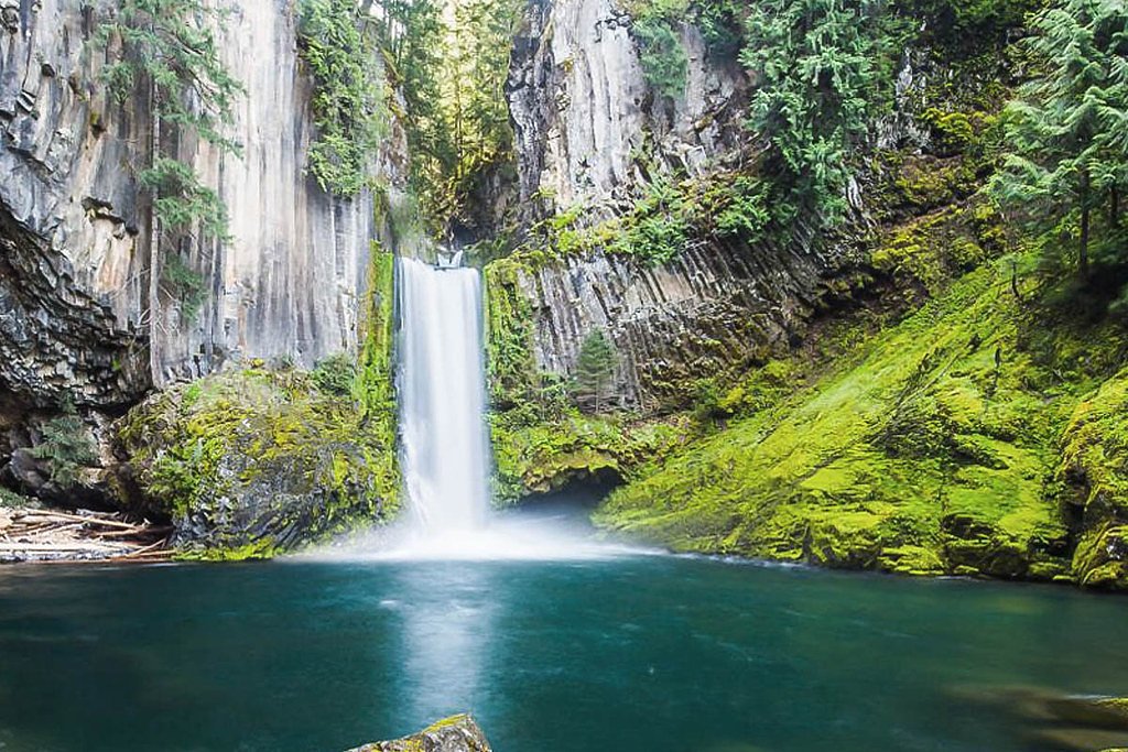
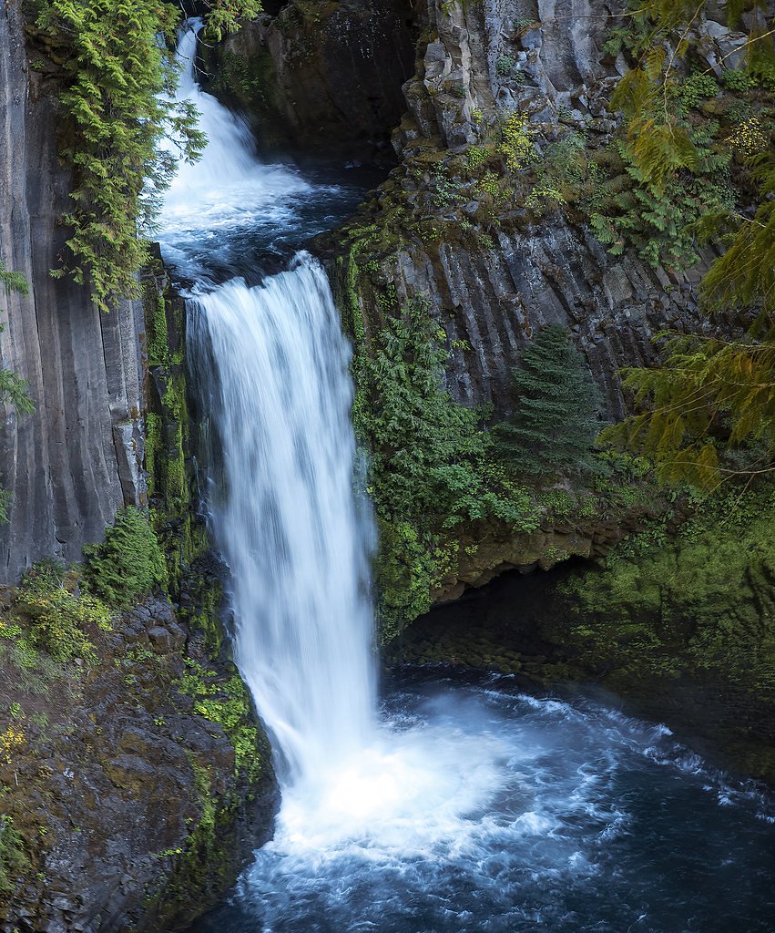
Photo Credits (5)
Difficulty
Moderate
Trail Length
2.4 miles
Trail Type
Out And Back
Elevation Gain
350 ft
About Clearwater Falls
Clearwater Falls is a picturesque waterfall located in the Umpqua National Forest in Oregon. It is known for its cascading flow over moss-covered rocks, creating a serene and photogenic scene. The waterfall is fed by underground springs, ensuring a steady flow year-round.
The Setting
Clearwater Falls sits at 4,213 feet within Umpqua National Forest, fed by the Clearwater River Abv Trap Ck, in the mountains of Oregon. The falls drop 30 feet.
Height: 30 feet
Nearby Falls Worth Visiting
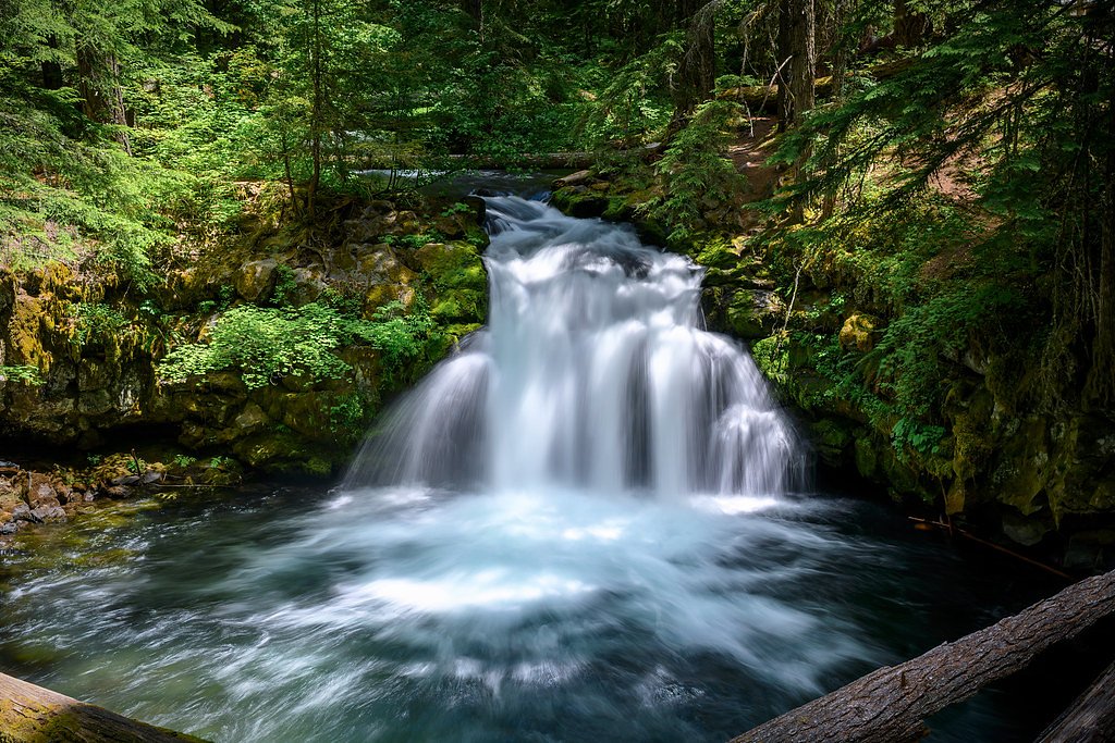
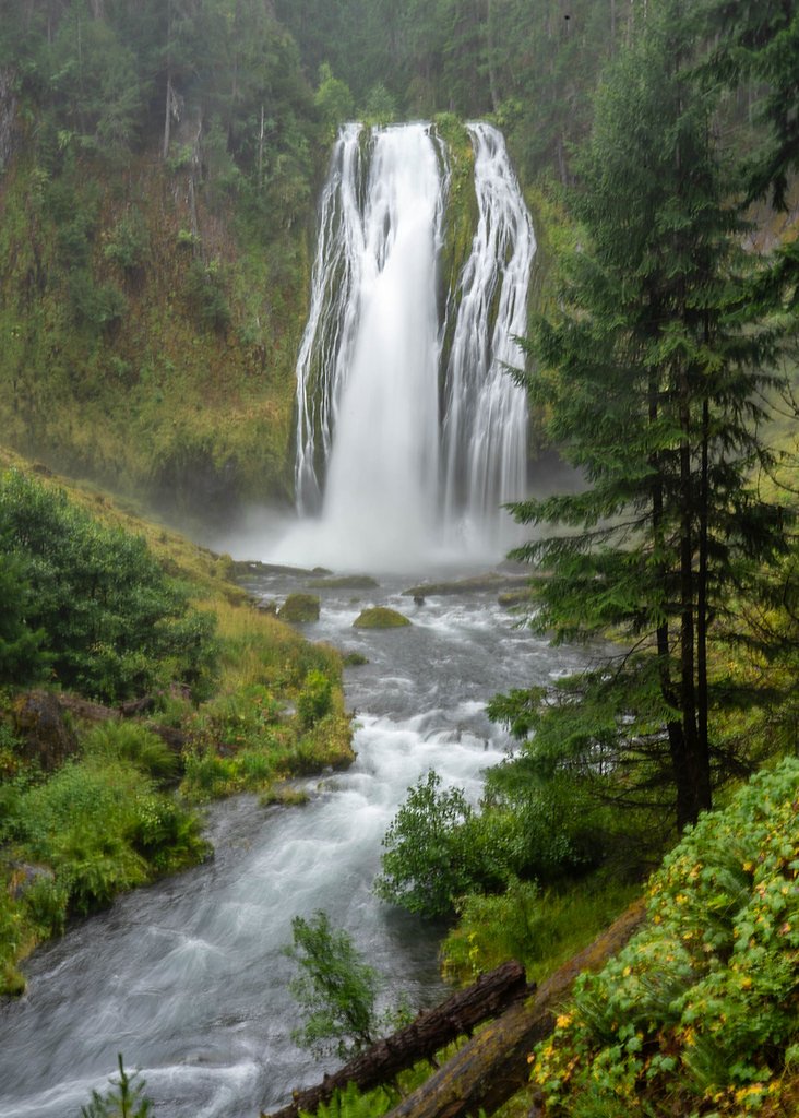
Watson Falls (272 ft) lies 8.2 miles to the west. Also nearby: Lemolo Falls (102 ft, 6.7 mi) and Whitehorse Falls (15 ft, 3.9 mi).
Trail & Hike Details
The Approach
The moderate hike follows Nfst 4785181 (#T4785181), a 2.4-mile out-and-back trail over natural surface. Expect 350 feet of elevation gain with grades of 12-20%. The trail is moderately developed (Class 2).
USFS Trail
NFST-4785181 #T4785181
Trail Class
Moderately Developed
Surface
Avg Grade
USFS Segment
0.09 miTrail Description
The trail to Clearwater Falls is a very short and easy walk, making it accessible for most visitors. The path is well-maintained and leads directly to a viewing area near the base of the falls. The surrounding area is lush with greenery, and the sound of the cascading water adds to the tranquil atmosphere.
What to Expect
The falls drop 30 feet. Dogs are welcome.
Accessibility
The trail is not wheelchair accessible. Uneven terrain and elevation changes require steady footing.
Frequently Asked Questions
🐶 Are Dogs Allowed at Clearwater Falls?
✅ Dogs are allowed
Are There Any Fees or Permits Required?
🆖 No fees required
🏊 Is There Swimming at Clearwater Falls?
❌ Swimming is not allowed
When to Visit
Spring and early summer are ideal times to visit, as the surrounding vegetation is lush and vibrant. However, the falls maintain a steady flow year-round, making them a great destination in any season.
Seasonal Access
The best time to visit is Spring, Summer, and Fall. Winter access may be limited. Check with Umpqua National Forest for seasonal road closures.
Safety Information
The rocks near the falls can be slippery, so exercise caution when exploring. Be mindful of wildlife and avoid feeding animals. Cell phone service may be limited in the area.
Current Water Conditions
66 ft³/s
Current discharge — how much water is flowing
About average for this time of year
Based on 98 years of record
3.57 ft
Water depth at gauge
7-Day Discharge Trend
What does this mean for your visit?
Flow is about average for this time of year.
About This Gauge
7-Day Flow Outlook
Based on the USGS gauge CLEARWATER RIVER ABV TRAP CK NR TOKETEE FALLS, OR (5 km away).
Today
Low
75 cfs
3/10Tomorrow
Low
76 cfs
3/10Sun
Low
69 cfs
4/10Mon
Barely Flowing
56 cfs
5/10Tue
Barely Flowing
58 cfs
3/10Wed
Barely Flowing
54 cfs
5/10Thu
Barely Flowing
54 cfs
3/10Best window: Mon — barely flowing flow, mostly sunny (trip score 5/10).
Best time of year: this gauge typically runs highest from mid April to early July, peaking in May.
How we calculate this
This is a transparent outlook, not a precise forecast. We take the waterfall's current flow strength (how it ranks against its historical normal for today, from the nearest USGS stream gauge), carry that ranking forward along the gauge's seasonal curve, and nudge it for forecast rain. Confidence is highest for the next day or two and falls further out. Always check official conditions and your own judgment before visiting — high flows can be dangerous.
Know when to go.
Get a free email alert when waterfalls near Chemult hit peak flow. We only send when conditions are worth the trip — no weekly newsletters, no spam.
Weather Forecast
Location & Access
Getting There
Clearwater Falls is located off Highway 138, also known as the Rogue-Umpqua Scenic Byway. It is approximately 70 miles east of Roseburg, Oregon. The falls are easily accessible via a short walk from the parking area.
Get Directions on Google MapsParking
There is a small parking area near the trailhead, which is free to use. Parking may be limited during peak seasons.
Elevation
4,213 feet above sea level
Coordinates
43.248709° N, -122.227901° W
Land Management
Managed by USFS
Visitor Tips & Gear
Arrive early during summer weekends to secure parking. Wear sturdy shoes as the area near the falls can be slippery. Bring a camera to capture the beautiful scenery.
As an Amazon Associate, we earn from qualifying purchases.
With 2.4 miles and 350 ft of elevation gain, sturdy boots and trekking poles will help on this moderate trail. Sun exposure on the trail makes good sun protection a must in summer.

Polarized Sunglasses (Knockaround)
Cuts glare off the water so you actually see the falls — and your photos turn out better too.

Columbia Watertight II Rain Jacket
Packs into its own pocket, seam-sealed, and keeps you dry from spray and surprise rain.

Earth Pak Waterproof Dry Bag
Keeps your phone and gear dry when waterfall mist soaks everything else.

Waterproof Phone Pouch (AiRunTech)
Cheap insurance — take photos right next to the falls without killing your phone.

Timberland Euro Sprint Mid Waterproof
Trusted waterproof boot with premium leather and grippy rubber sole — reliable on rocky, wet trails.

TrailBuddy Trekking Poles
Lightweight aluminum, cork grips, and flip-locks that actually hold — a best-seller for good reason.
Where to Stay

Umpqua's Last Resort - Wilderness Cabins, RV Park & Glamping

Union Creek Resort

Budget Inn Motel Chemult

Dawson House Lodge
Browse vacation cabins and private rentals nearby
Unique outdoor stays — tents, yurts, and treehouses
Rent a campervan or RV for your waterfall road trip
Some links are affiliate links. We may earn a commission at no extra cost to you.
Nearby Campground
BUNKER HILL CAMPGROUND
5.3 miles away · 5 sites
Overview This campground clings to the northwest shore of Lemolo Lake beneath the heavily wooded Bunker Hill. Bald eagles often soar above the lodgepole pine forest. Bunker Hill Campground is popular with fishermen.Recreation Boating, fishing, swimming, kayaking, canoeing and water skiing top the list of recreational activities at the campground. Lemolo Lake provides outdoor enthusiasts with a multitude of recreational opportunities year round. The forested shoreline and mountainous backdrop prov
Book on Recreation.govNearby Hot Springs
Hot springs near Chemult, Oregon

Umpqua Hot Springs
Umpqua Hot Springs flows at 117°F from multiple geothermal sources along the North Umpqua River in Lane County, forming cascadi...

Annie Spring
Annie Spring flows at 77°F within Crater Lake National Park at 5,983 feet elevation, discharging 1.71 cubic feet per second at ...

Mccredie Springs
McCredie Springs flows at 163°F along Salt Creek in the Willamette National Forest, creating one of western Oregon's most popul...
Kitson Hot Springs
Kitson Hot Springs flows at 109°F within Willamette National Forest at 1,664 feet elevation, positioned just 17 meters from For...
Wall Creek Warm Springs
Wall Creek Warm Springs flows at 106°F deep within Willamette National Forest at 2,362 feet elevation on the western Cascades s...
Paulina Springs
Paulina Springs emerges at 70°F within Newberry National Volcanic Monument in Deschutes County, flowing at 6,338 feet elevation...
Looking for a soak after your hike? Explore more hot springs near Chemult, Oregon on SoakingSprings.
Explore Oregon springsAdditional Information
Nearby Attractions
Nearby attractions include Toketee Falls, Watson Falls, and the Umpqua Hot Springs, all located within a short drive.
Wildlife
The area is home to various wildlife, including birds, deer, and small mammals. Visitors may also spot fish in the nearby Clearwater River.
Cities near Clearwater Falls
Nearby Waterfalls

Other waterfalls named Clearwater Falls
1 other waterfall shares this name across the U.S.
Writing about Clearwater Falls? Embed this waterfall on your site for free.