Photo Credits (5)
Difficulty
Moderate
Trail Length
2.4 miles
Trail Type
Out And Back
Elevation Gain
350 ft
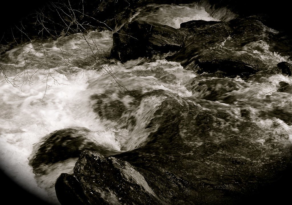
About Walker Falls
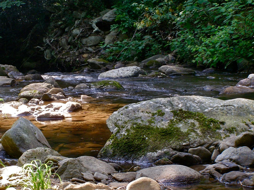
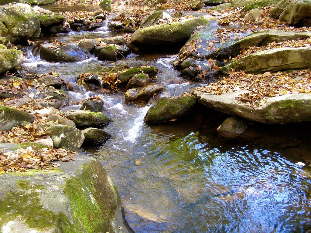
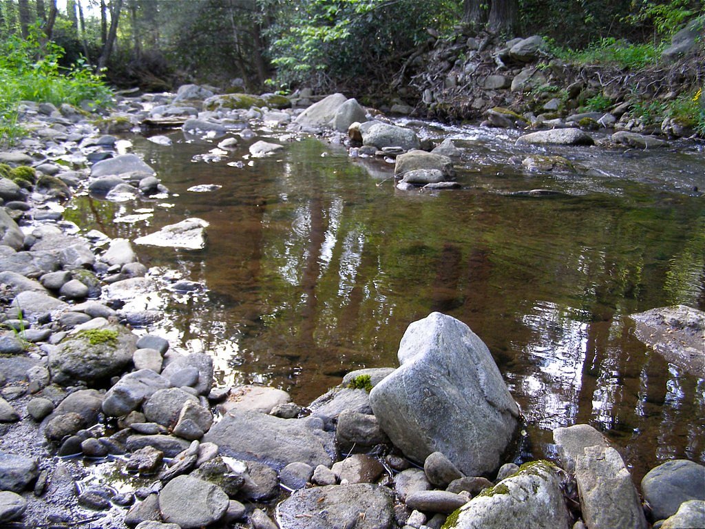
Walker Falls is a photogenic 45-foot cascading waterfall in Buncombe County, North Carolina, tumbling right beside NC-80 (the Forest Heritage Scenic Byway). Its roadside location makes it an easy, popular stop for waterfall hunters exploring this portion of Pisgah National Forest. Managed by the U.S. Forest Service, the area sits in a part of Buncombe County noted for a large number of small waterfalls as well as several larger falls, making Walker Falls a convenient highlight on a longer scenic drive. A Pisgah National Forest campground is located about 1.54 km away for those who want to turn the visit into an overnight trip. If you prefer a little more time in the woods, the nearby Walker Creek Trail (USFS Trail TR-165) offers a short forested option to stretch your legs. Whether you’re grabbing quick photos from the pull-off or taking a brief hike, Walker Falls provides an inviting, accessible taste of western North Carolina’s waterfall country.
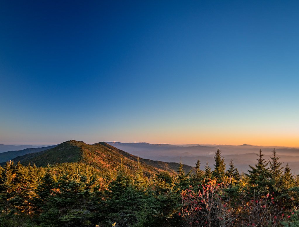
The Setting
Walker Falls sits at 3,747 feet within Pisgah National Forest, fed by the Beetree Creek, in the mountains of North Carolina.
Trail & Hike Details
The Approach
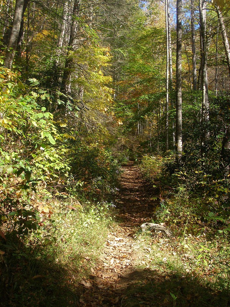
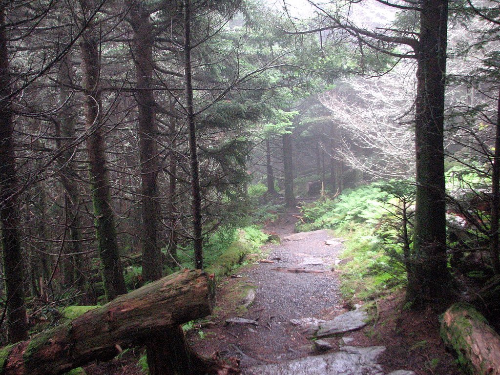
The moderate hike follows Walker Creek (#TR165), a 2.4-mile out-and-back trail over natural surface. Expect 350 feet of elevation gain. The trail is moderately developed (Class 2).
USFS Trail
WALKER CREEK #TR165
Trail Class
Moderately Developed
Surface
USFS Segment
1.71 miTrail Description
Walker Falls itself is visible from a pull-off along NC-80 and requires little to no hiking to enjoy the 45-foot cascade. For a short hike, the U.S. Forest Service lists the Walker Creek Trail (TR-165) nearby with a GIS-recorded length of 1.71 miles. The trail is Class 2 and has a natural tread (surface: native material). Many visitors report hiking a commonly used 2.4-mile out-and-back route with roughly 350 feet of elevation gain, typically rated moderate. Expect unpaved footing through Pisgah National Forest and easy-to-moderate trail conditions.
What to Expect
Dogs are welcome.
Accessibility
The trail is not wheelchair accessible. Uneven terrain and elevation changes require steady footing.
Frequently Asked Questions
🐶 Are Dogs Allowed at Walker Falls?
✅ Dogs are allowed
Are There Any Fees or Permits Required?
🆖 No fees required
🏊 Is There Swimming at Walker Falls?
❌ Swimming is not allowed
When to Visit
Spring and early summer are ideal times to visit, as the waterfall typically has stronger flow due to seasonal rainfall. Fall offers beautiful foliage, enhancing the scenery.
Seasonal Access
The best time to visit is Spring, Summer, and Fall. Winter access may be limited. Check with Pisgah National Forest for seasonal road closures.
Safety Information
Exercise caution when parking and walking along the roadside, as the road can be narrow and may have passing vehicles. Be aware of slippery rocks near the waterfall, especially after rain.
Current Water Conditions
4 ft³/s
Current discharge — how much water is flowing
About average for this time of year
Based on 92 years of record
1.50 ft
Water depth at gauge
7-Day Discharge Trend
What does this mean for your visit?
Flow is about average for this time of year.
About This Gauge
This gauge is on a nearby waterway and may not reflect exact conditions at the falls.
7-Day Flow Outlook
Based on the USGS gauge BEETREE CREEK NEAR SWANNANOA, NC (12 km away).
Today
Roaring
5 cfs
6/10Tomorrow
Roaring
5 cfs
6/10Wed
Roaring
5 cfs
6/10Thu
Roaring
5 cfs
6/10Fri
Roaring
5 cfs
6/10Sat
Roaring
5 cfs
6/10Sun
Roaring
5 cfs
6/10Best window: Today — roaring flow, patchy fog then slight chance showers and thunderstorms (trip score 6/10).
Best time of year: this gauge typically runs highest from early February to early May, peaking in March.
How we calculate this
This is a transparent outlook, not a precise forecast. We take the waterfall's current flow strength (how it ranks against its historical normal for today, from the nearest USGS stream gauge), carry that ranking forward along the gauge's seasonal curve, and nudge it for forecast rain. Confidence is highest for the next day or two and falls further out. Always check official conditions and your own judgment before visiting — high flows can be dangerous.
Know when to go.
Get a free email alert when waterfalls near Barnardsville hit peak flow. We only send when conditions are worth the trip — no weekly newsletters, no spam.
Weather Forecast
Location & Access
Getting There
Walker Falls is located along NC-80, also known as the Forest Heritage Scenic Byway, in Pisgah National Forest. The waterfall is visible from the road, and no hiking is required to access it.
Get Directions on Google MapsParking
There is limited roadside parking available near the waterfall. Visitors should exercise caution when parking and exiting their vehicles, as the road can be narrow.
Elevation
3,747 feet above sea level
Coordinates
35.755670° N, -82.354291° W
Land Management
Managed by USFS
Visitor Tips & Gear
Visit early in the day to avoid crowds and ensure better parking availability. Be cautious when parking and walking along the roadside. Bring a camera to capture the beauty of the falls.
As an Amazon Associate, we earn from qualifying purchases.
With 2.4 miles and 350 ft of elevation gain, sturdy boots and trekking poles will help on this moderate trail. Sun exposure on the trail makes good sun protection a must in summer.

Polarized Sunglasses (Knockaround)
Cuts glare off the water so you actually see the falls — and your photos turn out better too.

Columbia Watertight II Rain Jacket
Packs into its own pocket, seam-sealed, and keeps you dry from spray and surprise rain.

Earth Pak Waterproof Dry Bag
Keeps your phone and gear dry when waterfall mist soaks everything else.

Waterproof Phone Pouch (AiRunTech)
Cheap insurance — take photos right next to the falls without killing your phone.

Timberland Euro Sprint Mid Waterproof
Trusted waterproof boot with premium leather and grippy rubber sole — reliable on rocky, wet trails.

TrailBuddy Trekking Poles
Lightweight aluminum, cork grips, and flip-locks that actually hold — a best-seller for good reason.
Where to Stay

Apt with Wraparound Deck and Epic Views in Burnsville!

The Farmhouse at Wolfehaven

Lantern Lodge - formerly The Residences at Biltmore

Timber Ridge Retreat
Browse vacation cabins and private rentals nearby
Unique outdoor stays — tents, yurts, and treehouses
Rent a campervan or RV for your waterfall road trip
Some links are affiliate links. We may earn a commission at no extra cost to you.
Nearby Campground
Pisgah National Forest
1 miles away · 0 sites
The Pisgah National Forest is a land of mile-high peaks, cascading waterfalls, and heavily forested slopes. Comprised of over 500,000 acres, the Pisgah is primarily a hardwood forest with whitewater rivers, waterfalls and hundreds of miles of trails. This national forest is home of the first tract of land purchased under the Weeks Act of 1911 which led to the creation of the national forests in the eastern United States. It is also home of the first school of forestry in the United States, now pr
Book on Recreation.govNearby Hot Springs
Hot springs near Barnardsville, North Carolina

Looking for a soak after your hike? Explore more hot springs near Barnardsville, North Carolina on SoakingSprings.
Explore North Carolina springsAdditional Information
Nearby Attractions
Other waterfalls along NC-80, including Setrock Creek Falls and Roaring Fork Falls. The Blue Ridge Parkway is also nearby, offering additional scenic views and hiking opportunities.
Wildlife
The area is home to a variety of wildlife, including birds, deer, and small mammals. Visitors may also encounter insects such as mosquitoes during warmer months.
Cities near Walker Falls
Nearby Waterfalls
Writing about Walker Falls? Embed this waterfall on your site for free.