
Waipoʻo Falls
Hawaii • 800 ft
By Armen Suny · Last verified Sep 2026
LiDAR & 3D terrainDifficulty
Moderate
Trail Length
3.2 miles
Trail Type
Out And Back
Elevation Gain
800 ft
About Waipoʻo Falls
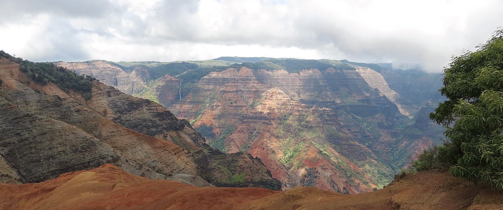
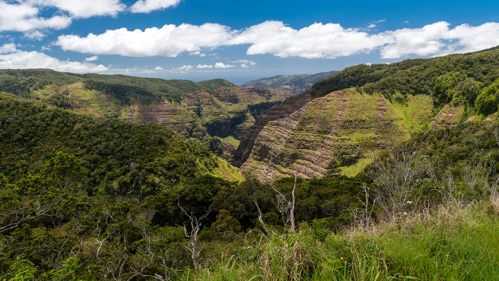
Waipoʻo Falls crowns the rim of Waimea Canyon with an impressive 800-foot, two-tier plunge that slices into the canyon’s verdant walls. Set in the dramatic landscape often called the “Grand Canyon of the Pacific,” the falls are framed by lush tropical vegetation and steep canyon vistas, making them one of Kauai’s most photogenic viewpoints. The site lies within the Puʻu Ka Pele Forest Reserve (designation: SCA) and is owned and managed by SDNR, so visitors should respect posted access rules and stewardship efforts. Access to the falls is typically along the Waipoʻo Falls Trail, a moderate out-and-back hike that rewards effort with sweeping canyon panoramas and close views of the upper cascades. The trail’s combination of dirt and rocky tread winds through native vegetation and offers changing perspectives of the canyon — great for photographers and hikers seeking a classic Waimea Canyon experience.
The Setting
Waipoʻo Falls sits at 2,776 feet within Pu'u Ka Pele Forest Reserve, in the hills of Hawaii. At 800 feet, it is among the taller waterfalls in Hawaii.
Height: 800 feet
Trail & Hike Details
The Approach
The moderate 3.2-mile out-and-back trail gains 800 feet of elevation on the way to the falls.
Trail Description
Waipoʻo Falls Trail — out-and-back, approximately 3.2 miles round trip with about 800 feet of elevation gain. Rated moderate, the route follows a combination of dirt paths and rocky sections with some steep inclines and uneven footing; hikers should wear sturdy shoes. The trail climbs and descends through canyon-side vegetation and ends near the top of Waipoʻo Falls, providing panoramic views of the upper cascades and the Waimea Canyon below. The trail and surrounding lands are within the Puʻu Ka Pele Forest Reserve and are managed by SDNR.
What to Expect
The falls plunge a dramatic 800 feet.
Accessibility
The trail is not wheelchair accessible. Uneven terrain and elevation changes require steady footing.
Frequently Asked Questions
🐶 Are Dogs Allowed at Waipoʻo Falls?
❌ Dogs are not allowed
Are There Any Fees or Permits Required?
🤑 Fee: $10.00
🏊 Is There Swimming at Waipoʻo Falls?
❌ Swimming is not allowed
When to Visit
The falls can be visited year-round, but the best time to visit is during the morning hours for cooler temperatures and fewer crowds. After rainfall, the waterfall flow is more robust, but the trail may be muddy.
Seasonal Access
The best time to visit is Spring, Summer, Fall, and Winter. Heavy rains during wet season (November through March) bring higher flow but can make trails slippery.
Safety Information
The trail can be slippery and muddy, especially after rain. Stay on marked paths to avoid dangerous cliffs and unstable ground. Bring sufficient water and be prepared for sudden weather changes.
Current Water Conditions
These readings come from the USGS gauge on Waimea River Us Of Kekaha-waiahulu Int., Kauai, Hi, 2.2 miles away, not on Waipoʻo Falls's own stream. Use them as a sign of whether the area is running wet or dry.
81 ft³/s
Current discharge — how much water is flowing
Higher than usual for this time of year
Based on 43 years of record
1.84 ft
Water depth at gauge
7-Day Discharge Trend
What does this mean for your visit?
The water is flowing higher than usual for this time of year.
About This Gauge
7-Day Flow Outlook
Based on the USGS gauge Waimea River US of Kekaha-Waiahulu Int., Kauai, HI (4 km away).
Today
Moderate
87 cfs
5/10Tomorrow
Low
84 cfs
6/10Mon
Low
81 cfs
6/10Tue
Low
95 cfs
6/10Wed
Low
109 cfs
6/10Thu
Low
95 cfs
6/10Fri
Low
90 cfs
6/10Best window: Tomorrow — low flow, sunny (trip score 6/10).
Best time of year: this gauge typically runs highest from late February to mid March, peaking in January.
How we calculate this
This is a transparent outlook, not a precise forecast. We take the waterfall's current flow strength (how it ranks against its historical normal for today, from the nearest USGS stream gauge), carry that ranking forward along the gauge's seasonal curve, and nudge it for forecast rain. Confidence is highest for the next day or two and falls further out. Always check official conditions and your own judgment before visiting — high flows can be dangerous.
Know when to go.
Get a free email alert when waterfalls near Pakala Village hit peak flow. We only send when conditions are worth the trip — no weekly newsletters, no spam.
Is Waipoʻo Falls Frozen?
Updated about 7 hours agoNot frozen highs above freezing lately
Waipoʻo Falls is not frozen right now; highs have been above freezing. Yesterday ran 71°F to 61°F.
- Days below freezing
- 0 of the last 14
- Current cold streak
- 0 days
- Freezing days ahead
- 0 of the next 7
- Flow
- 95 ft³/s
Winter safety. Frozen falls are the one waterfall trip with a documented injury pattern: falling ice, and ice-glazed rock and trail. Wear microspikes, keep well back from the base and from overhangs, and never walk out on ice over moving water.
Estimate from Open-Meteo daily temperatures at the falls, the LiDAR-measured facing direction, and the nearest stream gauge. It is a likelihood, not a report from the trail.
Weather Forecast
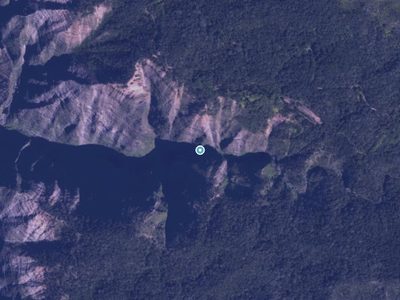
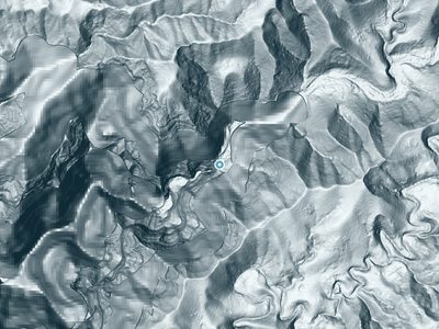
The Terrain, Seen by LiDAR
Aircraft-mounted lasers measured this ground to within inches. Trees and buildings are digitally stripped away, leaving the bare shape of the land the water has carved.
1-meter lidar shows Waipoʻo Falls dropping about 844 feet in a single sheer step. That agrees with the listed height of 800 feet. The brink sits at about 2,858 feet above sea level.
Steep ground runs through the entire stretch: about 317 feet of descent in the 500 feet above the pin and 628 feet in the 500 feet below it. Facing south, the falls sit in full sun for most of the day, best photographed early or late.
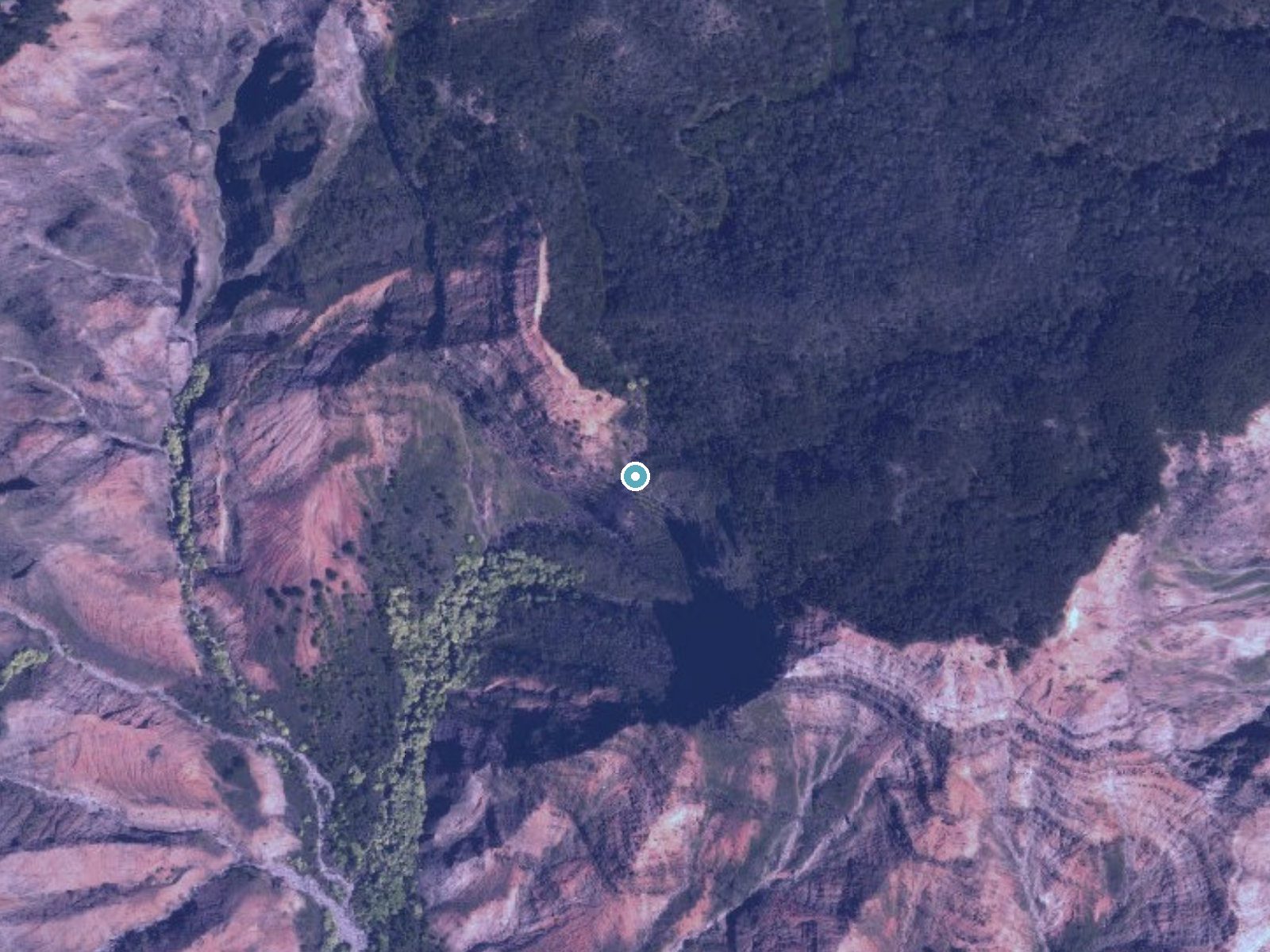
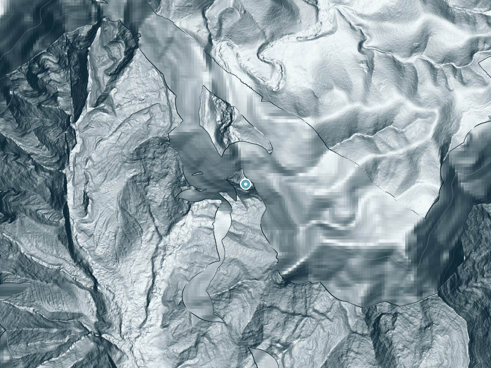
Drag to compare. The dot marks the waterfall. The frame is about a mile across.
- Ground elevation
- 2,858 feet
- Measured by 1-meter lidar
- Drop at the falls
- About 844 feet
- Change in ground height within ~250 feet of the falls
- Faces
- South
- Sunlit most of the day. Go early or late for softer light.
A slice through the lidar ground surface, from above the falls to downstream (heading south).
Elevation data: USGS 3D Elevation Program. Aerial imagery: USGS The National Map. Public domain.
Location & Access
Getting There
Waipoʻo Falls is located within Waimea Canyon State Park on the island of Kauai. Visitors can access the falls via the Waipoʻo Falls Trail, which begins at the Pu'u Hinahina Lookout parking area.
Get Directions on Google MapsParking
Parking is available at the Pu'u Hinahina Lookout, but it can fill up quickly during peak hours. Arrive early to secure a spot.
Elevation
2,776 feet above sea level
Coordinates
22.104267° N, -159.661493° W
Land Management
Managed by SDNR
Visitor Tips & Gear
Start your hike early in the day to avoid crowds and heat. Bring plenty of water, sunscreen, and sturdy hiking shoes. Be cautious on the trail, as it can be slippery in places. Note that the trail does not provide a view of the entire waterfall; for a full view, visit one of the canyon lookouts.
As an Amazon Associate, we earn from qualifying purchases.
With 3.2 miles and 800 ft of elevation gain, sturdy boots and trekking poles will help on this moderate trail. Icy conditions are common in winter — traction cleats are a smart addition.

Columbia Watertight II Rain Jacket
Packs into its own pocket, seam-sealed, and keeps you dry from spray and surprise rain.

Polarized Sunglasses (Knockaround)
Cuts glare off the water so you actually see the falls — and your photos turn out better too.

Earth Pak Waterproof Dry Bag
Keeps your phone and gear dry when waterfall mist soaks everything else.
Waterproof Phone Pouch (AiRunTech)
Cheap insurance — take photos right next to the falls without killing your phone.

Timberland Euro Sprint Mid Waterproof
Trusted waterproof boot with premium leather and grippy rubber sole — reliable on rocky, wet trails.

TrailBuddy Trekking Poles
Lightweight aluminum, cork grips, and flip-locks that actually hold — a best-seller for good reason.
Where to Stay

Hanalei Bay Resort

Banyan Harbor Resort

Kauai Shores Hotel

Poipu Plantation Vacation Rentals
Browse vacation cabins and private rentals nearby
Unique outdoor stays — tents, yurts, and treehouses
Rent a campervan or RV for your waterfall road trip
Some links are affiliate links. We may earn a commission at no extra cost to you.
Additional Information
Nearby Attractions
Nearby attractions include Waimea Canyon Lookout, Pu'u Hinahina Lookout, and Koke'e State Park.
Wildlife
Visitors may encounter native birds such as the nēnē (Hawaiian goose) and other wildlife typical of Kauai's forests.
Cities near Waipoʻo Falls
Nearby Waterfalls
 Aerial
 LiDAR
Writing about Waipoʻo Falls? Embed this waterfall on your site for free.