
Photo Credits (5)
Difficulty
Moderate
Trail Length
2.4 miles
Trail Type
Out And Back
Elevation Gain
350 ft
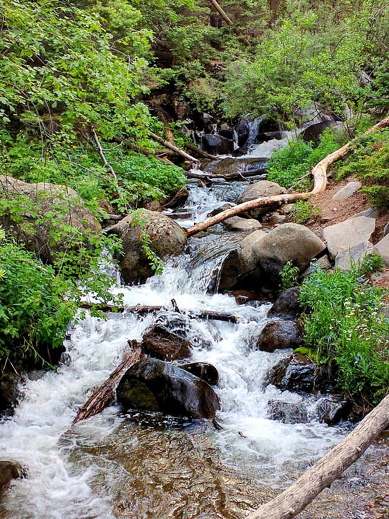
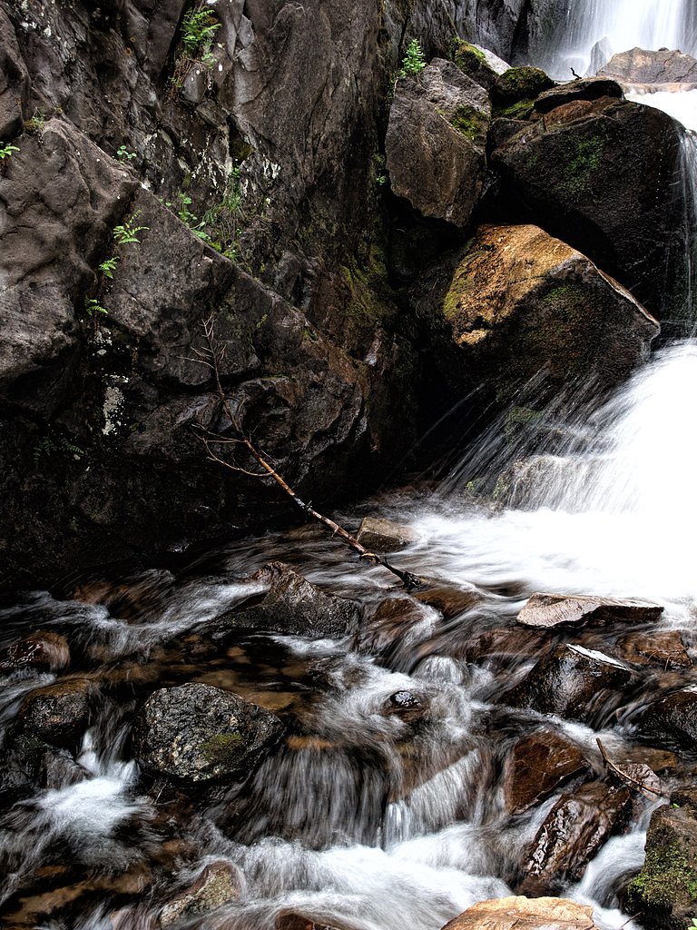
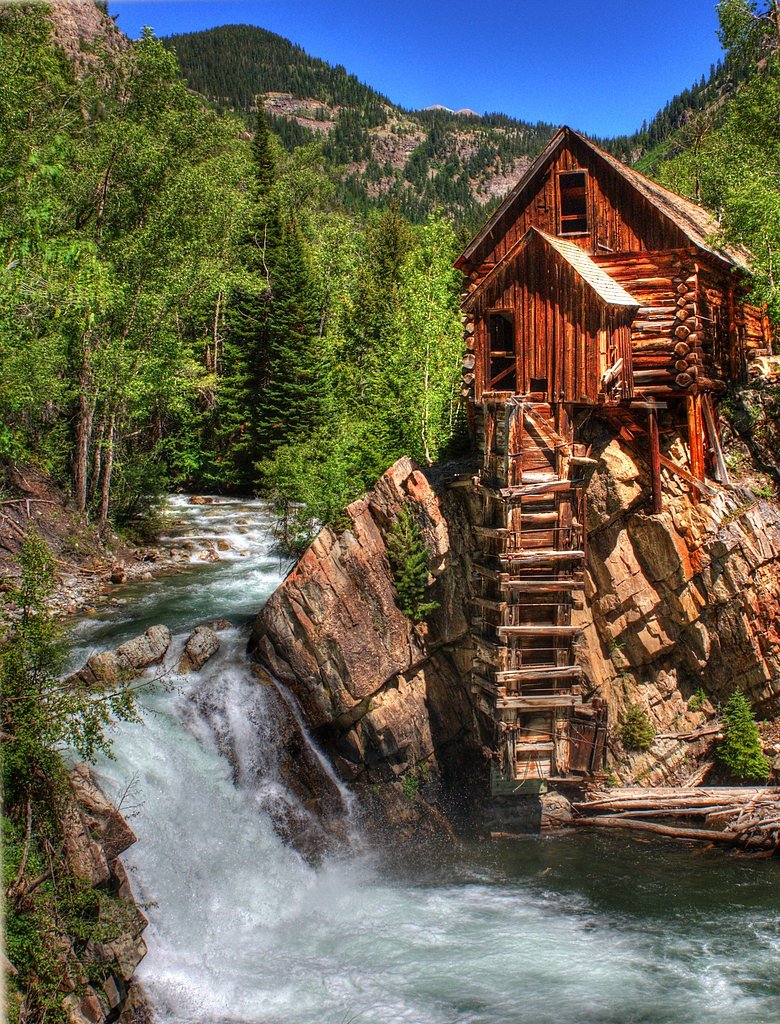
About Venable Falls
Venable Falls is a picturesque waterfall located in the Sangre de Cristo Mountains of Colorado. It is part of the Venable Creek Trail, which offers stunning views of alpine scenery, wildflowers, and rugged terrain.
The Setting
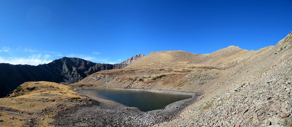
Venable Falls sits at 10,486 feet within San Isabel National Forest, in the high alpine of Colorado.
Trail & Hike Details
The Approach
The moderate hike follows Venable (#1347), a 2.4-mile out-and-back trail over natural surface. Expect 350 feet of elevation gain. The trail is developed (Class 3).
USFS Trail
VENABLE #1347
Trail Class
Developed
Surface
USFS Segment
4.52 miTrail Description
The trail to Venable Falls follows Venable Creek and features a mix of forested areas, open meadows, and rocky terrain. The waterfall is located along the trail, and hikers can enjoy views of cascading water surrounded by alpine scenery.
What to Expect
Dogs are welcome.
Accessibility
The trail is not wheelchair accessible. Uneven terrain and elevation changes require steady footing.
Frequently Asked Questions
🐶 Are Dogs Allowed at Venable Falls?
✅ Dogs are allowed
Are There Any Fees or Permits Required?
🆖 No fees required
🏊 Is There Swimming at Venable Falls?
❌ Swimming is not allowed
When to Visit
The best time to visit Venable Falls is late spring through early fall, when the trail is free of snow and the waterfall is flowing at its peak.
Seasonal Access
The best time to visit is Spring, Summer, and Fall. Access roads and trails may close during winter due to snow. Check with San Isabel National Forest for seasonal road closures.
Safety Information
Be prepared for changing weather conditions and carry layers. Watch for loose rocks on the trail, and be cautious near the waterfall as the rocks can be slippery. Always let someone know your hiking plans.
Know when to go.
Get a free email alert when waterfalls near Crestone hit peak flow. We only send when conditions are worth the trip — no weekly newsletters, no spam.
Weather Forecast
Location & Access
Getting There
Venable Falls is accessed via the Venable Creek Trailhead, located near Westcliffe, Colorado. The trailhead can be reached by driving along County Road 140 and then taking a dirt road to the parking area. A high-clearance vehicle may be recommended depending on road conditions.
Get Directions on Google MapsParking
Parking is available at the Venable Creek Trailhead. The lot may fill up during peak hiking seasons, so arriving early is advised.
Elevation
10,486 feet above sea level
Coordinates
38.075555° N, -105.595840° W
Land Management
Managed by USFS
Visitor Tips & Gear
Wear sturdy hiking boots and bring plenty of water, as the trail can be rocky and uneven in places. Check the weather forecast before heading out, as conditions in the mountains can change rapidly. Arrive early to secure parking and avoid crowds.
This trail sits at 10,486 ft — roughly 30% less oxygen than sea level
Extreme AltitudeAt this elevation, altitude sickness is a real concern. Monitor how you feel, take frequent rest breaks, and descend if symptoms worsen. Visitors arriving from lower elevations should allow time to acclimatize.
As an Amazon Associate, we earn from qualifying purchases.

Coppertone Sport SPF 50 Sunscreen
UV intensity jumps ~4% per 1,000 ft — at this elevation you can burn in half the time.

Sun Bum SPF 30 Lip Balm (3-Pack)
Lips have almost no natural UV protection and burn fast in thin, dry mountain air.

Liquid I.V. Electrolyte Packets
You lose moisture ~2x faster at elevation — electrolytes help you absorb water efficiently.

ROCKNIGHT Polarized UV400 Sunglasses
High-altitude glare off rock and water is intense — UV400 lenses block 99%+ of UVA/UVB.

Boost Oxygen 10L Canister (2-Pack)
Portable supplemental oxygen for quick relief from headaches and shortness of breath.

Altitude Rx OxyBoost Complex
Antioxidant formula designed to support your body's natural altitude acclimation.

Fingertip Pulse Oximeter
Monitor blood oxygen in real time — SpO2 commonly drops to 85–90% above 10,000 ft.
As an Amazon Associate, we earn from qualifying purchases.
With 2.4 miles and 350 ft of elevation gain, sturdy boots and trekking poles will help on this moderate trail. Sun exposure on the trail makes good sun protection a must in summer.

Polarized Sunglasses (Knockaround)
Cuts glare off the water so you actually see the falls — and your photos turn out better too.

Columbia Watertight II Rain Jacket
Packs into its own pocket, seam-sealed, and keeps you dry from spray and surprise rain.

Earth Pak Waterproof Dry Bag
Keeps your phone and gear dry when waterfall mist soaks everything else.

Waterproof Phone Pouch (AiRunTech)
Cheap insurance — take photos right next to the falls without killing your phone.

Timberland Euro Sprint Mid Waterproof
Trusted waterproof boot with premium leather and grippy rubber sole — reliable on rocky, wet trails.

TrailBuddy Trekking Poles
Lightweight aluminum, cork grips, and flip-locks that actually hold — a best-seller for good reason.
Where to Stay

Hillside Colorado Cottages

Crestone Adobe Vista Manor

High Mountain Desert Earthship with Stunning Views

Cozy Remote Retreat • Mountain Views • Stargazing
Browse vacation cabins and private rentals nearby
Unique outdoor stays — tents, yurts, and treehouses
Rent a campervan or RV for your waterfall road trip
Some links are affiliate links. We may earn a commission at no extra cost to you.
Nearby Campground
ALVARADO CAMPGROUND
1.8 miles away · 51 sites
Overview Alvarado Campground, located at an elevation of 9,000 ft., is a prime location for accessing easy to challenging hikes in the Sangre de Cristo Wilderness. The variety of trails lead to high elevation lakes, picturesque waterfalls, and a number of stunning scenic overlooks. Alvarado is designed for a range of campers, with facilities for tent, RV and equestrian campers. Pike-San Isabel National Forests include over a million acres of wilderness and over half of Colorado's mountain peaks t
Book on Recreation.govNearby Hot Springs
Hot springs near Crestone, Colorado

Valley View Hot Springs
Valley View Hot Springs flows at 99 degrees Fahrenheit from the eastern slopes of the Sangre de Cristo Range at 8,850 feet elev...

Mineral Hot Springs
Mineral Hot Springs emerges at 140°F in Saguache County at 7,744 feet elevation in the northern San Luis Valley, where thermal ...
Sand Dunes Pool
Sand Dunes Pool sits at 7,539 feet in Colorado's San Luis Valley, just eight meters from a gravel road. At this remote, high-el...

Canon City Hot Springs
Canon City Hot Springs emerges at an impressive 104 degrees Fahrenheit near Canon City in Fremont County, just 31 meters from R...
Swissvale Warm Springs
Swissvale Warm Springs reaches 82 degrees Fahrenheit along Swissvale Road near Salida, providing easy roadside access at just 1...
Wellsville Warm Spring
Wellsville Warm Spring emerges at 91 degrees Fahrenheit in Chaffee County near Salida at 6,861 feet elevation in the Arkansas R...
Looking for a soak after your hike? Explore more hot springs near Crestone, Colorado on SoakingSprings.
Explore Colorado springsAdditional Information
Nearby Attractions
Nearby attractions include the Comanche-Venable Loop Trail, which offers stunning views of the Sangre de Cristo Mountains, and the town of Westcliffe, known for its dark-sky stargazing opportunities.
Wildlife
The area is home to a variety of wildlife, including deer, elk, marmots, and birds. Be cautious of bears and mountain lions, and store food properly.
Cities near Venable Falls
Nearby Waterfalls
Writing about Venable Falls? Embed this waterfall on your site for free.