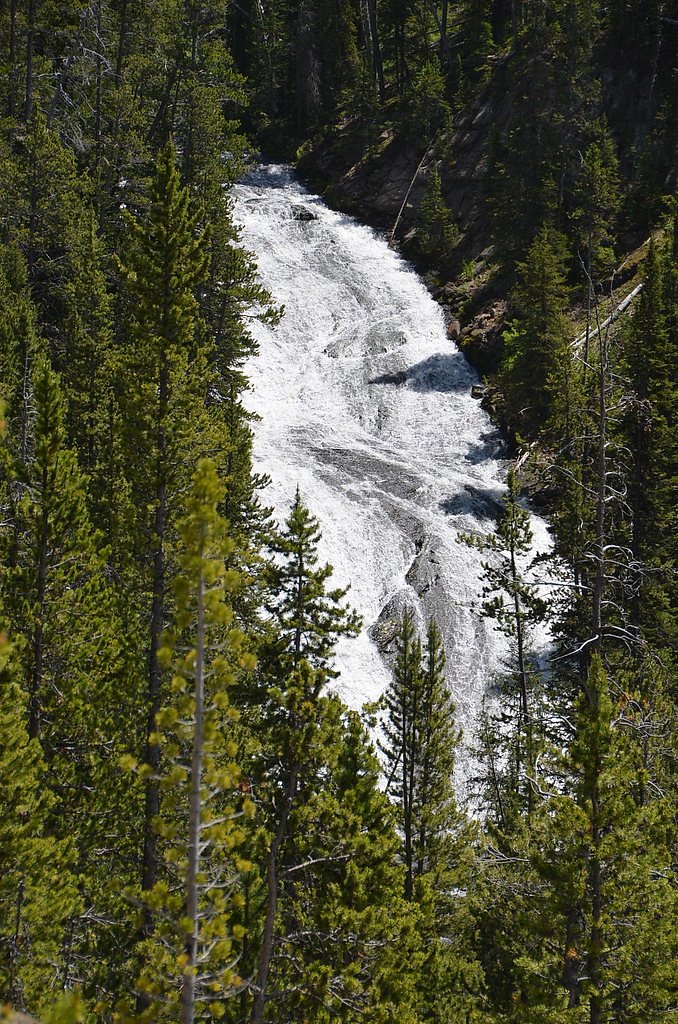
Upper Falls of the Yellowstone River
Wyoming • 109 ft
By Armen Suny · Last verified Mar 2026
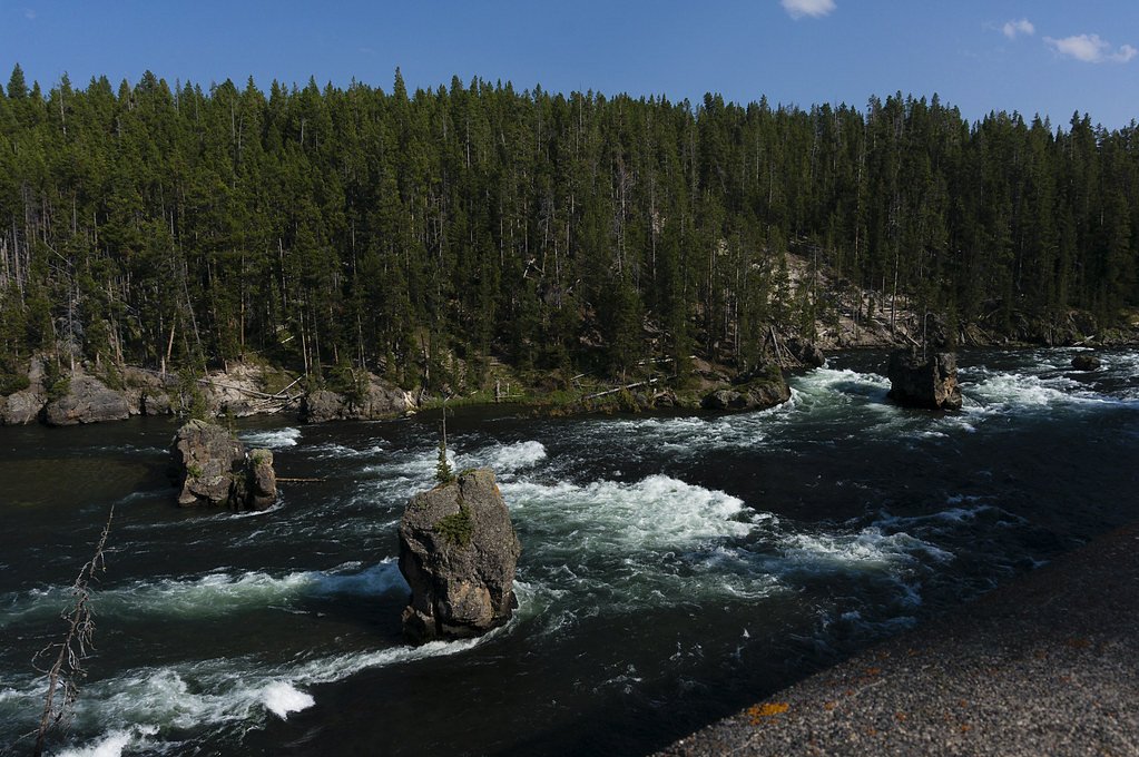
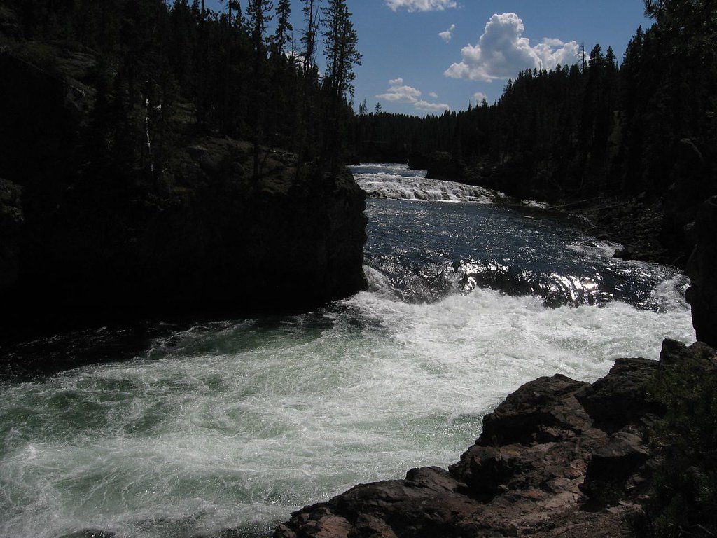
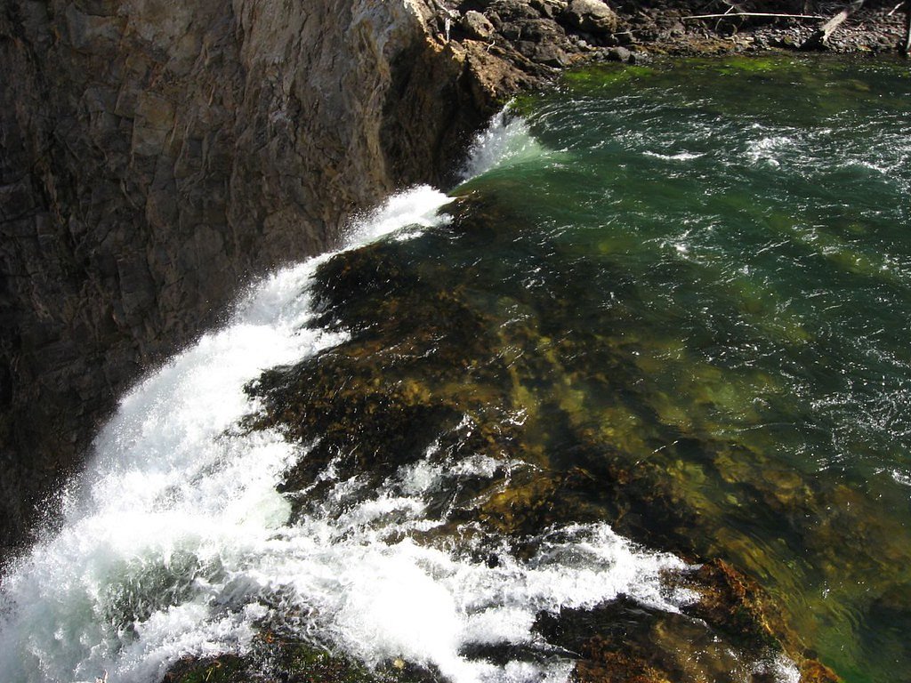
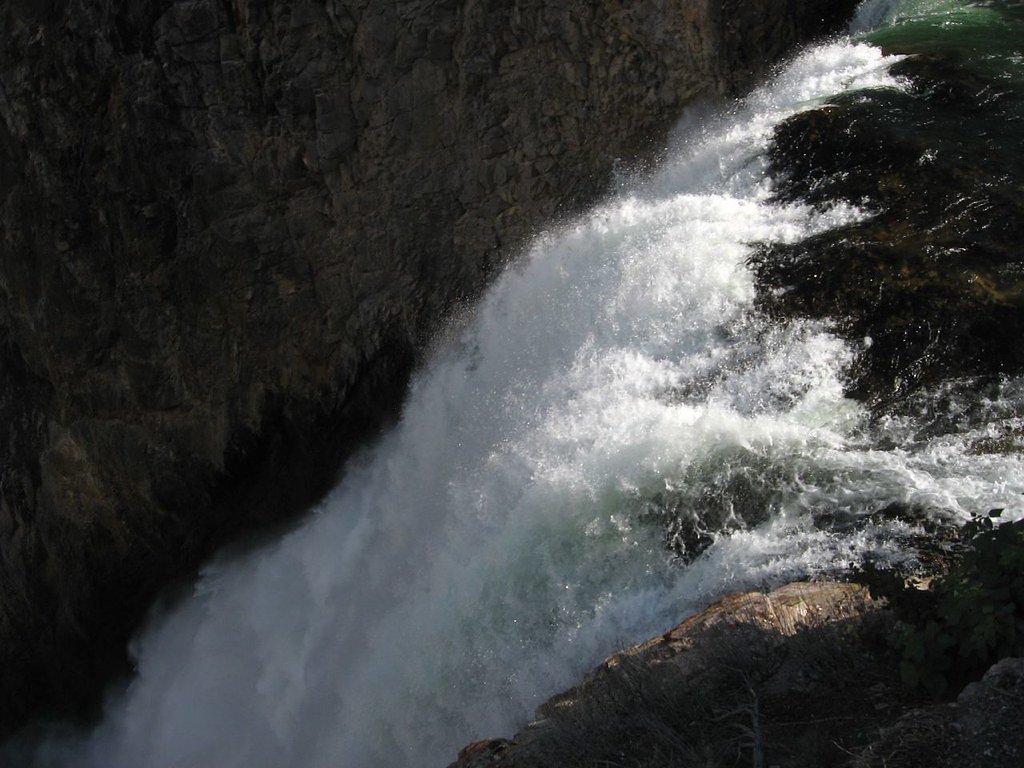

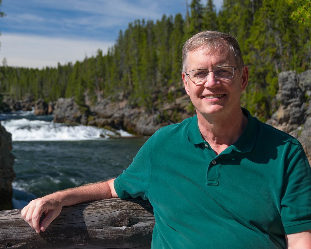
Photo Credits (5)
Difficulty
Easy
Trail Length
0.4 miles
Trail Type
Out And Back
Elevation Gain
100 ft
About Upper Falls of the Yellowstone River
The Upper Falls of the Yellowstone River is a stunning 109-foot waterfall located in Yellowstone National Park, Wyoming. It is one of the park's most iconic waterfalls, offering breathtaking views and showcasing the power of the Yellowstone River as it cascades through the canyon.
The Setting
Upper Falls of the Yellowstone River sits at 7,618 feet within Yellowstone National Park, fed by the Tantalus Creek, in the high mountains of Wyoming. At 109 feet, it is among the taller waterfalls in Wyoming.
Height: 109 feet
Nearby Falls Worth Visiting
Lower Falls of the Yellowstone River (308 ft) lies 0.4 miles to the northeast.
Trail & Hike Details
The Approach
The easy 0.4-mile out-and-back trail gains 100 feet of elevation on the way to the falls.
Trail Description
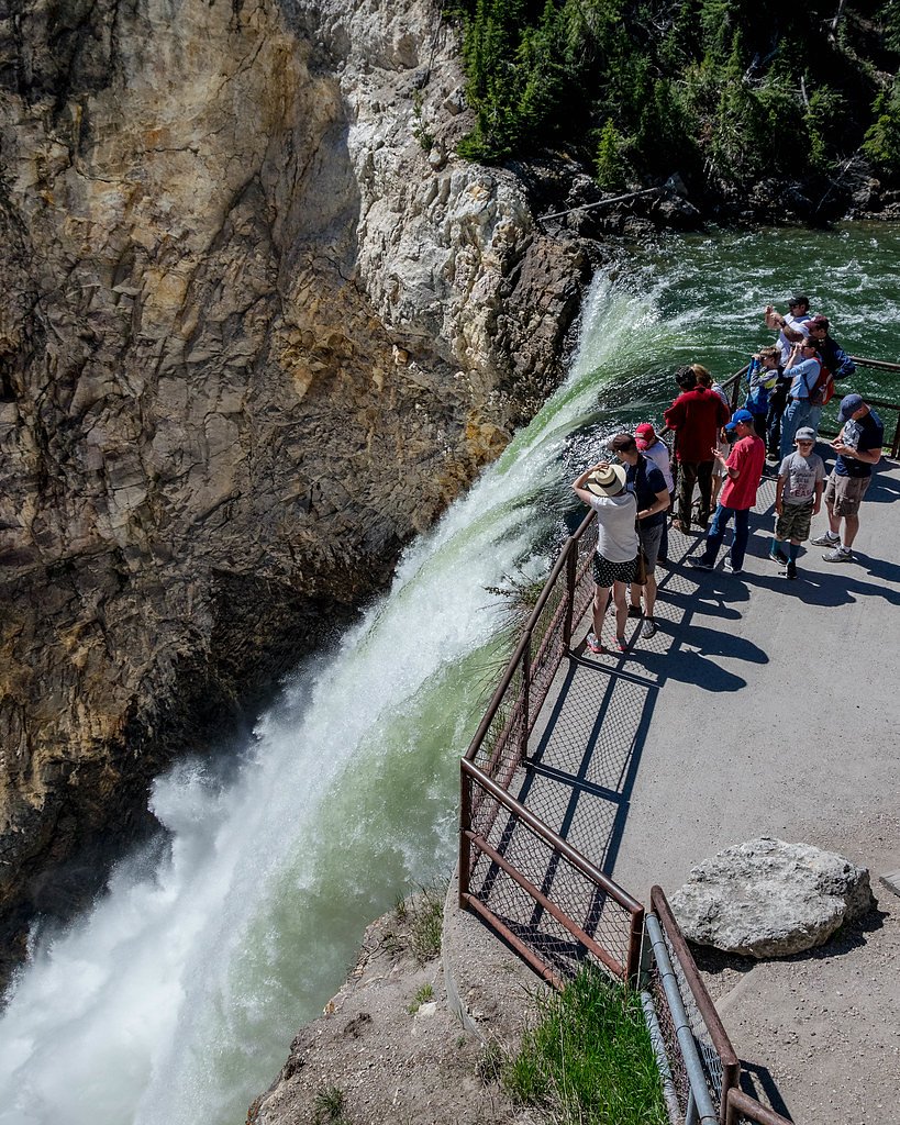
The trails to the Upper Falls viewpoints are short and well-maintained, making them accessible to most visitors. The Brink of the Upper Falls trail provides a closer view of the waterfall, while other viewpoints along the South and North Rim Drives offer panoramic perspectives.
What to Expect
The falls cascade 109 feet.
Accessibility
The trail is short and relatively flat, but the surface may be uneven. Contact the managing agency for accessibility details.
Frequently Asked Questions
🐶 Are Dogs Allowed at Upper Falls of the Yellowstone River?
❌ Dogs are not allowed
Are There Any Fees or Permits Required?
🤑 Fee: $35.00
🏊 Is There Swimming at Upper Falls of the Yellowstone River?
❌ Swimming is not allowed
When to Visit
The best time to visit is during late spring through early fall when the trails are clear, and the water flow is at its peak. Winter visits may be possible but could require additional preparation due to snow and ice.
Seasonal Access
The best time to visit is Spring, Summer, and Fall. Access roads and trails may close during winter due to snow. Check the National Park Service website for current conditions.
Safety Information
Stay on designated trails and behind safety barriers at all times. The canyon walls are steep and unstable in some areas. Be cautious of slippery surfaces, especially near the water. Weather can change rapidly, so be prepared for sudden rain or temperature drops.
Current Water Conditions
3 ft³/s
Current discharge — how much water is flowing
About average for this time of year
Based on 21 years of record
1.45 ft
Water depth at gauge
76°F
ComfortablePleasant for swimming
7-Day Discharge Trend
What does this mean for your visit?
Flow is about average for this time of year. The water is a comfortable 76 degrees F, pleasant for swimming.
About This Gauge
This gauge is on a nearby waterway and may not reflect exact conditions at the falls.
7-Day Flow Outlook
Based on the USGS gauge Tantalus Creek at Norris Junction, YNP (17 km away).
Today
Moderate
3 cfs
6/10Tomorrow
Moderate
4 cfs
6/10Fri
Moderate
3 cfs
6/10Sat
Moderate
4 cfs
6/10Sun
Moderate
3 cfs
6/10Mon
Moderate
3 cfs
6/10Tue
Moderate
3 cfs
8/10Best window: Tue — moderate flow, mostly sunny (trip score 8/10).
Best time of year: this gauge typically runs highest from late December to late January, peaking in May.
How we calculate this
This is a transparent outlook, not a precise forecast. We take the waterfall's current flow strength (how it ranks against its historical normal for today, from the nearest USGS stream gauge), carry that ranking forward along the gauge's seasonal curve, and nudge it for forecast rain. Confidence is highest for the next day or two and falls further out. Always check official conditions and your own judgment before visiting — high flows can be dangerous.
Know when to go.
Get a free email alert when waterfalls near Mammoth hit peak flow. We only send when conditions are worth the trip — no weekly newsletters, no spam.
Weather Forecast
Location & Access
Getting There
The Upper Falls is located in the Canyon area of Yellowstone National Park. It can be accessed via the South Rim Drive or North Rim Drive, with several viewpoints available, including Uncle Tom's Trail and the Brink of the Upper Falls.
Get Directions on Google MapsParking
Parking is available at designated lots near the South Rim Drive and North Rim Drive. These lots can fill up quickly during peak seasons, so arriving early is recommended.
Elevation
7,618 feet above sea level
Coordinates
44.712808° N, -110.499847° W
Land Management
Managed by NPS
Visitor Tips & Gear
Arrive early to secure parking, especially during the summer months. Wear sturdy shoes for the short walks to the viewpoints, and bring a camera to capture the stunning scenery. Be prepared for changing weather conditions, as temperatures can vary significantly throughout the day.
This trail sits at 7,618 ft above sea level
Elevated TrailUV radiation is roughly 30% stronger at this elevation than at sea level, and the dry air accelerates dehydration. Extra sun protection and fluids go a long way.
As an Amazon Associate, we earn from qualifying purchases.

Coppertone Sport SPF 50 Sunscreen
UV intensity jumps ~4% per 1,000 ft — at this elevation you can burn in half the time.

Sun Bum SPF 30 Lip Balm (3-Pack)
Lips have almost no natural UV protection and burn fast in thin, dry mountain air.

Liquid I.V. Electrolyte Packets
You lose moisture ~2x faster at elevation — electrolytes help you absorb water efficiently.

ROCKNIGHT Polarized UV400 Sunglasses
High-altitude glare off rock and water is intense — UV400 lenses block 99%+ of UVA/UVB.
As an Amazon Associate, we earn from qualifying purchases.
For this easy 0.4 miles trail, lightweight trail shoes and a water bottle are usually sufficient. Sun exposure on the trail makes good sun protection a must in summer.
America the Beautiful Annual Pass
Covers entrance fees at 2,000+ federal recreation sites — required at most National Parks.

Polarized Sunglasses (Knockaround)
Cuts glare off the water so you actually see the falls — and your photos turn out better too.

Columbia Watertight II Rain Jacket
Packs into its own pocket, seam-sealed, and keeps you dry from spray and surprise rain.

Earth Pak Waterproof Dry Bag
Keeps your phone and gear dry when waterfall mist soaks everything else.

Waterproof Phone Pouch (AiRunTech)
Cheap insurance — take photos right next to the falls without killing your phone.

JOBY GorillaPod Starter Kit
Wraps around railings and rocks for long-exposure waterfall shots — no flat surface needed.

Osprey Daylite Daypack
Light, organized, and just the right size for a day hike — fits water, snacks, and layers.
Where to Stay
Browse vacation cabins and private rentals nearby
Unique outdoor stays — tents, yurts, and treehouses
Rent a campervan or RV for your waterfall road trip
Some links are affiliate links. We may earn a commission at no extra cost to you.
Nearby Campground
Lake Yellowstone Hotel and Cabins
12.2 miles away · 0 sites
The Lake Yellowstone Hotel & Cabins, built in 1891 and a member of Historic Hotels of America® since 2012 was designated a National Historic Landmark in 2015. Historic Hotels of America is the official program of the National Trust for Historic Preservation® for recognizing and celebrating the finest historic hotels across America. Lake Yellowstone Hotel was completed in 1891 as part of a series of hotels to accomodate visitors to Yellowstone National Park. Hotel guestrooms capture the historic a
Book on Recreation.govNearby Hot Springs
Hot springs near Mammoth, Wyoming

Unnamed Spring Gallatin County 6
This unnamed thermal feature emerges at 167°F in Yellowstone National Park at 7,805 feet elevation, creating very hot discharge...
Hot Springs
This hot spring emerges at 7,742 feet elevation along Yellowstone's South Rim Drive, requiring a 0.8-mile walk from the road. T...
Warm Spring
Warm Spring flows at a genuinely warm rather than hot temperature within Yellowstone National Park, located 1,355 meters from S...
Forest Springs
Forest Springs occupies high-elevation terrain at 7,740 feet within Yellowstone's backcountry, designated 'H' for hot but unmea...
Gas Vents
This roadside thermal feature emerges just 175 feet from Norris-Canyon Road at 8,020 feet elevation, producing acidic waters at...

Sulphur Springs
Sulphur Spring, also known as Crater Hills Geyser, reaches 194°F in Yellowstone's Hayden Valley at 7,805 feet elevation, requir...
Looking for a soak after your hike? Explore more hot springs near Mammoth, Wyoming on SoakingSprings.
Explore Wyoming springsAdditional Information
Nearby Attractions
Nearby attractions include the Lower Falls of the Yellowstone River, Artist Point, and the Grand Canyon of the Yellowstone.
Wildlife
Visitors may encounter wildlife such as bison, elk, and various bird species. Always maintain a safe distance from wildlife and follow park guidelines.
Cities near Upper Falls of the Yellowstone River
Nearby Waterfalls
Writing about Upper Falls of the Yellowstone River? Embed this waterfall on your site for free.