
Photo Credits (2)
Difficulty
Moderate
Trail Length
2.4 miles
Trail Type
Out And Back
Elevation Gain
350 ft
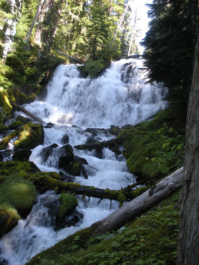
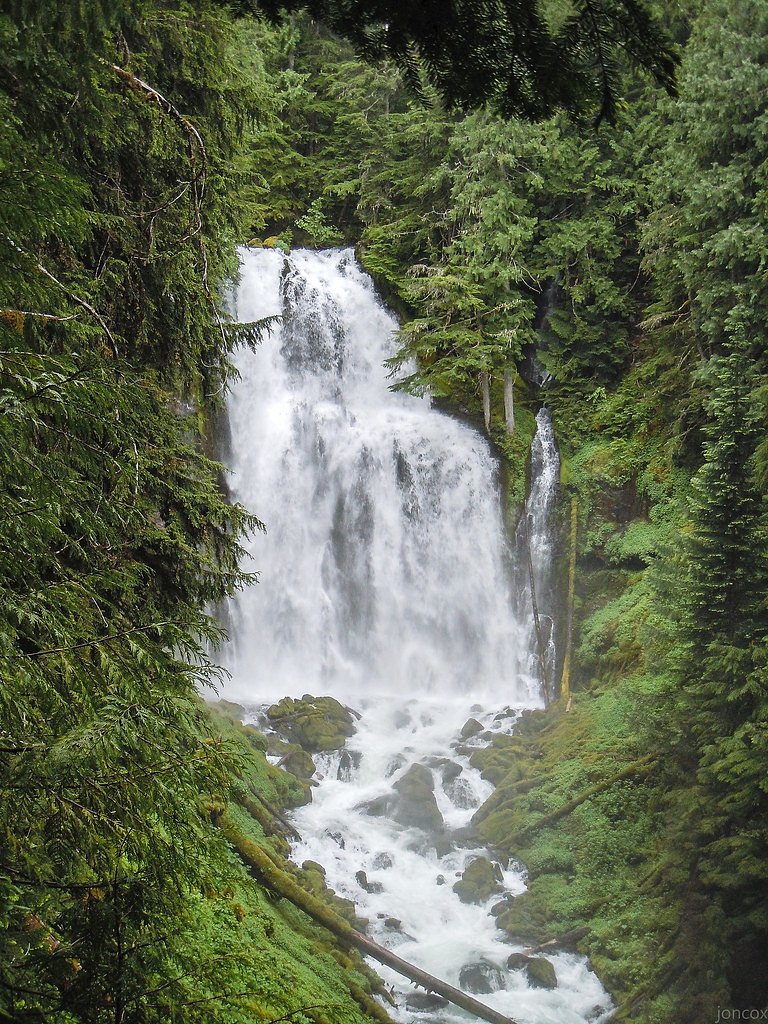
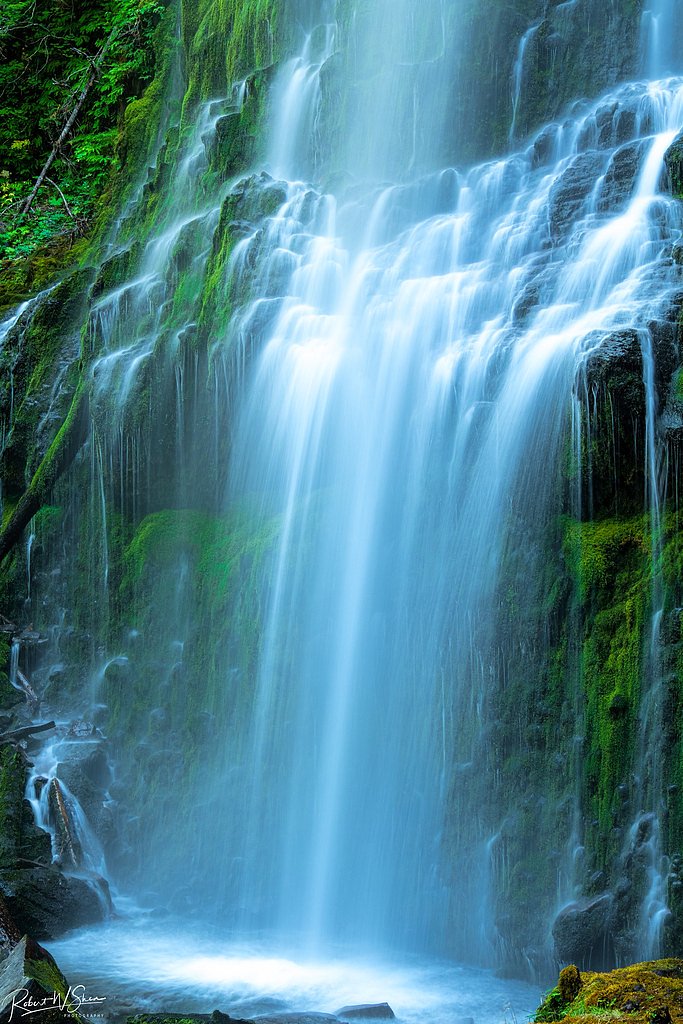
About Indian Hole Falls
Indian Hole Falls is a tucked-away cascade set within the Willamette National Forest and managed by the U.S. Forest Service. The falls sit amid dense Pacific Northwest forest, offering a quiet, photogenic stop for hikers who prefer less-crowded routes. Approaches generally use the Buck Meadows route—USFS Trail #3521—which threads through native-forested slopes and provides a pleasant mix of shade and fern-carpeted understory. The hike to the falls is a moderate out-and-back outing: about 2.4 miles total with roughly 350 feet of elevation gain, making it accessible to most day hikers who are comfortable with some uphill walking. The setting rewards those who make the short effort with a peaceful cascade and a strong sense of solitude. While there isn’t a developed campground immediately adjacent to the falls, the nearest developed site is Alder Springs Campground, approximately 10.3 km away.
The Setting
Indian Hole Falls sits at 4,797 feet within Willamette National Forest, fed by the M F Tumalo Creek Abv Prowell Springs,, in the mountains of Oregon.
Trail & Hike Details
The Approach
The moderate hike follows Buck Meadows (#3521), a 2.4-mile out-and-back trail over natural surface. Expect 350 feet of elevation gain with grades of 12-20%. The trail is developed (Class 3).
USFS Trail
BUCK MEADOWS #3521
Trail Class
Developed
Surface
Avg Grade
USFS Segment
0.99 miTrail Description
Trail: Buck Meadows (USFS Trail #3521). Route type: out-and-back, total distance 2.4 miles with about 350 ft elevation gain; difficulty: moderate. The Buck Meadows segment is mapped at roughly 0.99 GIS miles on Forest Service data and is the primary approach to the falls. Trail surface is native material and the route is classified by the USFS as Class 3, with a typical grade in the 12–20% range. Expect singletrack through forest with some root and rock sections and short steep pitches; sturdy footwear and basic trail skills are recommended. The native surface and grade can make the tread slick in wet conditions, so plan accordingly.
What to Expect
Visitors can expect a tranquil waterfall surrounded by natural beauty. The area may be less crowded compared to more popular waterfalls in Oregon, offering a peaceful experience.
Accessibility
The trail is not wheelchair accessible. Uneven terrain and elevation changes require steady footing.
Frequently Asked Questions
🐶 Are Dogs Allowed at Indian Hole Falls?
❌ Dogs are not allowed
Are There Any Fees or Permits Required?
🆖 No fees required
🏊 Is There Swimming at Indian Hole Falls?
❌ Swimming is not allowed
When to Visit
Spring and early summer are ideal times to visit, as the waterfall is likely to have higher flow due to snowmelt and rainfall.
Seasonal Access
The best time to visit is Spring, Summer, and Fall. Winter access may be limited. Check with Willamette National Forest for seasonal road closures.
Safety Information
The trail may be uneven or slippery, especially after rain. Visitors should exercise caution and avoid getting too close to the edge of the waterfall. Cell service may be limited in the area.
Current Water Conditions
8 ft³/s
Current discharge — how much water is flowing
About average for this time of year
Based on 8 years of record
4.87 ft
Water depth at gauge
50°F
WarmVery comfortable
7-Day Discharge Trend
What does this mean for your visit?
Flow is about average for this time of year. Water temperature is very cold at 50 degrees F, expect numbness within minutes.
About This Gauge
This gauge is on a nearby waterway and may not reflect exact conditions at the falls.
7-Day Flow Outlook
Based on the USGS gauge M F TUMALO CREEK ABV PROWELL SPRINGS, NR BEND, OR (20 km away).
Today
Moderate
7 cfs
5/10Tomorrow
Moderate
8 cfs
5/10Sun
Moderate
8 cfs
5/10Mon
Low
7 cfs
6/10Tue
Low
7 cfs
6/10Wed
Low
7 cfs
6/10Thu
Moderate
7 cfs
5/10Best window: Mon — low flow, partly sunny (trip score 6/10).
How we calculate this
This is a transparent outlook, not a precise forecast. We take the waterfall's current flow strength (how it ranks against its historical normal for today, from the nearest USGS stream gauge), carry that ranking forward along the gauge's seasonal curve, and nudge it for forecast rain. Confidence is highest for the next day or two and falls further out. Always check official conditions and your own judgment before visiting — high flows can be dangerous.
Know when to go.
Get a free email alert when waterfalls near Black Butte Ranch hit peak flow. We only send when conditions are worth the trip — no weekly newsletters, no spam.
Weather Forecast
Location & Access
Getting There
The exact location of Indian Hole Falls is not widely documented. Visitors may need to consult local hiking resources or maps for directions. It is recommended to check with local ranger stations for the most accurate information.
Get Directions on Google MapsParking
Parking availability is unclear. Visitors should prepare for limited or informal parking options near the trailhead.
Elevation
4,797 feet above sea level
Coordinates
44.090951° N, -121.866708° W
Land Management
Managed by USFS
Visitor Tips & Gear
Check local conditions and trail reports before visiting. Bring a map or GPS device as the trail may not be well-marked. Wear sturdy footwear and carry water.
As an Amazon Associate, we earn from qualifying purchases.
With 2.4 miles and 350 ft of elevation gain, sturdy boots and trekking poles will help on this moderate trail. Sun exposure on the trail makes good sun protection a must in summer.

Polarized Sunglasses (Knockaround)
Cuts glare off the water so you actually see the falls — and your photos turn out better too.

Columbia Watertight II Rain Jacket
Packs into its own pocket, seam-sealed, and keeps you dry from spray and surprise rain.

Earth Pak Waterproof Dry Bag
Keeps your phone and gear dry when waterfall mist soaks everything else.

Waterproof Phone Pouch (AiRunTech)
Cheap insurance — take photos right next to the falls without killing your phone.

Timberland Euro Sprint Mid Waterproof
Trusted waterproof boot with premium leather and grippy rubber sole — reliable on rocky, wet trails.

TrailBuddy Trekking Poles
Lightweight aluminum, cork grips, and flip-locks that actually hold — a best-seller for good reason.
Where to Stay

Cabin with Private Hot Tub Near the Deschutes River - Free SHARC access

Paper Birch - Unit 10

Rager Mountain - Unit 10

2 Tennis Village..
Browse vacation cabins and private rentals nearby
Unique outdoor stays — tents, yurts, and treehouses
Rent a campervan or RV for your waterfall road trip
Some links are affiliate links. We may earn a commission at no extra cost to you.
Nearby Campground
Alder Springs Campground
6.4 miles away · 0 sites
This small, rustic site is right on the side of the historic McKenzie Pass Highway. Surrounded by towering Douglas fir trees, this is a perfect spot to be on a warm day.Access to Linton Lake Trailhead in the Three Sisters Wilderness is immediately across the highway from the campground.
Book on Recreation.govNearby Hot Springs
Hot springs near Black Butte Ranch, Oregon
Belknap Springs
Belknap Springs flows at 160°F along the McKenzie River in the Cascade Range, emerging just 510 feet from North Belknap Springs...
Foley Springs
Foley Springs emerges at 178°F in the Cascade Range of Lane County, making it one of Oregon's hottest thermal features with rec...

Bigelow Hot Springs
Bigelow Hot Springs, also called Deer Creek Hot Springs, emerges at 142°F just 400 feet from Deer Creek Road in the Willamette ...

Cougar Reservoir Hot Springs
Cougar Reservoir Hot Springs, widely known as Terwilliger Hot Springs, flows at 111 degrees Fahrenheit with roadside access req...
Wall Creek Warm Springs
Wall Creek Warm Springs flows at 106°F deep within Willamette National Forest at 2,362 feet elevation on the western Cascades s...

Mccredie Springs
McCredie Springs flows at 163°F along Salt Creek in the Willamette National Forest, creating one of western Oregon's most popul...
Looking for a soak after your hike? Explore more hot springs near Black Butte Ranch, Oregon on SoakingSprings.
Explore Oregon springsAdditional Information
Nearby Attractions
Other waterfalls and hiking trails in the region may be worth exploring. Check local guides for recommendations.
Wildlife
The area may be home to various wildlife, including birds and small mammals. Be cautious and respect the natural habitat.
Cities near Indian Hole Falls
Nearby Waterfalls
Writing about Indian Hole Falls? Embed this waterfall on your site for free.