
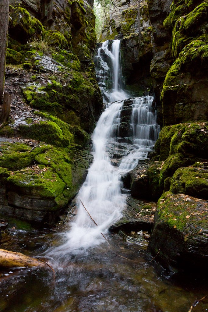
Photo Credits (5)
Difficulty
Moderate
Trail Length
1.5 miles
Trail Type
Out And Back
Elevation Gain
300 ft
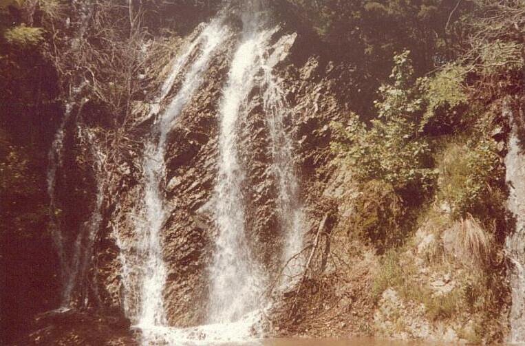
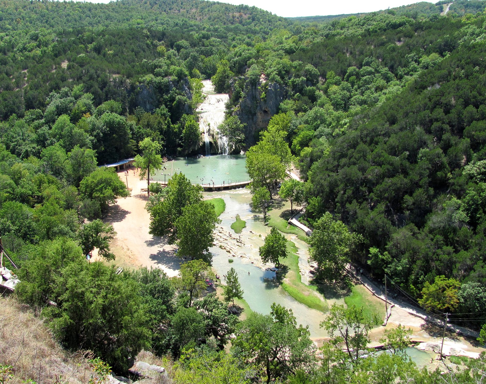
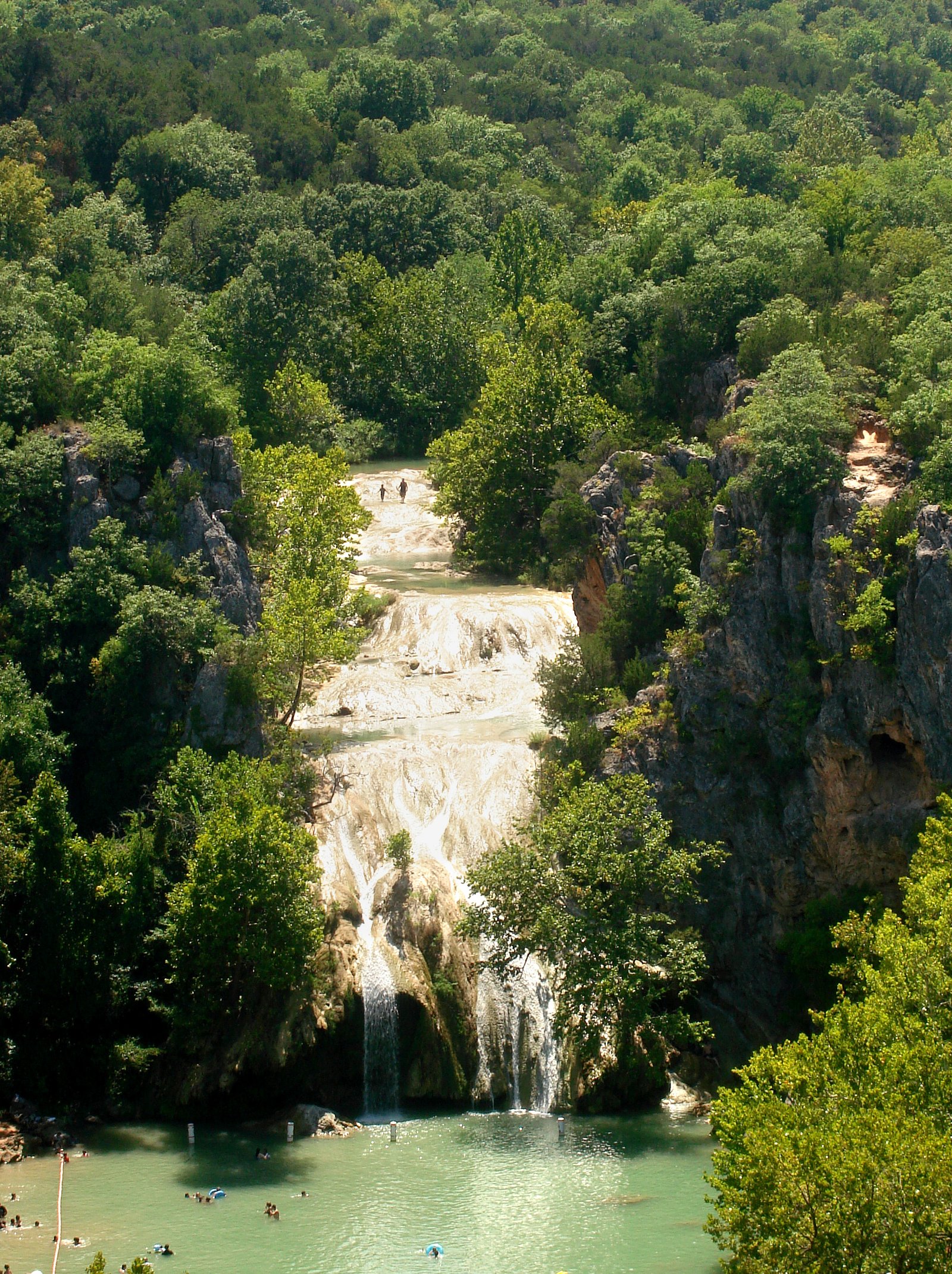
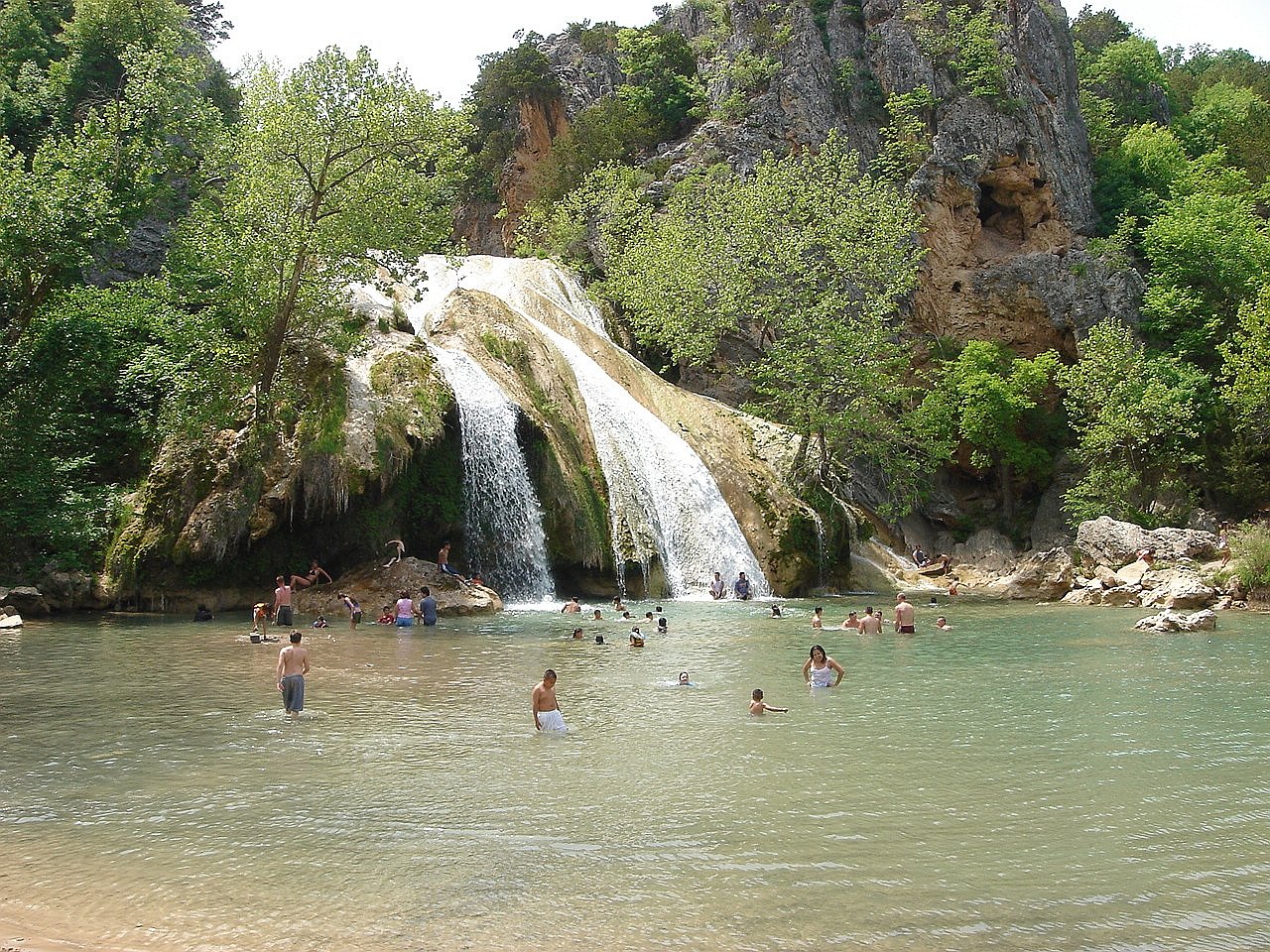
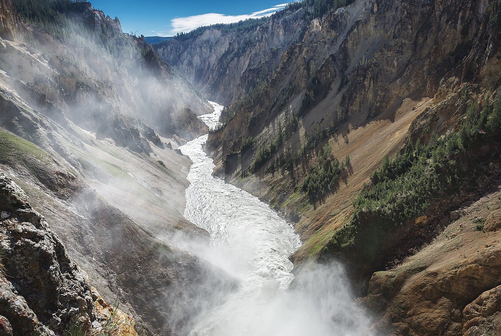
About Turner Falls
Turner Falls is a scenic waterfall located on U.S. Forest Service land within Montana’s Kootenai National Forest. The falls offer a peaceful, woodsy escape framed by the surrounding national forest — an accessible reward after a short hike on a maintained USFS trail. Managed by the USFS, the site makes for an inviting half-day outing for hikers who want a close-to-nature stop without a long backcountry commitment. Access to the falls is via the USFS Turner Creek Trail (Trail #161), a short, moderately paced route that threads through native forest surfaces and climbs steadily toward the water. The setting is ideal for photographers and hikers looking for a compact walk with a clear destination rather than an extended trek.
The Setting
Turner Falls sits at 3,576 feet within Kootenai National Forest, fed by the Tobacco River, in the mountains of Montana.
Nearby Falls Worth Visiting
Lower Falls (308 ft) lies 6.5 miles to the northwest. Also nearby: Upper Falls (109 ft, 7.6 mi).
Trail & Hike Details
The Approach
The moderate hike follows Turner Creek (#161), a 1.5-mile out-and-back trail over natural surface. Expect 300 feet of elevation gain with grades of 12-20%. The trail is moderately developed (Class 2).
USFS Trail
TURNER CREEK #161
Trail Class
Moderately Developed
Surface
Avg Grade
USFS Segment
0.71 miTrail Description
Turner Creek (Trail #161) — managed by the U.S. Forest Service — is an out-and-back route of approximately 1.5 miles round-trip (GIS one-way 0.71 miles) with about 300 feet of elevation gain. The trail is rated Moderate and classified as Class 2; the surface is native material and the typical grade ranges from 12–20%. Expect a fairly short but steady climb on natural tread; the route is best suited to hikers comfortable on native-surface trails with modest uphill sections.
What to Expect
Dogs are welcome.
Accessibility
The trail is not wheelchair accessible. Uneven terrain and elevation changes require steady footing.
Frequently Asked Questions
🐶 Are Dogs Allowed at Turner Falls?
✅ Dogs are allowed
Are There Any Fees or Permits Required?
🆖 No fees required
🏊 Is There Swimming at Turner Falls?
❌ Swimming is not allowed
When to Visit
Spring and early summer are ideal for visiting Turner Falls, as the water flow is typically strongest during this time. Fall offers beautiful foliage, while summer provides warmer weather for hiking.
Seasonal Access
The best time to visit is Spring, Summer, and Fall. Winter access may be limited. Check with Kootenai National Forest for seasonal road closures.
Safety Information
Be cautious of slippery rocks near the waterfall. Carry bear spray and make noise while hiking to avoid surprising wildlife. Check trail conditions before visiting, especially after heavy rain or snow.
Current Water Conditions
Based on a USGS gauge 23.9 miles away
358 ft³/s
Current discharge — how much water is flowing
About average for this time of year
Based on 10 years of record
3.34 ft
Water depth at gauge
7-Day Discharge Trend
What does this mean for your visit?
Flow is about average for this time of year.
About This Gauge
This gauge is on a regional waterway. Conditions at the falls may differ, especially after local rain.
7-Day Flow Outlook
Based on the USGS gauge Tobacco River at Eureka, MT (38 km away).
Today
Moderate
408 cfs
4/10Tomorrow
Moderate
412 cfs
4/10Tue
Moderate
382 cfs
5/10Wed
Moderate
344 cfs
5/10Thu
Low
304 cfs
6/10Fri
Low
286 cfs
6/10Sat
Low
277 cfs
6/10Best window: Thu — low flow, mostly sunny (trip score 6/10).
Best time of year: this gauge typically runs highest from early April to early July, peaking in May.
How we calculate this
This is a transparent outlook, not a precise forecast. We take the waterfall's current flow strength (how it ranks against its historical normal for today, from the nearest USGS stream gauge), carry that ranking forward along the gauge's seasonal curve, and nudge it for forecast rain. Confidence is highest for the next day or two and falls further out. Always check official conditions and your own judgment before visiting — high flows can be dangerous.
Know when to go.
Get a free email alert when waterfalls near Yaak hit peak flow. We only send when conditions are worth the trip — no weekly newsletters, no spam.
Weather Forecast
Location & Access
Getting There
Turner Falls is located in the Lewis and Clark National Forest, near the town of Neihart, Montana. Access is typically via Forest Service roads, which may require a high-clearance vehicle depending on conditions.
Get Directions on Google MapsParking
Parking is available near the trailhead, but spaces may be limited during peak seasons.
Elevation
3,576 feet above sea level
Coordinates
48.868845° N, -115.580182° W
Land Management
Managed by USFS
Visitor Tips & Gear
Wear sturdy hiking shoes, as the trail can be uneven and slippery. Bring plenty of water and snacks, as there are no facilities nearby. Check weather conditions before your visit, as the trail may be muddy or icy depending on the season.
As an Amazon Associate, we earn from qualifying purchases.
With 1.5 miles and 300 ft of elevation gain, sturdy boots and trekking poles will help on this moderate trail. Sun exposure on the trail makes good sun protection a must in summer.

Polarized Sunglasses (Knockaround)
Cuts glare off the water so you actually see the falls — and your photos turn out better too.

Columbia Watertight II Rain Jacket
Packs into its own pocket, seam-sealed, and keeps you dry from spray and surprise rain.

Earth Pak Waterproof Dry Bag
Keeps your phone and gear dry when waterfall mist soaks everything else.

Waterproof Phone Pouch (AiRunTech)
Cheap insurance — take photos right next to the falls without killing your phone.

Timberland Euro Sprint Mid Waterproof
Trusted waterproof boot with premium leather and grippy rubber sole — reliable on rocky, wet trails.

TrailBuddy Trekking Poles
Lightweight aluminum, cork grips, and flip-locks that actually hold — a best-seller for good reason.
Where to Stay

Eureka Vacation Rental Steps to Creek and Fishing!

Maggies Cabin - Enjoy a Slice of Paradise in Rexford Montana

Waterfront Log Home w/ 95 Acres on Yaak River

Hot Tub & Views: 'Sunset Valley Retreat' in Eureka
Browse vacation cabins and private rentals nearby
Unique outdoor stays — tents, yurts, and treehouses
Rent a campervan or RV for your waterfall road trip
Some links are affiliate links. We may earn a commission at no extra cost to you.
Nearby Campground
Pete Creek Campground
8.9 miles away · 0 sites
The Pete Creek Campground is located northwest of Troy on Yaak Hwy 508. The campground has 13 sites, including one host site, with tables and fire rings. Campground roads and parking spurs are gravel. Amentities include potable water, vault toilets and access to the Yaak River.
Book on Recreation.govAdditional Information
Nearby Attractions
The nearby town of Neihart offers small-town charm, and the Kings Hill Scenic Byway provides stunning views of the Little Belt Mountains.
Wildlife
The area is home to a variety of wildlife, including deer, elk, and birds. Be cautious of bears and carry bear spray if hiking in the area.
Cities near Turner Falls
Nearby Waterfalls

Other waterfalls named Turner Falls
1 other waterfall shares this name across the U.S.
Writing about Turner Falls? Embed this waterfall on your site for free.