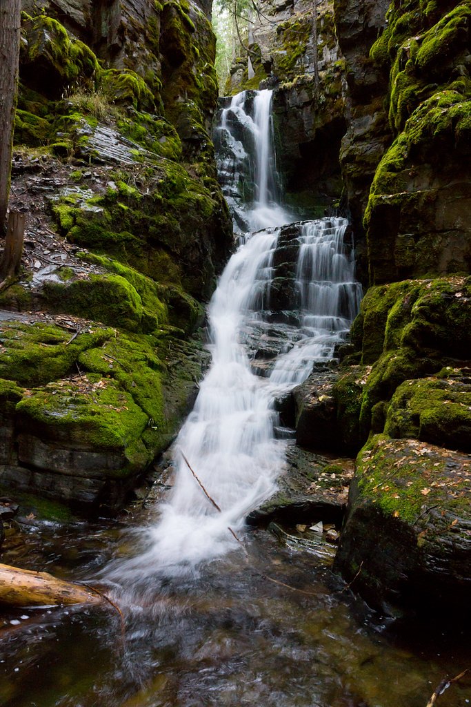
Little North Fork Falls
By Armen Suny · Last verified Mar 2026
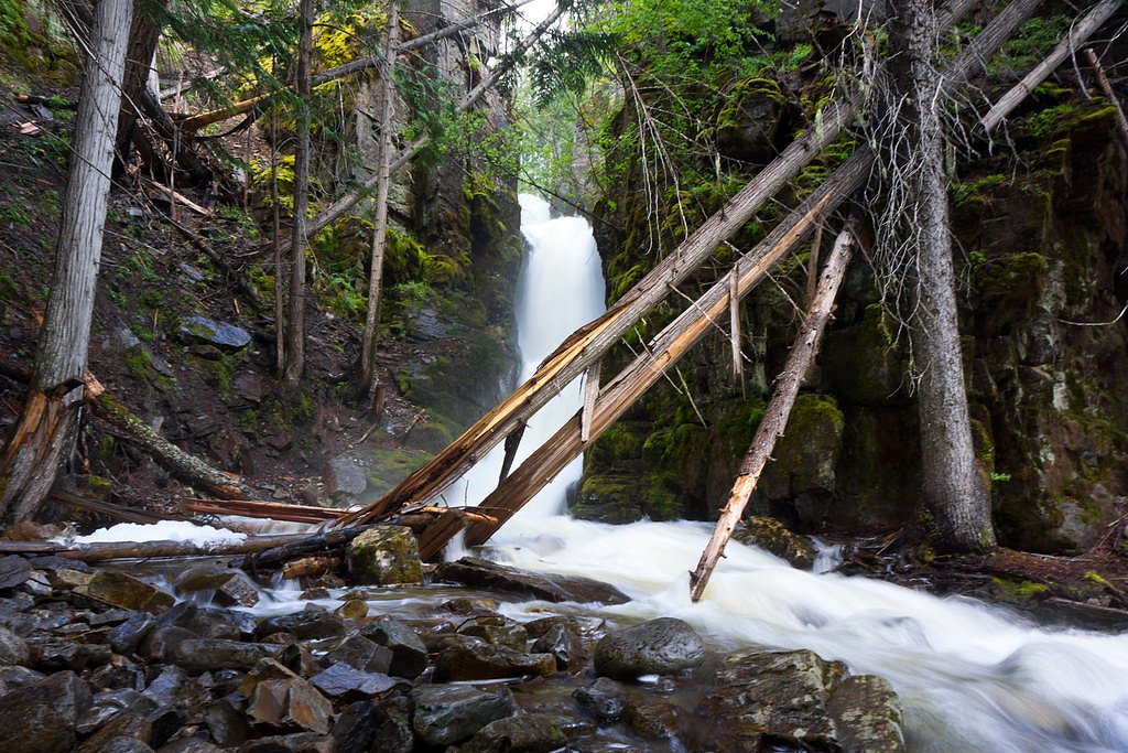
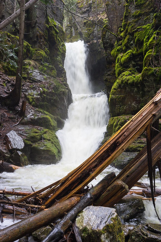
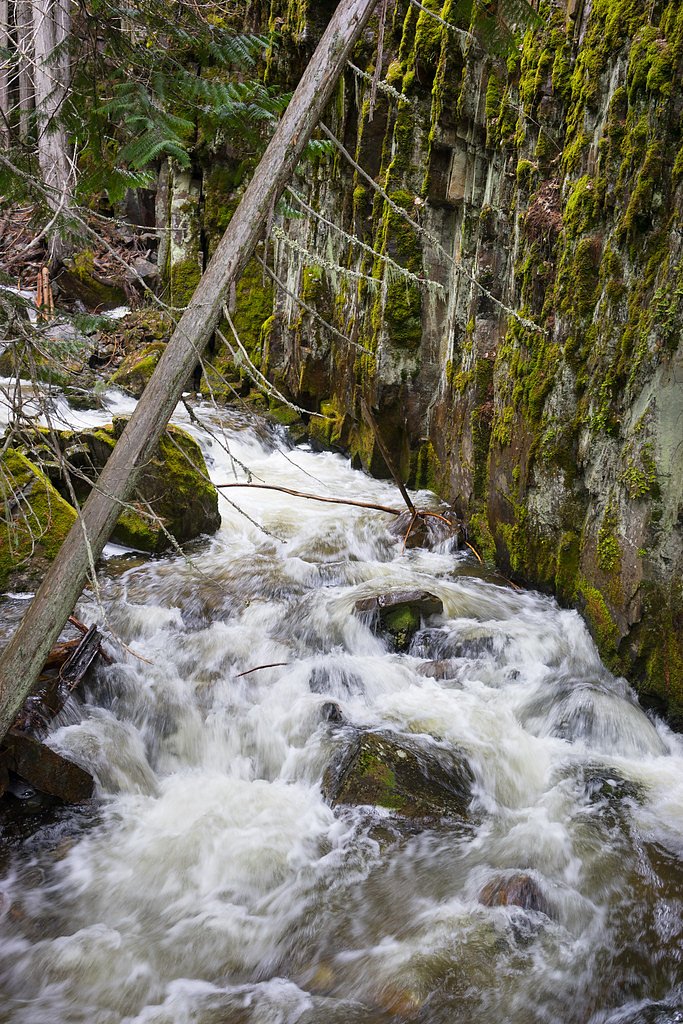
Photo Credits (5)
Difficulty
Moderate
Trail Length
2.0 miles
Trail Type
Out And Back
Elevation Gain
300 ft
About Little North Fork Falls
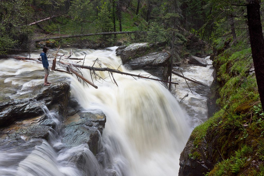
Little North Fork Falls is a compact, scenic cascade tucked into the forested slopes of Kootenai National Forest in northwest Montana. Managed by the U.S. Forest Service, the falls are reached via the USFS LITTLE NORTH FORK BIG CREEK Trail (Trail #249), and reward hikers with a peaceful streamside setting framed by evergreen canopy and native understory. The walk to the falls is short but satisfying — the typical outing is a roughly 2.0-mile out-and-back with about 300 feet of elevation gain and a moderate difficulty rating, making it a good half-day trip for hikers who enjoy a quieter, less-traveled route.
The Setting
Little North Fork Falls sits at 3,058 feet within Kootenai National Forest, fed by the Tobacco River, in the mountains of Montana.
Trail & Hike Details
The Approach
The moderate hike follows Little North Fork Big Creek (#249), a 2.0-mile out-and-back trail over natural surface. Expect 300 feet of elevation gain with grades of 5-8%. The trail is developed (Class 3).
USFS Trail
LITTLE NORTH FORK BIG CREEK #249
Trail Class
Developed
Surface
Avg Grade
USFS Segment
0.16 miTrail Description
Trail: LITTLE NORTH FORK BIG CREEK (USFS Trail #249). USFS trail data list this route as Class 3 on a native-material surface with a typical grade of 5–8% (USFS GIS miles: 0.16). The commonly used hiking route is an approximately 2.0-mile out-and-back with ~300 ft of elevation gain and a moderate difficulty. Expect native singletrack and natural tread with some uneven and steeper sections; the short distance and manageable grade make it an accessible but real-forest hiking experience. Nearby camping: Webb Mtn. Lookout Rental is about 6.87 km away for those planning an overnight.
What to Expect
Dogs are welcome.
Accessibility
The trail is not wheelchair accessible. Uneven terrain and elevation changes require steady footing.
Frequently Asked Questions
🐶 Are Dogs Allowed at Little North Fork Falls?
✅ Dogs are allowed
Are There Any Fees or Permits Required?
🆖 No fees required
🏊 Is There Swimming at Little North Fork Falls?
❌ Swimming is not allowed
When to Visit
Spring and early summer are ideal for viewing the waterfall at its fullest flow, while fall offers stunning foliage. Late summer may see reduced water flow.
Seasonal Access
The best time to visit is Spring, Summer, and Fall. Winter access may be limited. Check with Kootenai National Forest for seasonal road closures.
Safety Information
Be prepared for changing weather conditions. The trail may be slippery after rain, and wildlife encounters are possible. Carry bear spray and hike in groups if possible.
Current Water Conditions
Based on a USGS gauge 16.7 miles away
363 ft³/s
Current discharge — how much water is flowing
About average for this time of year
Based on 10 years of record
3.35 ft
Water depth at gauge
7-Day Discharge Trend
What does this mean for your visit?
Flow is about average for this time of year.
About This Gauge
This gauge is on a regional waterway. Conditions at the falls may differ, especially after local rain.
7-Day Flow Outlook
Based on the USGS gauge Tobacco River at Eureka, MT (27 km away).
Today
Low
414 cfs
3/10Tomorrow
Moderate
430 cfs
4/10Mon
Moderate
409 cfs
4/10Tue
Moderate
379 cfs
5/10Wed
Low
317 cfs
6/10Thu
Low
290 cfs
6/10Fri
Low
307 cfs
4/10Best window: Wed — low flow, mostly sunny (trip score 6/10).
Best time of year: this gauge typically runs highest from early April to early July, peaking in May.
How we calculate this
This is a transparent outlook, not a precise forecast. We take the waterfall's current flow strength (how it ranks against its historical normal for today, from the nearest USGS stream gauge), carry that ranking forward along the gauge's seasonal curve, and nudge it for forecast rain. Confidence is highest for the next day or two and falls further out. Always check official conditions and your own judgment before visiting — high flows can be dangerous.
Know when to go.
Get a free email alert when waterfalls near Rexford hit peak flow. We only send when conditions are worth the trip — no weekly newsletters, no spam.
Weather Forecast
Location & Access
Getting There
The waterfall is located in a remote area of Montana. Access typically involves driving on forest service roads, which may require a high-clearance vehicle depending on conditions. Specific directions should be verified with local resources or maps.
Get Directions on Google MapsParking
Parking is available near the trailhead, but spaces may be limited. Visitors should plan to arrive early during peak seasons.
Elevation
3,058 feet above sea level
Coordinates
48.759959° N, -115.375730° W
Land Management
Managed by USFS
Visitor Tips & Gear
Wear sturdy hiking shoes and bring plenty of water. Check trail conditions before visiting, especially after heavy rains, as the trail may become muddy or slippery.
As an Amazon Associate, we earn from qualifying purchases.
With 2.0 miles and 300 ft of elevation gain, sturdy boots and trekking poles will help on this moderate trail. Sun exposure on the trail makes good sun protection a must in summer.

Polarized Sunglasses (Knockaround)
Cuts glare off the water so you actually see the falls — and your photos turn out better too.

Columbia Watertight II Rain Jacket
Packs into its own pocket, seam-sealed, and keeps you dry from spray and surprise rain.

Earth Pak Waterproof Dry Bag
Keeps your phone and gear dry when waterfall mist soaks everything else.

Waterproof Phone Pouch (AiRunTech)
Cheap insurance — take photos right next to the falls without killing your phone.

Timberland Euro Sprint Mid Waterproof
Trusted waterproof boot with premium leather and grippy rubber sole — reliable on rocky, wet trails.

TrailBuddy Trekking Poles
Lightweight aluminum, cork grips, and flip-locks that actually hold — a best-seller for good reason.
Where to Stay

Eureka Vacation Rental Steps to Creek and Fishing!

Maggies Cabin - Enjoy a Slice of Paradise in Rexford Montana

Waterfront Log Home w/ 95 Acres on Yaak River

Wilderness Club Nest - Modern Cabin Retreat for 9 with Hot Tub
Browse vacation cabins and private rentals nearby
Unique outdoor stays — tents, yurts, and treehouses
Rent a campervan or RV for your waterfall road trip
Some links are affiliate links. We may earn a commission at no extra cost to you.
Nearby Campground
WEBB MTN. LOOKOUT RENTAL
4.3 miles away · 1 sites
Overview Webb Mountain Lookout is perched at 5,988 feet atop its namesake mountain in Kootenai National Forest. The lookout was built in 1959 and used as an observation point for fighting forest fires for over 40 years. The structure rests on a concrete block basement and encompasses 196 square feet. The lookout is accessible by car and the roads are well maintained; however, the last quarter mile of the access road is steep and rocky and not suited for low clearance vehicles. This rustic cabin o
Book on Recreation.govAdditional Information
Nearby Attractions
Nearby attractions may include other hiking trails and scenic viewpoints in the surrounding forest.
Wildlife
The area is home to various wildlife, including deer, birds, and small mammals. Be cautious of bears and carry bear spray if hiking in bear country.
Cities near Little North Fork Falls
Nearby Waterfalls
Writing about Little North Fork Falls? Embed this waterfall on your site for free.