Photo Credits (5)
Difficulty
Moderate
Trail Length
2.4 miles
Trail Type
Out And Back
Elevation Gain
350 ft
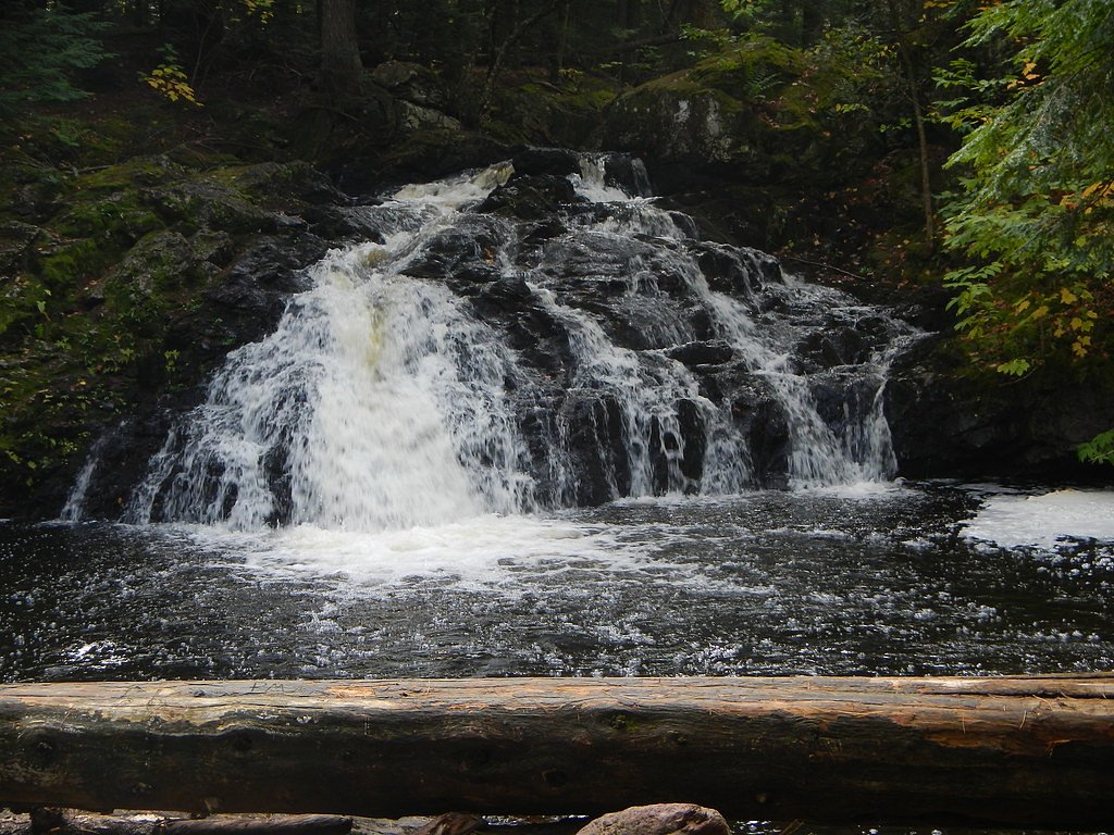
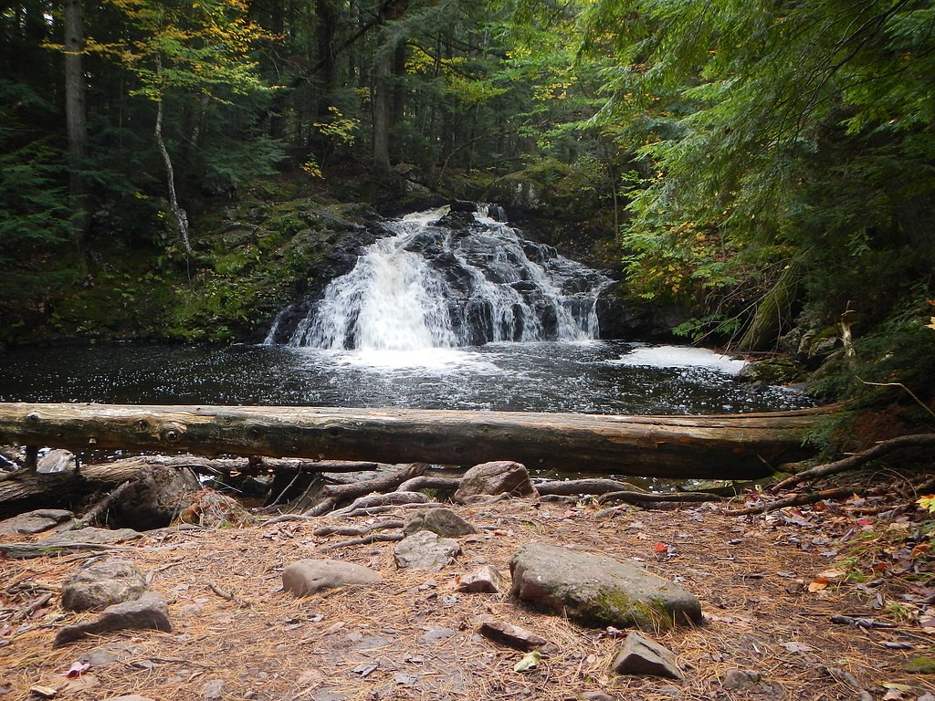
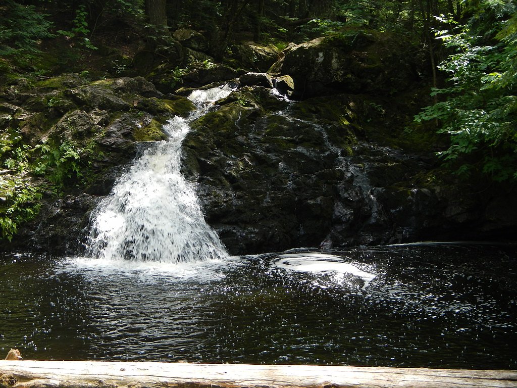
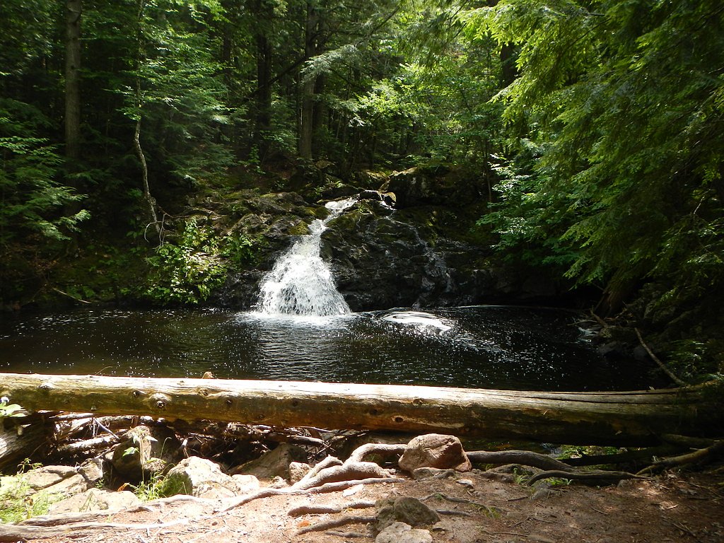
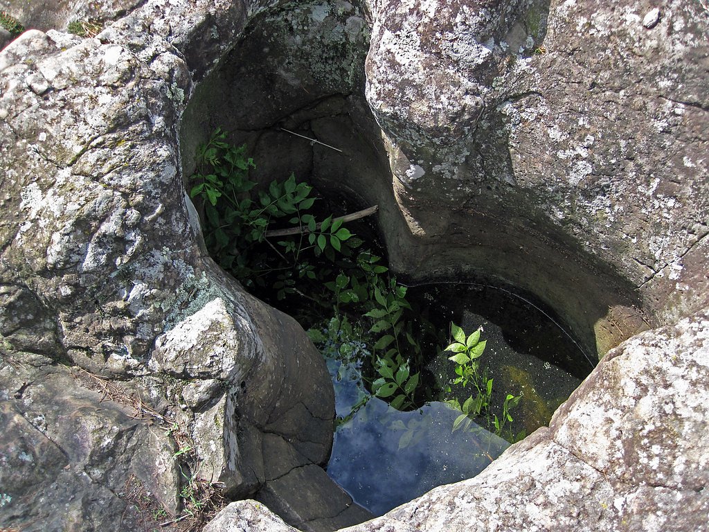
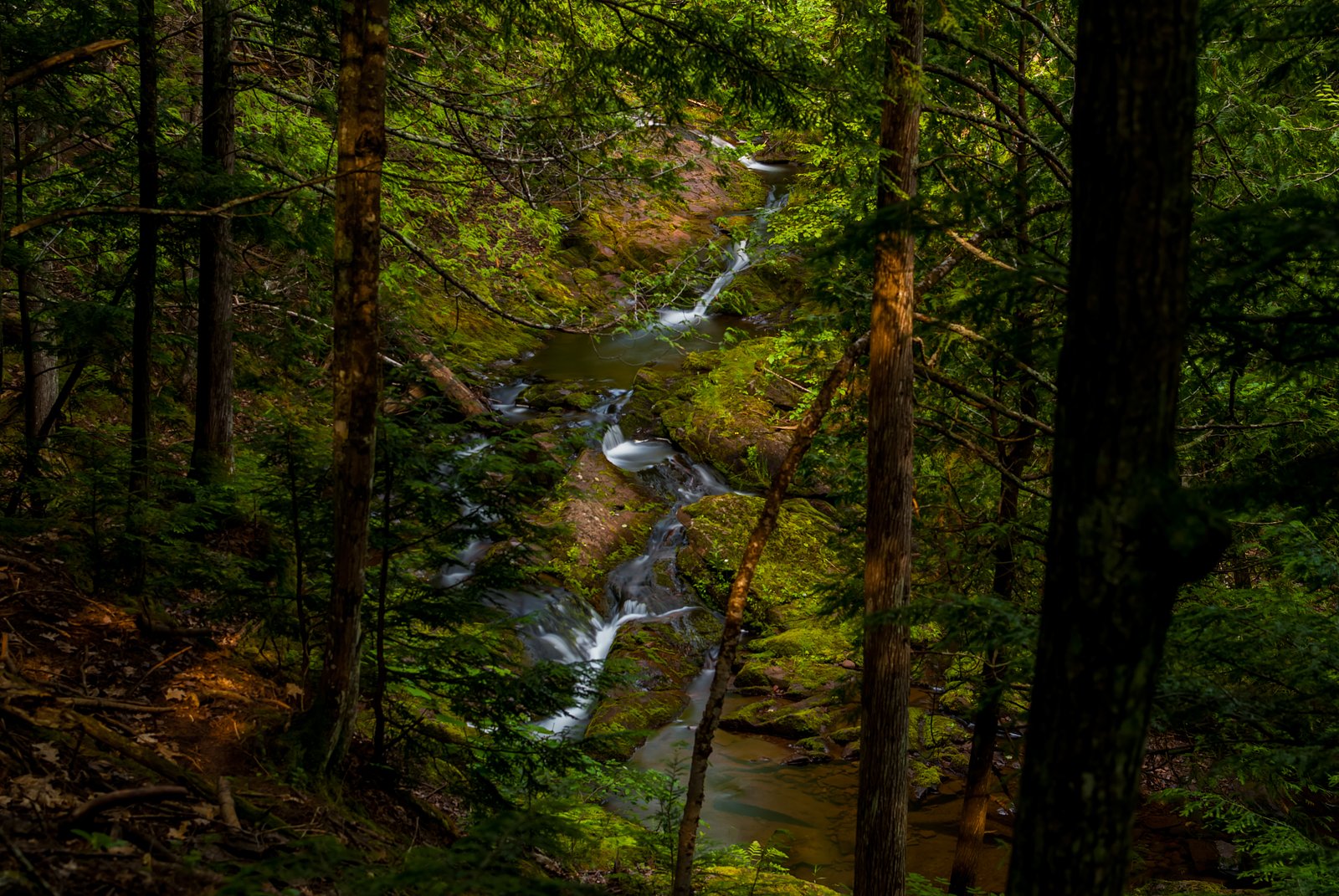
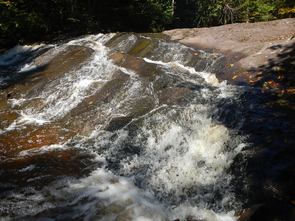
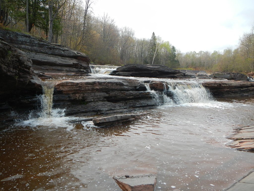
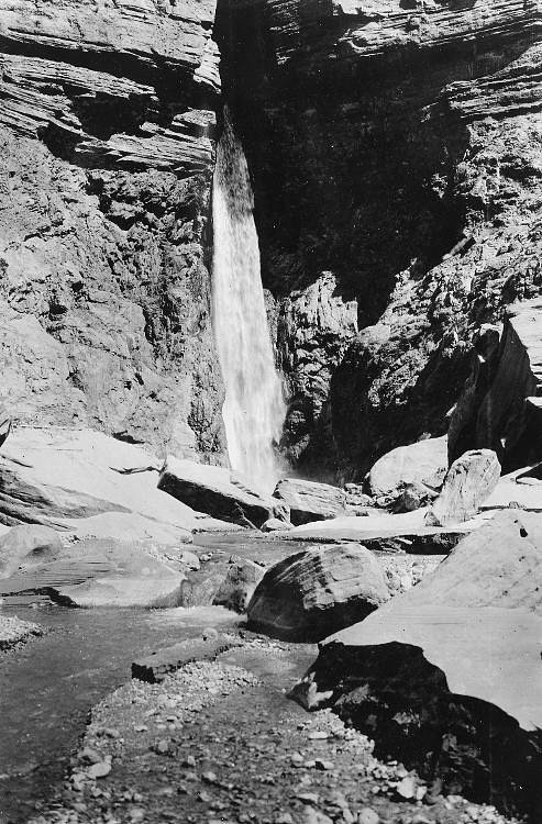
About Trap Falls
Trap Falls sits within the Porcupine Mountains Wilderness State Park in Michigan’s Upper Peninsula, a protected unit owned by SDNR and managed under SPR. Tucked into the Porkies’ famously rugged landscape, the falls offer a peaceful woodland setting that complements the park’s old-growth northern hardwoods and proximity to Lake Superior — a hallmark of the state park’s scenery. The waterfall is a rewarding destination for hikers who want a scenic payoff without a long backcountry commitment. The route to Trap Falls is an out-and-back that travels through mature forest and offers classic Porkies’ vistas: mossy rocks, hardwood canopy, and seasonal water flow that swells in spring and after rains. Expect a moderate hike with some uneven footing; sturdy shoes and standard trail precautions will make the experience more enjoyable. Because the falls lie inside the state park, visitors should follow Leave No Trace practices and any site-specific rules posted by park staff.
The Setting
Trap Falls sits at 1,312 feet within Porcupine Mountains Wilderness State Park, fed by the Presque Isle River, in the foothills of Michigan.
Trail & Hike Details
The Approach
The moderate 2.4-mile out-and-back trail gains 350 feet of elevation on the way to the falls.
Trail Description
This is a moderate 2.4-mile out-and-back hike with approximately 350 feet of elevation gain. The trail threads through forested terrain and can be uneven in spots, so expect roots, rocks, and short grades rather than a paved surface. Difficulty is rated moderate; the route is suitable for hikers comfortable with a few steady climbs and uneven footing. Bring sturdy footwear, water, and be prepared for variable trail conditions depending on season.
What to Expect
Dogs are welcome.
Accessibility
The trail is not wheelchair accessible. Uneven terrain and elevation changes require steady footing.
Frequently Asked Questions
🐶 Are Dogs Allowed at Trap Falls?
✅ Dogs are allowed
Are There Any Fees or Permits Required?
🆖 No fees required
🏊 Is There Swimming at Trap Falls?
❌ Swimming is not allowed
When to Visit
Spring and early summer are ideal for visiting Trap Falls, as water flow is typically higher due to snowmelt and rainfall.
Seasonal Access
The best time to visit is Spring, Summer, and Fall. Winter access may be limited.
Safety Information
Exercise caution near the waterfall, as rocks can be slippery. Be aware of changing weather conditions and carry a map or GPS device if exploring the area further.
Current Water Conditions
88 ft³/s
Current discharge — how much water is flowing
About average for this time of year
Based on 3 years of record
5.49 ft
Water depth at gauge
69°F
CoolRefreshing for swimming
7-Day Discharge Trend
What does this mean for your visit?
Flow is about average for this time of year. Water temperature is a refreshing 69 degrees F, good for a quick swim. Expect adequate dissolved oxygen levels. Mineral content is typical.
Water Quality
Dissolved Oxygen
GoodAdequate oxygen levels
Conductance
Dissolved minerals in the water
About This Gauge
This gauge is on a nearby waterway and may not reflect exact conditions at the falls.
7-Day Flow Outlook
Based on the USGS gauge PRESQUE ISLE RIVER NEAR CONNORVILLE, MI (24 km away).
Today
Barely Flowing
88 cfs
5/10Tomorrow
Barely Flowing
88 cfs
5/10Sun
Low
95 cfs
4/10Mon
Low
103 cfs
3/10Tue
Low
106 cfs
3/10Wed
Low
106 cfs
3/10Thu
Low
106 cfs
3/10Best window: Today — barely flowing flow, mostly sunny (trip score 5/10).
How we calculate this
This is a transparent outlook, not a precise forecast. We take the waterfall's current flow strength (how it ranks against its historical normal for today, from the nearest USGS stream gauge), carry that ranking forward along the gauge's seasonal curve, and nudge it for forecast rain. Confidence is highest for the next day or two and falls further out. Always check official conditions and your own judgment before visiting — high flows can be dangerous.
Know when to go.
Get a free email alert when waterfalls near White Pine hit peak flow. We only send when conditions are worth the trip — no weekly newsletters, no spam.
Weather Forecast
Location & Access
Getting There
Trap Falls is located near the Black River Scenic Byway in the Ottawa National Forest. Visitors can access the falls by following forest roads, with signage typically guiding the way.
Get Directions on Google MapsParking
There is a small parking area near the trailhead, but availability may be limited during peak seasons.
Elevation
1,312 feet above sea level
Coordinates
46.791613° N, -89.690713° W
Land Management
Managed by SPR
Visitor Tips & Gear
Visit early in the day to avoid crowds, especially during summer and fall. Bring insect repellent during warmer months, as mosquitoes can be present.
As an Amazon Associate, we earn from qualifying purchases.
With 2.4 miles and 350 ft of elevation gain, sturdy boots and trekking poles will help on this moderate trail. Sun exposure on the trail makes good sun protection a must in summer.

Polarized Sunglasses (Knockaround)
Cuts glare off the water so you actually see the falls — and your photos turn out better too.

Columbia Watertight II Rain Jacket
Packs into its own pocket, seam-sealed, and keeps you dry from spray and surprise rain.

Earth Pak Waterproof Dry Bag
Keeps your phone and gear dry when waterfall mist soaks everything else.

Waterproof Phone Pouch (AiRunTech)
Cheap insurance — take photos right next to the falls without killing your phone.

Timberland Euro Sprint Mid Waterproof
Trusted waterproof boot with premium leather and grippy rubber sole — reliable on rocky, wet trails.

TrailBuddy Trekking Poles
Lightweight aluminum, cork grips, and flip-locks that actually hold — a best-seller for good reason.
Where to Stay

Bergland Bay Bungalow

Scott's Superior Inn and Cabins

Pet-Friendly Michigan Getaway with Porch and Kayaks!

AJ's Lodge and Oven
Browse vacation cabins and private rentals nearby
Unique outdoor stays — tents, yurts, and treehouses
Rent a campervan or RV for your waterfall road trip
Some links are affiliate links. We may earn a commission at no extra cost to you.
Nearby Campground
Ontonagon Ranger District
18.5 miles away · 0 sites
Ontonagon Ranger District is on the shores of Lake Superior, largest of the Great Lakes, and the mouth of the Ontonagon River. There are numerous outdoor recreational opportunities. Hunting, fishing, swimming, hiking, boating, and ATV riding are available in the summer and fall months. In the winter downhill, cross-country skiing, snowmobiling and snowshoeing are available.
Book on Recreation.govAdditional Information
Nearby Attractions
The Black River Scenic Byway features several other waterfalls, including Rainbow Falls and Sandstone Falls. The area also offers hiking trails and scenic overlooks.
Wildlife
The surrounding forest is home to a variety of wildlife, including deer, birds, and small mammals. Be cautious of black bears, which may be present in the area.
Cities near Trap Falls
Nearby Waterfalls
Writing about Trap Falls? Embed this waterfall on your site for free.