Difficulty
Moderate
Trail Length
2.4 miles
Trail Type
Out And Back
Elevation Gain
350 ft
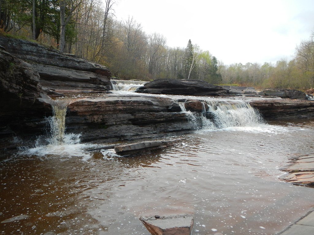
About Pewabeck Falls
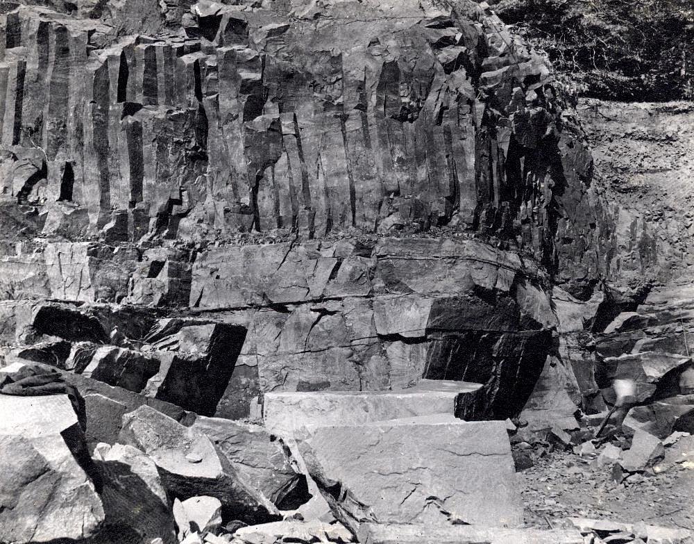
Pewabeck Falls is a small, picturesque cascade tucked into Michigan’s Upper Peninsula on the Keweenaw Peninsula. The falls tumble over rocky ledges into a tranquil pocket of forest, offering a quiet, photogenic stop for hikers exploring this rugged part of northern Michigan. Access to the falls is commonly achieved via a short hike: the typical approach is a 2.4‑mile out‑and‑back route with roughly 350 feet of elevation gain and is generally rated moderate. The nearest U.S. Forest Service facility is the Ontonagon Ranger District, about 21.6 km away, so visitors should plan logistics accordingly and come prepared for a somewhat remote outing.
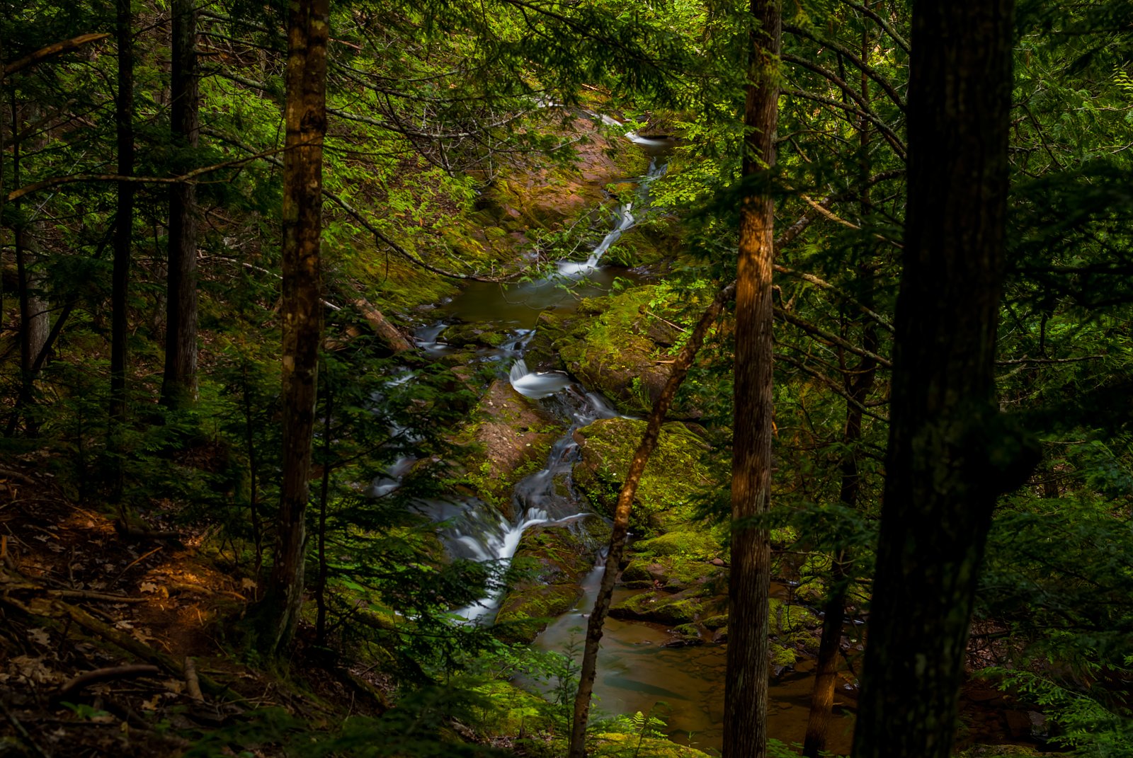
The Setting
Pewabeck Falls sits at 673 feet along the West Branch Ontonagon River, in the foothills of Michigan.
Trail & Hike Details
The Approach
The moderate 2.4-mile out-and-back trail gains 350 feet of elevation on the way to the falls.
Trail Description
Length & type: 2.4 miles (out-and-back, round-trip). Elevation gain: ~350 feet. Difficulty: Moderate. USFS surface/grade/class: not specified in the available data. The approach is not extensively documented; visitors may encounter short unmarked sections or need to walk along the roadside to reach viewpoints. Expect uneven, rocky footing in places and bring sturdy footwear and basic navigation tools.
What to Expect
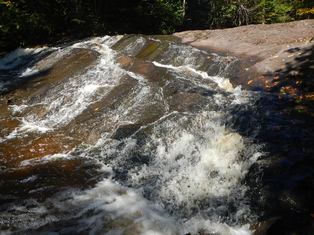
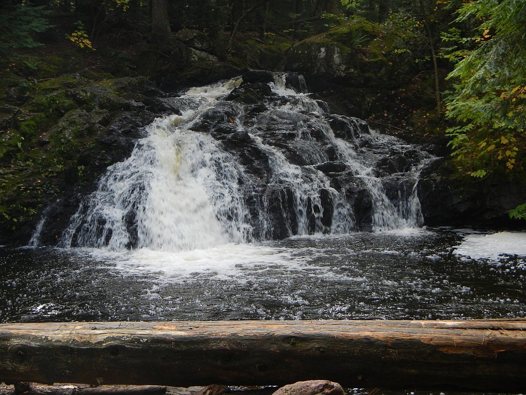
Visitors can expect a peaceful, natural setting with a small waterfall cascading over rocks. The area is surrounded by forest, offering opportunities for photography and quiet reflection.
Accessibility
The trail is not wheelchair accessible. Uneven terrain and elevation changes require steady footing.
Frequently Asked Questions
🐶 Are Dogs Allowed at Pewabeck Falls?
❌ Dogs are not allowed
Are There Any Fees or Permits Required?
🆖 No fees required
🏊 Is There Swimming at Pewabeck Falls?
❌ Swimming is not allowed
When to Visit
Spring and early summer are ideal times to visit, as the waterfall is likely to have the most water flow due to snowmelt and rainfall.
Seasonal Access
The best time to visit is Spring, Summer, and Fall. Winter access may be limited.
Safety Information
Be cautious of slippery rocks near the waterfall. The area may have uneven ground and limited signage. Always stay on safe, stable surfaces.
Current Water Conditions
Based on a USGS gauge 15.4 miles away
74 ft³/s
Current discharge — how much water is flowing
About average for this time of year
Based on 83 years of record
1.89 ft
Water depth at gauge
7-Day Discharge Trend
What does this mean for your visit?
Flow is about average for this time of year.
About This Gauge
This gauge is on a regional waterway. Conditions at the falls may differ, especially after local rain.
7-Day Flow Outlook
Based on the USGS gauge WEST BRANCH ONTONAGON RIVER NEAR BERGLAND, MI (25 km away).
Today
Strong
74 cfs
10/10Tomorrow
Strong
74 cfs
8/10Mon
Roaring
81 cfs
6/10Tue
Roaring
79 cfs
6/10Wed
Roaring
79 cfs
6/10Thu
Roaring
80 cfs
6/10Fri
Roaring
75 cfs
6/10Best window: Today — strong flow, sunny (trip score 10/10).
Best time of year: this gauge typically runs highest from late March to early May, peaking in April.
How we calculate this
This is a transparent outlook, not a precise forecast. We take the waterfall's current flow strength (how it ranks against its historical normal for today, from the nearest USGS stream gauge), carry that ranking forward along the gauge's seasonal curve, and nudge it for forecast rain. Confidence is highest for the next day or two and falls further out. Always check official conditions and your own judgment before visiting — high flows can be dangerous.
Know when to go.
Get a free email alert when waterfalls near White Pine hit peak flow. We only send when conditions are worth the trip — no weekly newsletters, no spam.
Weather Forecast
Location & Access
Getting There
Pewabeck Falls is located near the town of Eagle River in Michigan's Keweenaw Peninsula. It can be accessed via local roads, but specific directions may vary depending on the starting point. Visitors are advised to use GPS or consult local maps for the most accurate route.
Get Directions on Google MapsParking
Parking is available nearby, but it may be limited. Visitors should plan to park along the roadside or in designated areas if available.
Elevation
673 feet above sea level
Coordinates
46.807446° N, -89.587097° W
Visitor Tips & Gear
Wear sturdy shoes as the terrain may be uneven. Bring insect repellent during warmer months, as mosquitoes and other insects are common in the area. Check local weather conditions before visiting.
As an Amazon Associate, we earn from qualifying purchases.
With 2.4 miles and 350 ft of elevation gain, sturdy boots and trekking poles will help on this moderate trail. Sun exposure on the trail makes good sun protection a must in summer.

Columbia Watertight II Rain Jacket
Packs into its own pocket, seam-sealed, and keeps you dry from spray and surprise rain.

Earth Pak Waterproof Dry Bag
Keeps your phone and gear dry when waterfall mist soaks everything else.

Waterproof Phone Pouch (AiRunTech)
Cheap insurance — take photos right next to the falls without killing your phone.

Timberland Euro Sprint Mid Waterproof
Trusted waterproof boot with premium leather and grippy rubber sole — reliable on rocky, wet trails.

TrailBuddy Trekking Poles
Lightweight aluminum, cork grips, and flip-locks that actually hold — a best-seller for good reason.

Polarized Sunglasses (Knockaround)
Cuts glare off the water so you actually see the falls — and your photos turn out better too.
Where to Stay

Scott's Superior Inn and Cabins

Bergland Bay Bungalow

Pet-Friendly Michigan Getaway with Porch and Kayaks!

Walk to Lake Superior: Ontonagon Home w/ Fire Pit!
Browse vacation cabins and private rentals nearby
Unique outdoor stays — tents, yurts, and treehouses
Rent a campervan or RV for your waterfall road trip
Some links are affiliate links. We may earn a commission at no extra cost to you.
Nearby Campground
Ontonagon Ranger District
13.4 miles away · 0 sites
Ontonagon Ranger District is on the shores of Lake Superior, largest of the Great Lakes, and the mouth of the Ontonagon River. There are numerous outdoor recreational opportunities. Hunting, fishing, swimming, hiking, boating, and ATV riding are available in the summer and fall months. In the winter downhill, cross-country skiing, snowmobiling and snowshoeing are available.
Book on Recreation.govAdditional Information
Nearby Attractions
Nearby attractions include Eagle River Falls, the historic town of Eagle River, and other natural sites in the Keweenaw Peninsula.
Wildlife
The area is home to a variety of wildlife, including birds, deer, and small mammals. Visitors should be cautious of ticks and other insects.
Cities near Pewabeck Falls
Nearby Waterfalls
Writing about Pewabeck Falls? Embed this waterfall on your site for free.