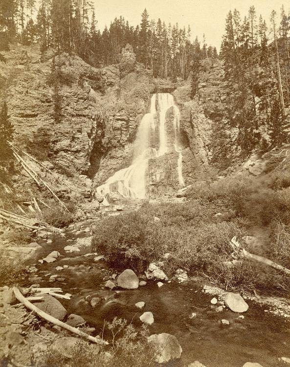
Sumner Falls
By Armen Suny · Last verified May 2026
Difficulty
Moderate
Trail Length
2.4 miles
Trail Type
Out And Back
Elevation Gain
350 ft
About Sumner Falls
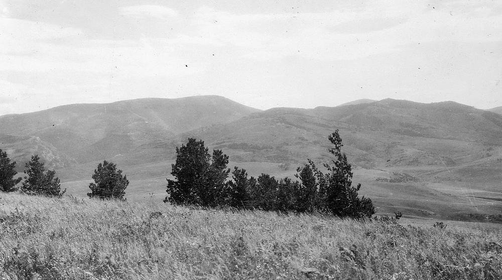
Sumner Falls sits along the Connecticut River in Hartland, New Hampshire, and is best appreciated as a series of rapids and cascading ledges rather than a single vertical drop. The spot is a favorite with paddlers and anglers looking for lively current and clear river scenery; the falls unfold across a stretch of river that offers multiple bright vantage points for photographs, fishing, or simply listening to flowing water. The surroundings retain a quiet, wooded character that makes the area feel tucked away from busy roads. Access to the falls is via a short hiking route that brings you close to the water’s edge; the approach and viewpoints reward a modest effort with a sense of solitude and seasonal color. If you’re planning an overnight, North Hartland Lake Beach (VT) campground lies just 3.43 km away, making it convenient to pair a morning at the falls with an evening by the lake.
The Setting
Sumner Falls sits at 308 feet along the Connecticut River, in the coastal lowlands of New Hampshire.
Trail & Hike Details
The Approach
The moderate 2.4-mile out-and-back trail gains 350 feet of elevation on the way to the falls.
Trail Description
The trail to Sumner Falls is an out-and-back route of approximately 2.4 miles round trip with about 350 feet of elevation gain and is rated moderate. The climb is steady in places, so plan for sustained uphill and downhill walking; the route is best suited to hikers comfortable with a moderate effort rather than a flat stroll. Trail users should allow time for stops at multiple viewpoints along the river; with the nearby North Hartland Lake Beach campground 3.43 km away, the hike is an easy addition to a longer outdoor trip. There is no USFS trail number or surface/grade/class data provided for this route in the materials supplied, so conditions can vary—bring appropriate footwear and expect natural, undeveloped trail conditions.
What to Expect
Dogs are welcome.
Accessibility
The trail is not wheelchair accessible. Uneven terrain and elevation changes require steady footing.
Frequently Asked Questions
🐶 Are Dogs Allowed at Sumner Falls?
✅ Dogs are allowed
Are There Any Fees or Permits Required?
🆖 No fees required
🏊 Is There Swimming at Sumner Falls?
❌ Swimming is not allowed
When to Visit
Spring and fall are the best times to visit for optimal water flow and scenic beauty. Summer is also popular for outdoor activities.
Seasonal Access
The best time to visit is Spring, Summer, and Fall. Winter access may be limited.
Safety Information
Be cautious near the water as the rocks can be slippery, and the currents are strong. Always supervise children and pets.
Current Water Conditions
9,240 ft³/s
Current discharge — how much water is flowing
Higher than usual for this time of year
Based on 112 years of record
7.97 ft
Water depth at gauge
7-Day Discharge Trend
What does this mean for your visit?
The water is flowing higher than usual for this time of year.
About This Gauge
This gauge is on a nearby waterway and may not reflect exact conditions at the falls.
7-Day Flow Outlook
Based on the USGS gauge CONNECTICUT RIVER AT WEST LEBANON, NH (11 km away).
Today
Low
9240 cfs
5/10Tomorrow
Moderate
10805 cfs
4/10Tue
Moderate
10473 cfs
4/10Wed
Moderate
10107 cfs
4/10Thu
Moderate
9976 cfs
4/10Fri
Moderate
9452 cfs
4/10Sat
Moderate
7018 cfs
5/10Best window: Today — low flow, patchy fog then sunny (trip score 5/10).
Best time of year: this gauge typically runs highest from mid March to early June, peaking in April.
How we calculate this
This is a transparent outlook, not a precise forecast. We take the waterfall's current flow strength (how it ranks against its historical normal for today, from the nearest USGS stream gauge), carry that ranking forward along the gauge's seasonal curve, and nudge it for forecast rain. Confidence is highest for the next day or two and falls further out. Always check official conditions and your own judgment before visiting — high flows can be dangerous.
Know when to go.
Get a free email alert when waterfalls near North Hartland hit peak flow. We only send when conditions are worth the trip — no weekly newsletters, no spam.
Weather Forecast
Location & Access
Getting There
Sumner Falls is located off Route 5 in Hartland, New Hampshire, near the Connecticut River. It is easily accessible by car, and the area is well-marked with signs.
Get Directions on Google MapsParking
There is a small parking area near the site, which is free to use.
Elevation
308 feet above sea level
Coordinates
43.564515° N, -72.380925° W
Visitor Tips & Gear
Wear sturdy shoes as the area near the water can be slippery. Bring a picnic to enjoy by the river, and consider visiting during the fall for beautiful foliage views.
As an Amazon Associate, we earn from qualifying purchases.
With 2.4 miles and 350 ft of elevation gain, sturdy boots and trekking poles will help on this moderate trail. Sun exposure on the trail makes good sun protection a must in summer.

Columbia Watertight II Rain Jacket
Packs into its own pocket, seam-sealed, and keeps you dry from spray and surprise rain.

Earth Pak Waterproof Dry Bag
Keeps your phone and gear dry when waterfall mist soaks everything else.

Waterproof Phone Pouch (AiRunTech)
Cheap insurance — take photos right next to the falls without killing your phone.

Timberland Euro Sprint Mid Waterproof
Trusted waterproof boot with premium leather and grippy rubber sole — reliable on rocky, wet trails.

TrailBuddy Trekking Poles
Lightweight aluminum, cork grips, and flip-locks that actually hold — a best-seller for good reason.

Polarized Sunglasses (Knockaround)
Cuts glare off the water so you actually see the falls — and your photos turn out better too.
Where to Stay

Spooner House

Holiday Inn Express Hotel & Suites White River Junction by IHG

The Shire Woodstock

Align Inn Vermont
Browse vacation cabins and private rentals nearby
Unique outdoor stays — tents, yurts, and treehouses
Rent a campervan or RV for your waterfall road trip
Some links are affiliate links. We may earn a commission at no extra cost to you.
Nearby Campground
NORTH HARTLAND LAKE BEACH (VT)
2.1 miles away · 3 sites
Overview North Hartland Lake is a US Army Corps of Engineers day use facility located on the Ottauquechee River in North Hartland, VT. Close to the towns of Lebanon, New Hampshire, and Hartford, Vermont, North Hartland Lake is a popular destination for outdoor recreation in the Upper Valley.Recreation Swimming, fishing, paddling, and boating are all popular activities at North Hartland Lake. A playground, horseshoe pits, volleyball nets, picnic tables and grills are available for all to enjoy. Fa
Book on Recreation.govAdditional Information
Nearby Attractions
Nearby attractions include Quechee Gorge and the town of Woodstock, Vermont, which offers shops, restaurants, and historic sites.
Wildlife
The area is home to various bird species, including herons and eagles, as well as fish in the river.
Cities near Sumner Falls
Nearby Waterfalls
Writing about Sumner Falls? Embed this waterfall on your site for free.