Difficulty
Moderate
Trail Length
2.4 miles
Trail Type
Out And Back
Elevation Gain
350 ft
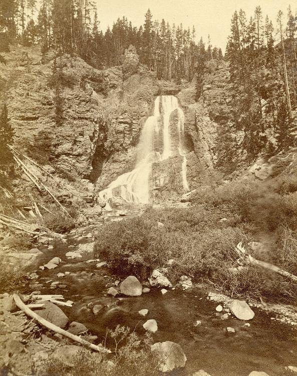
About Gerrys Falls
Gerry's Falls is a small, picturesque cascade tucked into Ascutney State Park in Vermont, set on land owned by SPR. The falls offer a peaceful, photogenic scene framed by leafy forest—a favorite stop for hikers and nature photographers looking for a quiet break in the woods. Its modest size makes it an intimate spot to enjoy the sound of rushing water without a long or strenuous approach. The hike to the falls is an achievable outing: the route is an out-and-back about 2.4 miles round trip with roughly 350 feet of elevation gain and is rated moderate. Visitors should plan for a half-day trip, wear sturdy shoes, and pack water. If you want to make a night of it, Stoughton Pond Recreation Area is nearby (about 9.34 km / 5.8 mi) and offers camping within easy driving distance of the park.
The Setting
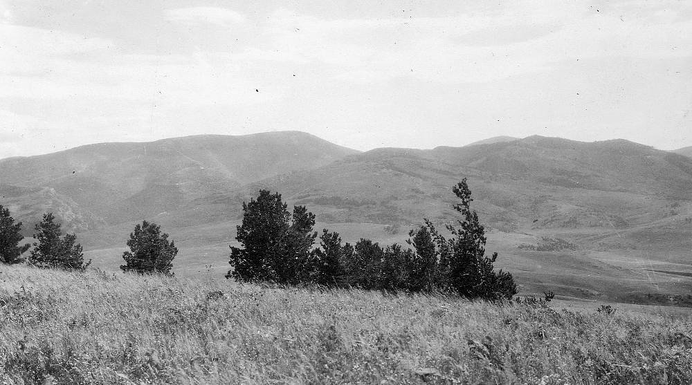
Gerrys Falls sits at 1,483 feet within Ascutney State Park, fed by the Black River, in the foothills of Vermont.
Trail & Hike Details
The Approach
The moderate 2.4-mile out and back trail gains 350 feet of elevation on the way to the falls.
Trail Description
Trail overview: out-and-back, 2.4 miles total, 350 feet elevation gain, difficulty: moderate. Specific USFS trail details such as surface type, grade, and trail class are not provided in the available land-unit data. Expect a typical park trail experience through mixed woodland with some moderate climbs; bring supportive footwear and be prepared for natural, potentially uneven terrain. Trailheads and management fall under Ascutney State Park (land unit: SPR).
What to Expect
Visitors can expect a tranquil natural setting with a small waterfall surrounded by forested areas. The falls may be more impressive during spring or after heavy rainfall.
Accessibility
The trail is not wheelchair accessible. Uneven terrain and elevation changes require steady footing.
Frequently Asked Questions
🐶 Are Dogs Allowed at Gerrys Falls?
❌ Dogs are not allowed
Are There Any Fees or Permits Required?
🆖 No fees required
🏊 Is There Swimming at Gerrys Falls?
❌ Swimming is not allowed
When to Visit
Spring and early summer are ideal times to visit, as the waterfall flow is typically stronger due to snowmelt and rainfall.
Seasonal Access
The best time to visit is Spring, Summer, and Fall. Winter access may be limited.
Safety Information
Visitors should be cautious of slippery rocks near the waterfall and uneven terrain. Always stay on marked trails and avoid venturing too close to the water's edge.
Current Water Conditions
292 ft³/s
Current discharge — how much water is flowing
Higher than usual for this time of year
Based on 68 years of record
2.82 ft
Water depth at gauge
7-Day Discharge Trend
What does this mean for your visit?
The water is flowing higher than usual for this time of year.
About This Gauge
This gauge is on a nearby waterway and may not reflect exact conditions at the falls.
7-Day Flow Outlook
Based on the USGS gauge BLACK RIVER AT NORTH SPRINGFIELD, VT (15 km away).
Today
Low
292 cfs
6/10Tomorrow
Moderate
326 cfs
4/10Wed
Moderate
353 cfs
4/10Thu
Moderate
297 cfs
8/10Fri
Moderate
313 cfs
4/10Sat
Moderate
296 cfs
4/10Sun
Moderate
282 cfs
5/10Best window: Thu — moderate flow, mostly sunny (trip score 8/10).
Best time of year: this gauge typically runs highest from mid March to late May, peaking in April.
How we calculate this
This is a transparent outlook, not a precise forecast. We take the waterfall's current flow strength (how it ranks against its historical normal for today, from the nearest USGS stream gauge), carry that ranking forward along the gauge's seasonal curve, and nudge it for forecast rain. Confidence is highest for the next day or two and falls further out. Always check official conditions and your own judgment before visiting — high flows can be dangerous.
Know when to go.
Get a free email alert when waterfalls near Ascutney hit peak flow. We only send when conditions are worth the trip — no weekly newsletters, no spam.
Weather Forecast
Location & Access
Getting There
Gerry's Falls is located near the town of Barre, Vermont. Access to the falls may require navigating local roads, and visitors should check for specific directions online or with local resources.
Get Directions on Google MapsParking
Parking availability is unclear, but visitors may find roadside parking or small parking areas nearby. It is recommended to plan ahead and arrive early during peak seasons.
Hours
Elevation
1,483 feet above sea level
Coordinates
43.450628° N, -72.436202° W
Land Management
Managed by UNK
Visitor Tips & Gear
Check weather conditions before visiting, as trails may become slippery after rain. Bring a map or GPS device, as signage may be limited. Arrive early to secure parking and enjoy a quieter experience.
As an Amazon Associate, we earn from qualifying purchases.
With 2.4 miles and 350 ft of elevation gain, sturdy boots and trekking poles will help on this moderate trail. Sun exposure on the trail makes good sun protection a must in summer.

Columbia Watertight II Rain Jacket
Packs into its own pocket, seam-sealed, and keeps you dry from spray and surprise rain.

Earth Pak Waterproof Dry Bag
Keeps your phone and gear dry when waterfall mist soaks everything else.

Waterproof Phone Pouch (AiRunTech)
Cheap insurance — take photos right next to the falls without killing your phone.

Timberland Euro Sprint Mid Waterproof
Trusted waterproof boot with premium leather and grippy rubber sole — reliable on rocky, wet trails.

TrailBuddy Trekking Poles
Lightweight aluminum, cork grips, and flip-locks that actually hold — a best-seller for good reason.

Polarized Sunglasses (Knockaround)
Cuts glare off the water so you actually see the falls — and your photos turn out better too.
Where to Stay

Holiday Inn Club Vacations Mount Ascutney Resort

The Shire Woodstock

Holiday Inn Express Hotel & Suites White River Junction by IHG

Woodbridge Inn Bed & Breakfast
Browse vacation cabins and private rentals nearby
Unique outdoor stays — tents, yurts, and treehouses
Rent a campervan or RV for your waterfall road trip
Some links are affiliate links. We may earn a commission at no extra cost to you.
Nearby Campground
Stoughton Pond Rec Area
5.8 miles away · 1 sites
Overview Stoughton Pond Recreation Area is a day use area located to the north of North Springfield Lake. Stoughton Pond is located off State Route 106 on Stoughton Pond Road in Perkinsville, Vermont. Recreation Stoughton Pond Recreation Area offers plenty of activities for visitors of all ages. Many people enjoy canoeing, kayaking, boating and fishing. The state of Vermont Department of Fish and Game annually stock the pond with rainbow trout, and the pond also offers excellent bass fishing. A b
Book on Recreation.govNearby Hot Springs
Hot springs near Ascutney, Vermont
Looking for a soak after your hike? Explore more hot springs near Ascutney, Vermont on SoakingSprings.
Explore Vermont springsAdditional Information
Nearby Attractions
The town of Barre offers additional outdoor activities and local attractions, including hiking trails and scenic drives.
Wildlife
The area around Gerry's Falls may feature common Vermont wildlife such as birds, deer, and small mammals. Visitors should be mindful of their surroundings.
Cities near Gerrys Falls
Nearby Waterfalls
Writing about Gerrys Falls? Embed this waterfall on your site for free.