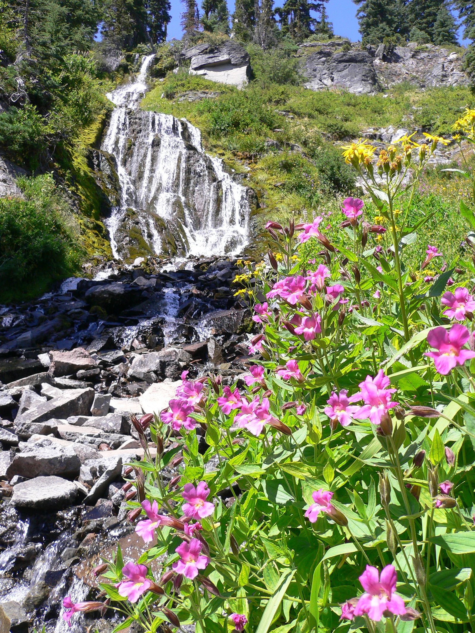
Stuart Falls
Oregon • Crater Lake National Park
By Armen Suny · Last verified Mar 2026
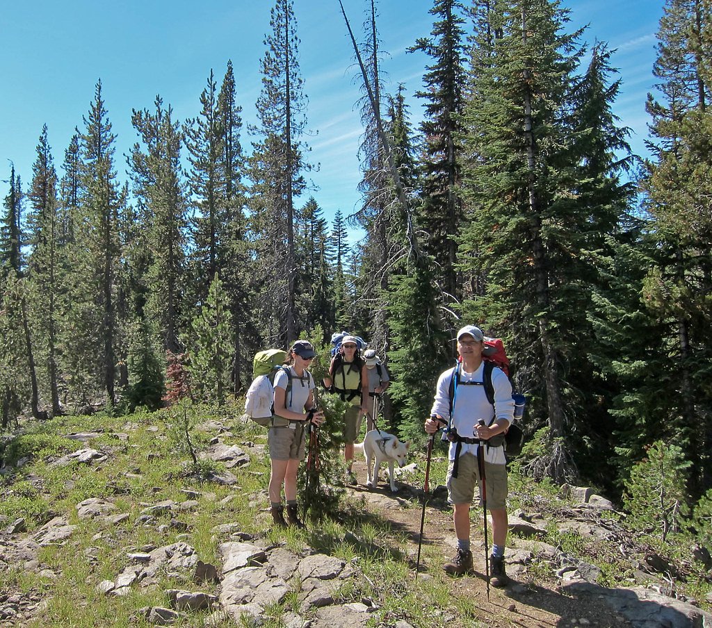
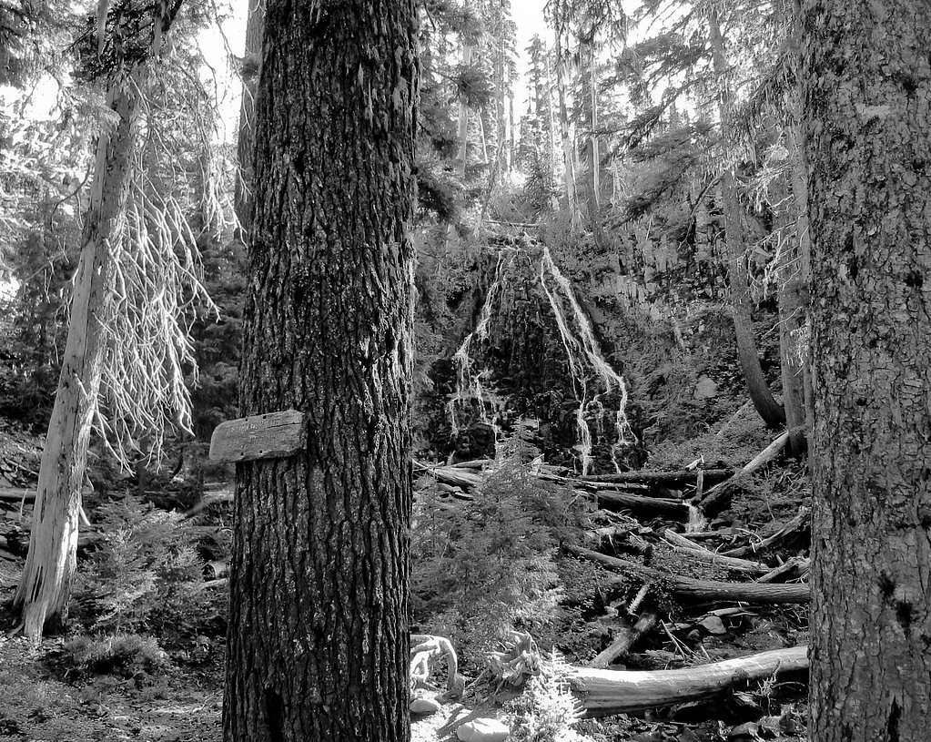
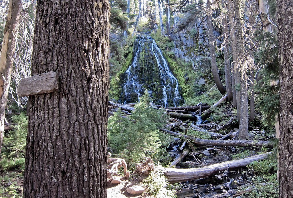
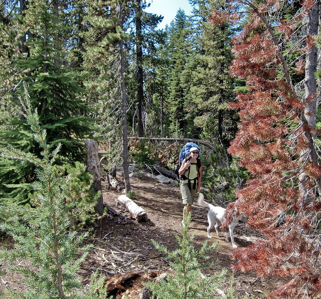
Photo Credits (5)
Difficulty
Moderate
Trail Length
2.4 miles
Trail Type
Out And Back
Elevation Gain
350 ft
About Stuart Falls
Tucked into the forests of southern Oregon, Stuart Falls sits within the Rogue River National Forest and is managed by the U.S. Forest Service. The cascade is a peaceful, wooded destination easily reached from nearby trailheads and makes a great half-day outing for hikers exploring the Crater Lake area. Stuart Falls is also close to Crater Lake National Park — home to Crater Lake, the deepest lake in the United States formed in the caldera of Mount Mazama — which helps place this waterfall in a region known for dramatic volcanic scenery and old-growth forest.
The Setting
Stuart Falls sits at 5,440 feet within Crater Lake National Park, fed by the South Fork Rogue River, in the high mountains of Oregon.
Trail & Hike Details
The Approach
The moderate hike follows Stuart Falls Trail (#1078), a 2.4-mile out-and-back trail over natural surface. Expect 350 feet of elevation gain. The trail is developed (Class 3).
USFS Trail
STUART FALLS TRAIL #1078
Trail Class
Developed
Surface
USFS Segment
3.32 miTrail Description
Access to the falls is via the USFS Stuart Falls Trail (Trail #1078). USFS trail data lists the route as Class 3 with a native-material surface; the agency’s GIS records put the trail length at about 3.32 miles. Many guide sources and hikers report the outing as a roughly 2.4-mile out-and-back with about 350 feet of elevation gain, rated moderate in difficulty. Expect a forested singletrack managed by the U.S. Forest Service through Rogue River National Forest. The trail’s native-material tread and Class 3 designation mean it’s a straightforward forest hike with moderate climbing over uneven natural surfaces; plan for a moderate effort and allow time to enjoy the falls at the end of the route.
What to Expect
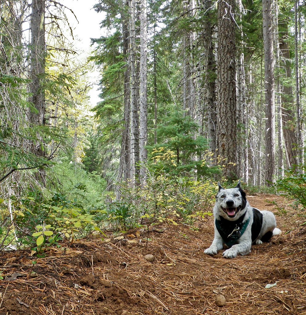
Dogs are welcome.
Accessibility
The trail is not wheelchair accessible. Uneven terrain and elevation changes require steady footing.
Frequently Asked Questions
🐶 Are Dogs Allowed at Stuart Falls?
✅ Dogs are allowed
Are There Any Fees or Permits Required?
🆖 No fees required
🏊 Is There Swimming at Stuart Falls?
❌ Swimming is not allowed
When to Visit
Spring and early summer are ideal for visiting Stuart Falls, as the waterfall flow is typically strongest during these seasons. Fall offers beautiful foliage, while summer provides warmer weather for hiking.
Seasonal Access
The best time to visit is Spring, Summer, and Fall. Access roads and trails may close during winter due to snow. Check with Crater Lake National Park for current conditions.
Safety Information
The trail may be slippery after rain, and there are some steep sections. Always stay on marked trails and be cautious near the waterfall. Cell service may be limited in the area.
Current Water Conditions
41 ft³/s
Current discharge — how much water is flowing
Higher than usual for this time of year
Based on 76 years of record
7.38 ft
Water depth at gauge
7-Day Discharge Trend
What does this mean for your visit?
The water is flowing higher than usual for this time of year.
About This Gauge
This gauge is on a nearby waterway and may not reflect exact conditions at the falls.
7-Day Flow Outlook
Based on the USGS gauge SOUTH FORK ROGUE RIVER NEAR PROSPECT, OR (18 km away).
Today
Moderate
46 cfs
6/10Tomorrow
Moderate
43 cfs
9/10Fri
Moderate
41 cfs
9/10Sat
Moderate
41 cfs
9/10Sun
Moderate
41 cfs
9/10Mon
Moderate
37 cfs
9/10Tue
Moderate
37 cfs
9/10Best window: Tomorrow — moderate flow, sunny (trip score 9/10).
Best time of year: this gauge typically runs highest from late March to mid June, peaking in May.
How we calculate this
This is a transparent outlook, not a precise forecast. We take the waterfall's current flow strength (how it ranks against its historical normal for today, from the nearest USGS stream gauge), carry that ranking forward along the gauge's seasonal curve, and nudge it for forecast rain. Confidence is highest for the next day or two and falls further out. Always check official conditions and your own judgment before visiting — high flows can be dangerous.
Know when to go.
Get a free email alert when waterfalls near Prospect hit peak flow. We only send when conditions are worth the trip — no weekly newsletters, no spam.
Weather Forecast
Location & Access
Getting There
Stuart Falls is located near the southern boundary of Crater Lake National Park. The trailhead is typically accessed from the Union Creek area or via the Annie Creek Sno-Park. Visitors should check local maps and trail guides for the most accurate directions.
Get Directions on Google MapsParking
Parking is available at the trailhead, but spaces may be limited during peak seasons. Visitors should arrive early to secure a spot.
Elevation
5,440 feet above sea level
Coordinates
42.799082° N, -122.212910° W
Land Management
Managed by USFS
Visitor Tips & Gear
Wear sturdy hiking shoes and bring plenty of water. Bug spray is recommended during warmer months. Start early to avoid crowds and ensure you have enough daylight for the hike.
This trail sits at 5,440 ft above sea level
Elevated TrailUV radiation is roughly 22% stronger at this elevation than at sea level, and the dry air accelerates dehydration. Extra sun protection and fluids go a long way.
As an Amazon Associate, we earn from qualifying purchases.

Coppertone Sport SPF 50 Sunscreen
UV intensity jumps ~4% per 1,000 ft — at this elevation you can burn in half the time.

Sun Bum SPF 30 Lip Balm (3-Pack)
Lips have almost no natural UV protection and burn fast in thin, dry mountain air.

Liquid I.V. Electrolyte Packets
You lose moisture ~2x faster at elevation — electrolytes help you absorb water efficiently.

ROCKNIGHT Polarized UV400 Sunglasses
High-altitude glare off rock and water is intense — UV400 lenses block 99%+ of UVA/UVB.
As an Amazon Associate, we earn from qualifying purchases.
With 2.4 miles and 350 ft of elevation gain, sturdy boots and trekking poles will help on this moderate trail. Sun exposure on the trail makes good sun protection a must in summer.

Polarized Sunglasses (Knockaround)
Cuts glare off the water so you actually see the falls — and your photos turn out better too.

Columbia Watertight II Rain Jacket
Packs into its own pocket, seam-sealed, and keeps you dry from spray and surprise rain.

Earth Pak Waterproof Dry Bag
Keeps your phone and gear dry when waterfall mist soaks everything else.

Waterproof Phone Pouch (AiRunTech)
Cheap insurance — take photos right next to the falls without killing your phone.

Timberland Euro Sprint Mid Waterproof
Trusted waterproof boot with premium leather and grippy rubber sole — reliable on rocky, wet trails.

TrailBuddy Trekking Poles
Lightweight aluminum, cork grips, and flip-locks that actually hold — a best-seller for good reason.
Where to Stay

Heartline Ranch, LLC

Aspen Inn

Union Creek Resort

Cozy Chiloquin Retreat < 30 Mi to Crater Lake!
Browse vacation cabins and private rentals nearby
Unique outdoor stays — tents, yurts, and treehouses
Rent a campervan or RV for your waterfall road trip
Some links are affiliate links. We may earn a commission at no extra cost to you.
Nearby Campground
Crater Lake Lodge
11 miles away · 0 sites
The Crater Lake Lodge, built in 1915 and a member of Historic Hotels of America® since 2012 was listed in the National Register of Historic Places in 1981. Historic Hotels of America is the official program of the National Trust for Historic Preservation® for recognizing and celebrating the finest historic hotels across America. A grand northwest lodge, the historic 71-guestroom Crater Lake Lodge originally opened in 1915 on the edge of one of the country's crown jewels-Crater Lake. No place else
Book on Recreation.govNearby Hot Springs
Hot springs near Prospect, Oregon

Annie Spring
Annie Spring flows at 77°F within Crater Lake National Park at 5,983 feet elevation, discharging 1.71 cubic feet per second at ...
Eagle Point Spring
Eagle Point Spring flows at 95°F in Klamath County, emerging 45.6°F above the 49.4°F ambient temperature in a climate receiving...

Umpqua Hot Springs
Umpqua Hot Springs flows at 117°F from multiple geothermal sources along the North Umpqua River in Lane County, forming cascadi...
Howard Holiday
Howard Holiday flows at 77°F in Klamath County near Klamath Falls, emerging at 4,107 feet elevation approximately 157 meters fr...
Hardboard Spring
Hardboard Spring flows at 70°F from roadside terrain 36 meters from the nearest road in Klamath County near Klamath Falls, emer...
Jackson Hot Springs
Jackson Hot Springs registers 95°F with highly alkaline chemistry, posting pH 9.3 in sodium-dominated waters containing 95 mg/L...
Looking for a soak after your hike? Explore more hot springs near Prospect, Oregon on SoakingSprings.
Explore Oregon springsAdditional Information
Nearby Attractions
Crater Lake National Park, Union Creek, Rogue River
Wildlife
Deer, birds, and other forest wildlife are commonly seen in the area.
Cities near Stuart Falls
Nearby Waterfalls
Writing about Stuart Falls? Embed this waterfall on your site for free.