Duwee Falls
Oregon • Crater Lake National Park
By Armen Suny · Last verified May 2026
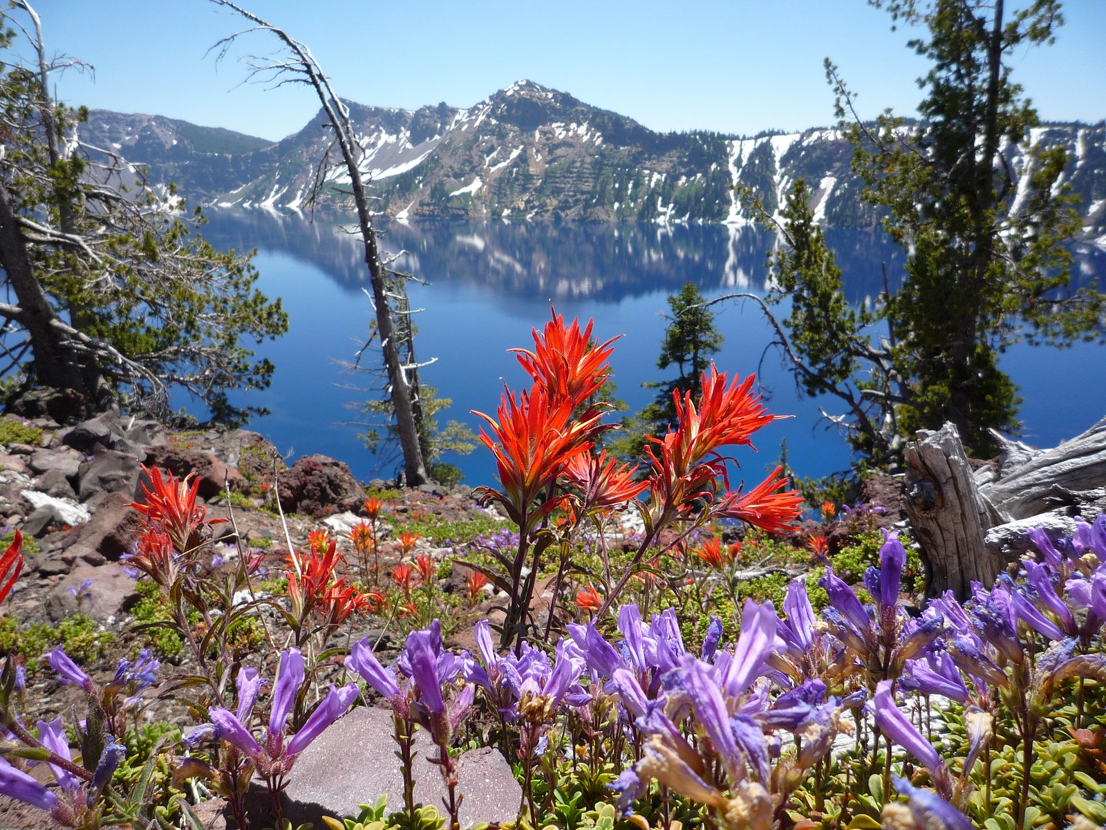
Photo Credits (2)
Difficulty
Moderate
Trail Length
2.4 miles
Trail Type
Out And Back
Elevation Gain
350 ft
About Duwee Falls
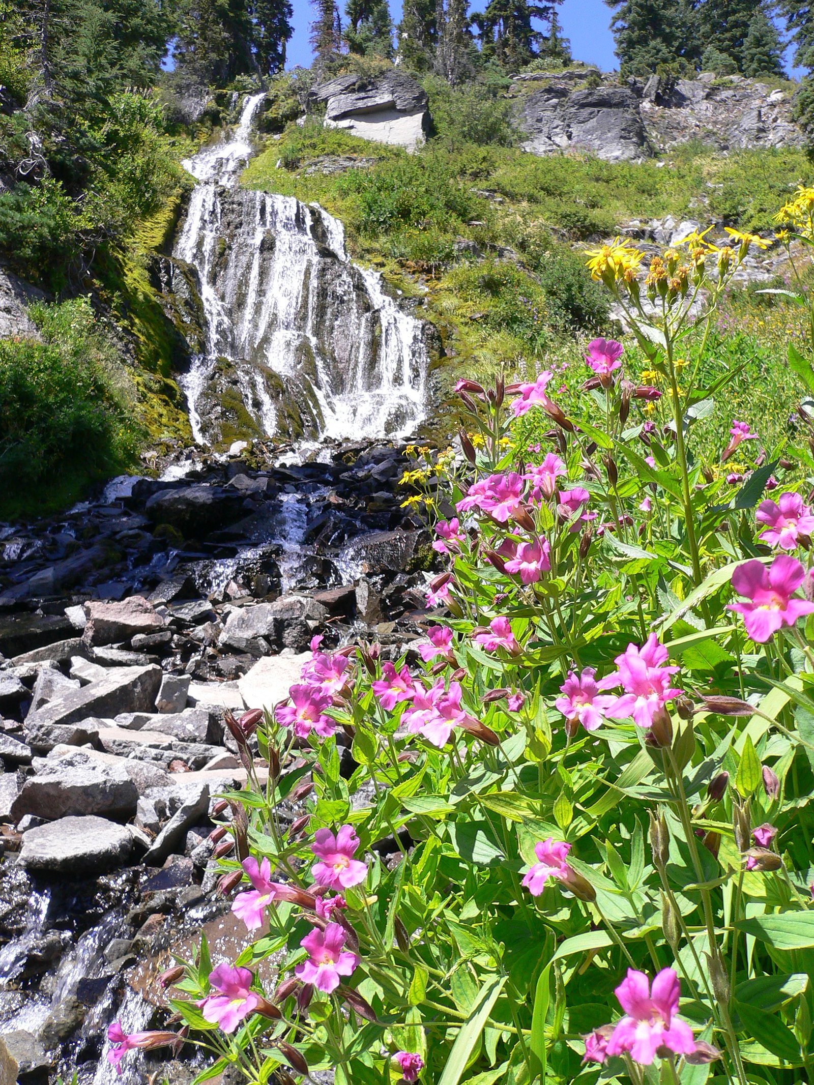
Duwee Falls is a steep, tiered waterfall on Munson Creek that plunges into a gaping canyon within Crater Lake National Park. The falls are notable for a main plunge of about 100 feet (30 m), the highest single-drop plunge in the park, and sit where Munson Creek — a tributary of the Klamath River — tumbles through rugged canyon terrain. The site is managed by the National Park Service and feels distinctly wild and dramatic compared with many roadside cascades. Access to Duwee Falls is via a moderate 2.4-mile out-and-back trail that gains roughly 350 feet; the hike rewards visitors with canyon viewpoints and a clear sightline to the main drop. For overnight stays, Crater Lake Lodge campground lies about 8.9 km away, making Duwee Falls a convenient day hike or a scenic stop on a longer Crater Lake itinerary.
The Setting
Duwee Falls sits at 5,932 feet within Crater Lake National Park, fed by the Scott Creek, in the high mountains of Oregon.
Trail & Hike Details
The Approach
The moderate 2.4-mile out-and-back trail gains 350 feet of elevation on the way to the falls.
Trail Description
Trail stats: 2.4 miles round-trip (out-and-back), approximately 350 feet elevation gain, rated moderate. The route is inside Crater Lake National Park and managed by the National Park Service; it leads toward viewpoints overlooking Munson Creek’s steep, tiered 100-foot plunge into the canyon. No USFS trail name/number or USFS surface/grade/class data was provided for this route in the supplied records.
What to Expect
Dogs are welcome.
Accessibility
The trail is not wheelchair accessible. Uneven terrain and elevation changes require steady footing.
Frequently Asked Questions
🐶 Are Dogs Allowed at Duwee Falls?
✅ Dogs are allowed
Are There Any Fees or Permits Required?
🆖 No fees required
🏊 Is There Swimming at Duwee Falls?
❌ Swimming is not allowed
When to Visit
Spring and early summer are the best times to visit, as the waterfall flow is typically strongest due to seasonal rainfall and snowmelt.
Seasonal Access
The best time to visit is Spring, Summer, and Fall. Access roads and trails may close during winter due to snow. Check with Crater Lake National Park for current conditions.
Safety Information
Be cautious of traffic when parking or walking along the Historic Columbia River Highway. The area may be slippery during wet conditions, so wear appropriate footwear.
Current Water Conditions
2 ft³/s
Current discharge — how much water is flowing
Much lower than usual for this time of year
Based on 1 years of record
20.50 ft
Water depth at gauge
62°F
CoolRefreshing for swimming
7-Day Discharge Trend
What does this mean for your visit?
Flow is well below normal for this time of year, so the waterfall may be a trickle. Water temperature is a refreshing 62 degrees F, good for a quick swim.
About This Gauge
This gauge is on a nearby waterway and may not reflect exact conditions at the falls.
7-Day Flow Outlook
Based on the USGS gauge SCOTT CREEK BLW SAND CREEK CANAL NR CHINCHALO, OR (23 km away).
Today
Low
2 cfs
5/10Tomorrow
Moderate
3 cfs
4/10Sun
Moderate
3 cfs
4/10Mon
Low
2 cfs
6/10Tue
Low
2 cfs
6/10Wed
Low
2 cfs
6/10Thu
Low
2 cfs
6/10Best window: Mon — low flow, partly sunny (trip score 6/10).
Best time of year: this gauge typically runs highest from mid May to early July, peaking in June.
How we calculate this
This is a transparent outlook, not a precise forecast. We take the waterfall's current flow strength (how it ranks against its historical normal for today, from the nearest USGS stream gauge), carry that ranking forward along the gauge's seasonal curve, and nudge it for forecast rain. Confidence is highest for the next day or two and falls further out. Always check official conditions and your own judgment before visiting — high flows can be dangerous.
Know when to go.
Get a free email alert when waterfalls near Fort Klamath hit peak flow. We only send when conditions are worth the trip — no weekly newsletters, no spam.
Weather Forecast
Location & Access
Getting There
Duwee Falls is located along the Historic Columbia River Highway, near the town of Cascade Locks, Oregon. It is easily accessible by car and is situated close to other notable waterfalls in the area.
Get Directions on Google MapsParking
Limited parking is available along the Historic Columbia River Highway. Visitors should be cautious as parking may be roadside and can fill up quickly during peak seasons.
Elevation
5,932 feet above sea level
Coordinates
42.864615° N, -122.147246° W
Land Management
Managed by NPS
Visitor Tips & Gear
Visit early in the day to avoid crowds and secure parking. Be cautious of traffic along the Historic Columbia River Highway when parking or walking near the road.
This trail sits at 5,932 ft above sea level
Elevated TrailUV radiation is roughly 24% stronger at this elevation than at sea level, and the dry air accelerates dehydration. Extra sun protection and fluids go a long way.
As an Amazon Associate, we earn from qualifying purchases.

Coppertone Sport SPF 50 Sunscreen
UV intensity jumps ~4% per 1,000 ft — at this elevation you can burn in half the time.

Sun Bum SPF 30 Lip Balm (3-Pack)
Lips have almost no natural UV protection and burn fast in thin, dry mountain air.

Liquid I.V. Electrolyte Packets
You lose moisture ~2x faster at elevation — electrolytes help you absorb water efficiently.

ROCKNIGHT Polarized UV400 Sunglasses
High-altitude glare off rock and water is intense — UV400 lenses block 99%+ of UVA/UVB.
As an Amazon Associate, we earn from qualifying purchases.
With 2.4 miles and 350 ft of elevation gain, sturdy boots and trekking poles will help on this moderate trail. Sun exposure on the trail makes good sun protection a must in summer.
America the Beautiful Annual Pass
Covers entrance fees at 2,000+ federal recreation sites — required at most National Parks.

Polarized Sunglasses (Knockaround)
Cuts glare off the water so you actually see the falls — and your photos turn out better too.

Columbia Watertight II Rain Jacket
Packs into its own pocket, seam-sealed, and keeps you dry from spray and surprise rain.

Earth Pak Waterproof Dry Bag
Keeps your phone and gear dry when waterfall mist soaks everything else.

Waterproof Phone Pouch (AiRunTech)
Cheap insurance — take photos right next to the falls without killing your phone.

Timberland Euro Sprint Mid Waterproof
Trusted waterproof boot with premium leather and grippy rubber sole — reliable on rocky, wet trails.

TrailBuddy Trekking Poles
Lightweight aluminum, cork grips, and flip-locks that actually hold — a best-seller for good reason.
Where to Stay

Union Creek Resort

Budget Inn Motel Chemult

Dawson House Lodge

Eagle Crater Lake Inn
Browse vacation cabins and private rentals nearby
Unique outdoor stays — tents, yurts, and treehouses
Rent a campervan or RV for your waterfall road trip
Some links are affiliate links. We may earn a commission at no extra cost to you.
Nearby Campground
Crater Lake Lodge
5.5 miles away · 0 sites
The Crater Lake Lodge, built in 1915 and a member of Historic Hotels of America® since 2012 was listed in the National Register of Historic Places in 1981. Historic Hotels of America is the official program of the National Trust for Historic Preservation® for recognizing and celebrating the finest historic hotels across America. A grand northwest lodge, the historic 71-guestroom Crater Lake Lodge originally opened in 1915 on the edge of one of the country's crown jewels-Crater Lake. No place else
Book on Recreation.govNearby Hot Springs
Hot springs near Fort Klamath, Oregon

Annie Spring
Annie Spring flows at 77°F within Crater Lake National Park at 5,983 feet elevation, discharging 1.71 cubic feet per second at ...
Eagle Point Spring
Eagle Point Spring flows at 95°F in Klamath County, emerging 45.6°F above the 49.4°F ambient temperature in a climate receiving...

Umpqua Hot Springs
Umpqua Hot Springs flows at 117°F from multiple geothermal sources along the North Umpqua River in Lane County, forming cascadi...
Howard Holiday
Howard Holiday flows at 77°F in Klamath County near Klamath Falls, emerging at 4,107 feet elevation approximately 157 meters fr...
Hardboard Spring
Hardboard Spring flows at 70°F from roadside terrain 36 meters from the nearest road in Klamath County near Klamath Falls, emer...
Olene Gap Hot Springs
Olene Gap Hot Springs emerges at 165°F in Klamath County's volcanic landscape, flowing at 4,116 feet elevation and running 116 ...
Looking for a soak after your hike? Explore more hot springs near Fort Klamath, Oregon on SoakingSprings.
Explore Oregon springsAdditional Information
Nearby Attractions
Nearby attractions include Multnomah Falls, Horsetail Falls, and the Columbia River Gorge Scenic Area.
Wildlife
The area is home to various bird species, small mammals, and native plants. Keep an eye out for wildlife while visiting.
Cities near Duwee Falls
Nearby Waterfalls
Writing about Duwee Falls? Embed this waterfall on your site for free.