
Photo Credits (5)
Difficulty
Drive Up
Trail Length
0.1 miles
Trail Type
Out And Back
Elevation Gain
50 ft
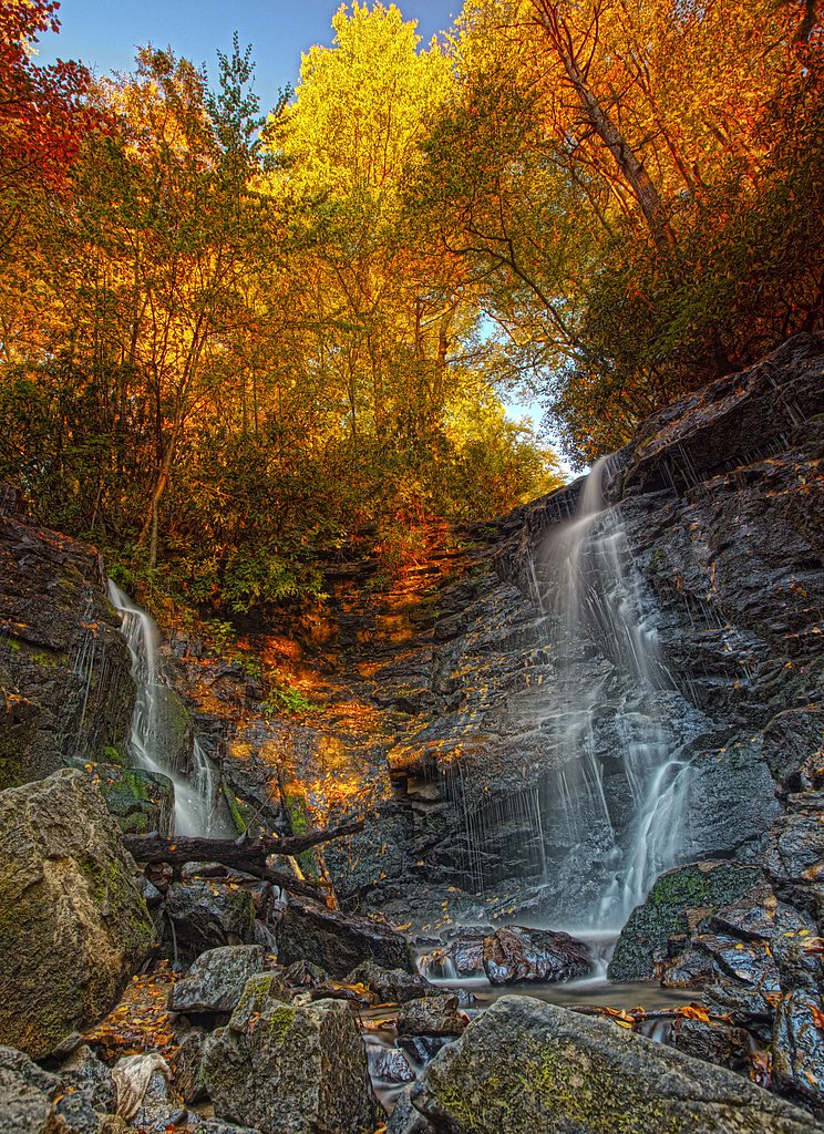
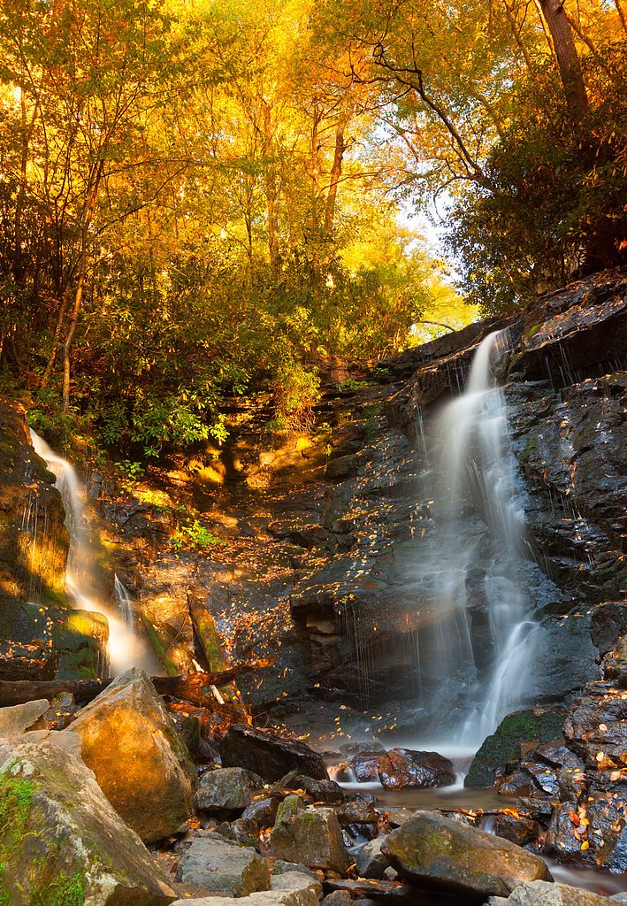
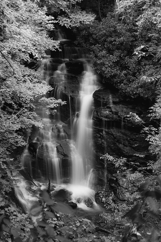
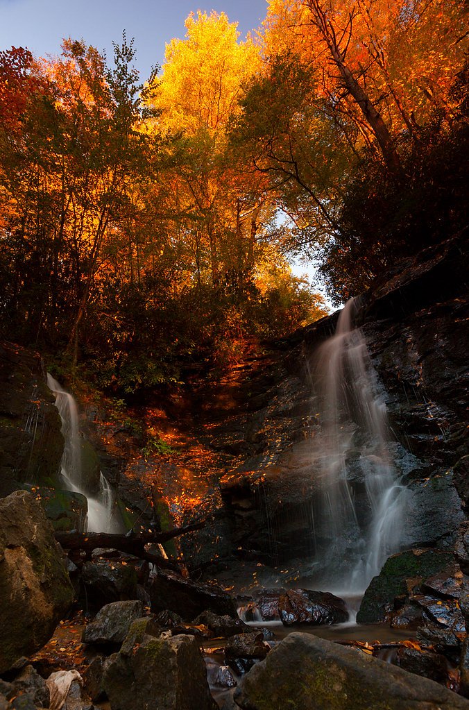
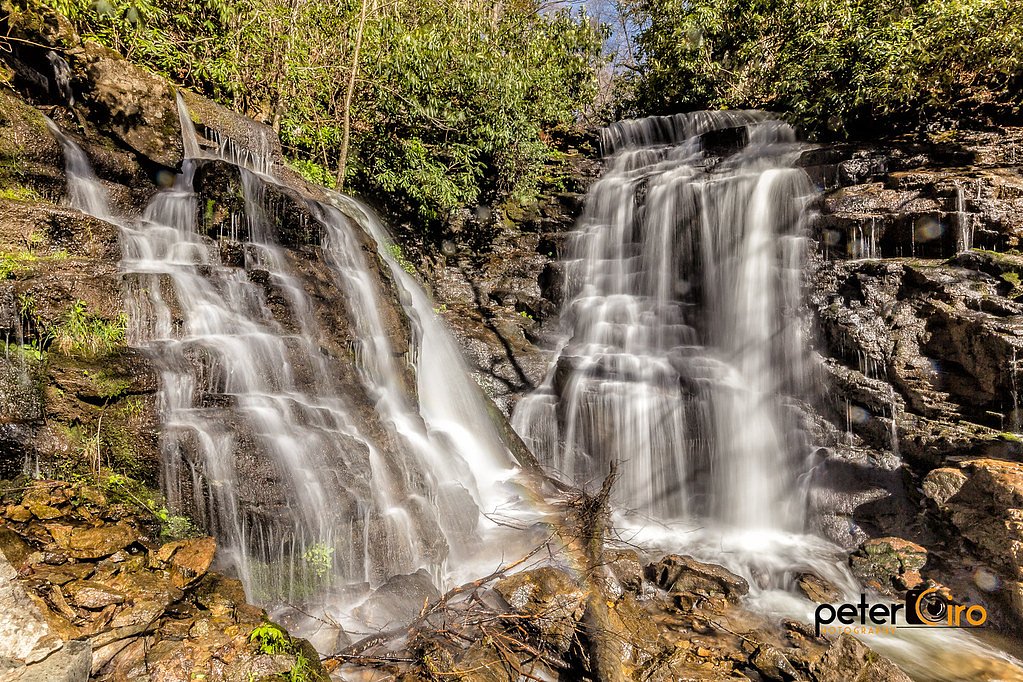
About Soco Falls
Soco Falls is a striking double waterfall just off the road near Maggie Valley, North Carolina, where two cascades drop into a fern-lined gorge to create a dramatic, photogenic scene. A wooden viewing platform provides an easy, safe vantage for most visitors, while the dense forest around the falls gives the spot a secluded, natural feel despite its roadside access. The falls sit on land within the Eastern Cherokee Reservation and are managed by tribal authorities (land owner: DESG; manager: TRIB). Because the parking and main viewpoint are essentially a short, drive-up visit, Soco Falls is a popular stop for families and photographers looking for big payoff with little hiking—just be mindful that descending to the rocky base involves a steep, slippery route requiring caution and sturdy footwear.
The Setting
Soco Falls sits at 3,848 feet within Eastern Cherokee Reservation, fed by the Tuckasegee River, in the mountains of North Carolina.
Nearby Falls Worth Visiting
Flat Creek Falls (200 ft) lies 3.9 miles to the north. Also nearby: Mingo Falls (120 ft, 6.5 mi).
Trail & Hike Details
The Approach
No hiking required. Soco Falls is accessible by vehicle with a roadside viewing area.
Trail Description
Trail type: out-and-back. Length: 0.1 miles round trip with roughly 50 feet of elevation gain. Difficulty: drive_up — the trail is a very short walk from roadside parking to a wooden viewing platform, suitable for most visitors. Note: there is an unmaintained, steep and often slippery path down to the base of the falls for those seeking a closer view; that optional route is uneven and requires careful footing and appropriate shoes.
What to Expect
Dogs are welcome.
Accessibility
This waterfall is viewable from a vehicle-accessible area. No hiking is required.
Frequently Asked Questions
🐶 Are Dogs Allowed at Soco Falls?
✅ Dogs are allowed
Are There Any Fees or Permits Required?
🆖 No fees required
🏊 Is There Swimming at Soco Falls?
❌ Swimming is not allowed
When to Visit
The best time to visit Soco Falls is during spring and early summer when water flow is typically strongest, or in the fall for vibrant foliage. Winter visits may offer a unique view of partially frozen falls.
Seasonal Access
The best time to visit is Spring, Summer, Fall, and Winter.
Safety Information
The path to the base of the falls is steep and slippery. Exercise caution and avoid descending during wet or icy conditions. Stay on marked trails to prevent accidents.
Current Water Conditions
529 ft³/s
Current discharge — how much water is flowing
About average for this time of year
Based on 21 years of record
3.80 ft
Water depth at gauge
7-Day Discharge Trend
What does this mean for your visit?
Flow is about average for this time of year.
About This Gauge
This gauge is on a nearby waterway and may not reflect exact conditions at the falls.
7-Day Flow Outlook
Based on the USGS gauge TUCKASEGEE RIVER AT BARKER'S CREEK, NC (16 km away).
Today
Moderate
529 cfs
9/10Tomorrow
Strong
603 cfs
7/10Tue
Roaring
640 cfs
6/10Wed
Strong
566 cfs
10/10Thu
Strong
603 cfs
7/10Fri
Roaring
640 cfs
6/10Sat
Roaring
640 cfs
6/10Best window: Wed — strong flow, mostly sunny (trip score 10/10).
How we calculate this
This is a transparent outlook, not a precise forecast. We take the waterfall's current flow strength (how it ranks against its historical normal for today, from the nearest USGS stream gauge), carry that ranking forward along the gauge's seasonal curve, and nudge it for forecast rain. Confidence is highest for the next day or two and falls further out. Always check official conditions and your own judgment before visiting — high flows can be dangerous.
Know when to go.
Get a free email alert when waterfalls near Cherokee hit peak flow. We only send when conditions are worth the trip — no weekly newsletters, no spam.
Weather Forecast
Location & Access
Getting There
Soco Falls is located off U.S. Highway 19, about 1.5 miles east of the Blue Ridge Parkway near Maggie Valley, North Carolina. There is a small, unmarked parking area on the side of the road, and a short trail leads to the viewing platform.
Get Directions on Google MapsParking
Parking is limited and consists of a small gravel pull-off area near the trailhead. Arrive early to secure a spot, especially during peak seasons.
Elevation
3,848 feet above sea level
Coordinates
35.492601° N, -83.169311° W
Land Management
Managed by TRIB
Visitor Tips & Gear
Wear sturdy shoes if you plan to descend to the base of the falls, as the path can be slippery and steep. Arrive early to avoid crowds and secure parking. Bring a camera to capture the beauty of the falls, and be cautious of wet rocks near the water.
As an Amazon Associate, we earn from qualifying purchases.
For this easy 0.1 miles trail, lightweight trail shoes and a water bottle are usually sufficient. Icy conditions are common in winter — traction cleats are a smart addition.

Columbia Watertight II Rain Jacket
Packs into its own pocket, seam-sealed, and keeps you dry from spray and surprise rain.

Polarized Sunglasses (Knockaround)
Cuts glare off the water so you actually see the falls — and your photos turn out better too.

Earth Pak Waterproof Dry Bag
Keeps your phone and gear dry when waterfall mist soaks everything else.

Waterproof Phone Pouch (AiRunTech)
Cheap insurance — take photos right next to the falls without killing your phone.

Kahtoola MICROspikes
Cult-favorite traction cleats that grip ice and wet rock — essential for winter waterfall hikes.

JOBY GorillaPod Starter Kit
Wraps around railings and rocks for long-exposure waterfall shots — no flat surface needed.
Where to Stay

Comfort Inn near Great Smoky Mountain National Park

Quality Inn & Suites Maggie Valley - Cherokee Area

Cherokee Grand Hotel

Modern Mountain Cabin - Spectacular Views at 3100 ft
Browse vacation cabins and private rentals nearby
Unique outdoor stays — tents, yurts, and treehouses
Rent a campervan or RV for your waterfall road trip
Some links are affiliate links. We may earn a commission at no extra cost to you.
Nearby Campground
ROUND BOTTOM HORSE CAMP
8.8 miles away · 5 sites
Overview Saddle up your horses for a camping trip in the stunning Great Smoky Mountains National Park. Located in the North Carolina portion of the park, this campsite offers miles of horse trails with a breathtaking backdrop. Whether blanketed in bright spring wildflowers or vivid fall colors, the scenery at Round Bottom never disappoints. World-renowned for its diversity of plant and animal life, the beauty of its ancient mountains and the quality of its remnants of Southern Appalachian culture
Book on Recreation.govNearby Hot Springs
Hot springs near Cherokee, North Carolina

Looking for a soak after your hike? Explore more hot springs near Cherokee, North Carolina on SoakingSprings.
Explore North Carolina springsAdditional Information
Nearby Attractions
Nearby attractions include the Blue Ridge Parkway, Maggie Valley, and the Great Smoky Mountains National Park.
Wildlife
The area is home to various bird species, small mammals, and occasional deer. Be cautious of snakes and other wildlife near the trail.
Cities near Soco Falls
Nearby Waterfalls
Writing about Soco Falls? Embed this waterfall on your site for free.