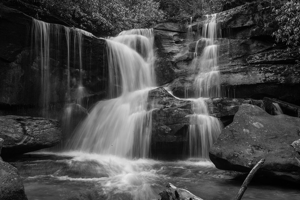
Flat Creek Falls
North Carolina • 200 ft
By Armen Suny · Last verified Mar 2026
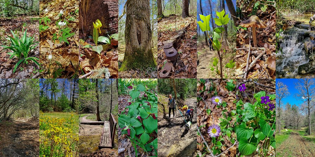
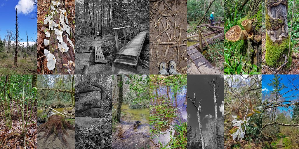
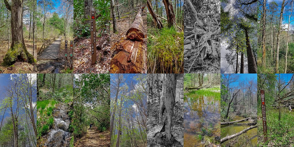
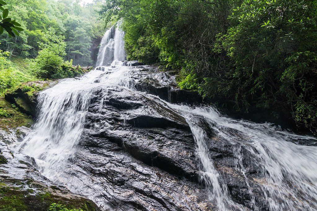
Photo Credits (5)
Difficulty
Moderate
Trail Length
4.5 miles
Trail Type
Out And Back
Elevation Gain
800 ft
About Flat Creek Falls
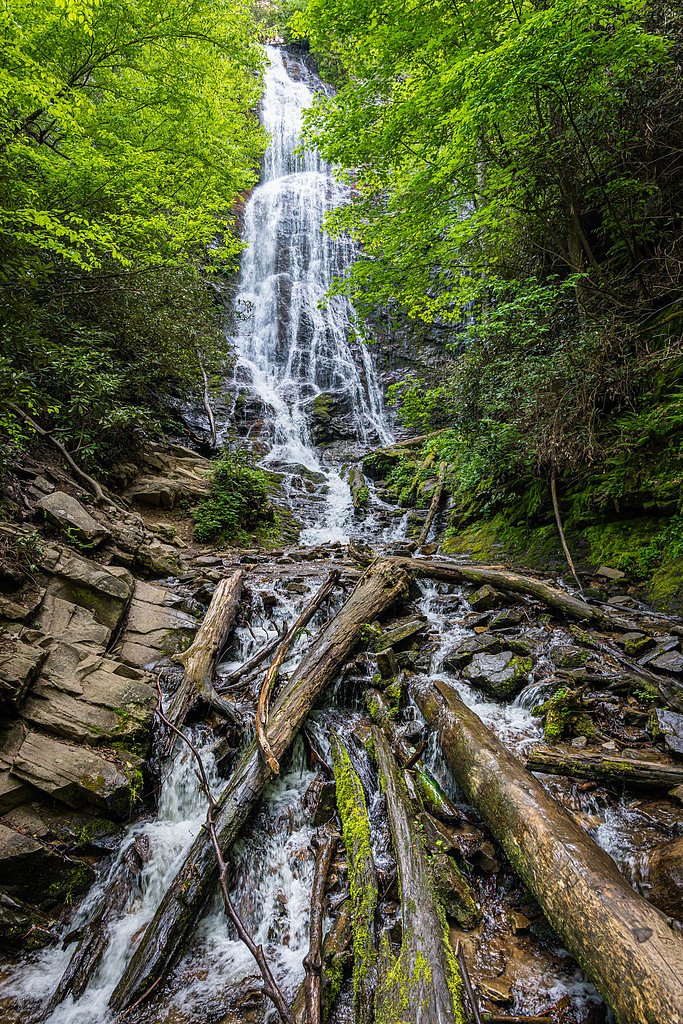
Flat Creek Falls is a striking multi-tier cascade plunging roughly 200 feet within Great Smoky Mountains National Park, managed by the National Park Service. Tucked into the park’s forested backcountry, the falls reward a moderate effort with sweeping views of carved rock and rushing water that feel far removed from the main park thoroughfares. The setting and waterfall height make it a memorable stop for day hikers looking for a scenic payoff. Access is via a 4.5-mile out-and-back route that gains about 800 feet and is commonly rated moderate; it’s a popular choice for hikers who want a substantial hike without technical scrambling. For overnight visitors, Balsam Mountain Campground lies about 1.78 km (roughly a mile) from the trailhead, making it easy to pair the hike with a camp night in the park. Because the falls sit inside the Great Smoky Mountains National Park, visitors should follow NPS regulations and Leave No Trace practices when planning their trip.
The Setting
Flat Creek Falls sits at 4,738 feet within Great Smoky Mountains National Park, fed by the Cataloochee Creek, in the mountains of North Carolina. At 200 feet, it is among the taller waterfalls in North Carolina.
Height: 200 feet
Trail & Hike Details
The Approach
The moderate 4.5-mile out-and-back trail gains 800 feet of elevation on the way to the falls.
Trail Description
Trail: 4.5 miles round-trip (out-and-back); elevation gain: ~800 ft; difficulty: moderate. The route is an out-and-back hike within Great Smoky Mountains National Park (managed by the NPS) that leads to viewpoints of the approximately 200-foot Flat Creek Falls. Specific trail surface, grade, and technical class were not provided in the available data; hikers should be prepared for typical park backcountry conditions and bring appropriate footwear and navigation. Nearest campground: Balsam Mountain Campground, 1.78 km away.
What to Expect
The falls plunge 200 feet. Dogs are welcome.
Accessibility
The trail is not wheelchair accessible. Uneven terrain and elevation changes require steady footing.
Frequently Asked Questions
🐶 Are Dogs Allowed at Flat Creek Falls?
✅ Dogs are allowed
Are There Any Fees or Permits Required?
🆖 No fees required
🏊 Is There Swimming at Flat Creek Falls?
❌ Swimming is not allowed
When to Visit
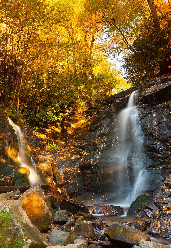
Spring and early summer are ideal for visiting Flat Creek Falls, as the water flow is typically strongest during these seasons. Fall offers beautiful foliage, while winter provides a quieter experience.
Seasonal Access
The best time to visit is Spring, Summer, and Fall. Winter access may be limited. Check the National Park Service website for current conditions.
Safety Information
The trail can be slippery, especially after rain. Be cautious near the waterfall, as the rocks can be wet and unstable. Cell service is limited, so inform someone of your plans before heading out.
Current Water Conditions
140 ft³/s
Current discharge — how much water is flowing
Much higher than usual for this time of year
Based on 82 years of record
2.76 ft
Water depth at gauge
64°F
CoolRefreshing for swimming
7-Day Discharge Trend
What does this mean for your visit?
The water is flowing much higher than usual, expect an impressive display. Water temperature is a refreshing 64 degrees F, good for a quick swim.
About This Gauge
This gauge is on a nearby waterway and may not reflect exact conditions at the falls.
7-Day Flow Outlook
Based on the USGS gauge CATALOOCHEE CREEK NEAR CATALOOCHEE, NC (16 km away).
Today
Roaring
113 cfs
6/10Tomorrow
Roaring
121 cfs
6/10Tue
Roaring
123 cfs
6/10Wed
Roaring
129 cfs
6/10Thu
Roaring
121 cfs
6/10Fri
Roaring
119 cfs
6/10Sat
Roaring
127 cfs
6/10Best window: Today — roaring flow, chance showers and thunderstorms (trip score 6/10).
Best time of year: this gauge typically runs highest from early February to mid April, peaking in March.
How we calculate this
This is a transparent outlook, not a precise forecast. We take the waterfall's current flow strength (how it ranks against its historical normal for today, from the nearest USGS stream gauge), carry that ranking forward along the gauge's seasonal curve, and nudge it for forecast rain. Confidence is highest for the next day or two and falls further out. Always check official conditions and your own judgment before visiting — high flows can be dangerous.
Know when to go.
Get a free email alert when waterfalls near Maggie Valley hit peak flow. We only send when conditions are worth the trip — no weekly newsletters, no spam.
Weather Forecast
Location & Access
Getting There
Flat Creek Falls is located near the town of Tuckasegee, North Carolina. Access typically involves driving on forest service roads, which may be unpaved and rough in some areas. A high-clearance vehicle is recommended.
Get Directions on Google MapsParking
Parking is available at a small pull-off area near the trailhead. Space may be limited, so arrive early to secure a spot.
Elevation
4,738 feet above sea level
Coordinates
35.549545° N, -83.172090° W
Land Management
Managed by NPS
Visitor Tips & Gear
Wear sturdy hiking shoes and bring plenty of water. The trail can be muddy after rain, so plan accordingly. Start early to avoid afternoon heat and ensure you have enough daylight for the hike.
As an Amazon Associate, we earn from qualifying purchases.
With 4.5 miles and 800 ft of elevation gain, sturdy boots and trekking poles will help on this moderate trail. Sun exposure on the trail makes good sun protection a must in summer.
America the Beautiful Annual Pass
Covers entrance fees at 2,000+ federal recreation sites — required at most National Parks.

Polarized Sunglasses (Knockaround)
Cuts glare off the water so you actually see the falls — and your photos turn out better too.

Columbia Watertight II Rain Jacket
Packs into its own pocket, seam-sealed, and keeps you dry from spray and surprise rain.

Earth Pak Waterproof Dry Bag
Keeps your phone and gear dry when waterfall mist soaks everything else.

Waterproof Phone Pouch (AiRunTech)
Cheap insurance — take photos right next to the falls without killing your phone.

Timberland Euro Sprint Mid Waterproof
Trusted waterproof boot with premium leather and grippy rubber sole — reliable on rocky, wet trails.

TrailBuddy Trekking Poles
Lightweight aluminum, cork grips, and flip-locks that actually hold — a best-seller for good reason.
Where to Stay

Comfort Inn near Great Smoky Mountain National Park

Quality Inn & Suites Maggie Valley - Cherokee Area

Cherokee Grand Hotel

Modern Mountain Cabin - Spectacular Views at 3100 ft
Browse vacation cabins and private rentals nearby
Unique outdoor stays — tents, yurts, and treehouses
Rent a campervan or RV for your waterfall road trip
Some links are affiliate links. We may earn a commission at no extra cost to you.
Nearby Campground
BALSAM MOUNTAIN CAMPGROUND
1.1 miles away · 43 sites
Overview Balsam Mountain Campground is located in a relatively remote part of Great Smoky Mountains National Park. The secluded setting offers visitors the ability to enjoy a multitude of recreational activities without the crowds which are sometimes common in other parts of the park.Recreation Great Smoky Mountains National Park is a hiker's paradise, with over 800 miles of maintained trails ranging from short, leg-stretchers to strenuous treks. The Balsam Mountain area features several trails t
Book on Recreation.govNearby Hot Springs
Hot springs near Maggie Valley, North Carolina

Looking for a soak after your hike? Explore more hot springs near Maggie Valley, North Carolina on SoakingSprings.
Explore North Carolina springsAdditional Information
Nearby Attractions
Nearby attractions include Panthertown Valley, known as the 'Yosemite of the East,' and Lake Glenville, which offers boating and fishing opportunities.
Wildlife
The area is home to a variety of wildlife, including deer, black bears, and numerous bird species. Be cautious and follow proper wildlife safety guidelines.
Cities near Flat Creek Falls
Nearby Waterfalls
Writing about Flat Creek Falls? Embed this waterfall on your site for free.