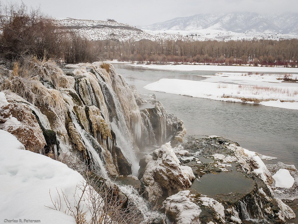
Snow Creek Falls
By Armen Suny · Last verified Mar 2026
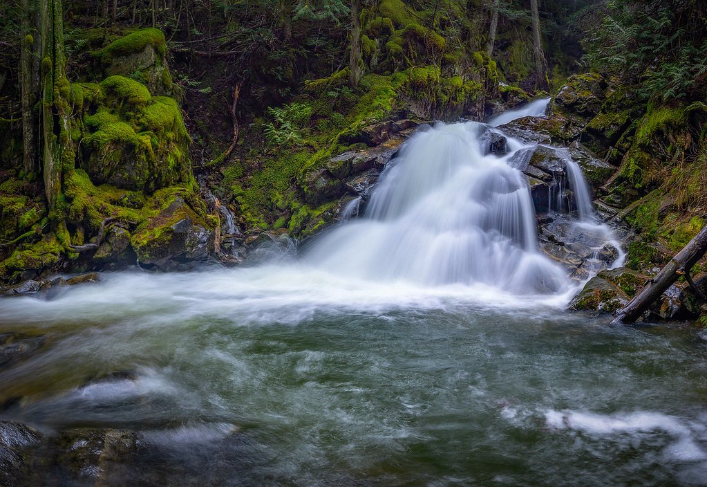
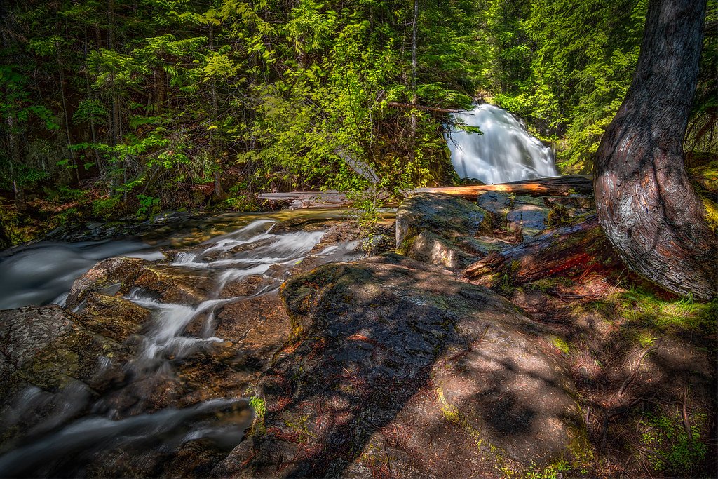
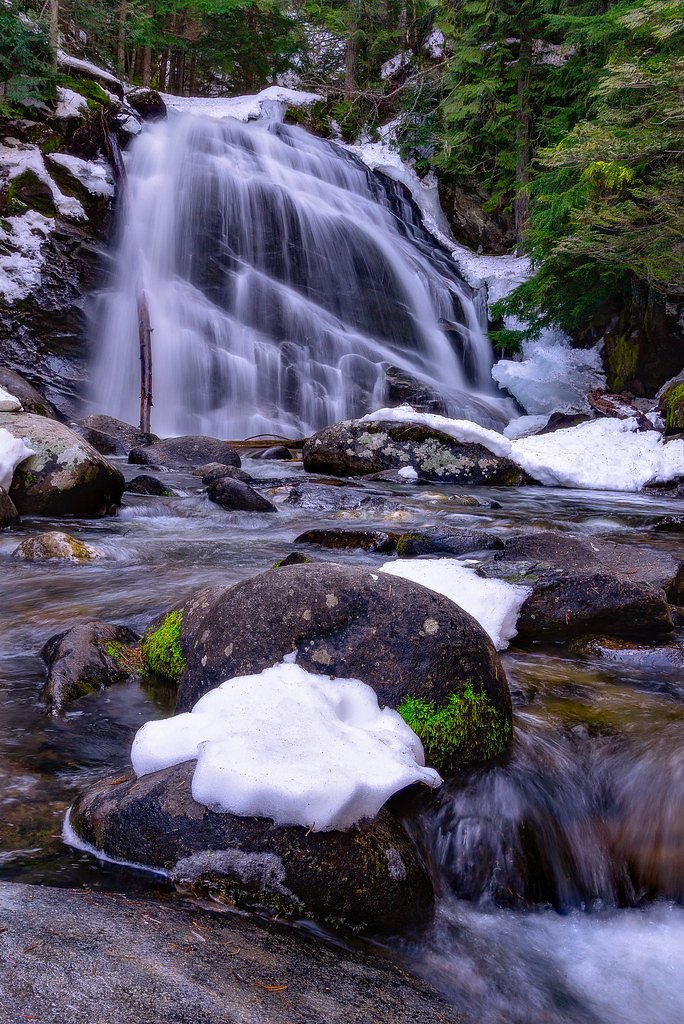

Photo Credits (5)
Difficulty
Moderate
Trail Length
2.5 miles
Trail Type
Out And Back
Elevation Gain
400 ft
About Snow Creek Falls
Snow Creek Falls is a picturesque waterfall located near Sandpoint, Idaho, in the Kaniksu National Forest. It features two tiers and is surrounded by lush forest, making it a popular destination for hikers and nature enthusiasts.
The Setting
Snow Creek Falls sits at 2,277 feet within Kaniksu National Forest, fed by the Kootenai River Bel Moyie River, in the hills of Idaho.
Trail & Hike Details
The Approach
The moderate hike follows Lower Snow Falls (#189A), a 2.5-mile out-and-back trail over natural surface. Expect 400 feet of elevation gain with grades of 5-8%. The trail is developed (Class 3).
USFS Trail
LOWER SNOW FALLS #189A
Trail Class
Developed
Surface
Avg Grade
USFS Segment
0.06 miTrail Description
The trail to Snow Creek Falls is well-maintained and winds through a dense forest with occasional views of the surrounding mountains. The path is relatively short but includes some moderate elevation gain, particularly near the falls. The trail leads to a viewing area where visitors can see both tiers of the waterfall.
What to Expect
Dogs are welcome.
Accessibility
The trail is not wheelchair accessible. Uneven terrain and elevation changes require steady footing.
Frequently Asked Questions
🐶 Are Dogs Allowed at Snow Creek Falls?
✅ Dogs are allowed
Are There Any Fees or Permits Required?
🆖 No fees required
🏊 Is There Swimming at Snow Creek Falls?
❌ Swimming is not allowed
When to Visit
Spring and early summer are the best times to visit, as the waterfall is typically at its fullest due to snowmelt. Fall offers beautiful foliage, while summer provides warmer weather for hiking.
Seasonal Access
The best time to visit is Spring, Summer, and Fall. Winter access may be limited. Check with Kaniksu National Forest for seasonal road closures.
Safety Information
Be cautious near the waterfall, as rocks can be slippery. Check weather conditions before visiting, as the trail may become hazardous during heavy rain or snow. Carry sufficient water and let someone know your hiking plans.
Current Water Conditions
13,100 ft³/s
Current discharge — how much water is flowing
About average for this time of year
Based on 15 years of record
73.86 ft
Water depth at gauge
7-Day Discharge Trend
What does this mean for your visit?
Flow is about average for this time of year.
About This Gauge
This gauge is on a nearby waterway and may not reflect exact conditions at the falls.
7-Day Flow Outlook
Based on the USGS gauge KOOTENAI RIVER BEL MOYIE RIVER NR BONNERS FERRY ID (17 km away).
Today
Barely Flowing
14148 cfs
3/10Tomorrow
Low
14457 cfs
3/10Tue
Low
13656 cfs
4/10Wed
Low
13194 cfs
4/10Thu
Barely Flowing
12056 cfs
5/10Fri
Barely Flowing
13028 cfs
3/10Sat
Barely Flowing
13232 cfs
5/10Best window: Thu — barely flowing flow, mostly sunny (trip score 5/10).
Best time of year: this gauge typically runs highest from late April to late June, peaking in May.
How we calculate this
This is a transparent outlook, not a precise forecast. We take the waterfall's current flow strength (how it ranks against its historical normal for today, from the nearest USGS stream gauge), carry that ranking forward along the gauge's seasonal curve, and nudge it for forecast rain. Confidence is highest for the next day or two and falls further out. Always check official conditions and your own judgment before visiting — high flows can be dangerous.
Know when to go.
Get a free email alert when waterfalls near Bonners Ferry hit peak flow. We only send when conditions are worth the trip — no weekly newsletters, no spam.
Weather Forecast
Location & Access
Getting There
Snow Creek Falls is accessed via the Snow Creek Falls Trailhead, located off Forest Road 2642. The trailhead is approximately 12 miles southeast of Sandpoint, Idaho. A high-clearance vehicle may be recommended for the forest road, especially during wet conditions.
Get Directions on Google MapsParking
There is a small parking area at the trailhead, but space may be limited during peak seasons.
Elevation
2,277 feet above sea level
Coordinates
48.667435° N, -116.429368° W
Land Management
Managed by USFS
Visitor Tips & Gear
Visit early in the day to avoid crowds and secure parking. Bring insect repellent during the summer months, as mosquitoes can be present. Be cautious on the trail, especially near the falls, as rocks can be slippery.
As an Amazon Associate, we earn from qualifying purchases.
With 2.5 miles and 400 ft of elevation gain, sturdy boots and trekking poles will help on this moderate trail. Sun exposure on the trail makes good sun protection a must in summer.

Polarized Sunglasses (Knockaround)
Cuts glare off the water so you actually see the falls — and your photos turn out better too.

Columbia Watertight II Rain Jacket
Packs into its own pocket, seam-sealed, and keeps you dry from spray and surprise rain.

Earth Pak Waterproof Dry Bag
Keeps your phone and gear dry when waterfall mist soaks everything else.

Waterproof Phone Pouch (AiRunTech)
Cheap insurance — take photos right next to the falls without killing your phone.

Timberland Euro Sprint Mid Waterproof
Trusted waterproof boot with premium leather and grippy rubber sole — reliable on rocky, wet trails.

TrailBuddy Trekking Poles
Lightweight aluminum, cork grips, and flip-locks that actually hold — a best-seller for good reason.
Where to Stay

Dodge Peak Lodge

Log Inn Bonners Ferry

Quiet Log Cabin • Gazebo • Near River & Trails

Northside School Bed & Breakfast
Browse vacation cabins and private rentals nearby
Unique outdoor stays — tents, yurts, and treehouses
Rent a campervan or RV for your waterfall road trip
Some links are affiliate links. We may earn a commission at no extra cost to you.
Nearby Campground
Lower Kootenai River Area
8.4 miles away · 0 sites
The Lower Kootenai River Area (Bonners Ferry District) is bordered by the Purcell and Cabinet Ranges and the Montana Line on the east, the rugged Selkirk Range on the west, and the Canadian border to the north. The Kootenai River meanders north and west through the District, and the Moyie River joins it from the north.Peaks are moderate in elevation (6000 - 7000 ft.) but are rugged due to heavy glaciation. They are renowned for their mountaineering challenge.There are many spectacular lakes, both
Book on Recreation.govAdditional Information
Nearby Attractions
Nearby attractions include Lake Pend Oreille, Schweitzer Mountain Resort, and the town of Sandpoint, which offers dining and shopping options.
Wildlife
The area is home to a variety of wildlife, including deer, birds, and occasionally bears. Visitors should practice bear safety and carry bear spray if hiking in the area.
Cities near Snow Creek Falls
Other waterfalls named Snow Creek Falls
2 other waterfalls share this name across the U.S.
Writing about Snow Creek Falls? Embed this waterfall on your site for free.